


As careful readers might have noticed, there was a 4 year gap between my White Princess and Item Peak trips. This raises the question: what was I doing during that time?
Well, I was exploring Byron’s NE ridge! In 2022 I was dealing with a bunch of changes in my life and bushwacking/route-finding up the ridge was a nice reprieve from those issues.
2022
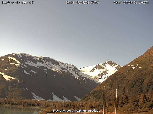
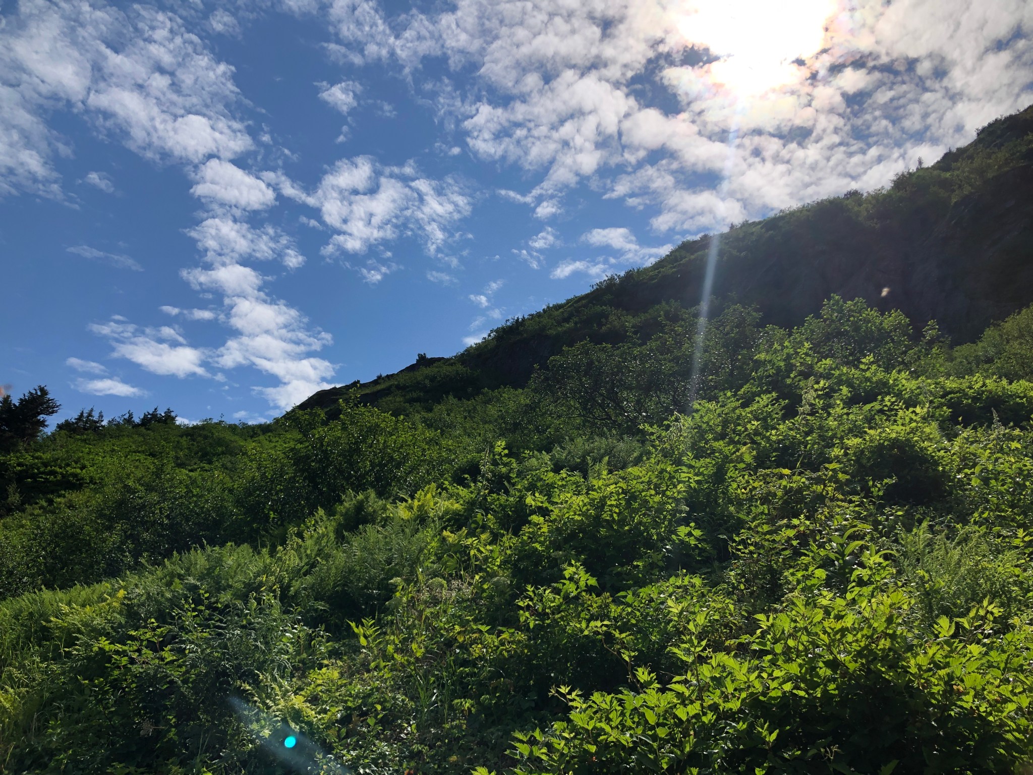
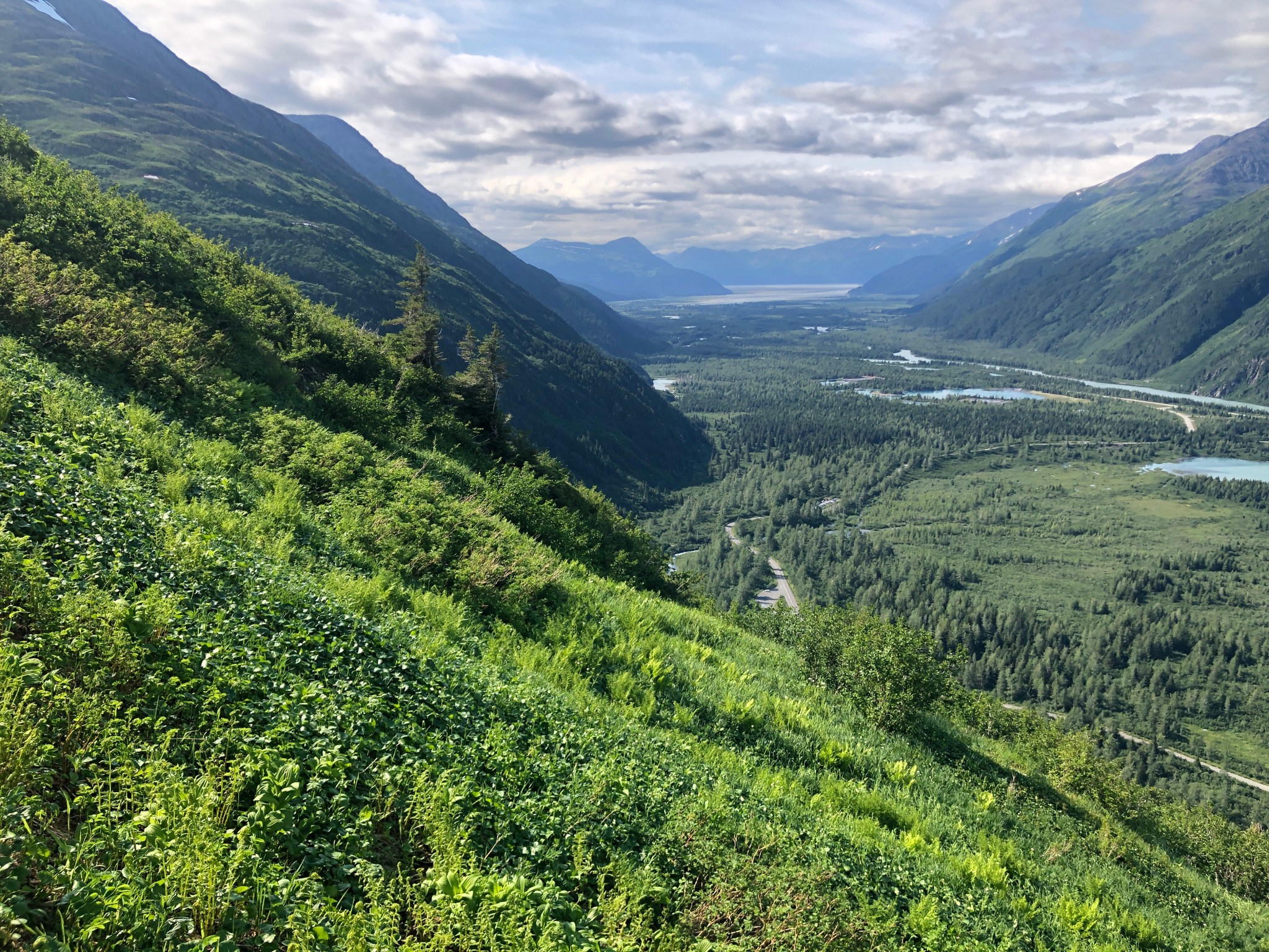
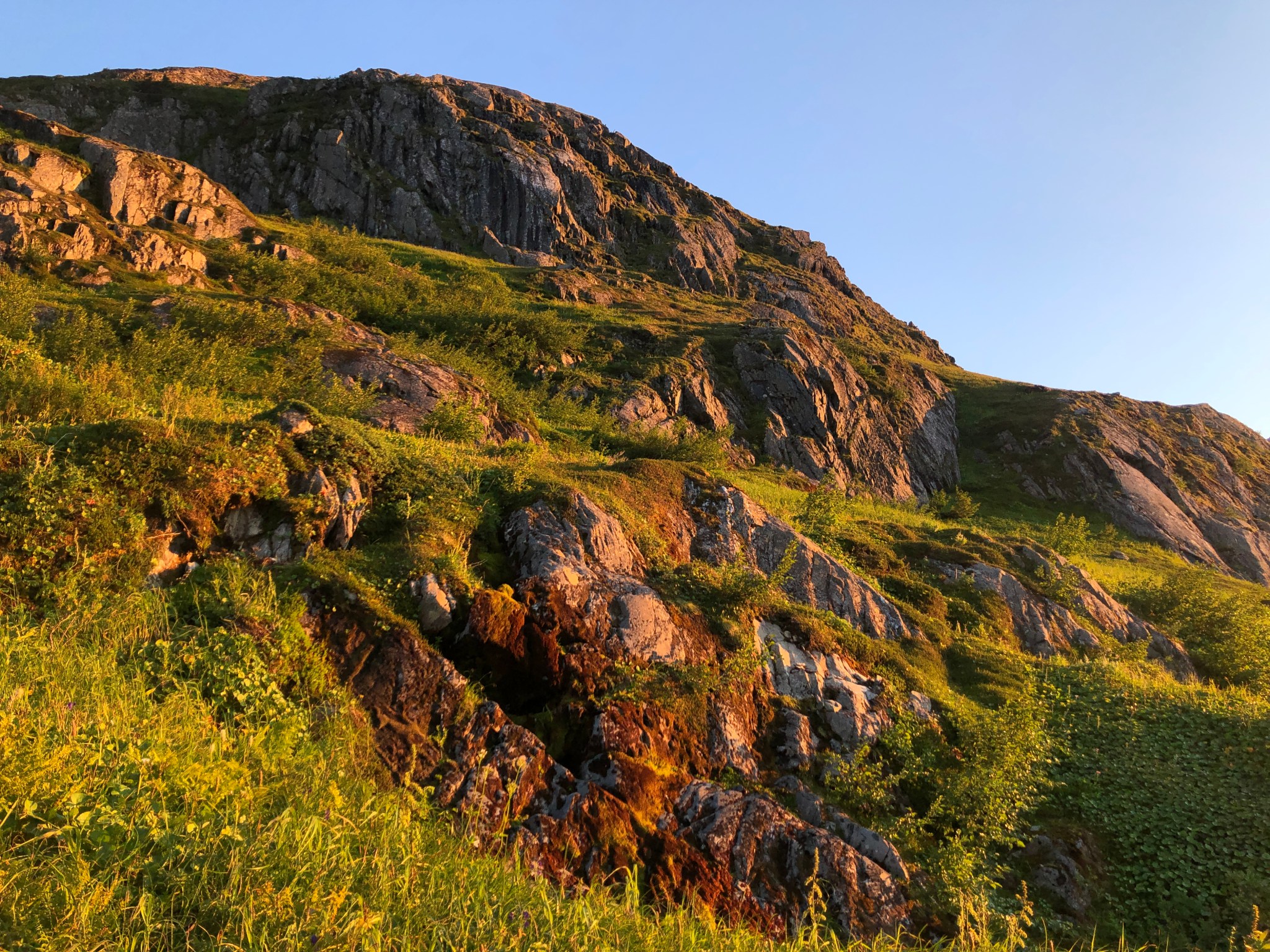
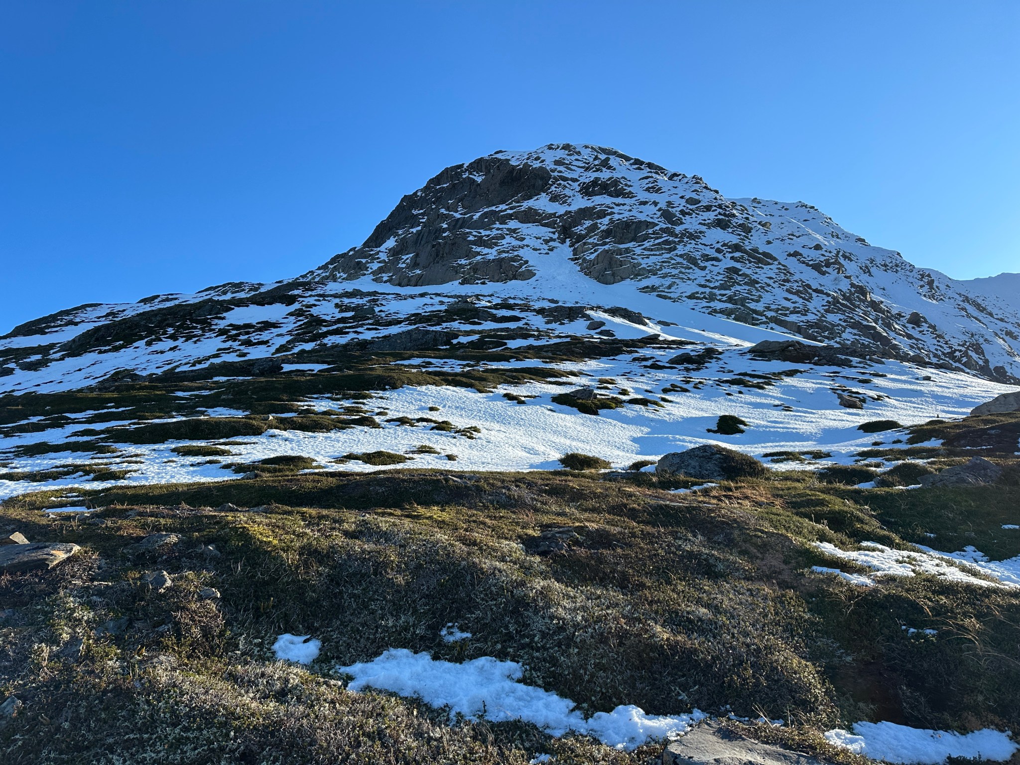
The idea of climbing the ridge came to me a few weeks before my hip surgery, when I was cruising google earth and scoped out an awesome potential view of Portage Glacier from Byron Peak’s NE ridge. Though it had seen at least one winter ascent by Luc Mehl (and maybe others), I couldn’t find any information on people climbing that ridge in the summer, which meant likely no one has taken a photo of Portage Glacier from that vantage point without tons of snow on the glacier. I thought that would be pretty neat and my mind started to solidify around this goal. I calculated it was only 900 vertical feet of bushwacking to get above the brushline and into tundra, though none of my friends seemed as excited about this as I was.
At the time, my only goal was to get a photo of Portage Glacier with Carpathian at its head; the idea of climbing Byron Peak itself didn’t occur to me until I got up there. The mountain was inspiring, but not something I was really interested in climbing via any of the traditional ways, mainly due to the unsavoriness of those routes (choss/cornice/icefall danger) I had seen numerous blog posts and trip reports about climbing Byron (including the accident reports), people ascended via the West ridge, North Glacier, or East Face via Portage Glacier. After sating my desire to climb to ridgecrest and see Portage Glacier, the idea of a summer ascent of the Byron via the NE ridge became stuck in my mind.
Trip Reports:
https://thingstolucat.com/portage-glacier-peaks/
https://www.akmountain.com/2007/08/11/byron-peak-north-glacier/
https://zackfields.blogspot.com/2017/04/byron-peak-ski.html
https://www.mikerecords.com/2017/03/byron-peak-242017.html
https://www.cnfaic.org/accidents/byron-peak/
https://www.reddit.com/r/Mountaineering/comments/b9hy2i/byron_peak_west_ridge_alaska_3312019/
https://kipsprout.com/2025/04/09/byron-peak-attempt/

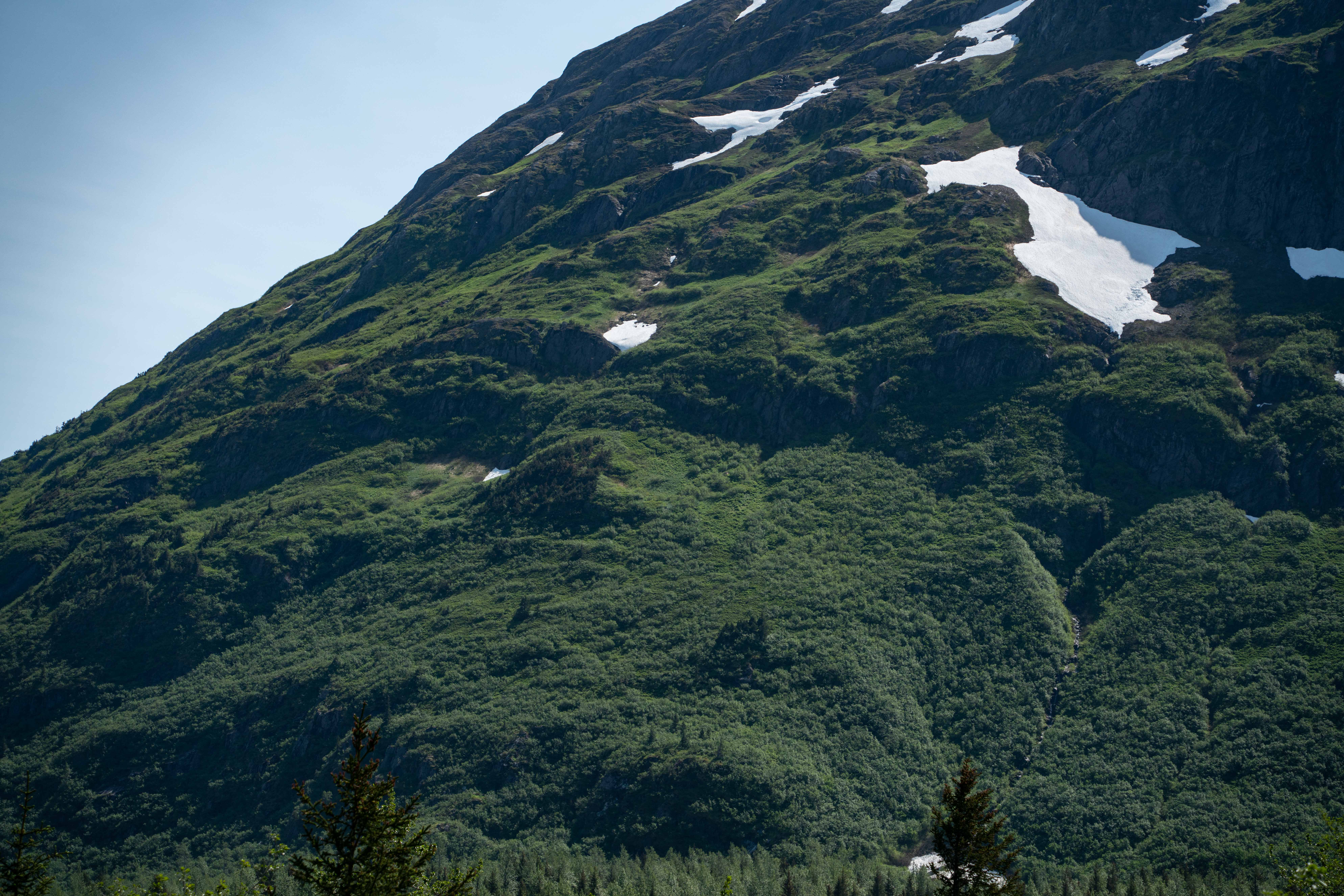
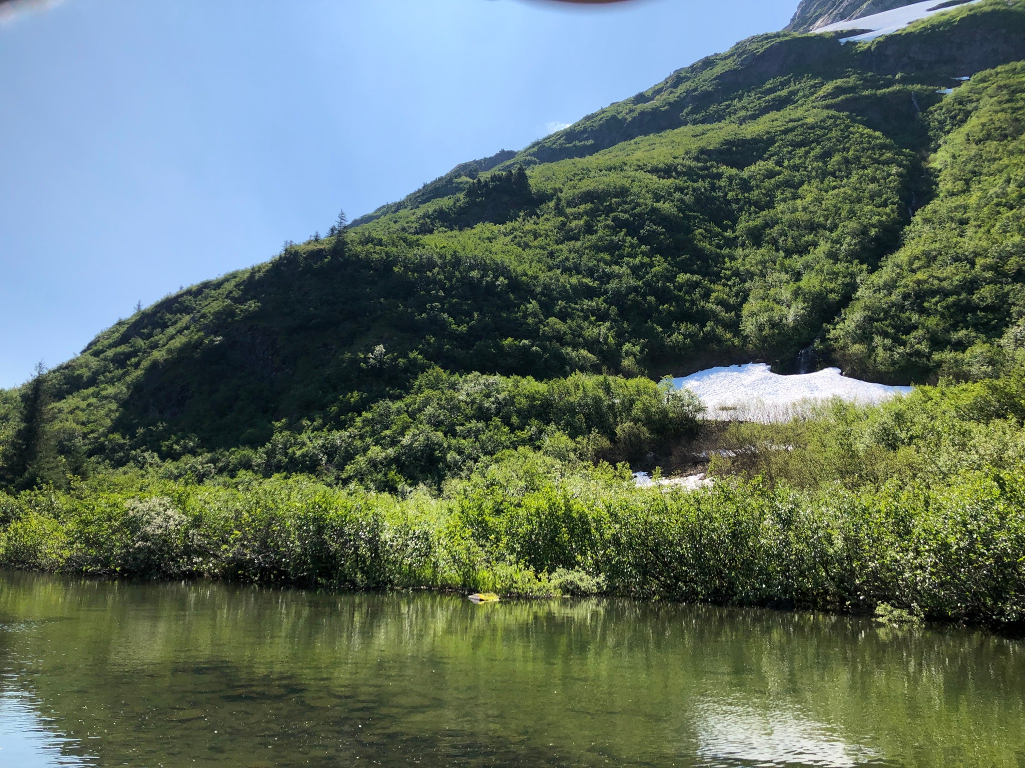
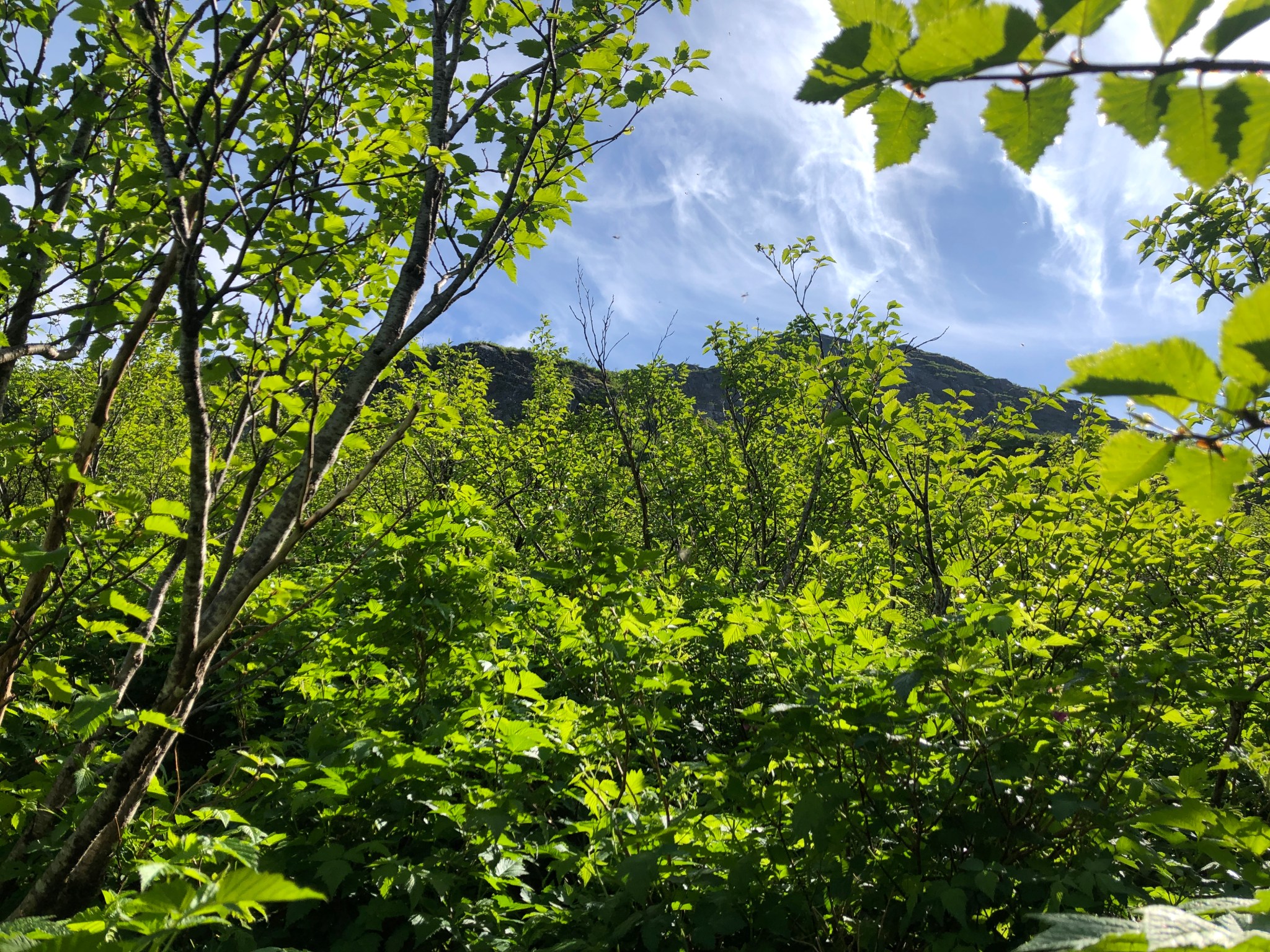
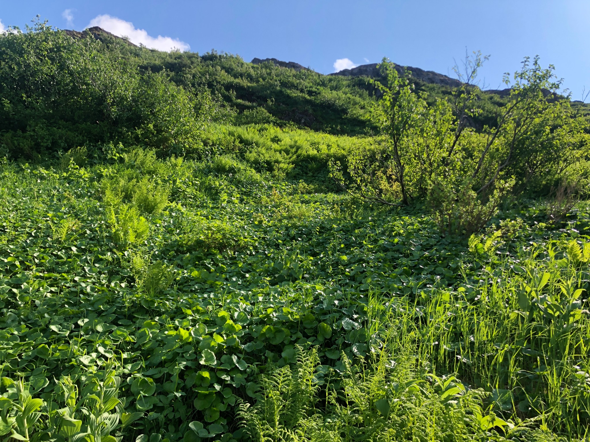
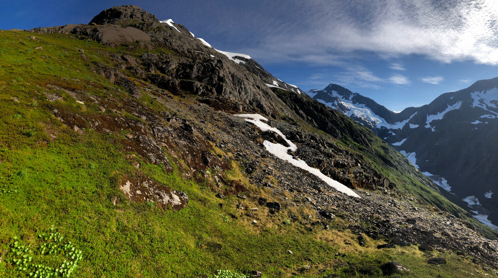
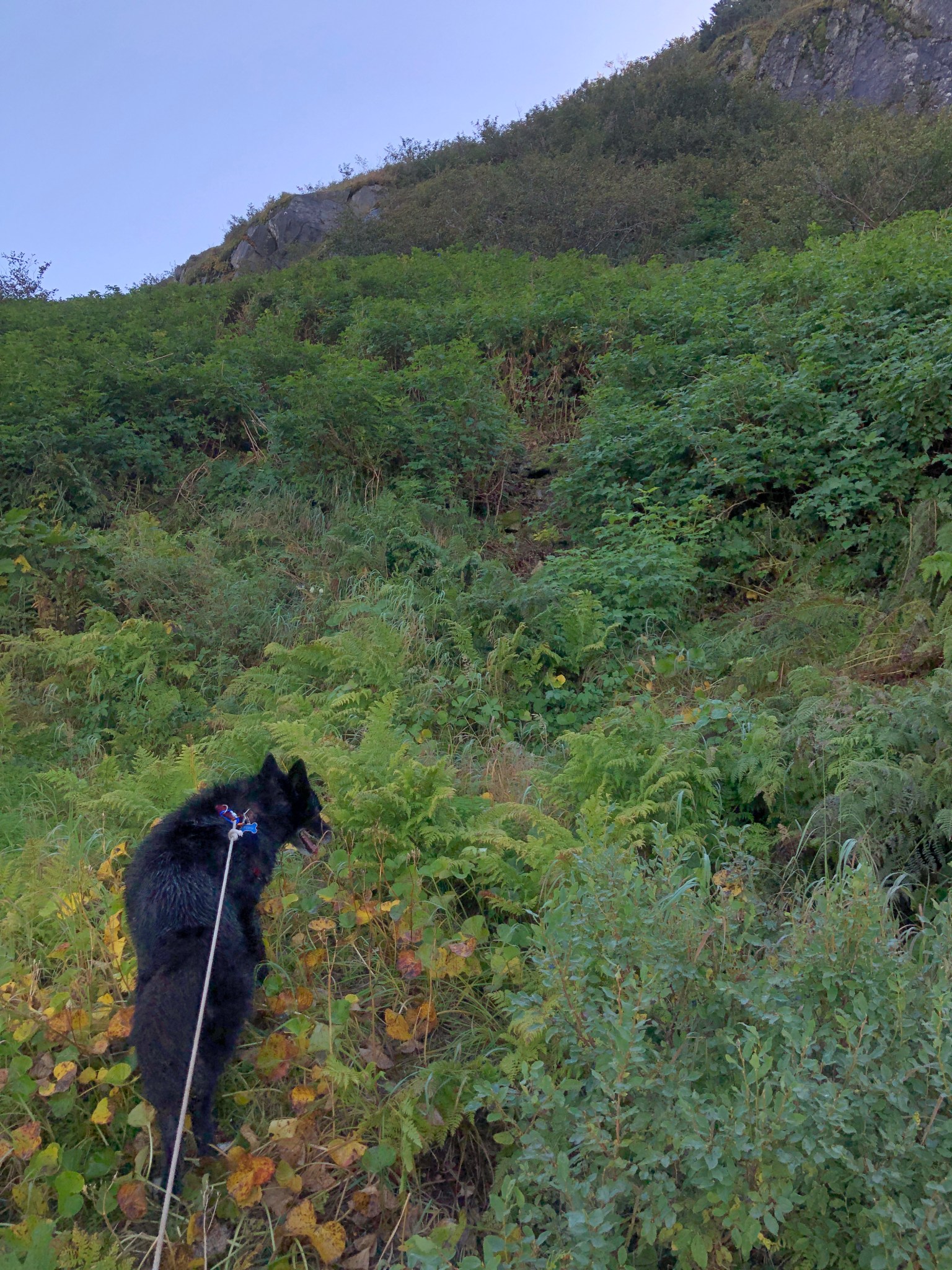
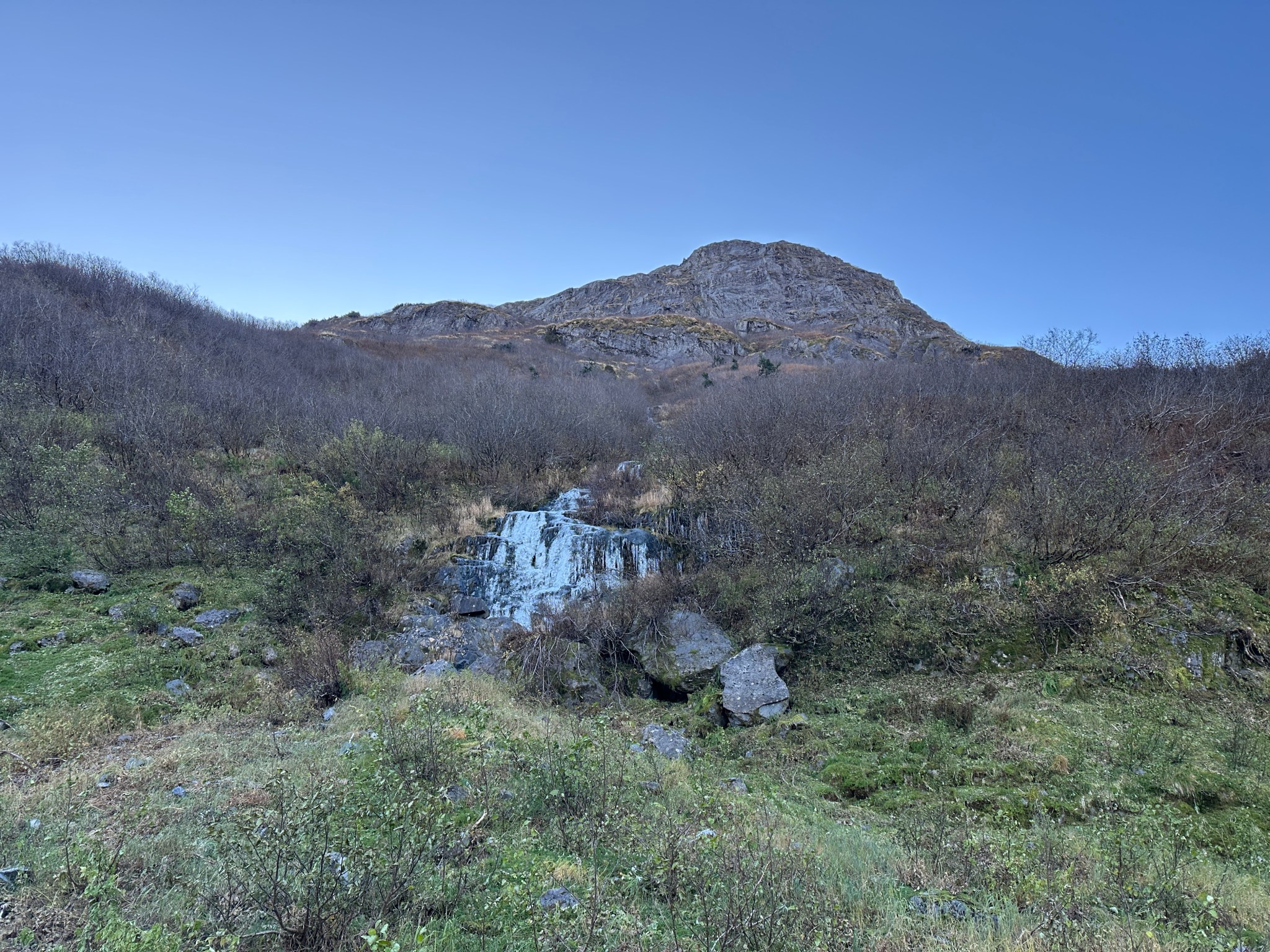
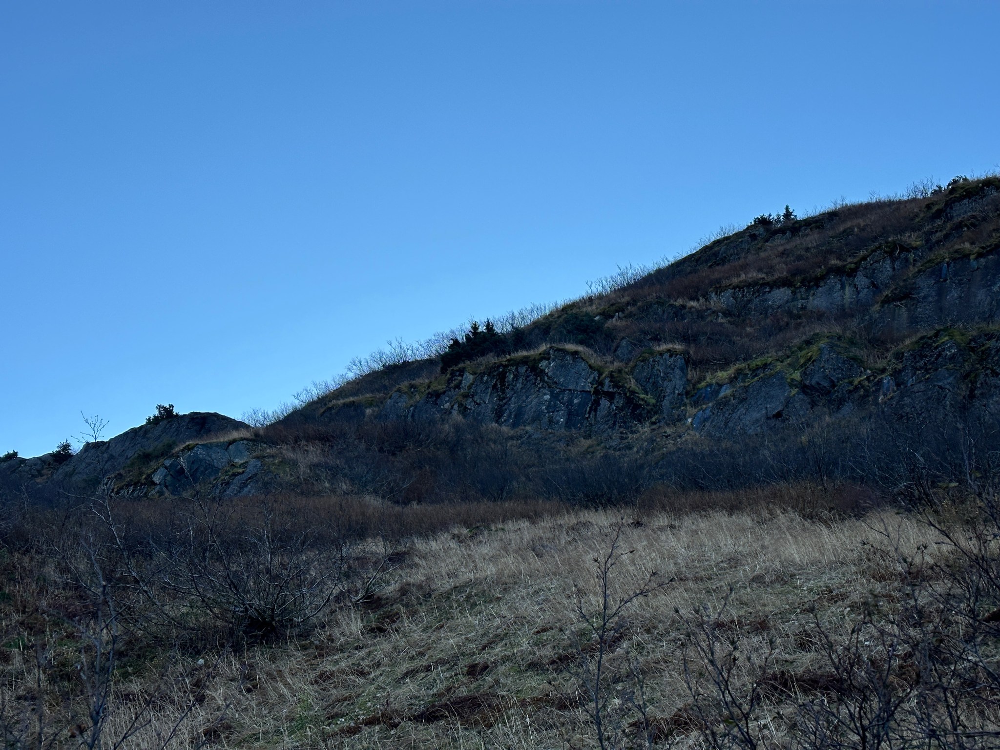
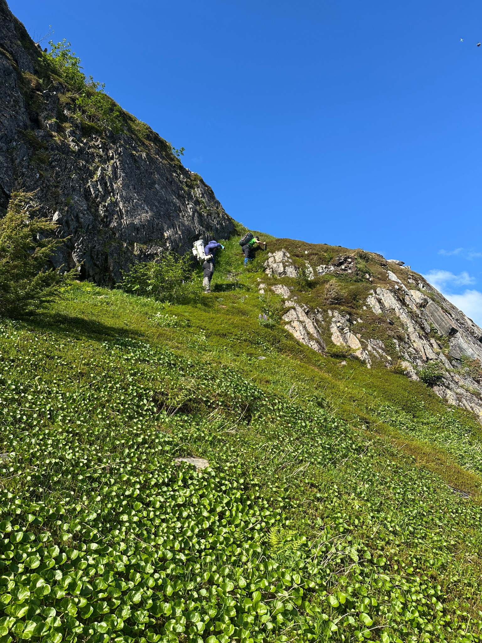
Our 2025 July 4th ascent of Byron Peak via the NE ridge started in 2022 on June 2nd, when I found an effective path up the slopes through the brush. The route begins by taking a right turn off Byron Glacier Road at the second tall cottonwood tree. After a flat tromp through the woods, the first obstacle is the “Mandatory Water Crossing” which felt awesome on the way back. Over two full days, a week apart and on my own, I bushwacked a crude “alder tunnel” (or whatever) up and through the 900′ of brush, pushing into the tundra on the second day with not much sunlight left. I ascended a few hundred feet to check out the tundra phase of the route, but the terrain above was incredibly steep and I realized I would need microspikes to safely hike further. But! I had the route up dialed and the brush a bit stomped in, which would make repeat ascents much easier. On my first ascent, there was no sign any creature walking above the brushline: all the deer cabbage was untrodden and the grass undisturbed. There weren’t even ground squirrels!
Finally gaining access to this area felt intimate and otherworldly, I felt with near-certainty I was pioneering something novel. I was wrong (Grace Hoeman was likely the first person up this ridge, decades previous in a much-less-bushy condition), but it felt that way.


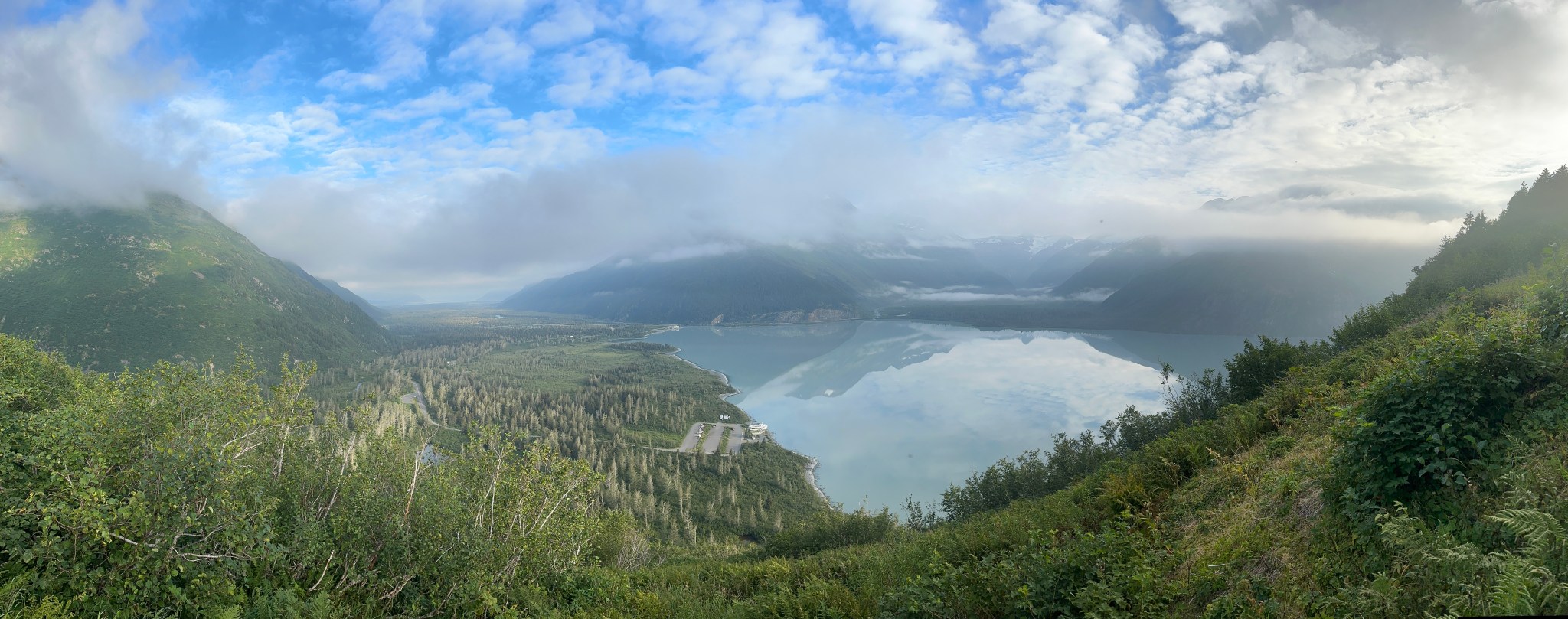
Over the next few weeks, I quickly realized a major problem with the Portage area was finding a good weather window to ascend the ridge. The Portage Group is bound by the ocean on both sides and this geographic situation results in fast-developing clouds. Within minutes the area can become cloudy. I watched the webcam at Portage Lake for the next few weeks, waiting for a window.
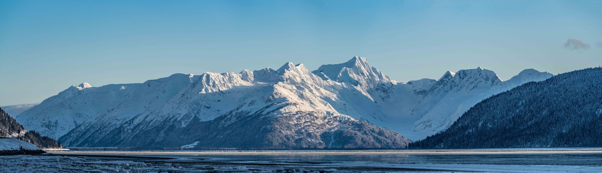
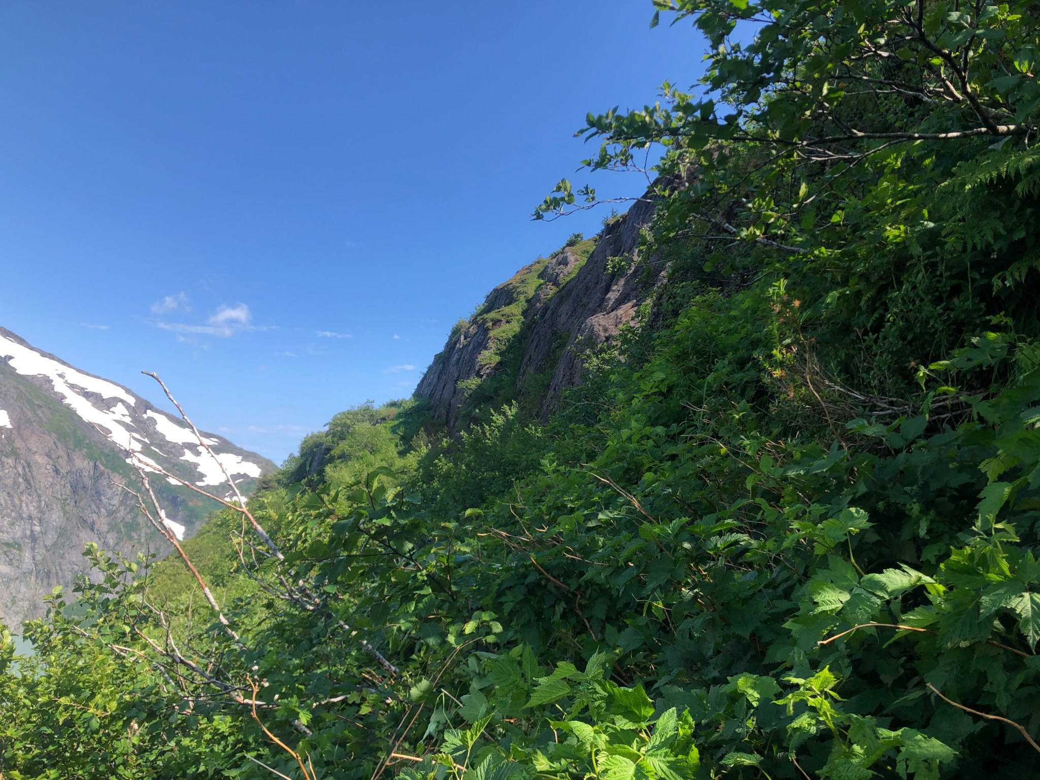
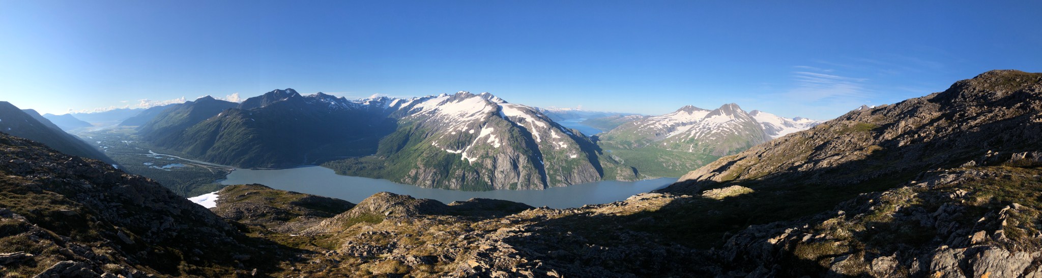
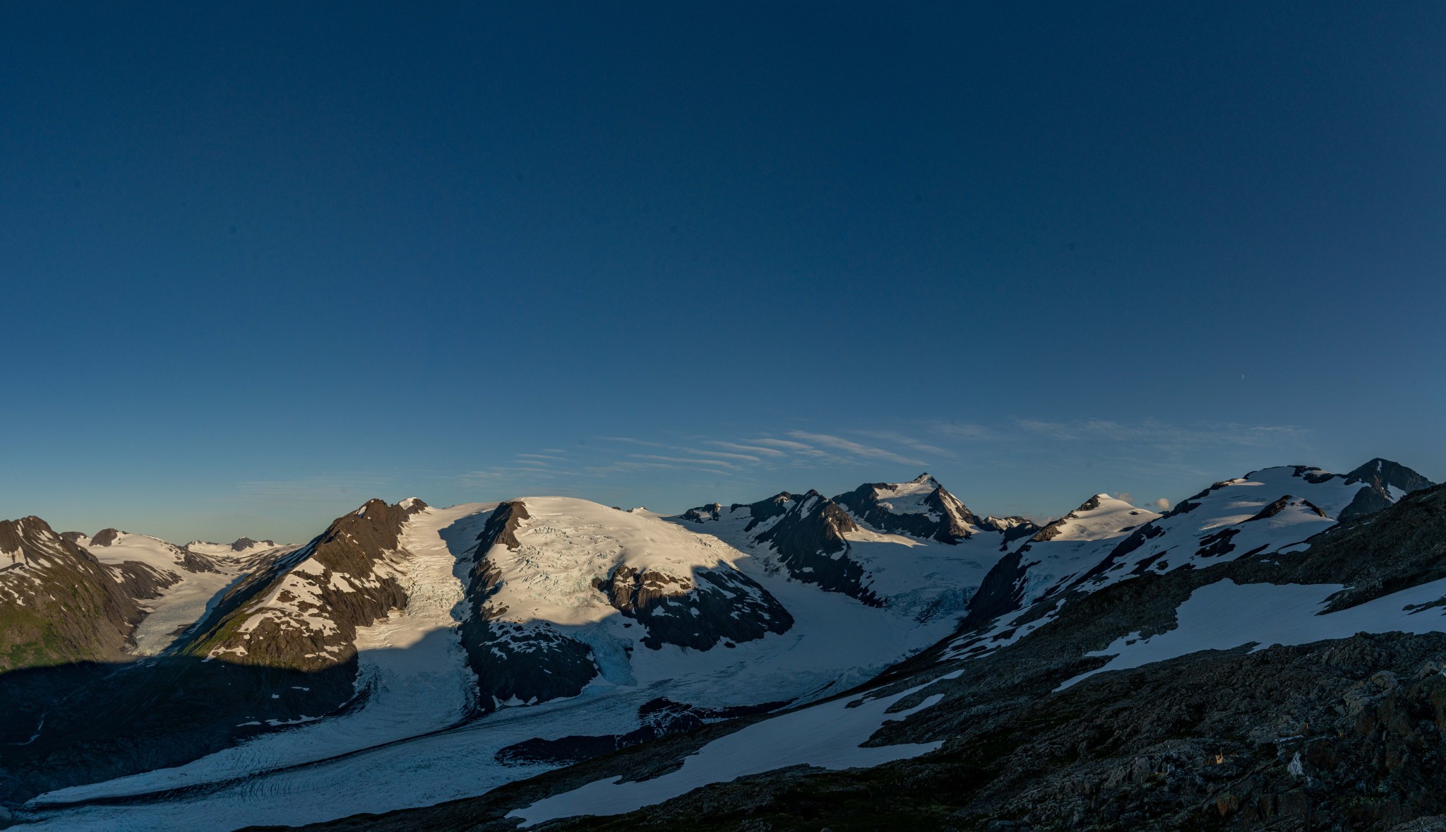
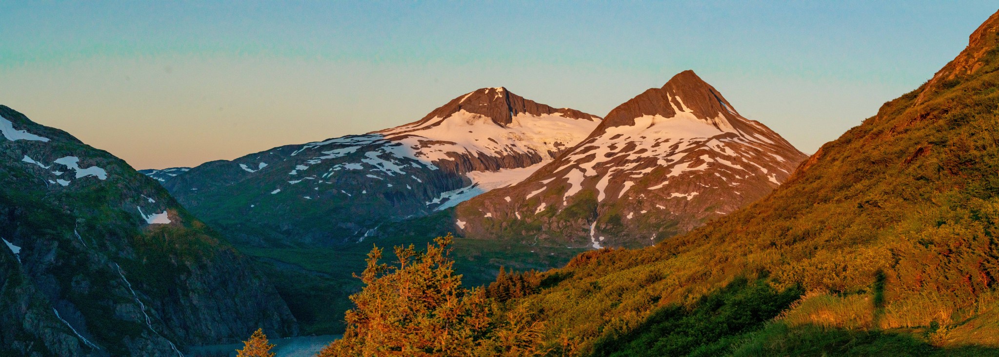
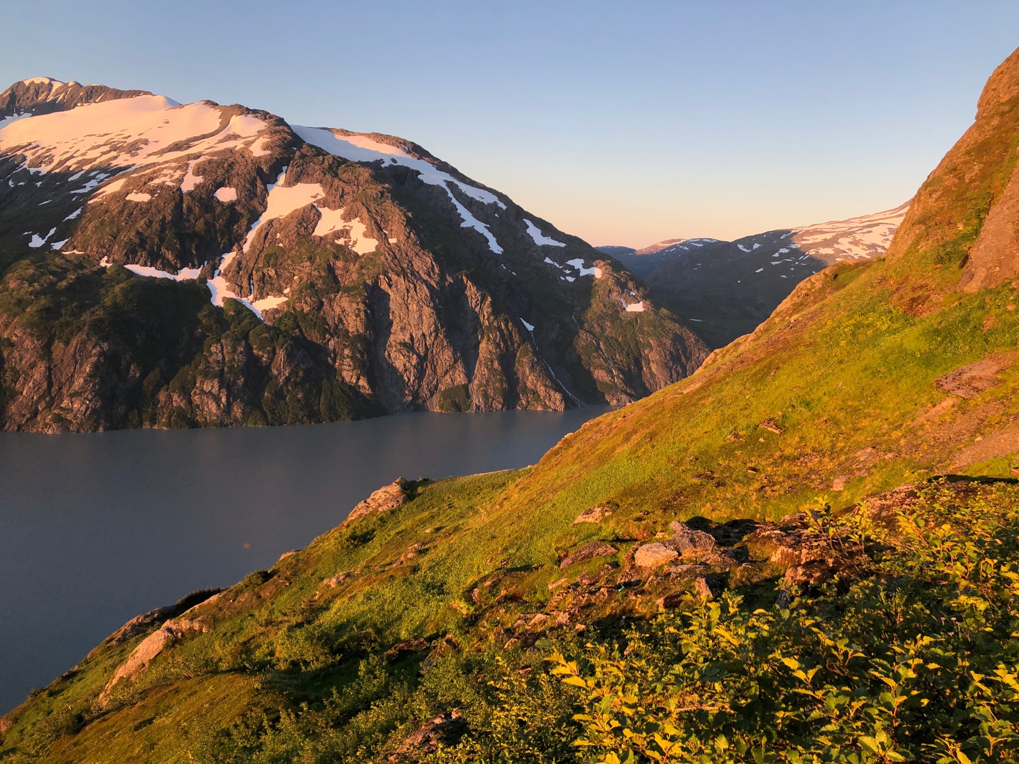
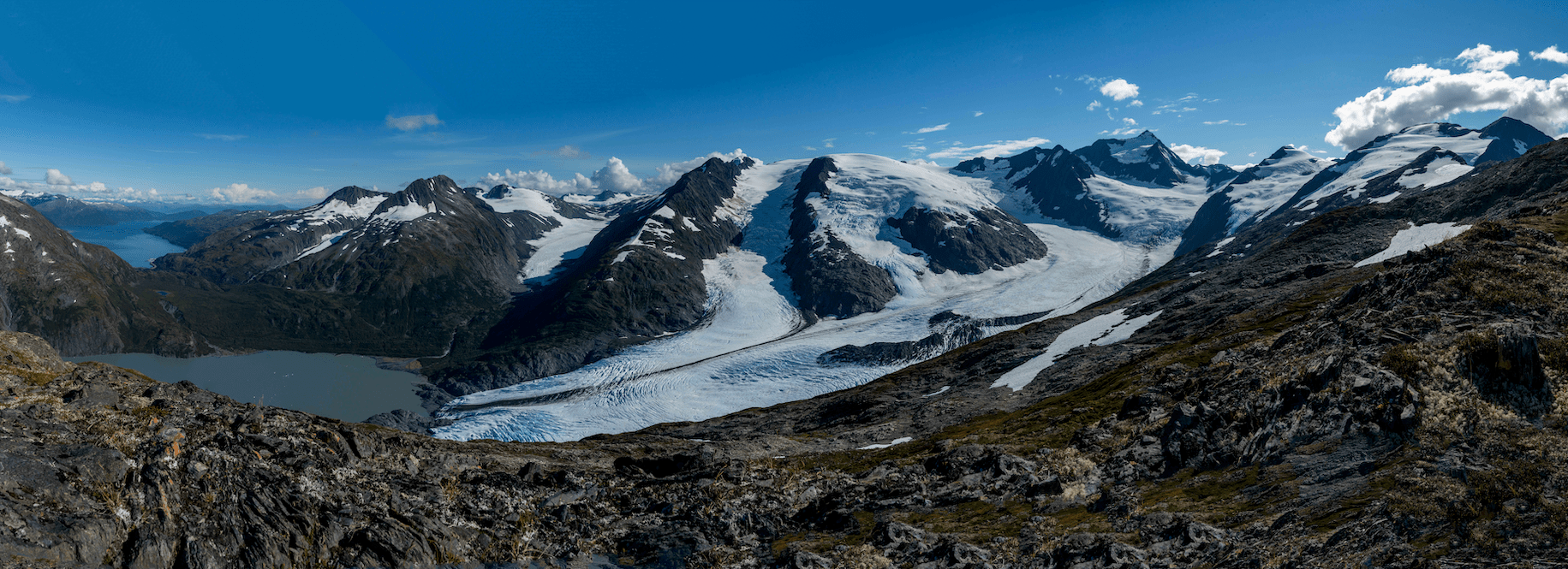
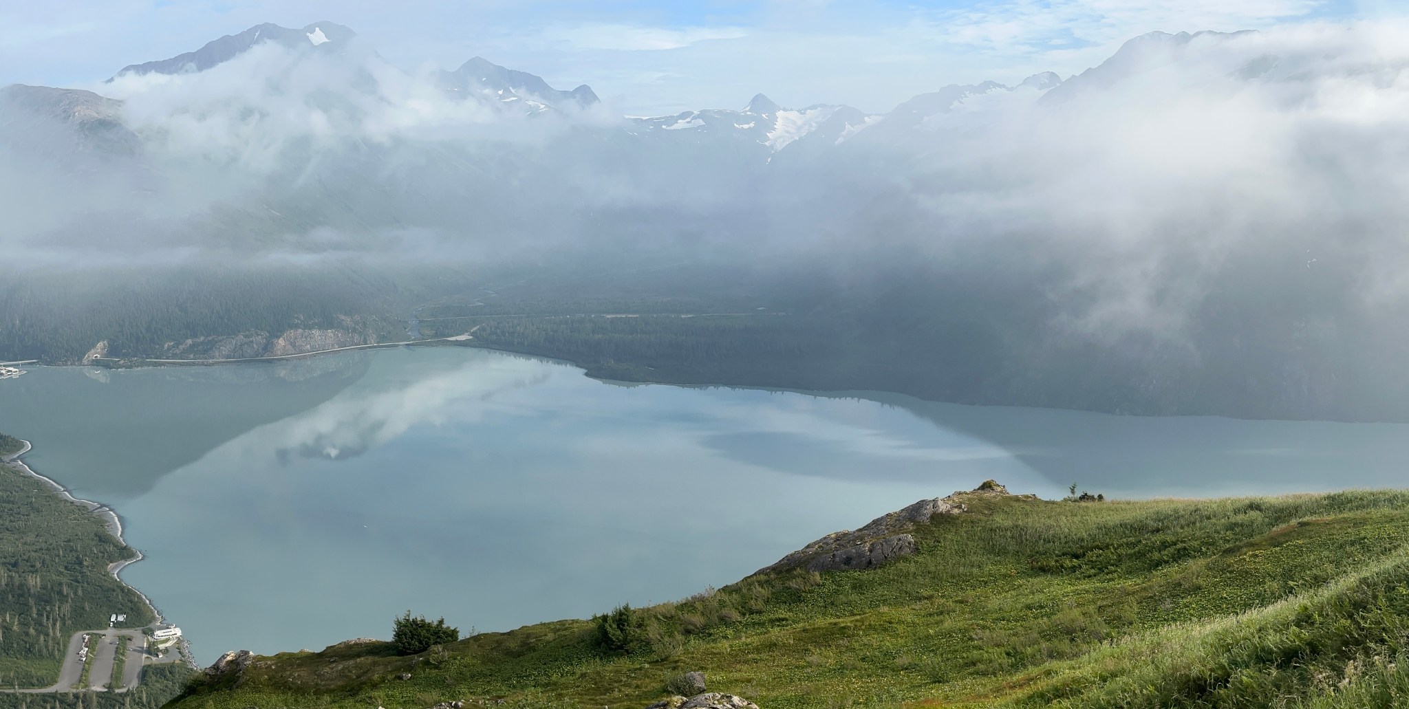
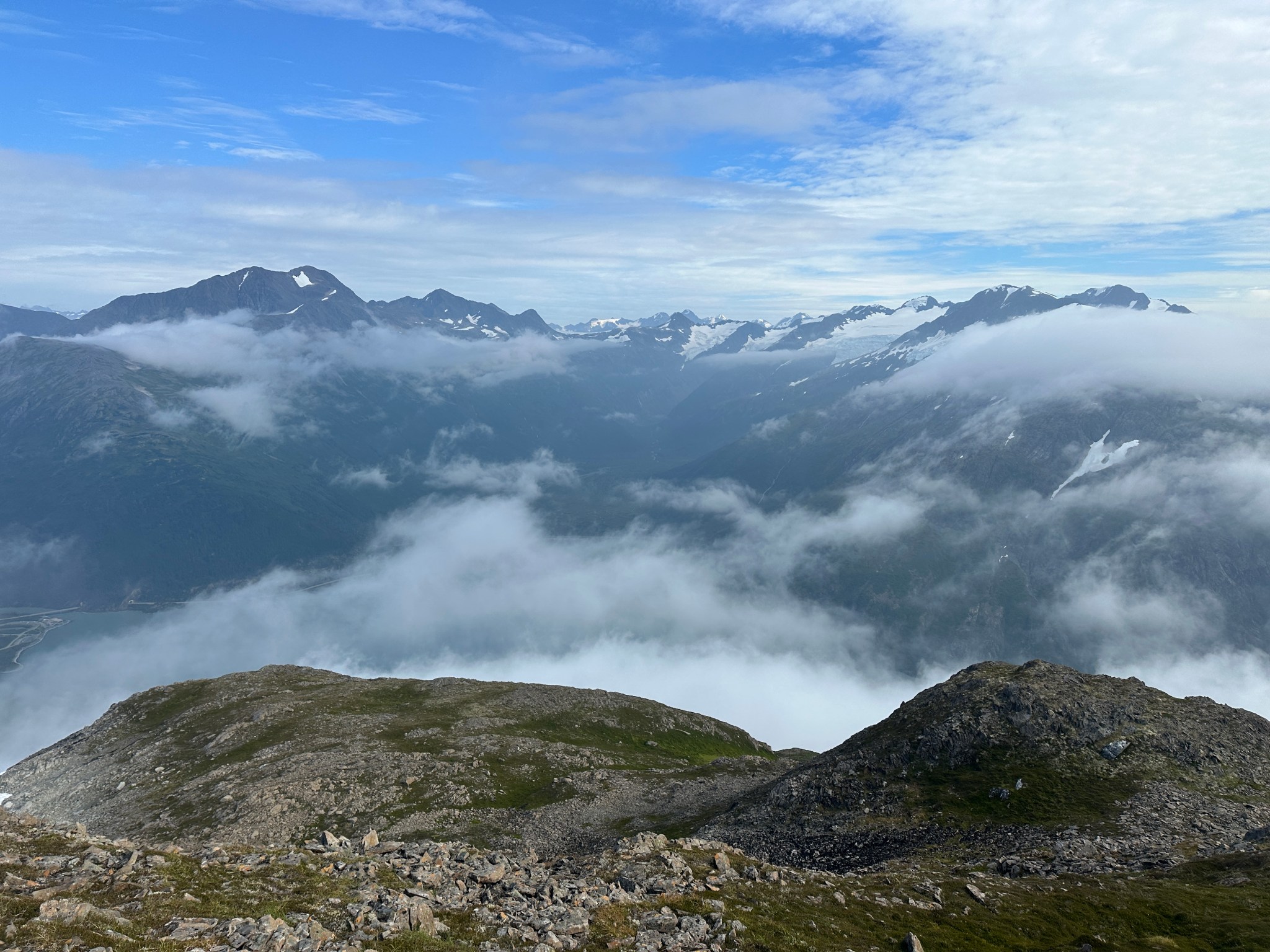
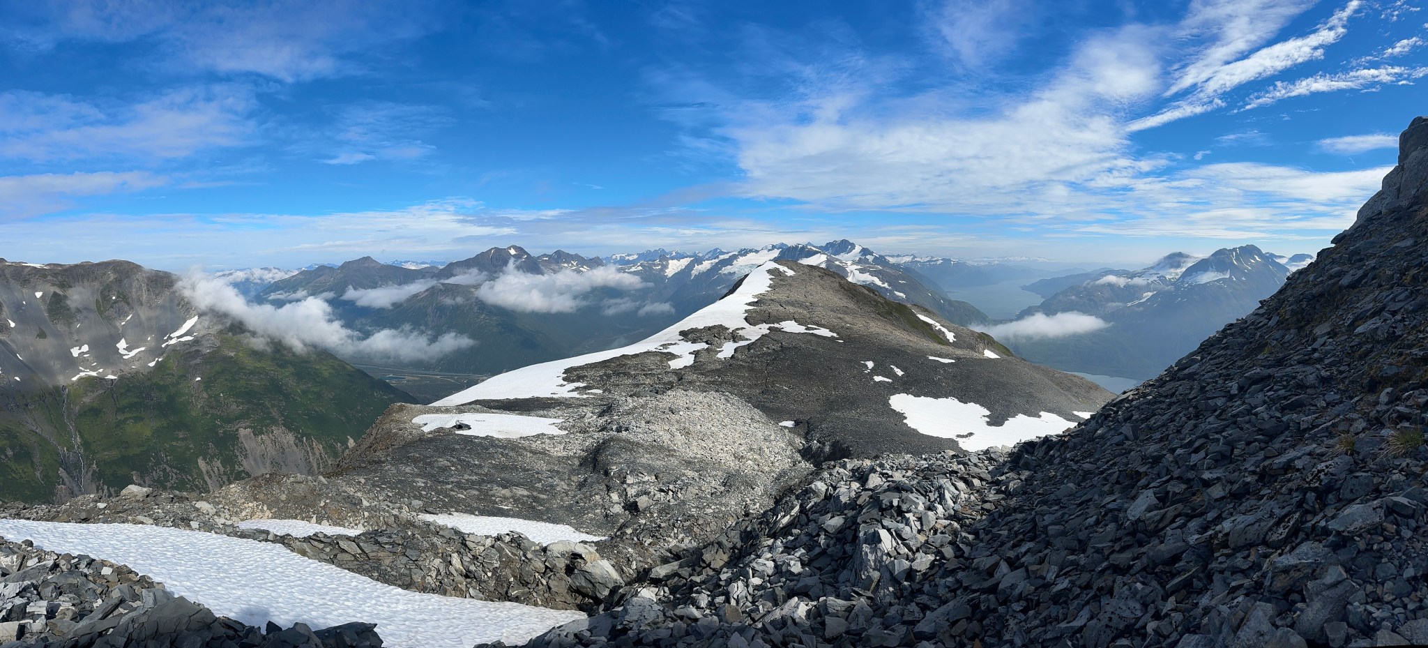
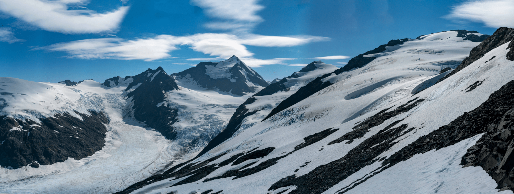
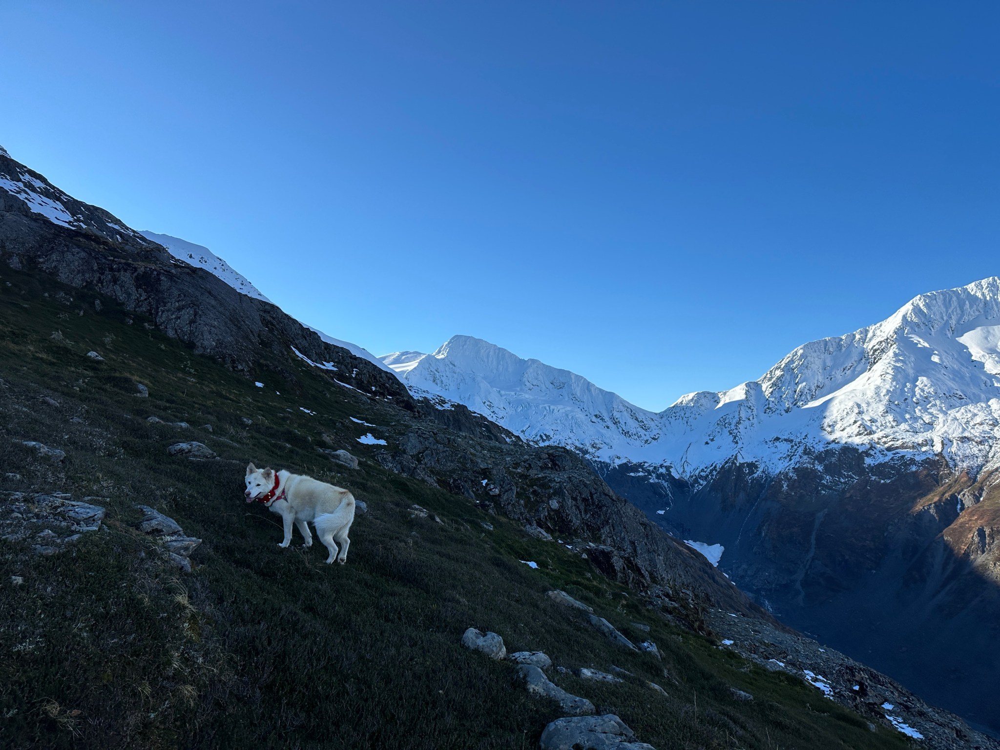
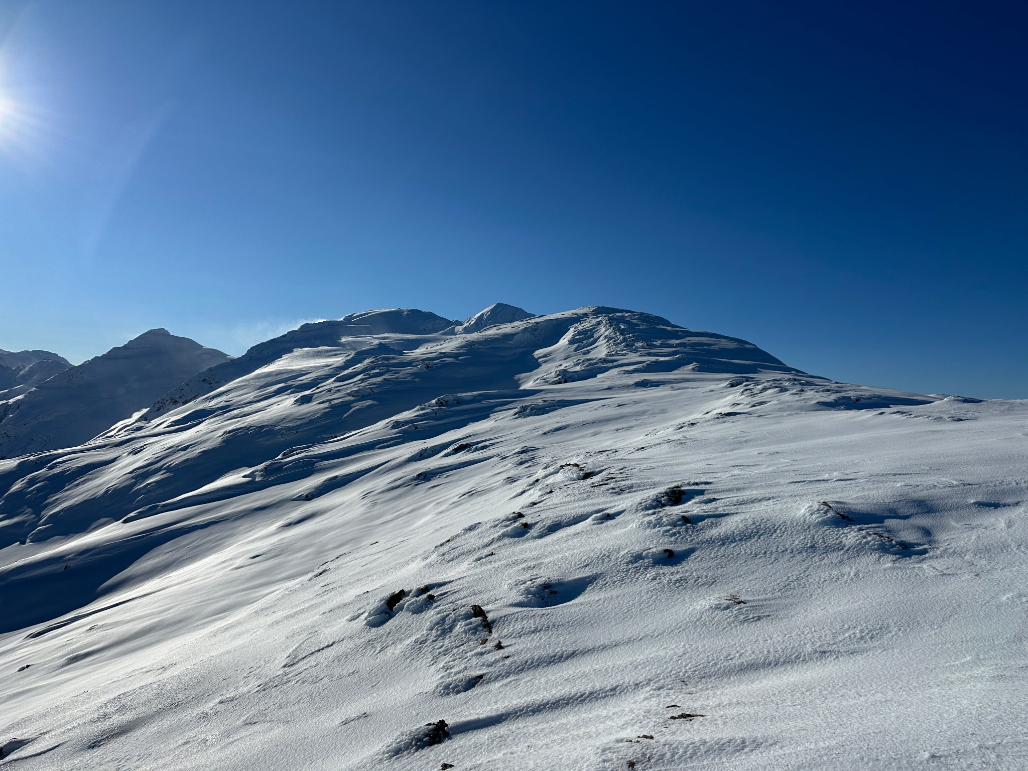
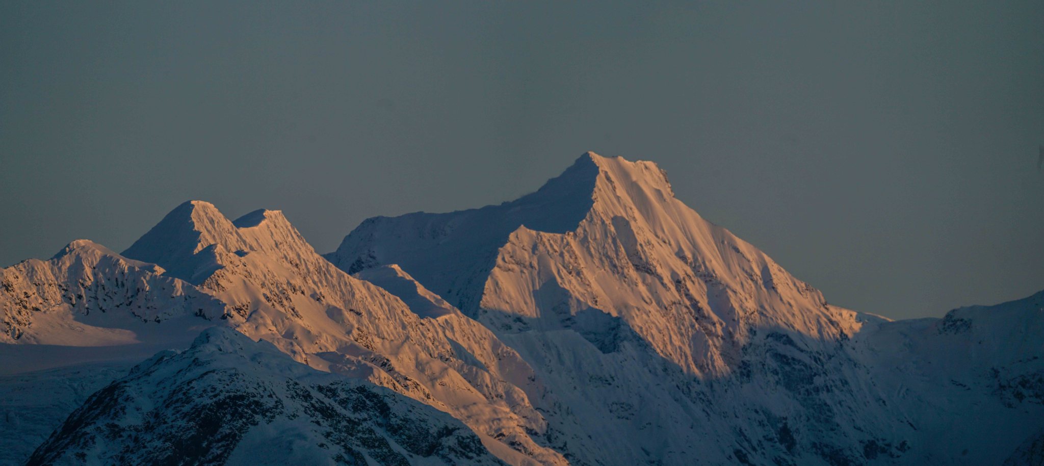
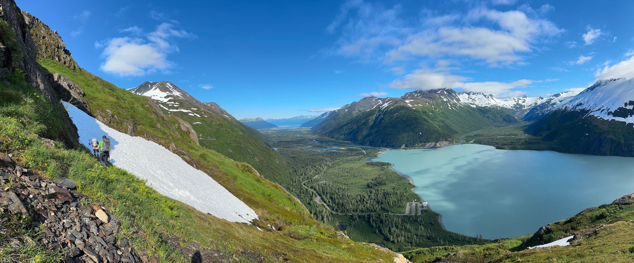
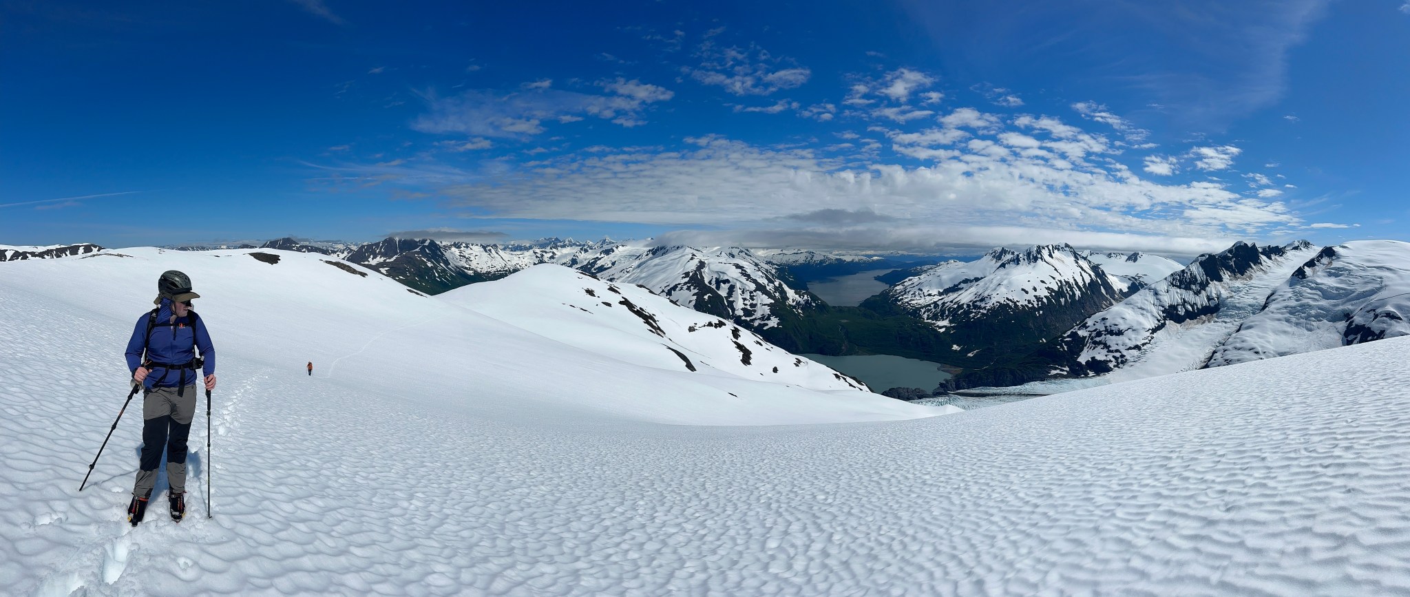
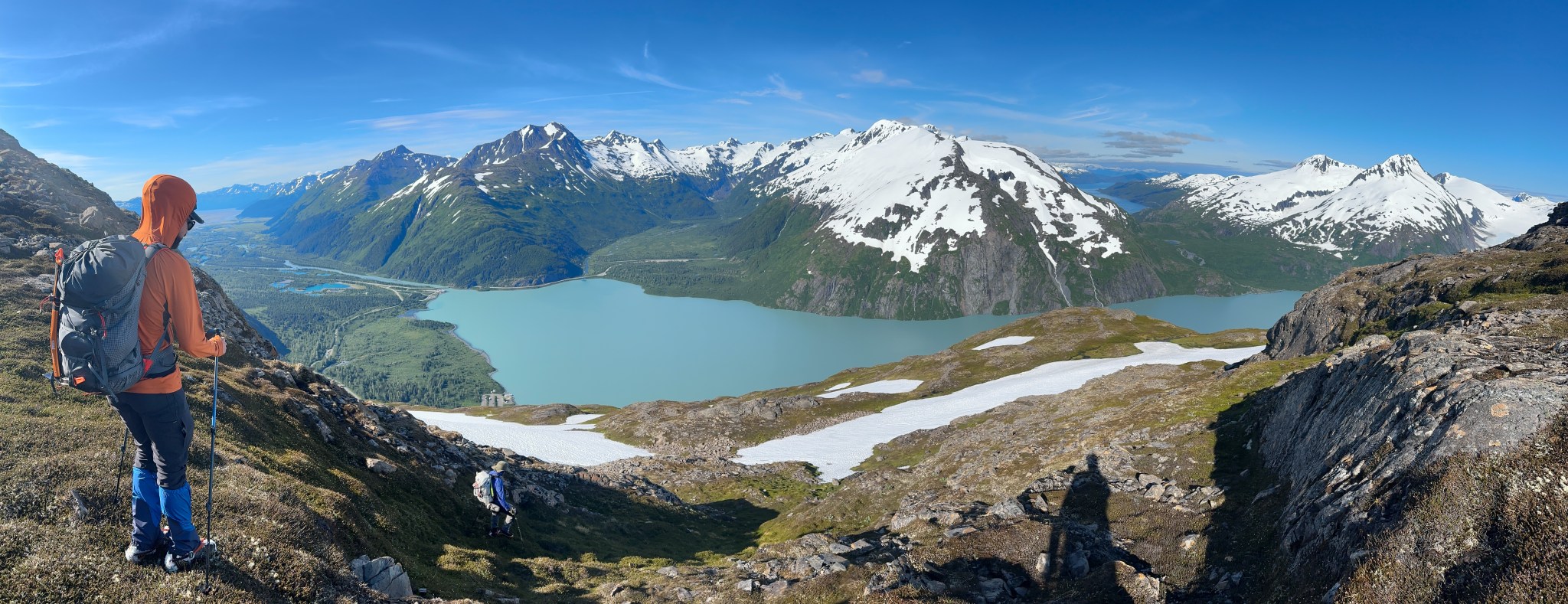
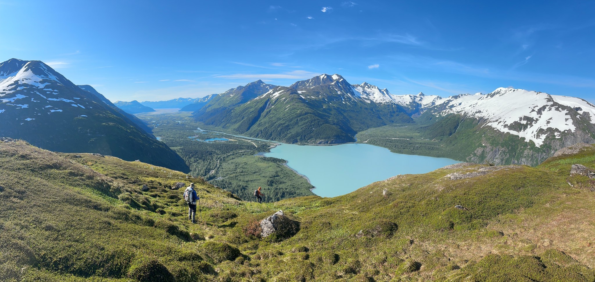
I finally saw it: on August 3rd, the clouds cleared and I took off from work early, leaving my dog Kiro with some of his friends. I left the parking lot around 5PM, and navigated the steep tundra up ~2,300′ above the brush and made it to the top of the ridge by 8:30PM. As I traversed the wide ridge from the northwest to the east side, the glaciers that feed Portage Glacier from the SE loomed into view. I found an excellent vantage point on some solid rocks on the east side of the ridge which I called the “ridgecrest”. The elevation is roughly 3,200′. The sun was setting and, while the evening light on Carpathian was gorgeous, I knew I’d have to come back to get a photo of Portage Glacier in the sun. Regardless, finally seeing the massive glacier was thrilling and fulfilling. I scurried back down the ridge and apologetically picked up Kiro from his dogsitters the sometime after midnight; they were retired and night owls, but I knew they wanted to get to bed.


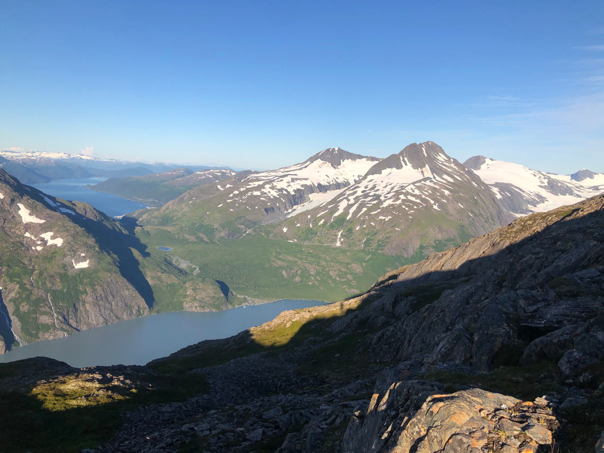
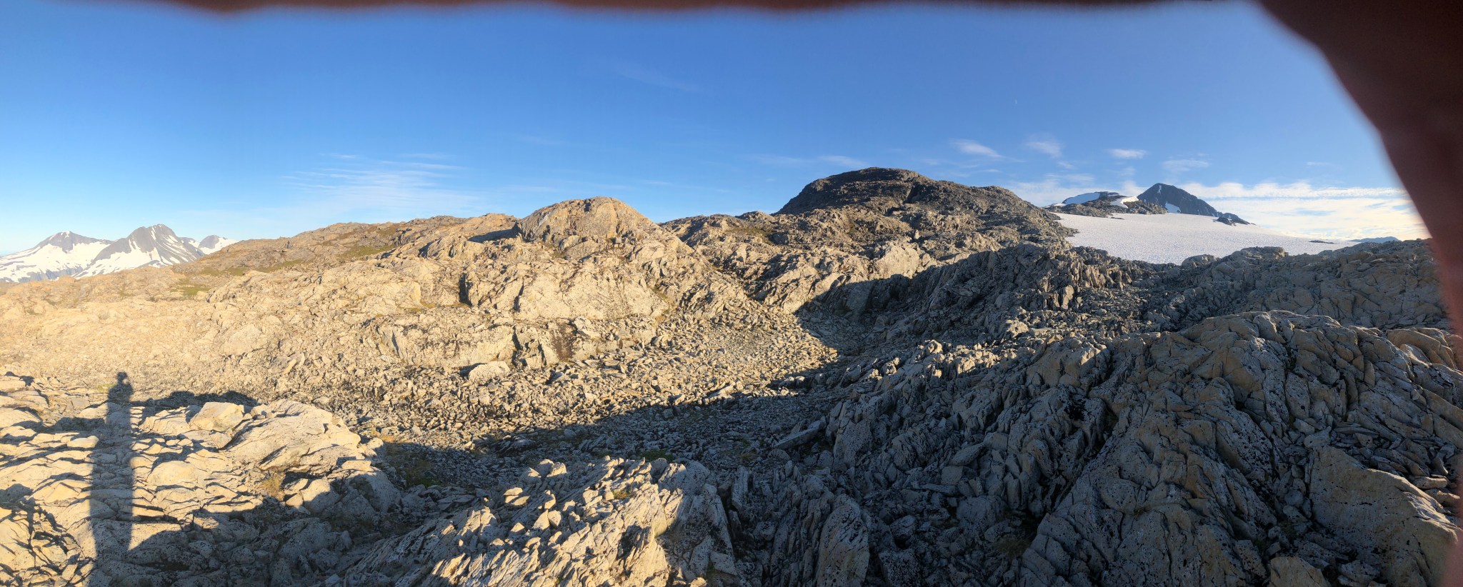


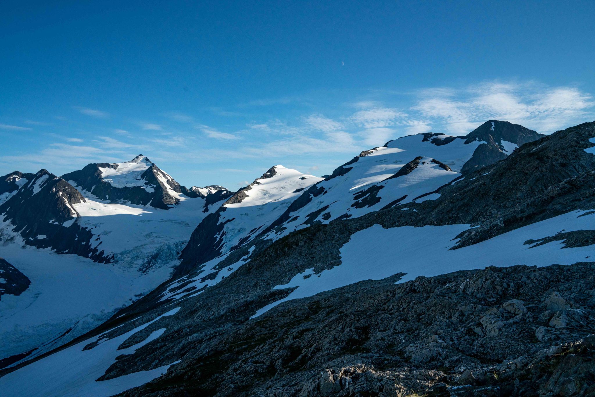

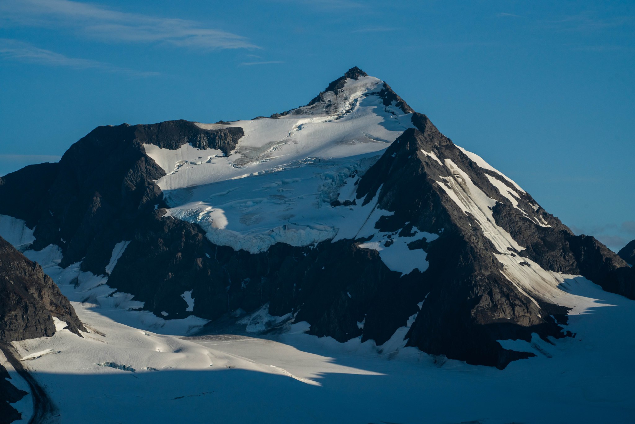
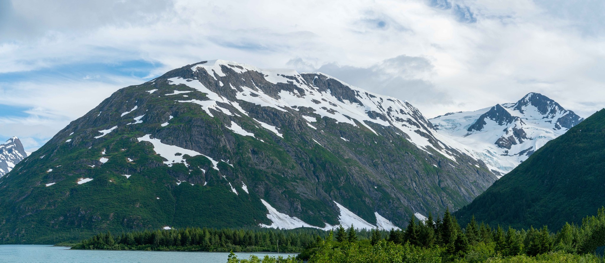
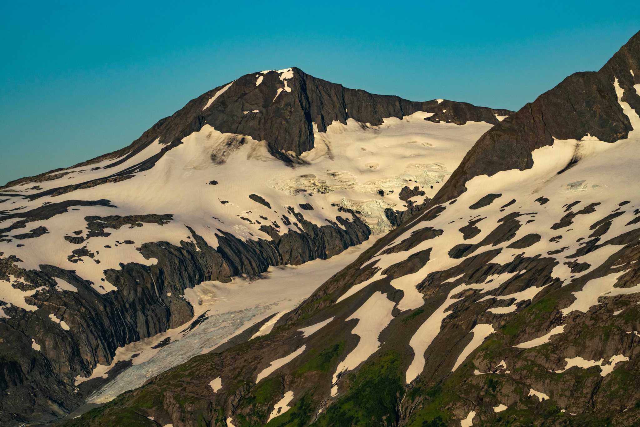
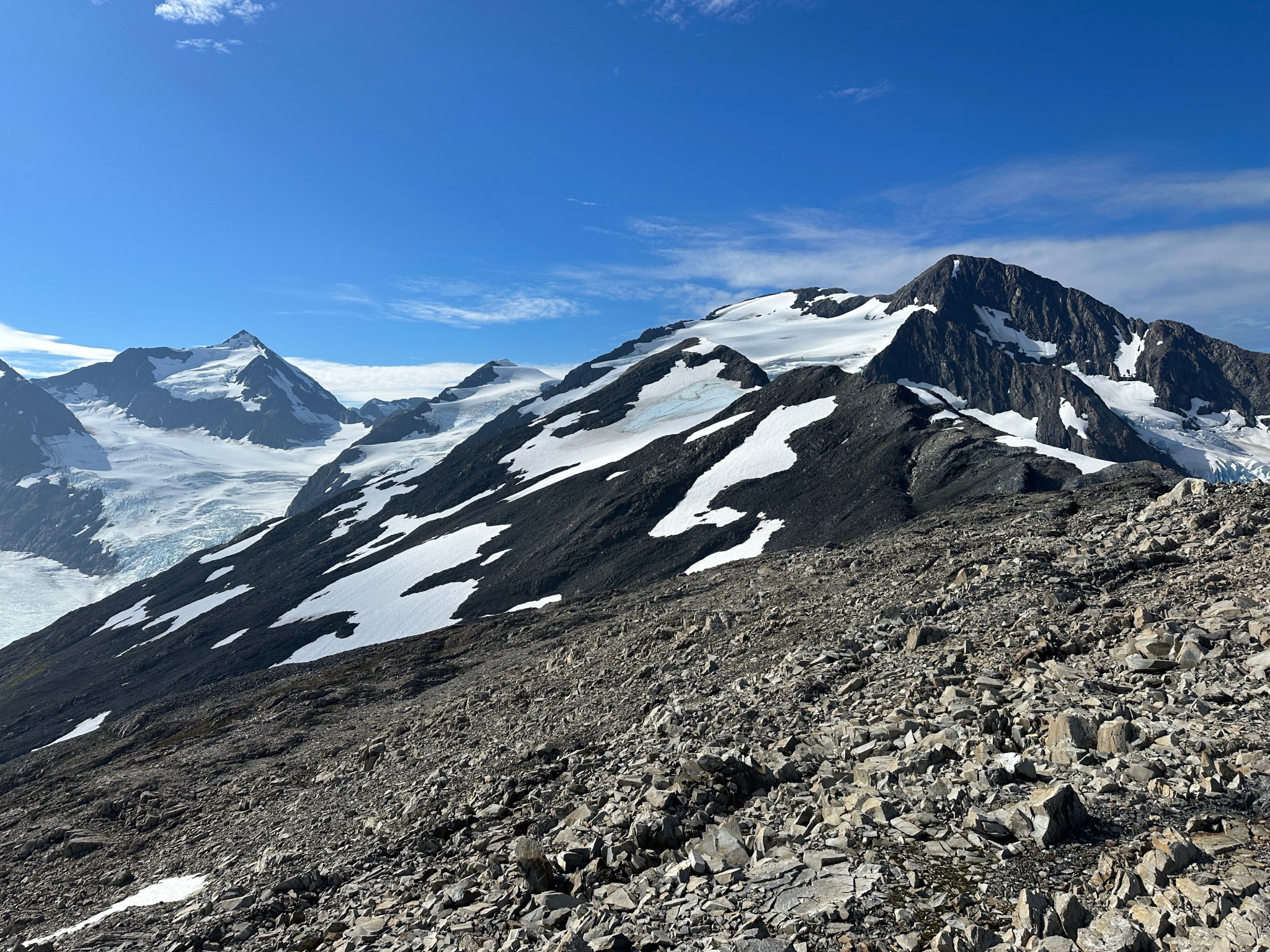
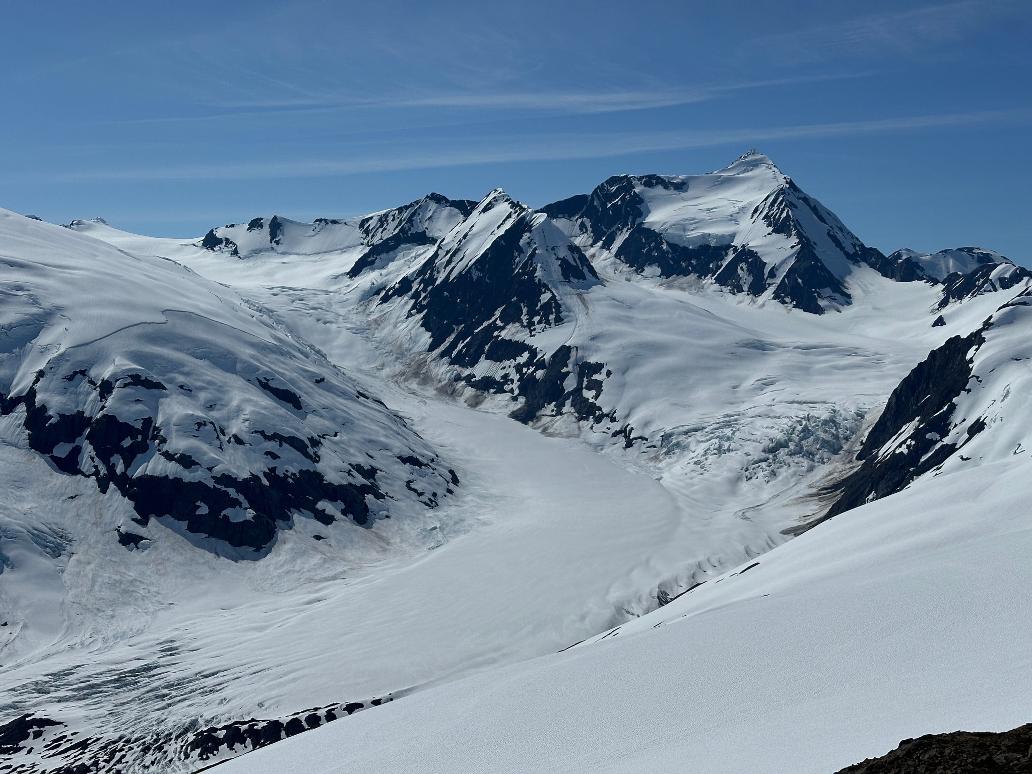
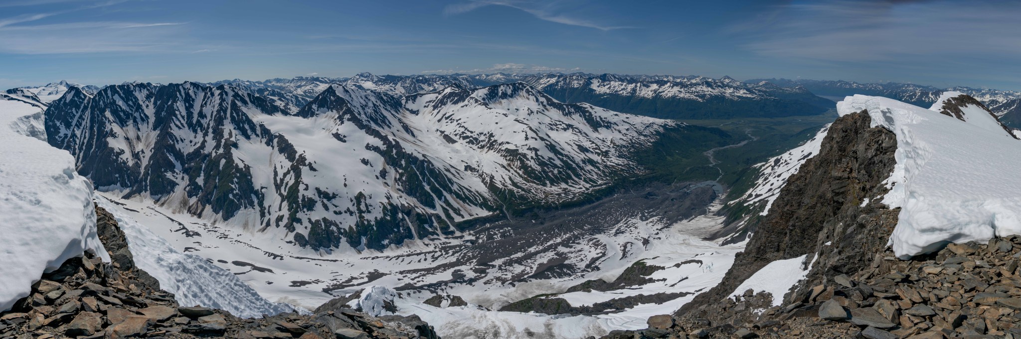
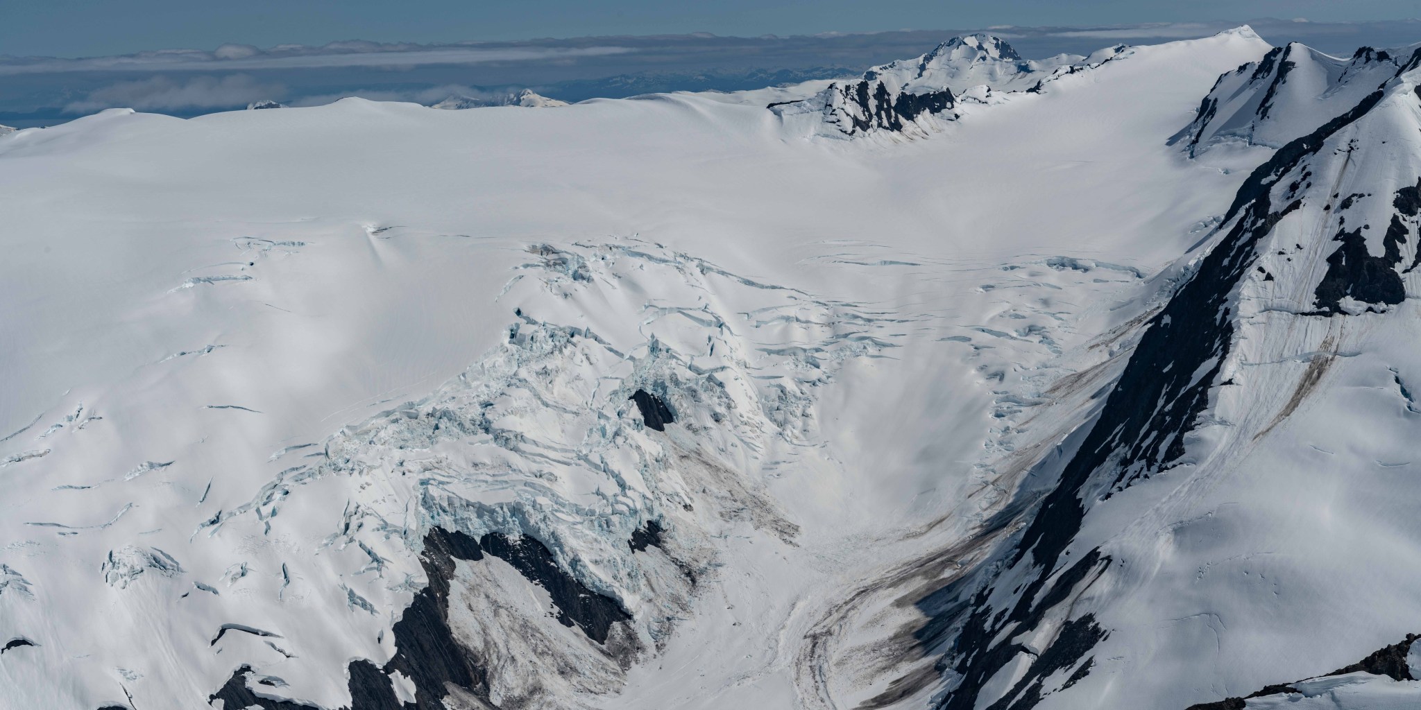
While I was taking photos from the ridgecrest, my eyes had been to the end of the long NE ridge of Byron Peak, where I spied the true summit. I snapped a few photos to look at later, as it was neither prominent nor impressive enough to stand out compared to Carpathian; it was merely the end of a long ridge and blanketed by Byron Glacier. That glacier is interesting, spanning the ridge and spilling over both the east and west sides. Unseen from the ridgecrest, a separated lobe of Byron glacier hangs on Byron’s north face and is the most prominent piece of ice visible from Byron Valley. Byron Glacier no longer connects with Portage Glacier, but it used to connect with the glacier to the south, which connected to Portage in 1984.

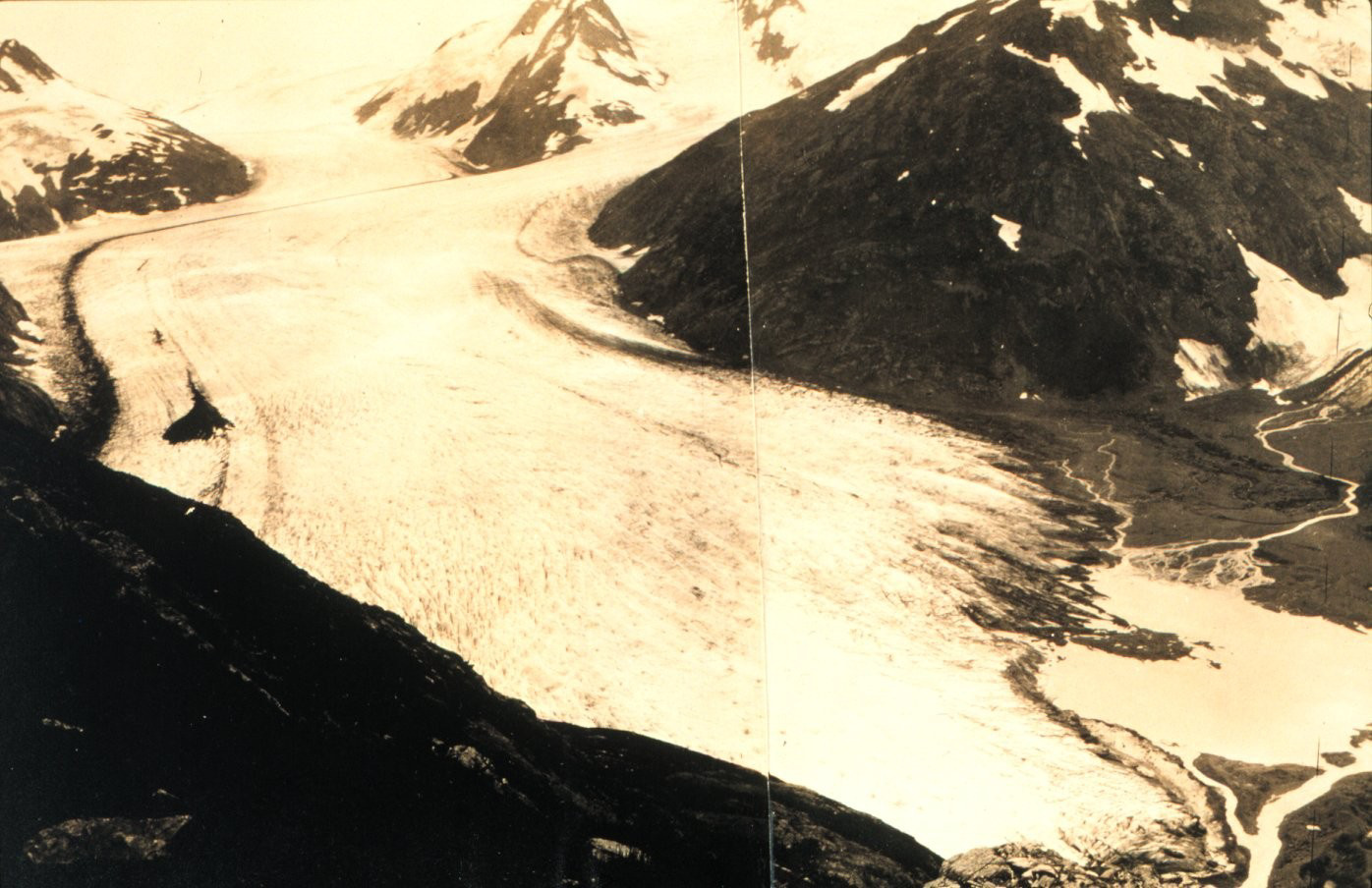
Archival Photo

Photo Credit: Tim Kelley
https://www.outlookalaska.com/PortagePhotoRecreate/

https://www.akmountain.com/wp-content/uploads/2024/09/0e8fff17-223a-4f11-834f-bc201731598f-750×536.jpg


On August 24th, I matched with my first Tinderella. Her name was Claire Dorn and at the time she was very busy with family in town and planned trips with friends, so we didn’t meet up for a few weeks. We graduated from Tinder to actual texting in early September. We exchanged a lot of photos during this time as our form of flirting. I told her I was going on a hike in Portage Valley but was pretty vague as to where….at the time I was keeping my route top secret!
I convinced Grant and his brother-in-law Blake to try my route on Labor Day of 2022. I was dogsitting Persi and decided to take her as well. She was 12 at the time, selectively deaf, and had to remain on-leash or she’d run off. I’ve known her since before she could open her eyes and felt she could make it up the ridge just fine. We made fast time up the ridge, with the exception of the one steep section where I had to pick up Persi and hoist her above my head, which she did not appreciate (“Grant this is my least favorite part”). I fell forward while lifting Persi and cleanly cut my palm on a rock, which later left a scar. Claire and I met up and walked Kincaid for a few hours on September 12th. We met up every day for 7 days (“Claire Week”). The first few times I held her hand I had to be very careful with my palm!


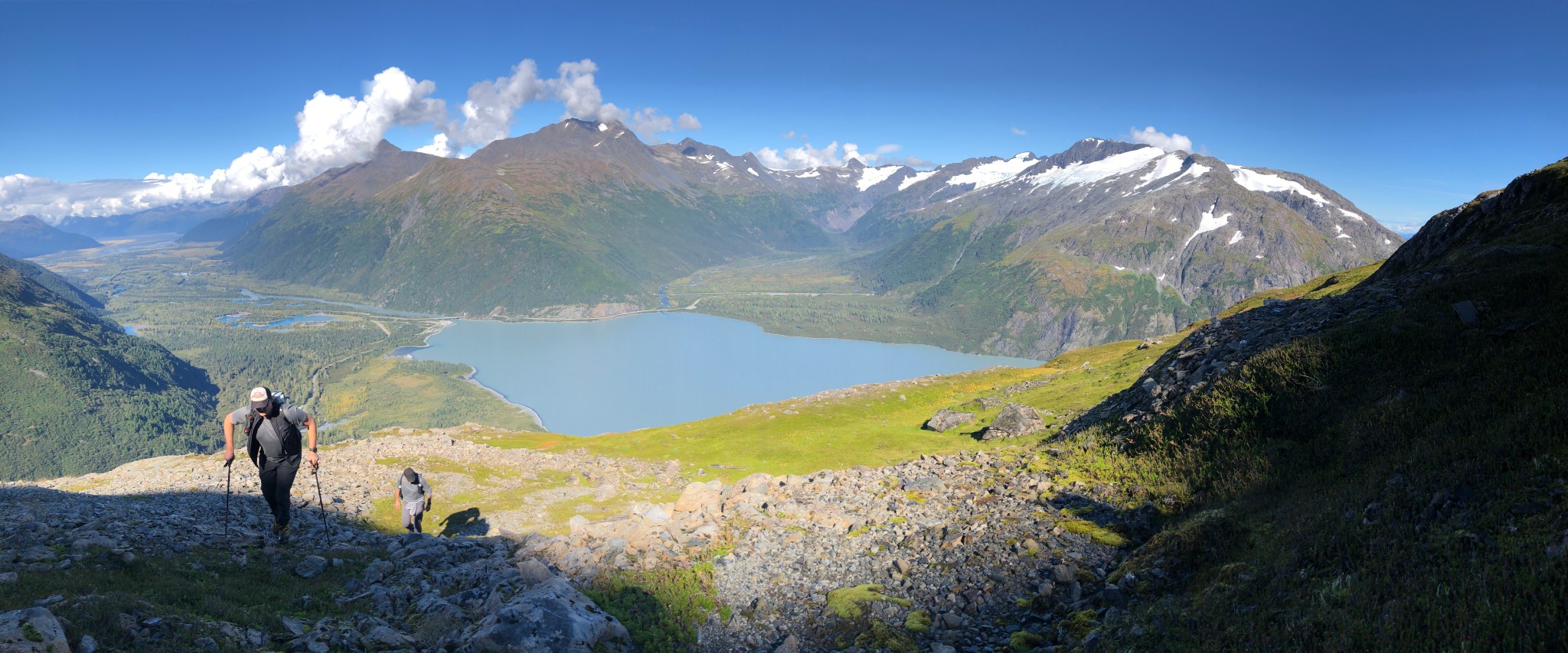
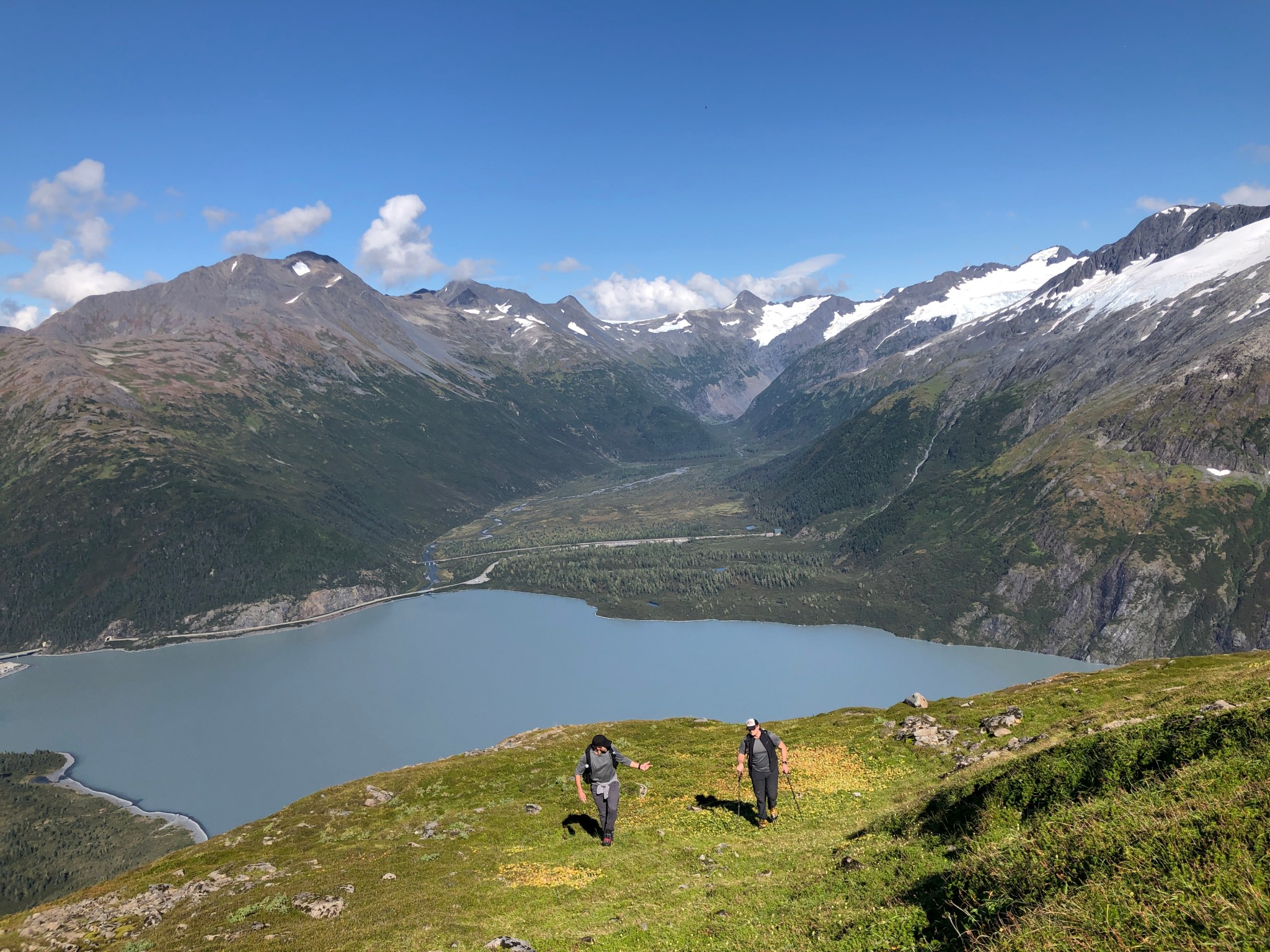


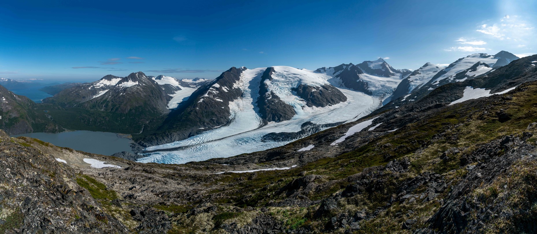
Grant, Blake, and I reached 3,200′ and traversed across the ridge to the east side to the ridgecrest. We hung out in full sunlight, taking photos for an hour or so. I finally had my Perfect Portage Panorama and was satisfied.

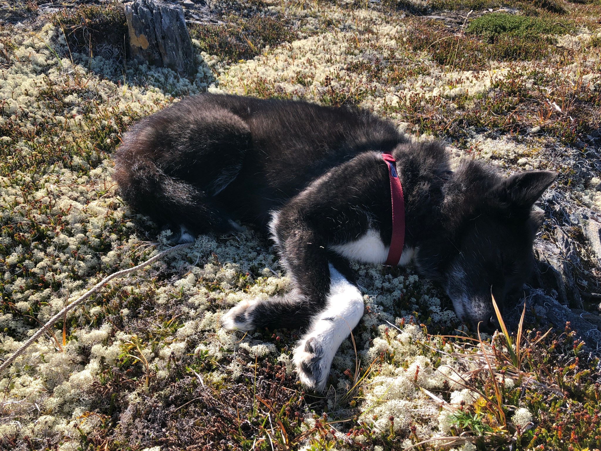


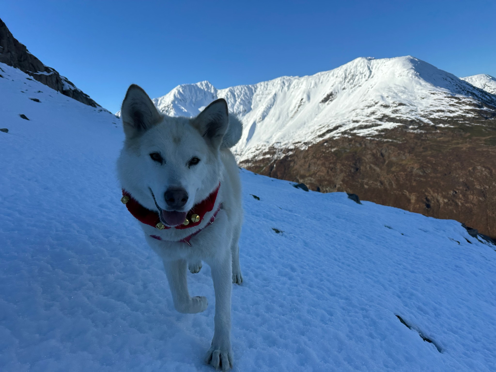
Foreground: Persi, ridgecrest

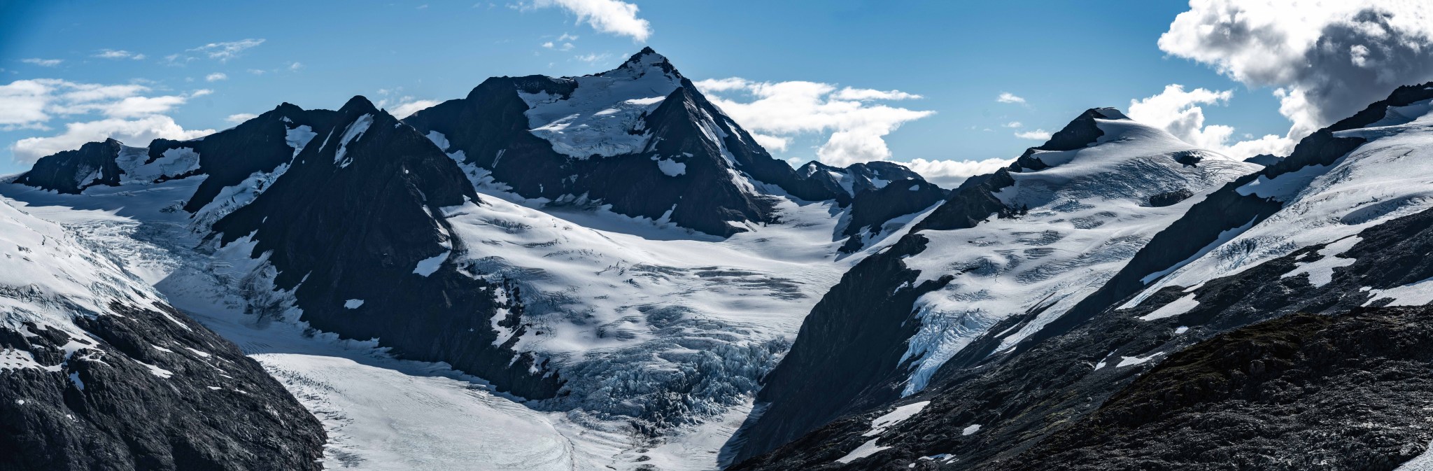


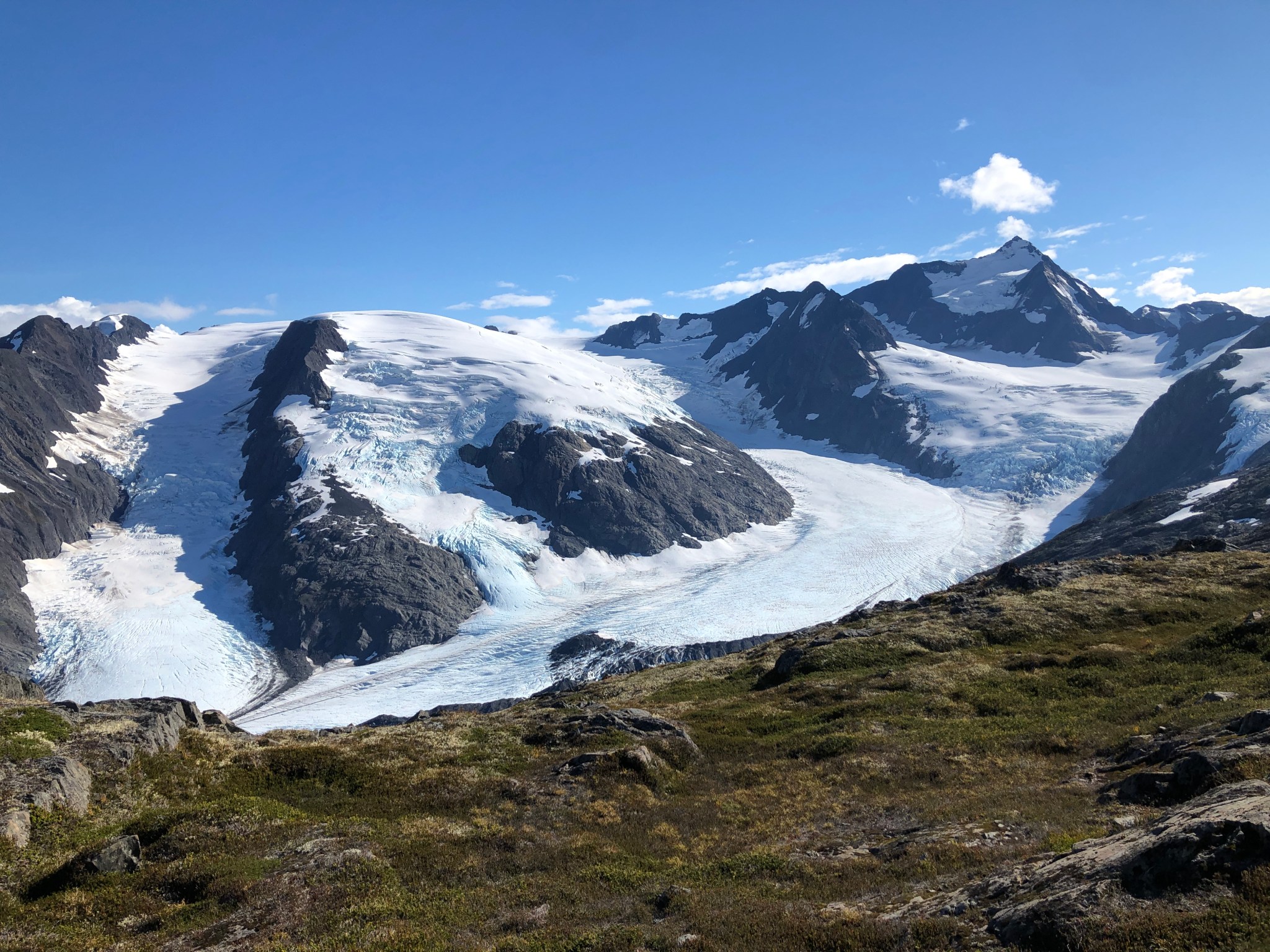
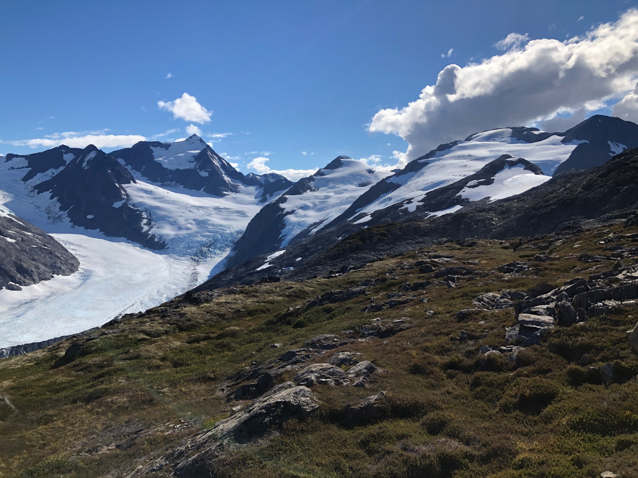
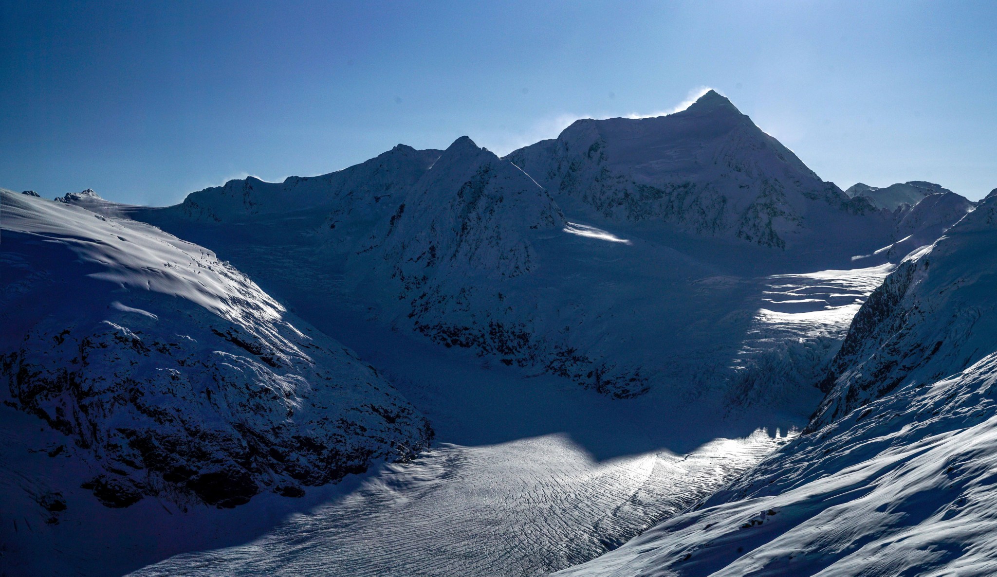
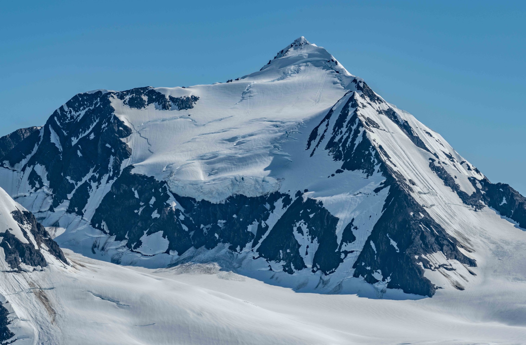
My eyes were increasingly drawn to Byron’s east summit, a mere 1,500′ higher. Byron Peak looks drastically different from the ridgecrest: a gentle glaciated high point versus the dramatic 3,500′ rocky cliff as seen from the Seward Highway and Byron Valley. Byron Peak has two summits, the slightly higher, less-climbed east summit was the focus of my attention (I’m a mountaineer). It looked fairly straightforward, though with the current thinning snowpack I could see a number of crevasses on the glacier-covered north-facing slopes that would be problematic. There was maybe 2.5 miles of travel from the ridgecrest to the summit, with a lot of rock in between. September was obviously too late in the season to efficiently climb the peak.
On our trip back down, Persi began insistently pulling me across the slope. We spied a lone mountain goat walking across the tundra. Grant started calling this route The GOAT, as well as The Devil’s Asscrack, for all the thorns and humid air.


2023
In 2023 I returned on my own on July 4th to pack down the alder tunnel, fix a rope, and hopefully visit the ridgecrest. On my way up, I noticed a few piles of bear scat on what was becoming a “trail”. I had only noticed one on my last trip up in 2022.
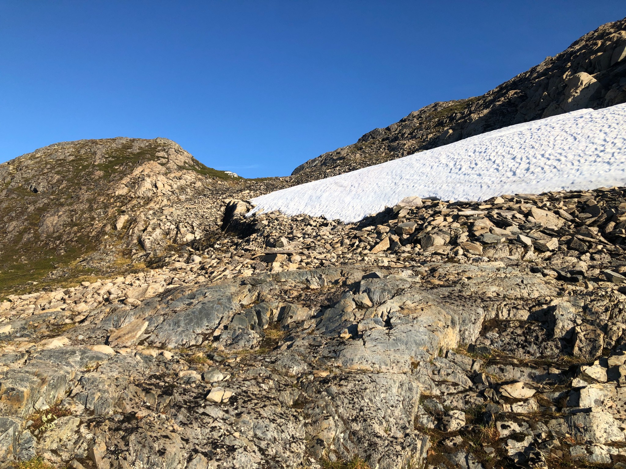
After the fresh bushwack to 900′, I climbed to the spot where I had cut my hand the previous year. This was where a rope would be useful. I used a few pieces of extra rope I had lying around and firmly fixed a ~50′ line to a clump of alders. Intending to ascend further, I yelled “yo bear!” and to my surprise, saw the head of a black bear pop up a couple hundred feet above me. I immediately turned around and descended.
In late August 2023, I attempted to find a partner with whom I could climb Byron’s east peak. The conditions and weather were looking perfect, but I could find no one who would join me. Claire and I were coming up on a year together and had just had a talk where I seriously committed to the relationship. For the first time, I brought a second can of bear spray. On August 22, 2023 I left the parking lot around 6:30AM and climbed to the ridgecrest in a little over 3 hours. This time I kept going.

Exploring the terrain south of the ridgecrest was rough, the snowy areas made for fast travel but everything else was endless piles of rock. I spied a lone mountain goat on the snow on the ridge, likely the same one I saw last year. I politely hiked around his hill as to not disturb him, but later when I realized I was in close proximity I snuck around and found myself within 100′ of him. He was very relaxed, lying next to some of his own shit on a patch of snow. I snapped a few photos, thanked him for letting me do so, and continued up the ridge.

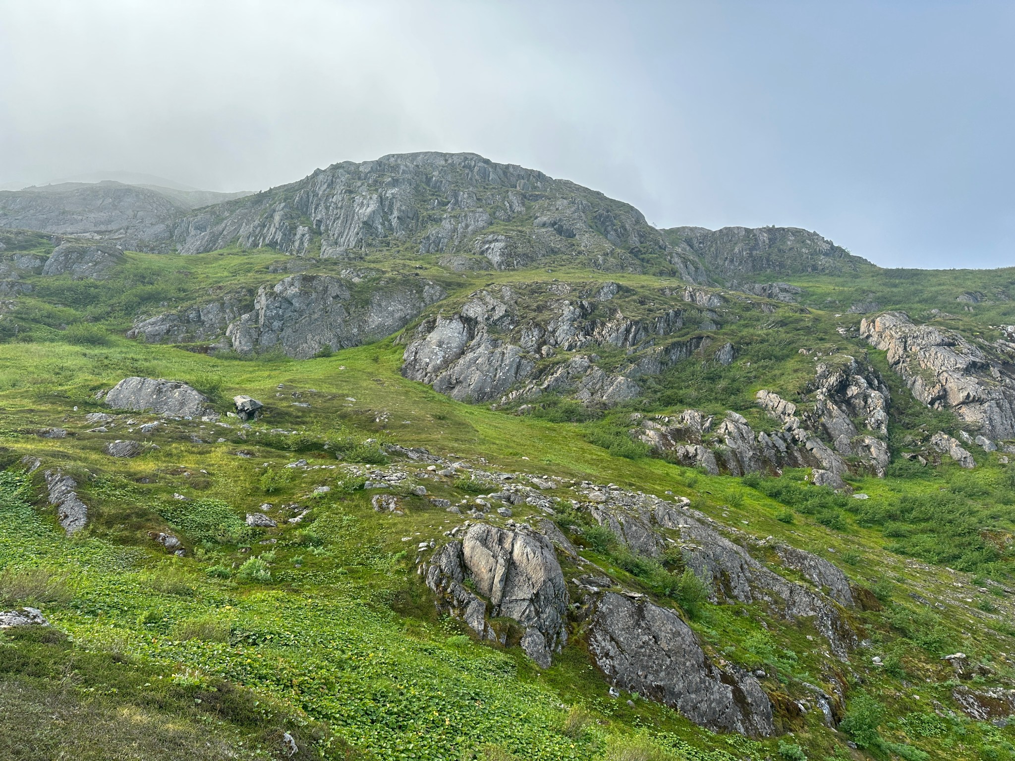


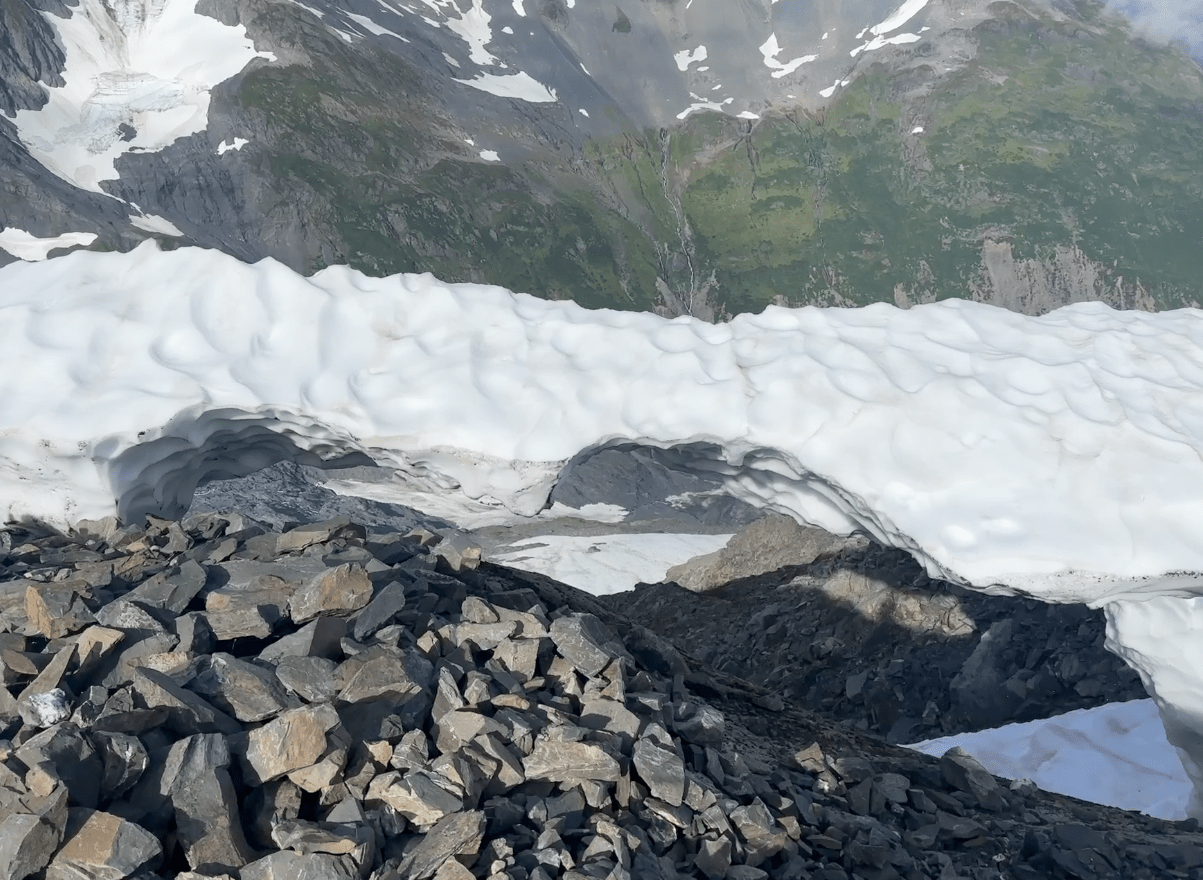
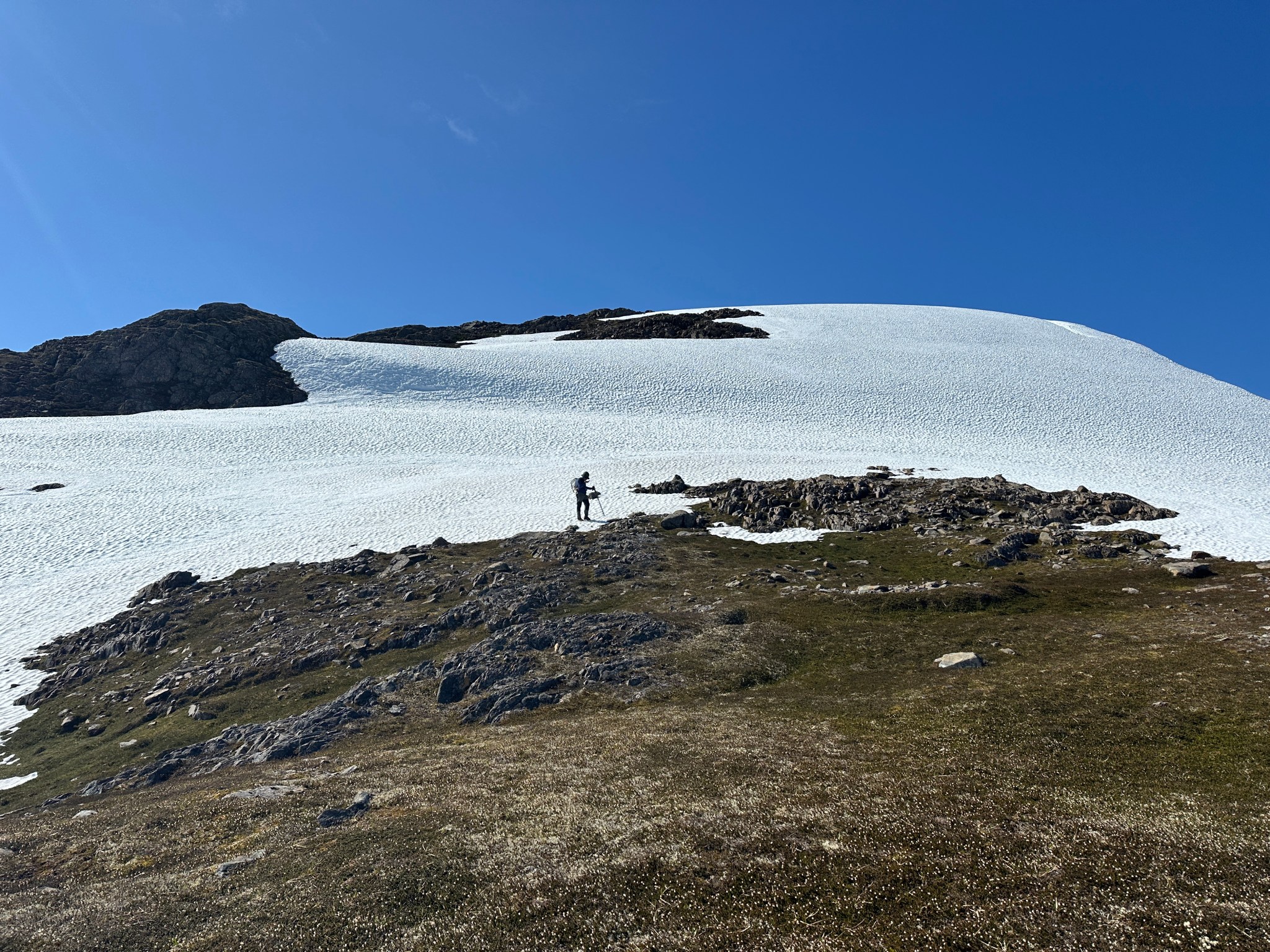
I hiked up the ridge as far as I could, staying high on the west side of the ridge after passing the goat. It was more exposed than the east side, but the massive cornices had (mostly) melted away and I was hiking on solid (for Alaska) rock. I passed a remnant glacier one one point, a glazing of ice on a low point between bumps on the ridge.


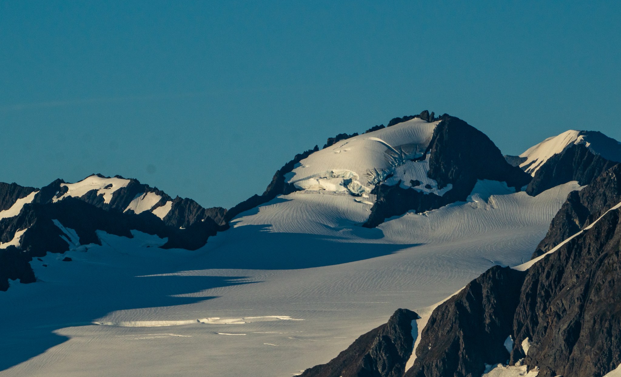
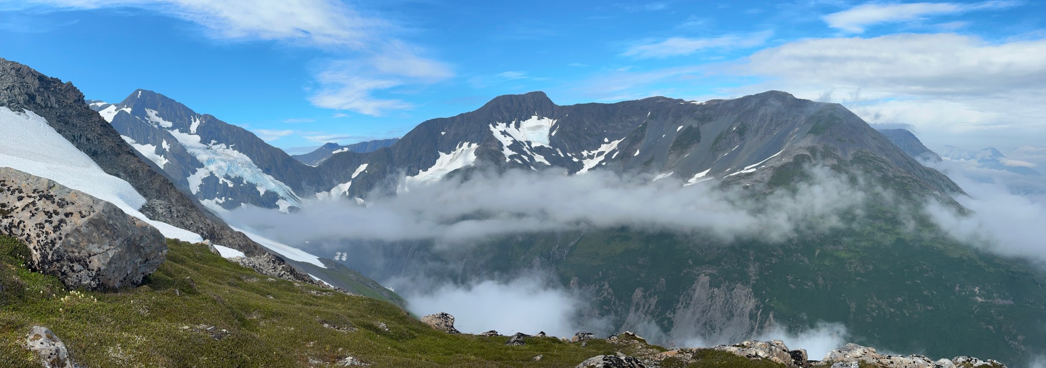
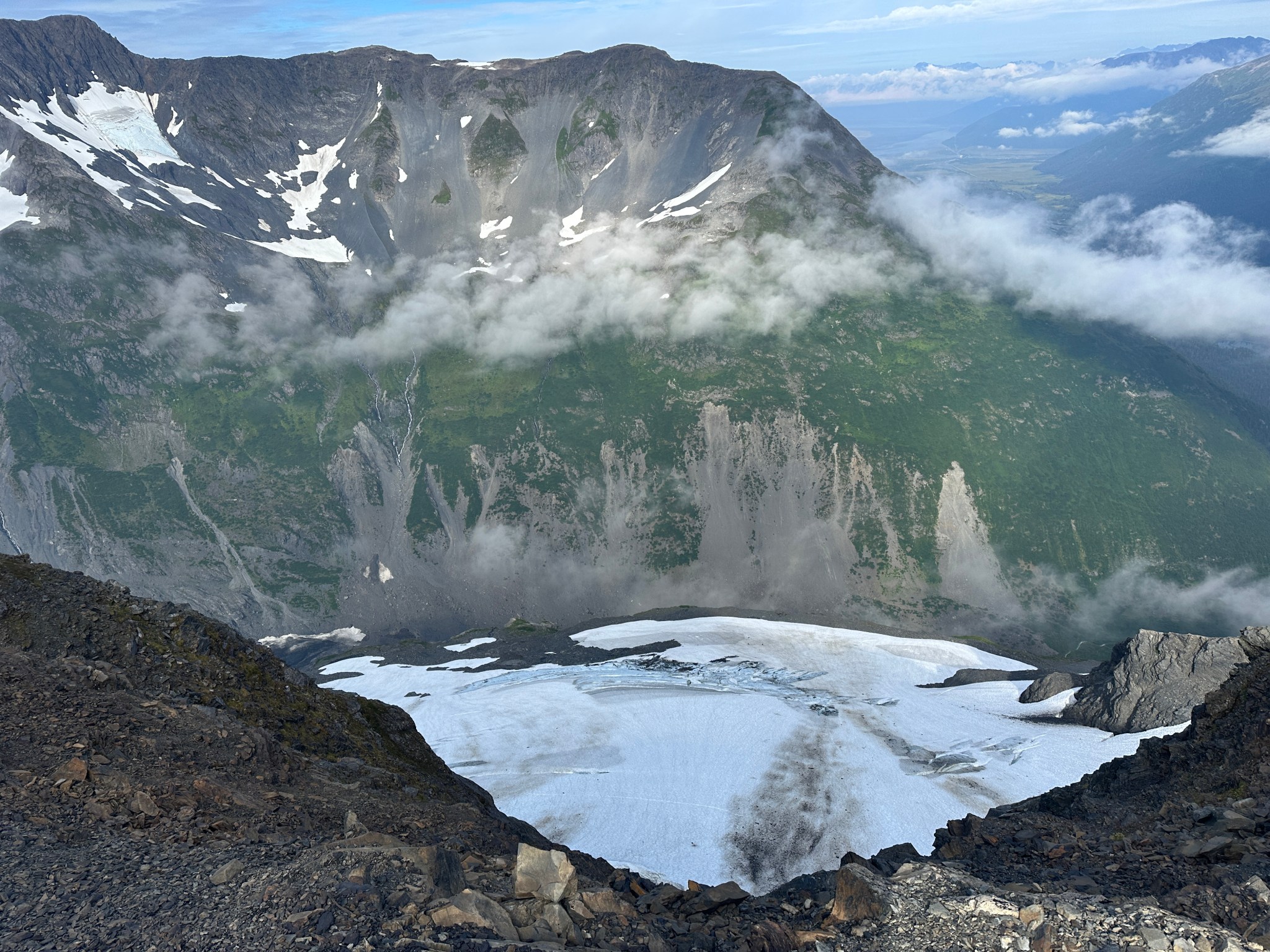
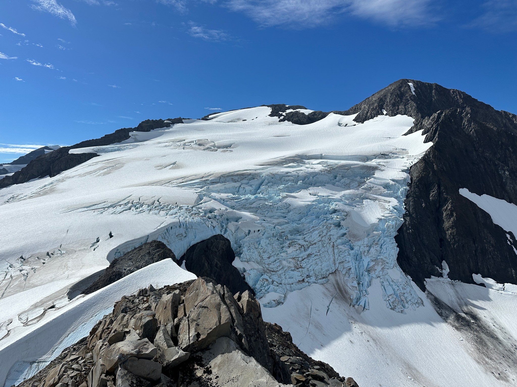
The views down into Byron valley were incredible and it was still early in the day. I was nearing the summit glacier, so I stayed on the west side of the ridge and climbed a little knife edge to gain the last rocky outcrop. If I were to proceed further I’d have to descend to the glacier, but from here I had a great vantage point. Before me Byron’s summit glacier oozed down the east side of the ridge as a long, sinuous ramp full of cracks, whereas it to the west it dropped off spectacularly as an icefall. I could barely make out the detached north piece of Byron Glacier. My mind considered the possibility of going for the summit, but as I had just seriously committed to a life with Claire I decided against such an attempt. I did hang out on the ridge for a long time, I was up there for 11 hours (car to car) and somehow only spent 5.5 hours moving. I could clearly see the remaining route to the summit and made note of it, when I retreated back down the ridge I tried taking the most efficient line possible, marking waypoints for a potential future ascent.


The first part of my descent was fairly uneventful; I spotted the goat from far away. I climbed down the north side of the ridge and started making my way down the west aspect. When I reached roughly 1,700′, I saw a black bear below me. Fuck! Fuck fuck fuck! I had imagined this, and short of dying this was my worst-case-scenario: being trapped on the ridge by a bear below me. There’s only one efficient way into the alpine, my now-obvious alder tunnel. I got my second bear spray out, just in case I had to use my first. Facing down the slope, I did my best Sarumon impression, lowering my voice to a bellow and screaming at the bear to GET OFF MY MOUNTAIN. I yelled and I yelled, and after some initial curiosity the bear fled downwards. I descended, following it, around the cliffs until I saw it again around 1,200′. Once again I screamed at the bear, scaring it further down. At this point I didn’t stop yelling, as I was reaching the choke point where the tunnel started and I wanted that fucker to fear me. I saw the bear running downhill as I rounded the last corner before the alder tunnel, but I didn’t see it again after that. I made it to my truck, a bit shook to say the least. While I didn’t promise Claire not to go back to Byron alone, I wasn’t really interested in going back on my own anymore.
2024
In 2023, I had begun studying for the Professional Engineering exam. Which is to say…I submitted my paperwork, studied for a few hours, then the PE Board got back to me and said I had to submit more justification to qualify to take the exam. So I postponed studying until the Board approved my amended application. After I wrote a long letter explaining my atypical career trajectory, the Board finally approved my application and I began studying in earnest after a successful moose hunt in September 2024. I studied for 5 months in total, for about two hours a day, every day, without much to look forward to besides time with Claire, running with the dogs, and yoga.
I hadn’t been to Byron Peak in over a year. I watched the summer season come and go without much appetite to climb back up that bear-infested ridge. The bears were conflated with Byron Peak in my mind. I had come to calling the alder tunnel “Byron Alley”, but it might as well have been “Bear’s Playground”. I knew the trail I blazed gave them access to the high tundra and they now claimed it as their own. I did briefly plan to climb Byron Peak in early July with one of the boys from Denali, but a recent bear kill in Byron valley caused the State of Alaska to close the Byron Glacier trail. Given my route was within a mile of that trail, Claire and I agreed it would be imprudent to try the climb at that time. I proposed to her while picking berries in Hatcher Pass in mid-August and didn’t think much more about Byron as I settled into a PE exam study routine.

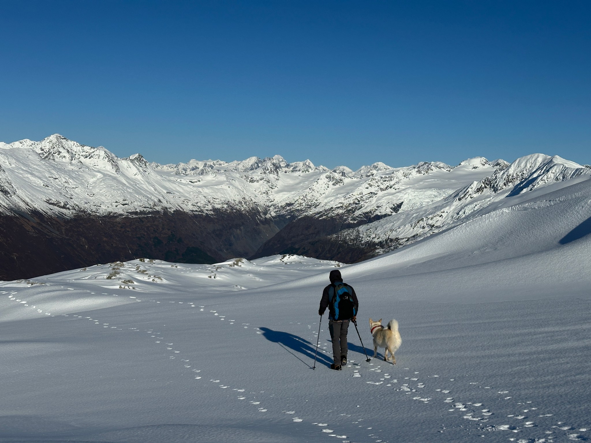
I kept watching the Portage webcam to keep track of conditions all year, as I wanted to understand how the snow accumulated and melted over time. The snowline had descended down the mountain, but given our weird winter it actually crept back up a fair amount and there was no snow below 2,000′. I figured this was a unique opportunity: hopefully the bears were denned for the winter and all the brush was dormant. A “safe” trip up Byron’s ridgecrest would be a nice break from studying so, with a high pressure weather window sitting on the Portage Group, on October 19 Zach Alexakis, Delta (my dog), and I went up to explore the ridge. We had an easy time finding my beat-in path with all the foliage fallen for the winter; with enough trips up and down, a semi-comfortable trail had begun to form and with gortex pants we had no problem with the thorny stalks of plants that cover the route. We made it through the alders in about an hour and were on snow before we topped out on the ridge, which made travel interesting and remarkably quick.
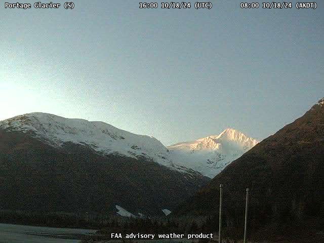


Much to my horror, we saw both bear tracks in the snow around 2,300′. Luckily, no actual bears. By the time we reached the approximate location of the ridgecrest (completely buried in snow), we were in full-winter conditions. The temperature had dropped, there was a strong wind with clear skies, and the ridge was more covered in snow than anytime I’d been up there. I snapped a few photos of the area, Delta played in the snow, and we descended without incident. I took some photos of the Portage Group on the drive back with my super-awesome new camera lens, though at the time I had not learned the value of a tripod so the golden-hour photos came out more blurry than I had hoped.


2025
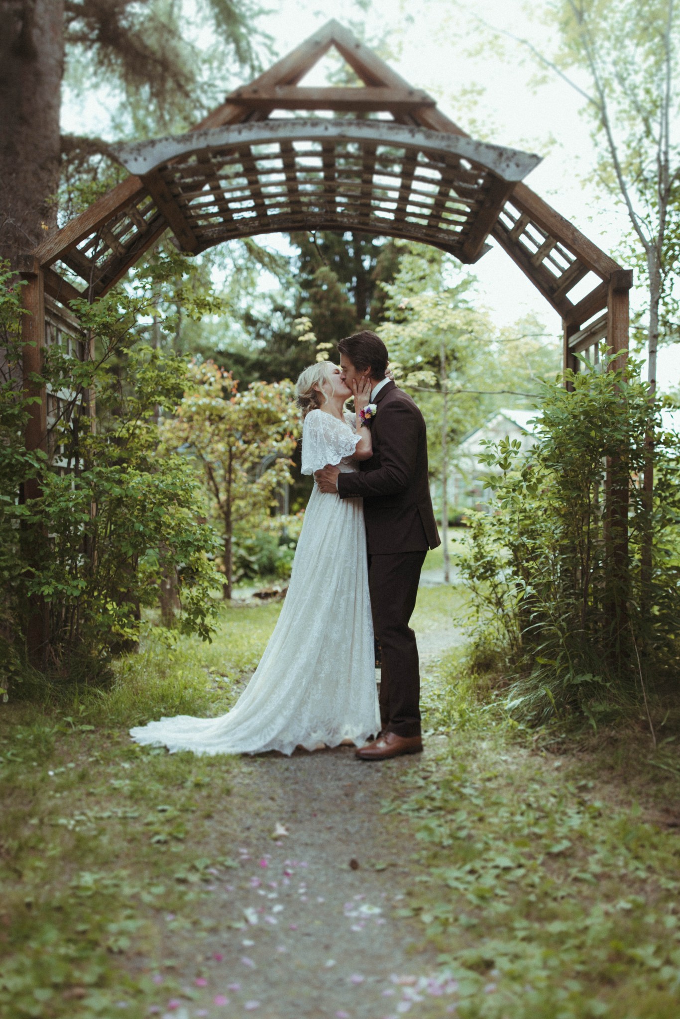
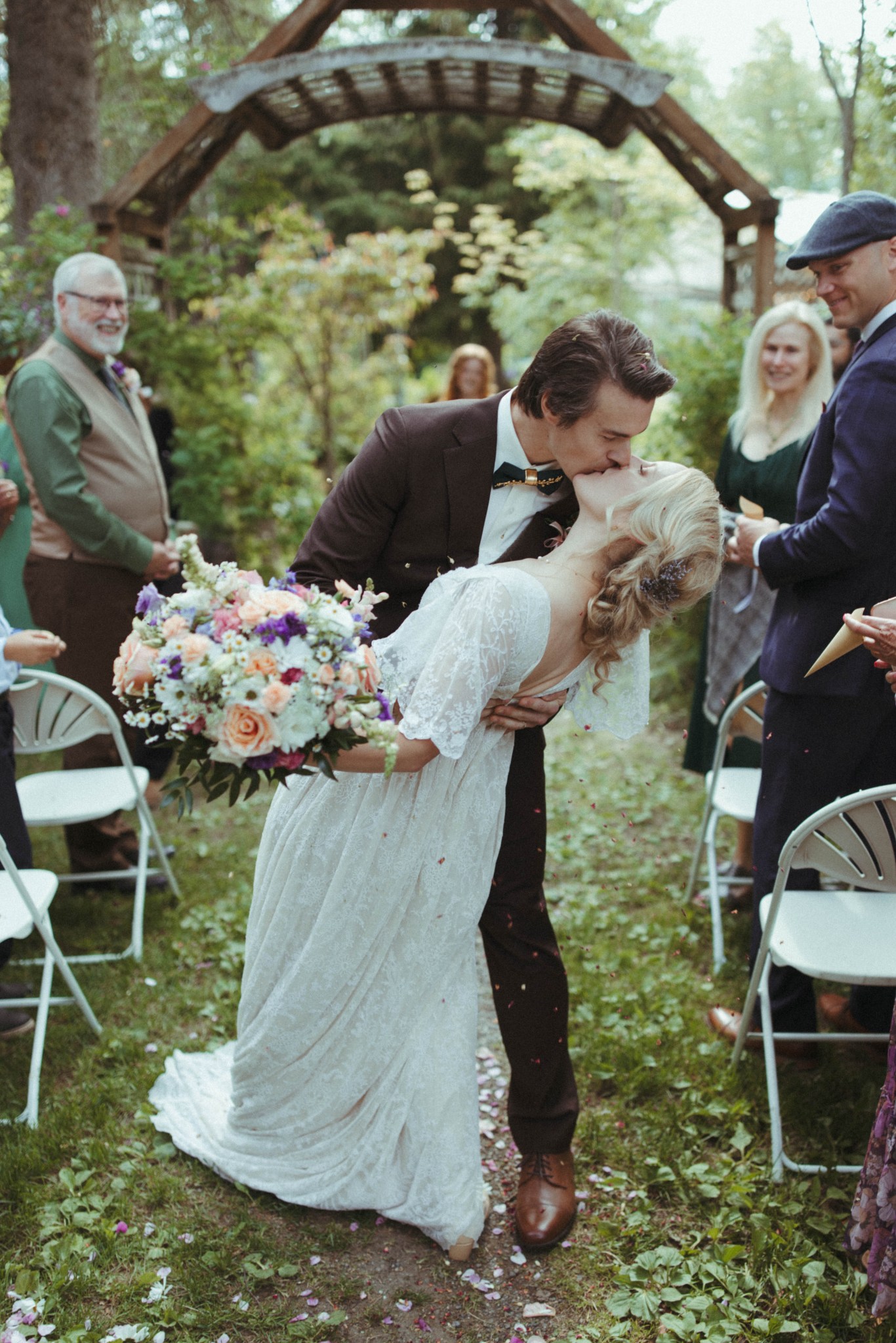
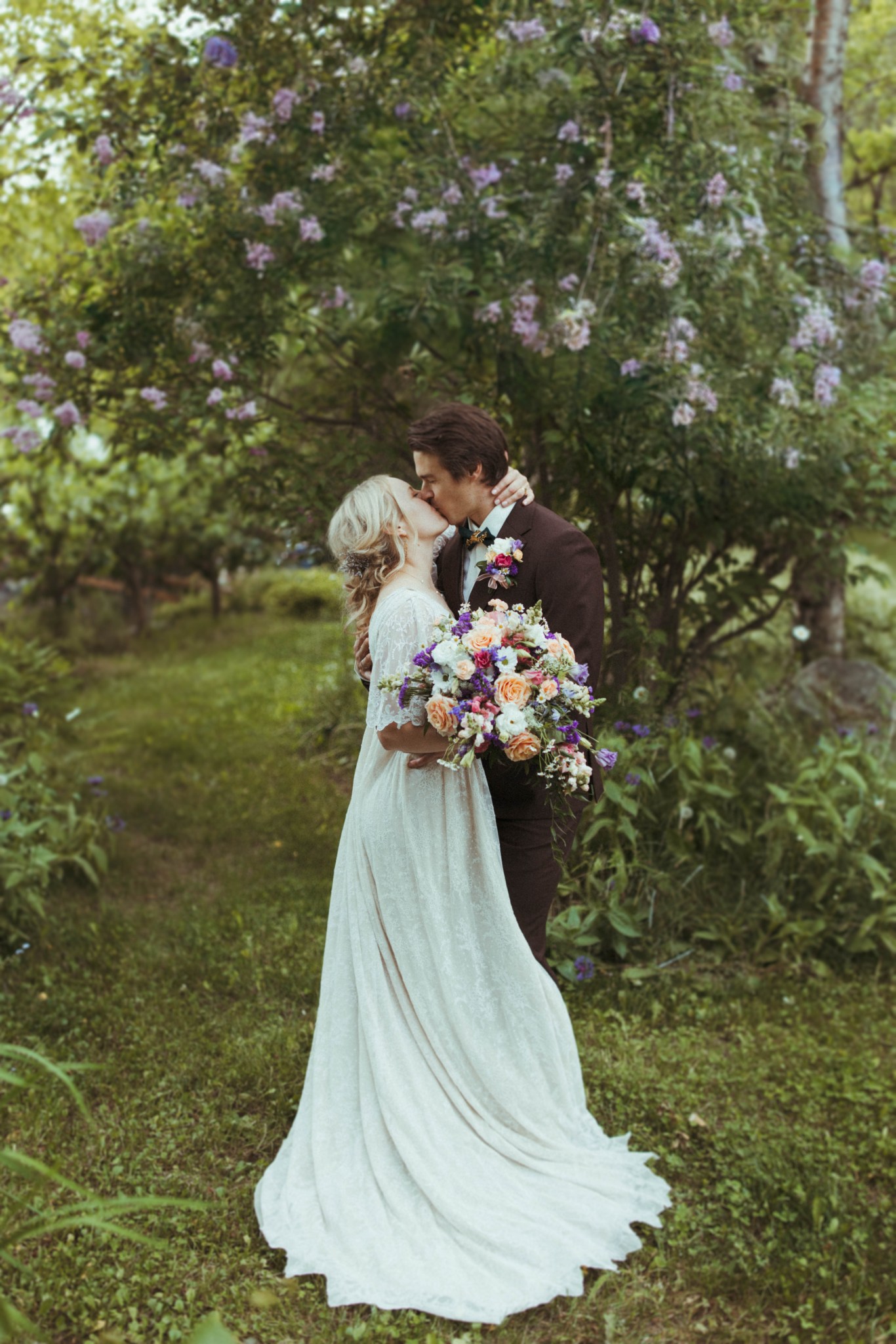
Flash forward to 2025. I took (and passed) the PE exam on February 13th, 2025. At this point, Claire and I had our wedding fast-approaching and I had long said I wanted my bachelor party to be the first summer ascent of Byron via the NE ridge alder tunnel. Unfortunately that hope was dashed by both a lack of available partners and by weeks of poor weather in the Portage area. Claire and I got married in a beautiful ceremony at Forget-Me-Not Nursery in Indian, Alaska.
June 28th, 2025 was the happiest day of our lives and perfect in every way!


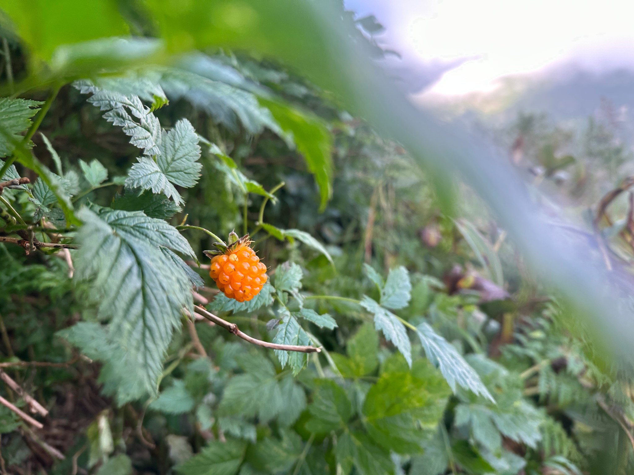
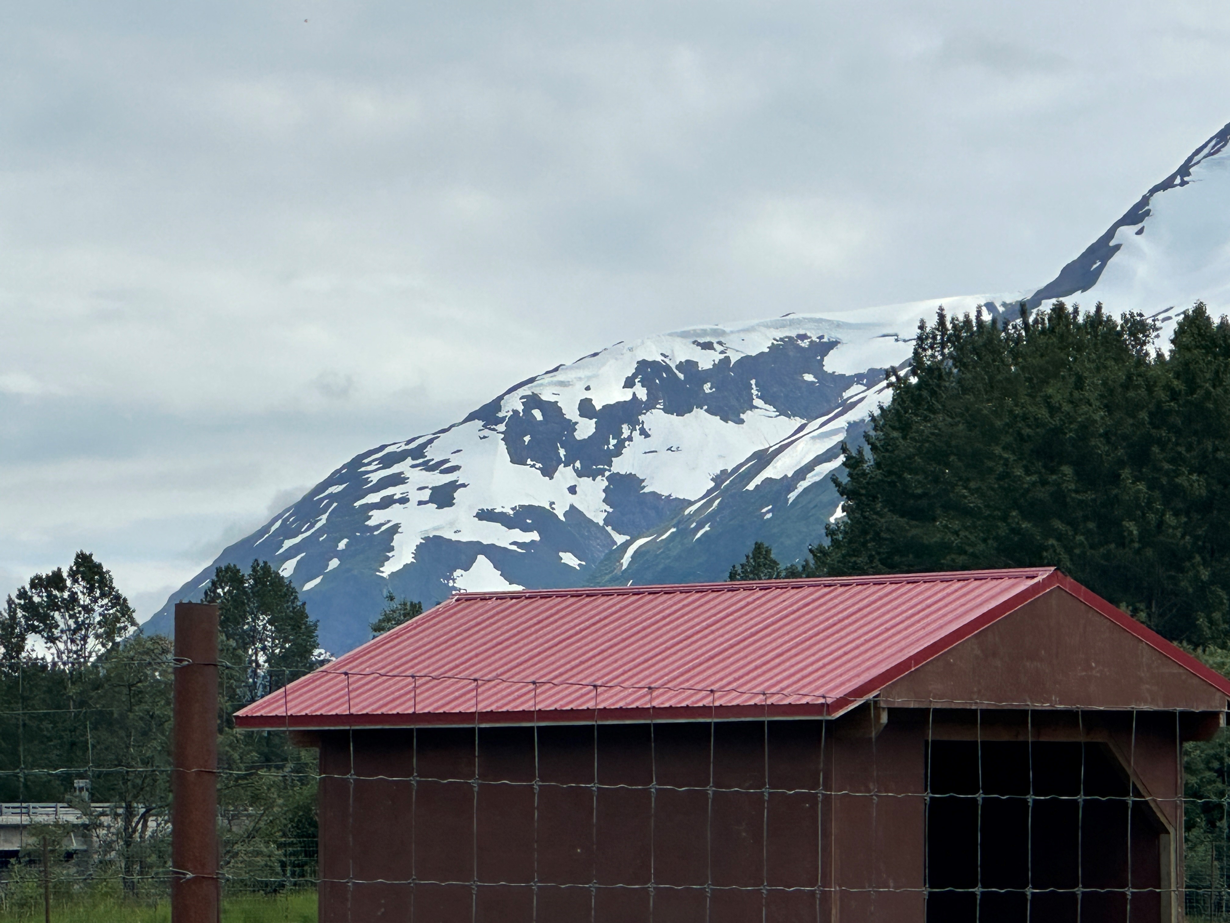
A few days later, my extended family spent time hiking in Girdwood and visited the Wildlife Conservation Center. I was able to spy Byron’s NE ridge from a distance, and confirmed there was still a massive amount of snow on top of the ridge. I had a few friends interested in trying the route on Wednesday, July 2nd, so I took my cousin Becky and her partner Patrick to Portage Lake and stood at the base of Byron’s NE ridge, scoping out my route. Naturally I spied one bear hanging out in the meadow below a particularly-prominent salmonberry patch around 600′ elevation.

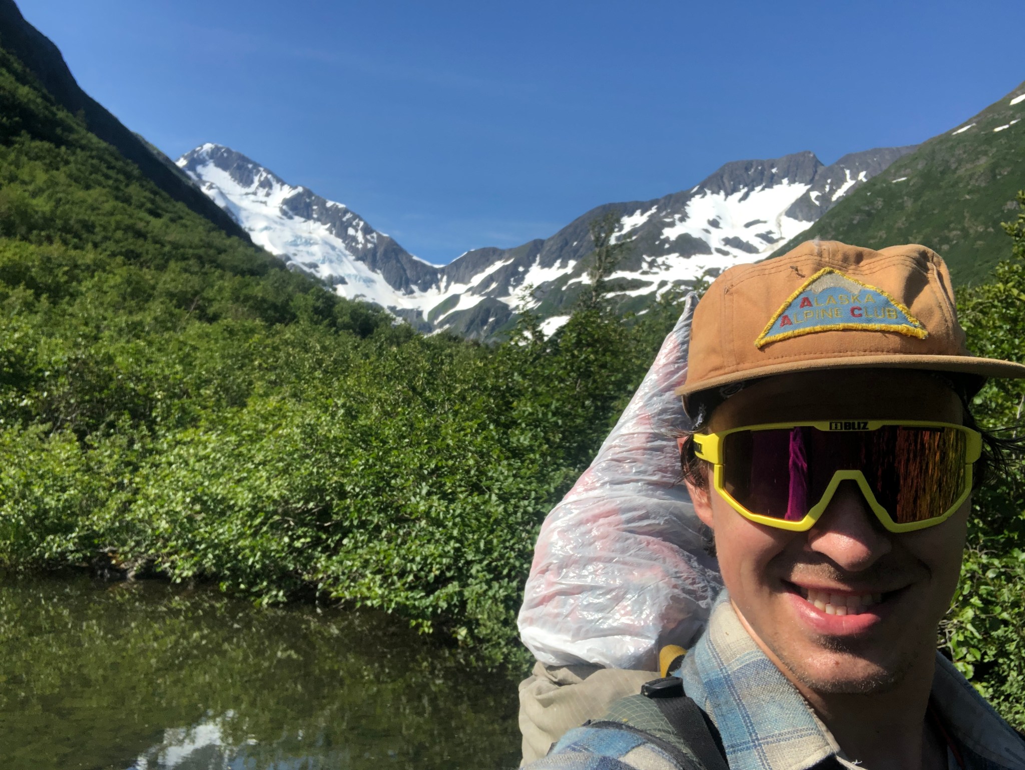
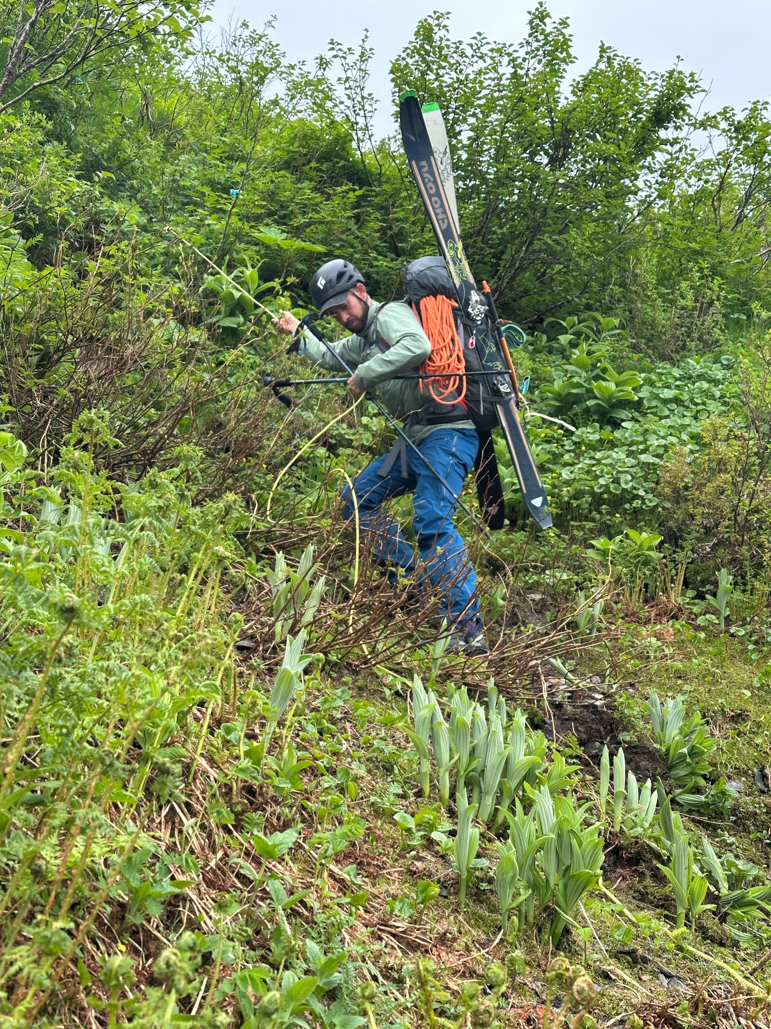
3 years exactly to the first day I started shwacking up the ridge, Galen, Emre, and I hauled skis up the ridge to 1,300′. Emre had contacted me prior to the wedding to let me know he’d have his mountaineering gear with him, since he planned on attempting to climb Mt. Rainier around July 12th. Boy, did I had a trip for him to join!
For years I’d been attempting to get Galen to join me up the ridge and for years he held out. Probably wisely. Unfortunately, Galen is the only person to pay the price of the alder tunnel but not experience the payoff of the ridgecrest. And he did the whole thing with skis! The path upward was heavily overgrown, as it hadn’t been beaten down in two years, and Galen did not appreciate the level of bushwacking required to gain the ridge. To be fair, I hated it too. The skis doubled the time, turning the typical quick hour-long ascent into a tortuous 2 hour struggle as our skis constantly got caught in the trees.. But we finally got above the brush!


July 2 weather was the worse of the two good weather windows that week. While we made it to 1,300′ with skis, the skies to the northeast dark and 20mph winds on the ridge. After a group discussion, we decided we should bail. The deer cabbage on the ridge is incredibly slick and we definitely did not want to risk getting caught up there in a rainstorm. There’s cell service with AT&T on the ridge, and with satellite imagery we could see a mass of dark clouds hanging out to the east, cementing our decision. Seconds after we decided to bail, a large black bear lumber into view across the mountain slopes. As Emre attempted to pull out his phone to snap a photo, Galen and I were already yelling, waving our arms, and I started blowing my air horn. The bear turned tail and ran back the way it came, Galen later saw it crashing down the mountain parallel to our path up. Galen did not bother removing his shoes to cross the “Mandatory Water Crossing” and was thoroughly done with the ridge.

I was cowed. I felt shitty for proposing we haul skis up, and I wish I had been able to get up the route beforehand and beat down the trail a bit. I wore only short and a tee shirt and my limbs were marred by hundreds of thorny rakes. I was ready to retire from the mountain, even going as far as making the route public. Emre was a beacon of positivity, partially due to two people ahead of him breaking trail, and encouraged me to take one last shot at Byron Peak on the better of the two weather windows. This time without skis.

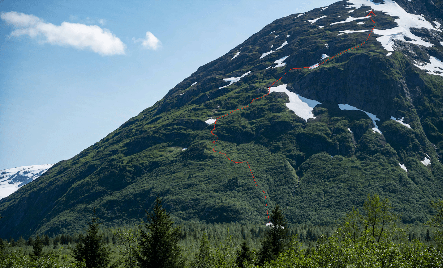
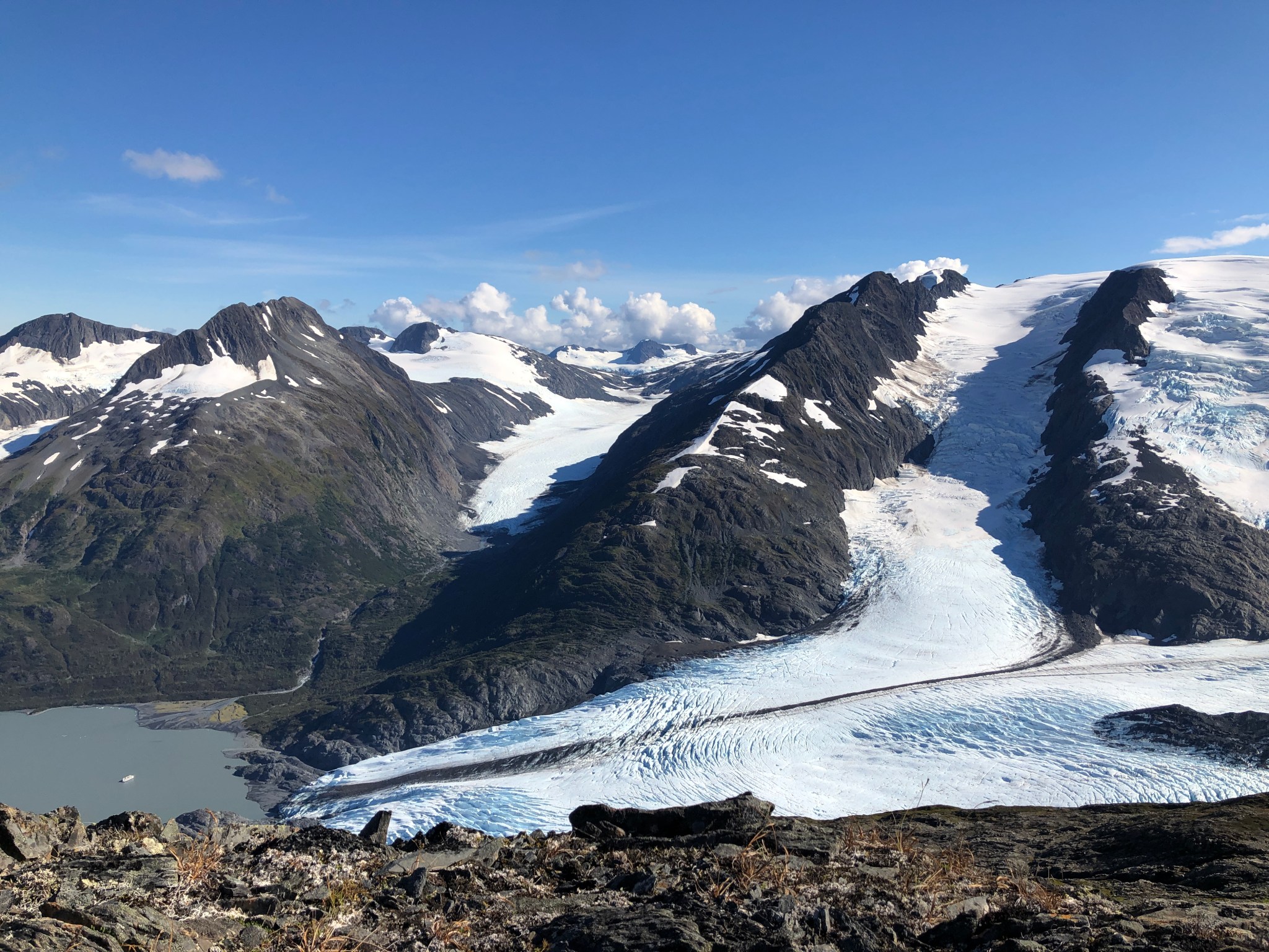
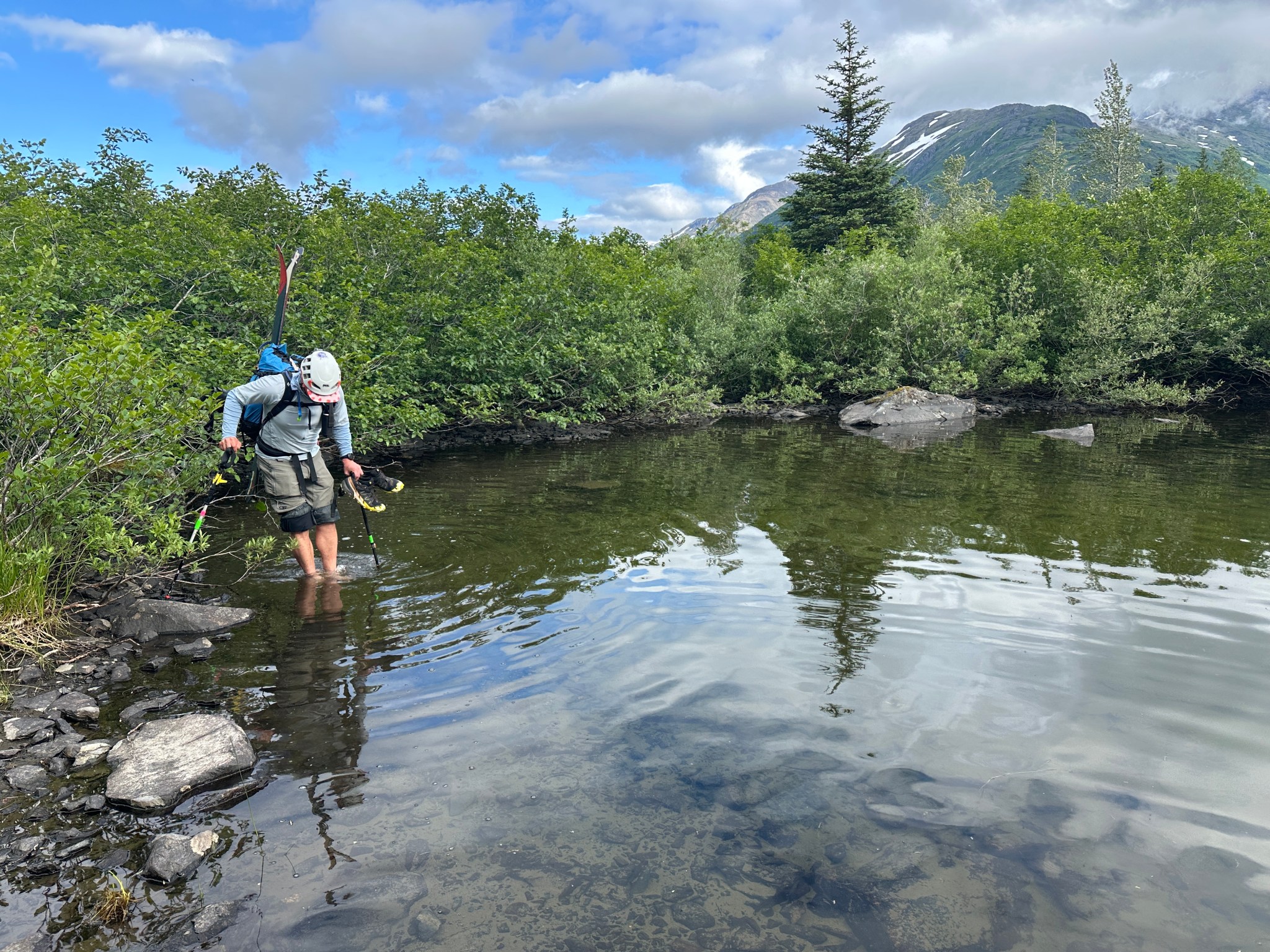
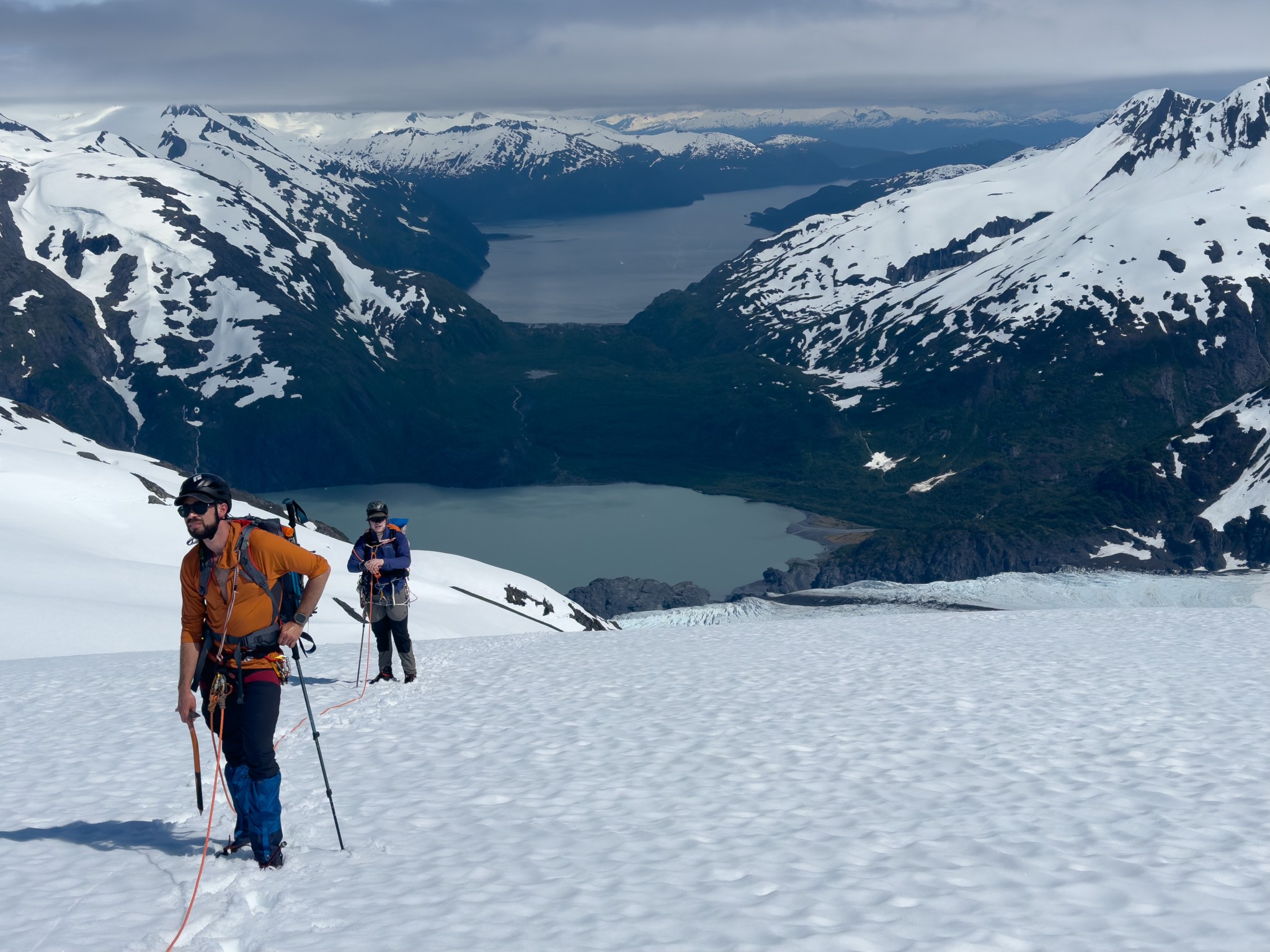
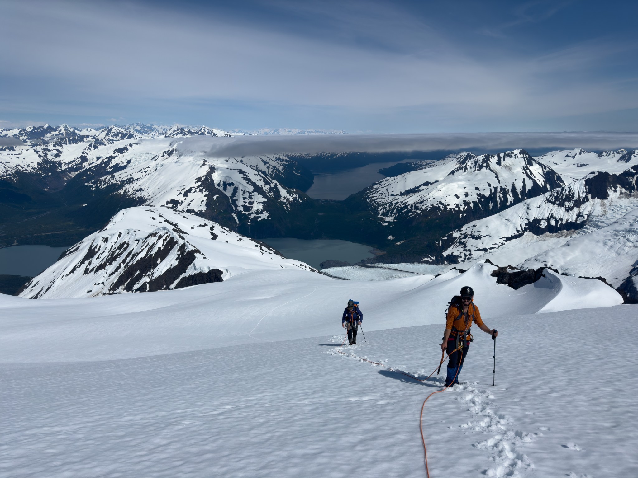
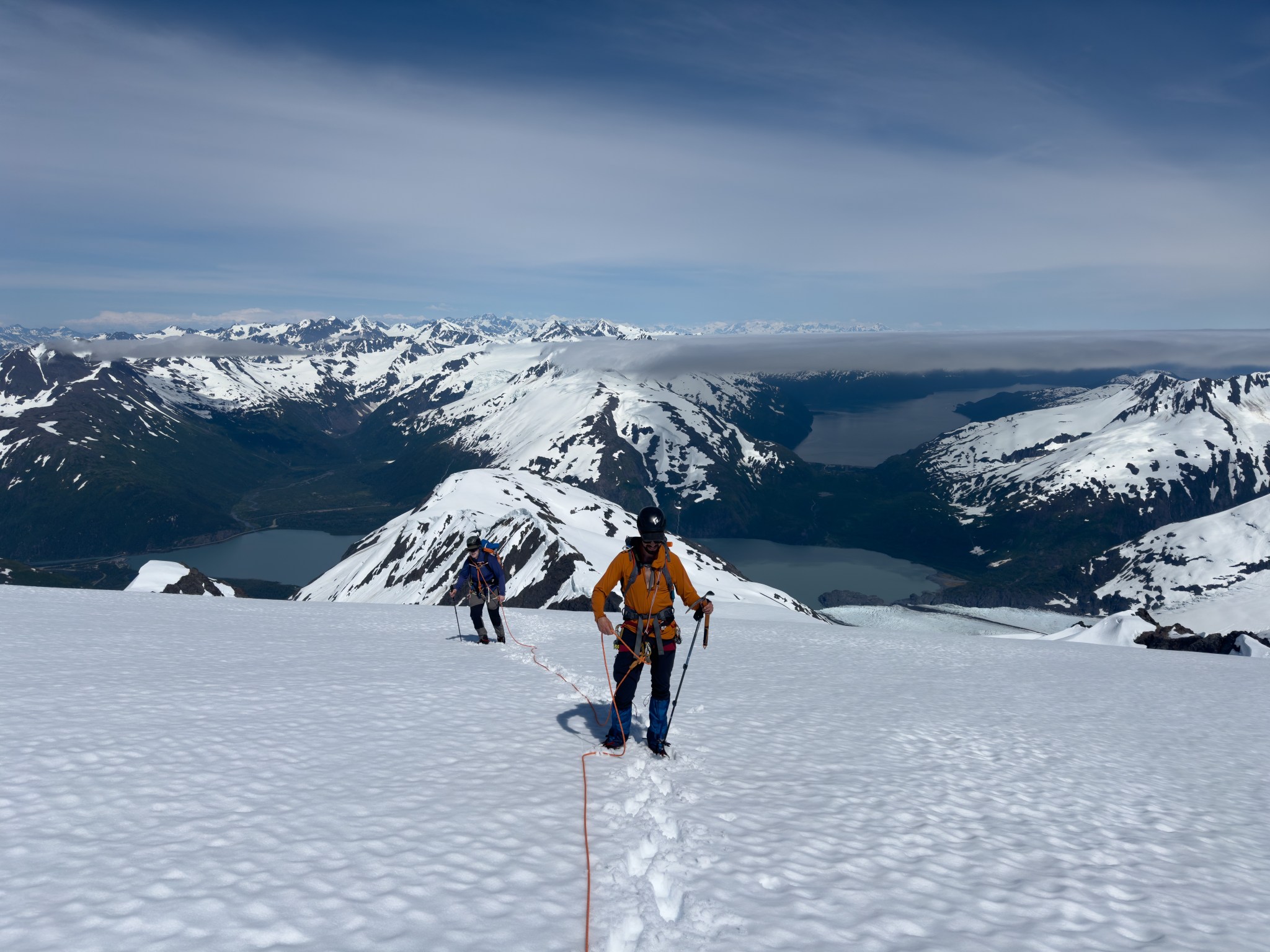
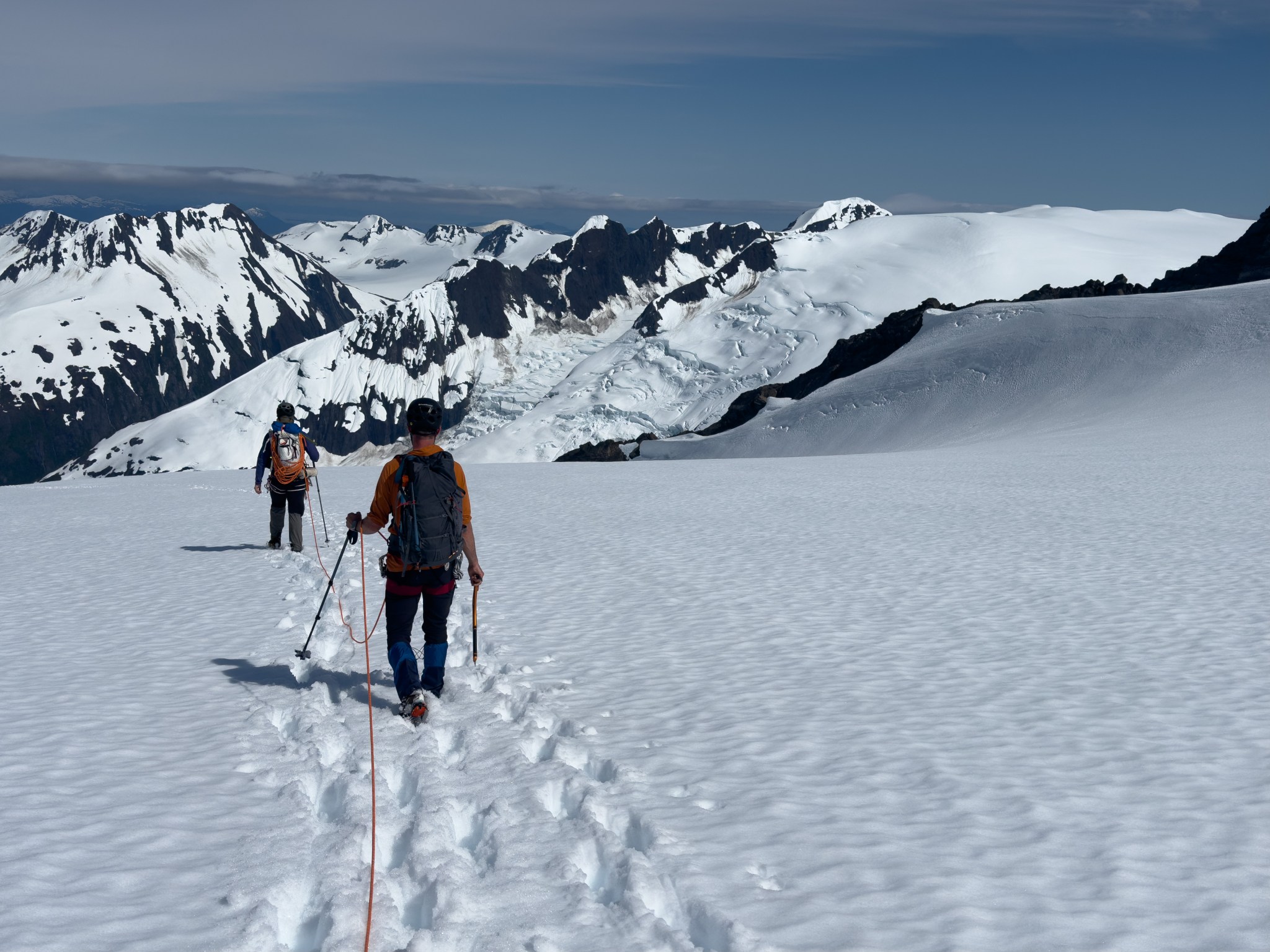
So it was, on Independance Day 2025, a party composed of myself, Emre, and Zach Sauve climbed the mountain via the NE ridge bushwacking route. We parked my truck at the last parking lot before the gate on Byron Glacier Road. At 8:30AM we passed the locked-gate, turned right off the road at the second tall cottonwood tree and walked into the woods. 10 minutes after leaving my truck, we climbed across the boulder that marks the “Previously-Mandatory Water Crossing”. I had to rename the feature because Zach found a way around the edge of the water and didn’t get wet. I still like the getting-my-feet-wet part. We headed towards the gully that fed that small body of water and followed the obvious alder tunnel up to 600′, where we crossed the two meadows and ascended the notable salmonberry patch through which I had a path stomped. We traversed north below the cliffs and climbed through the only gap between the cliffs, through more salmonberries, up and over the lip of the brushline to the lowest patch of snow.


Making lots of noise we hiked on the right side of the lowest patch of snow and diagonalled southwest once we gained the upper bowl, using the fixed rope to climb out and over the small cliff to the second-lowest snow patch. We climbed the snow, passing 1,300′ and continuing to make noise. We then climbed a small grassy gully that led us to a westerly traverse across the third snow patch on a ledge between the major cliffs on the lower mountain. Once we were on the other side of the traverse, we hiked southeast and up the tundra. There was still a fair amount of snow down, so we used that to make fast progress upwards. When we reached the final patch of snow on the west aspect, we stopped at a large pile of rocks where we left our hiking boots, microspikes, and bear spray behind as we transitioned to mountaineering boots and crampons.


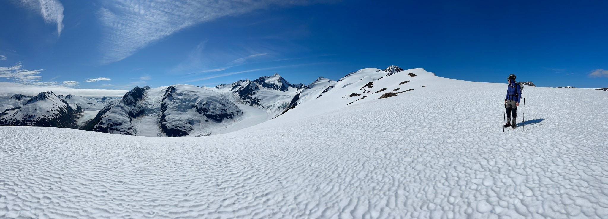


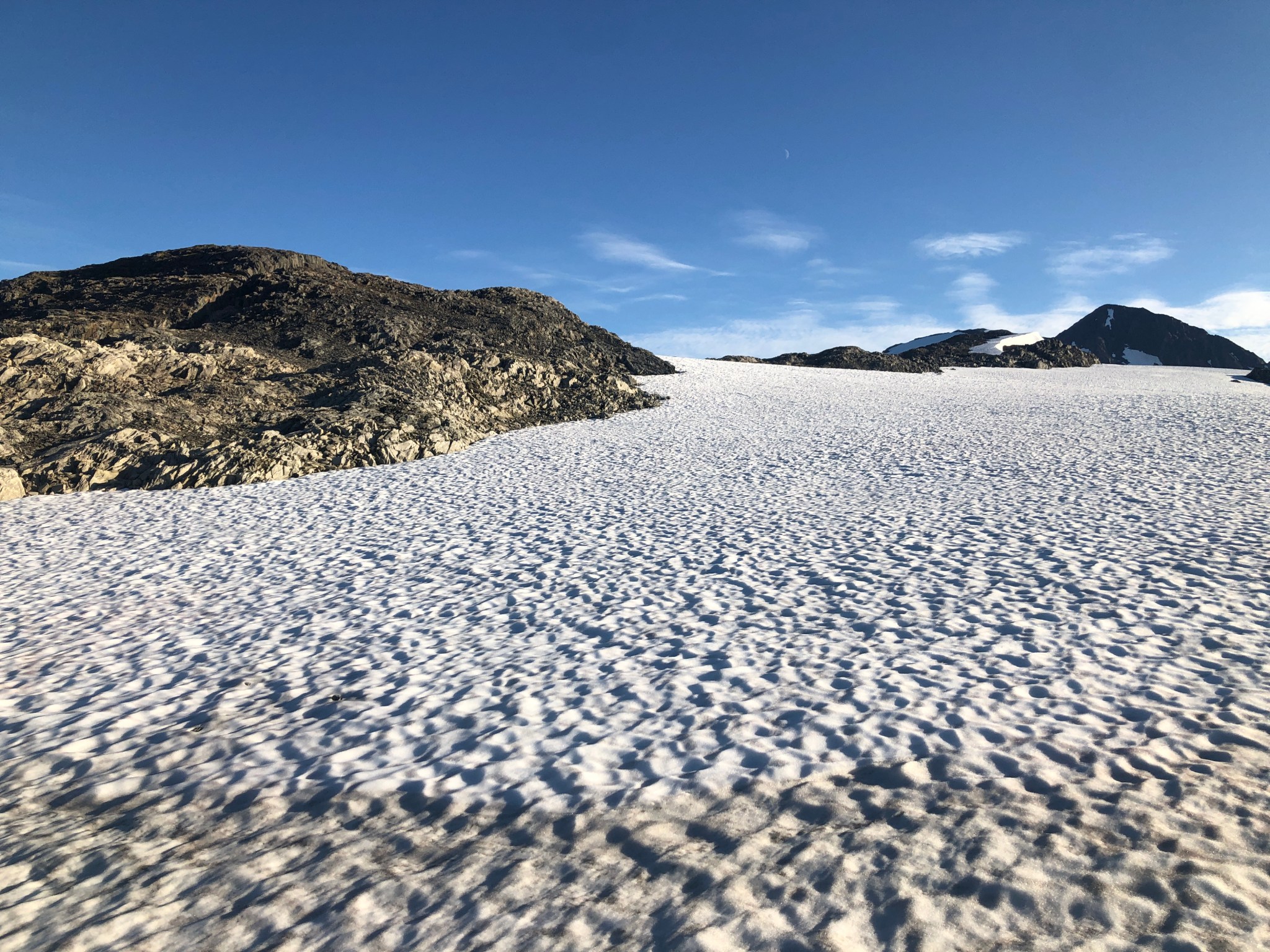
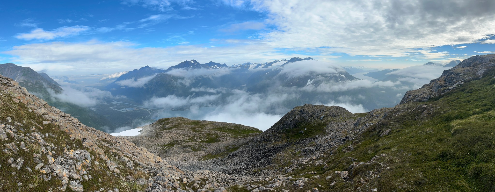
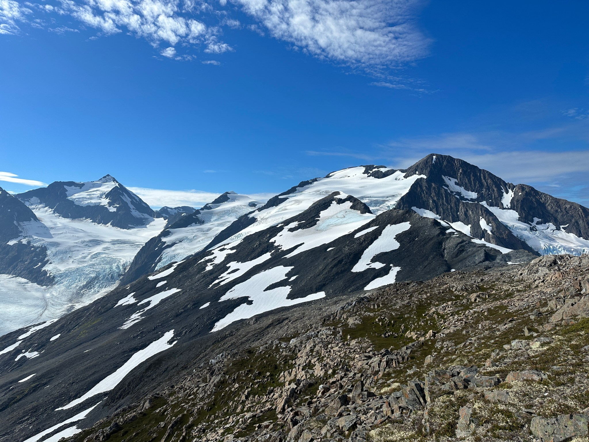
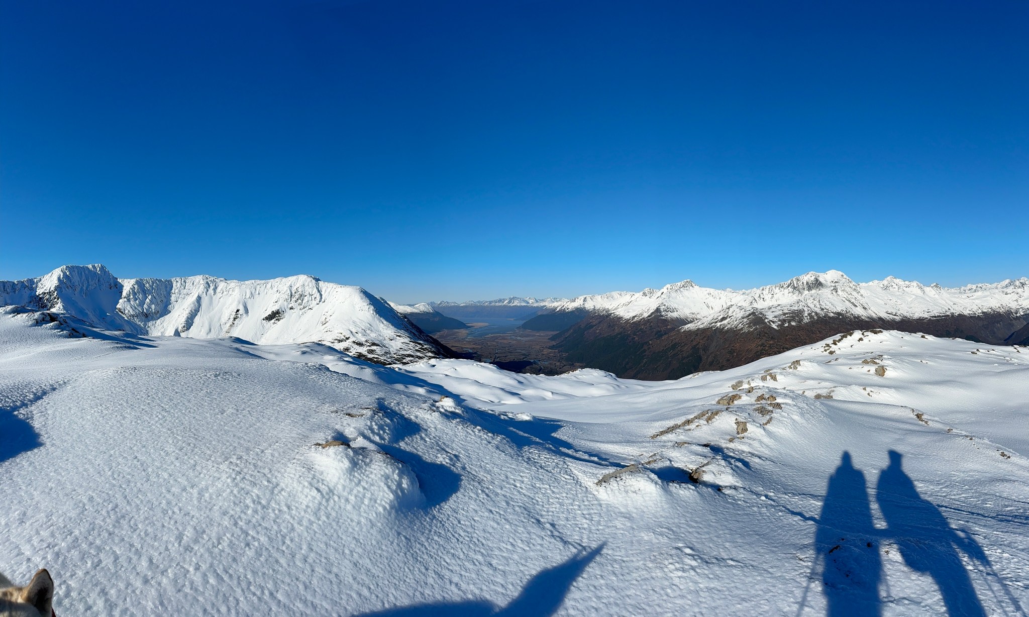
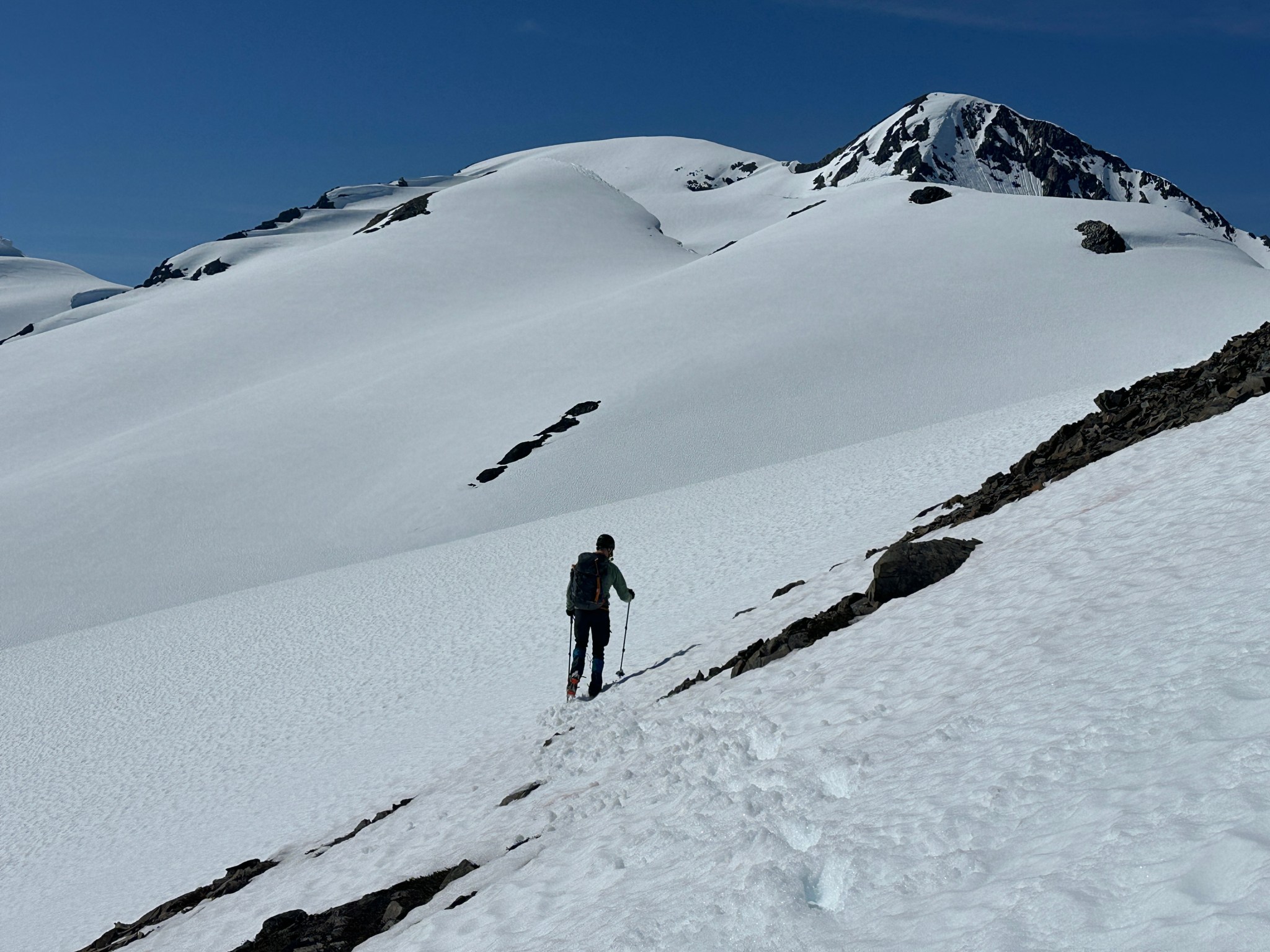
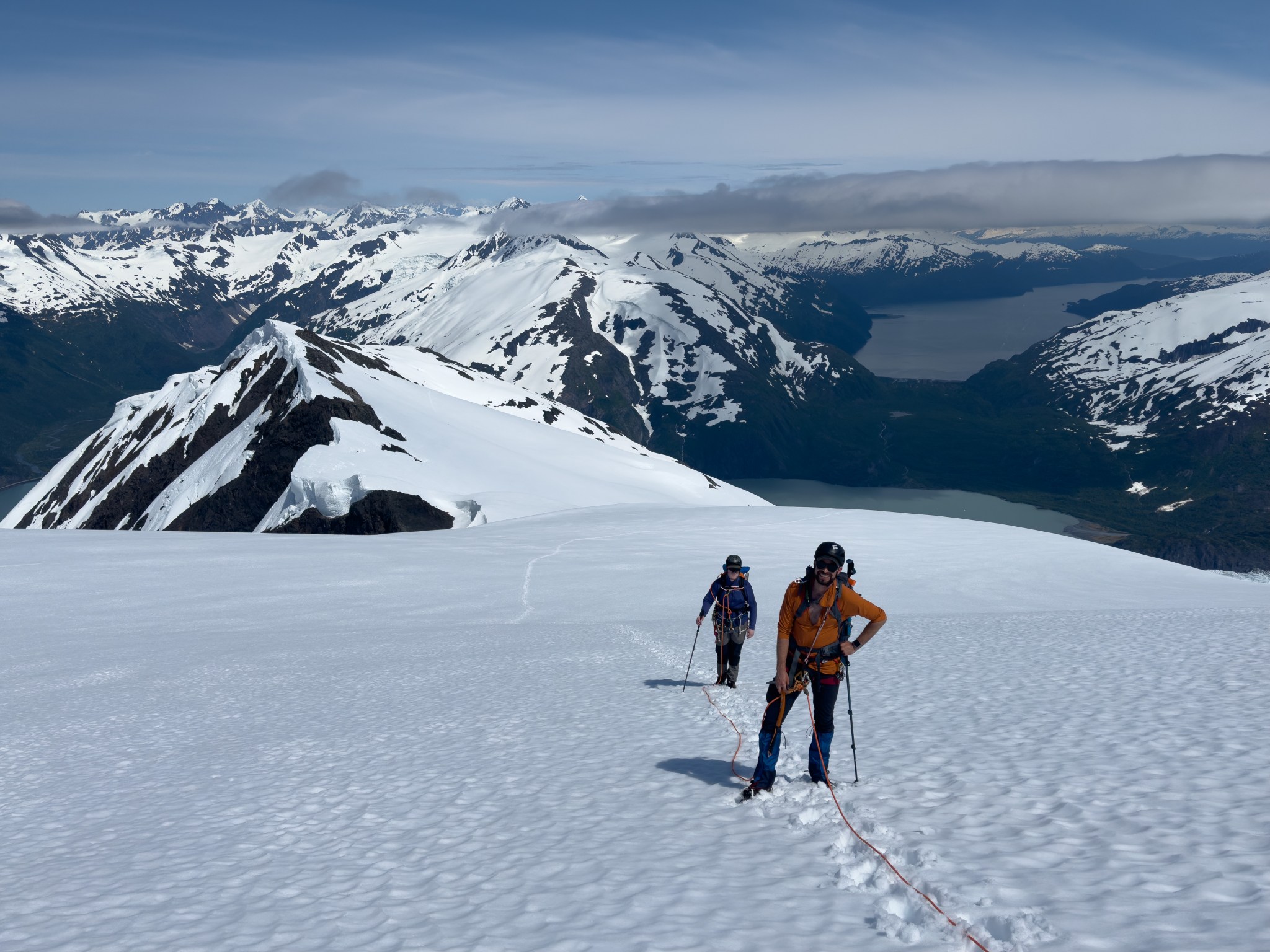
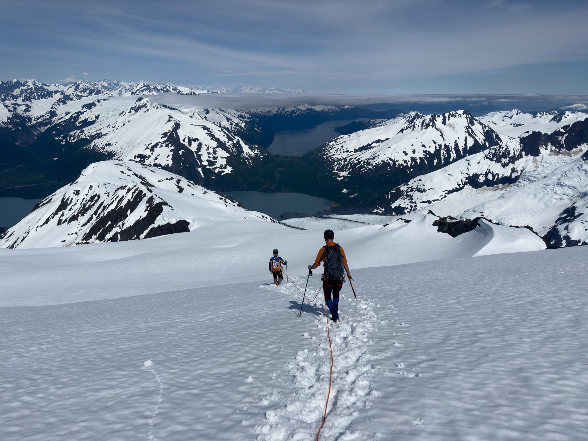
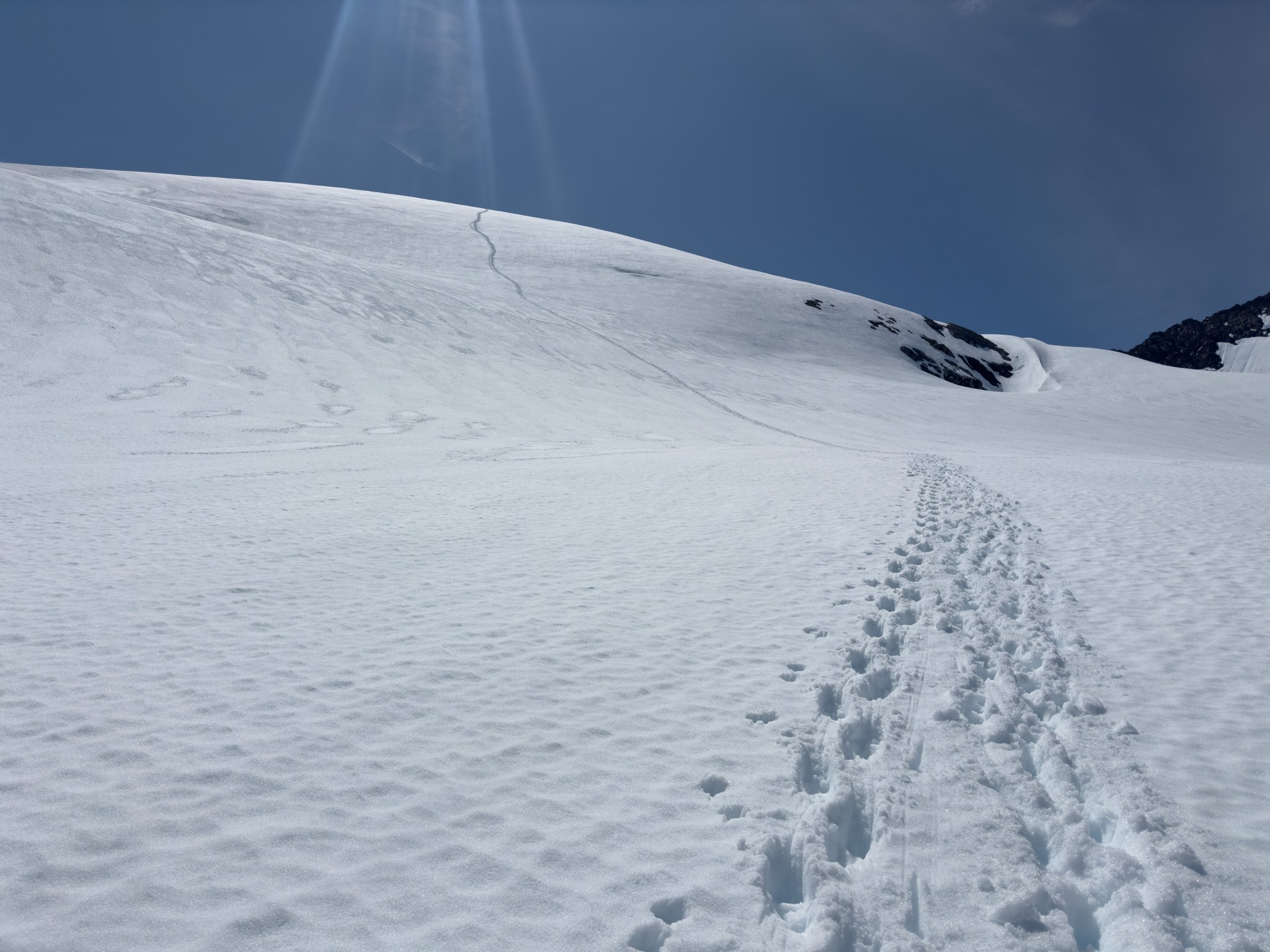
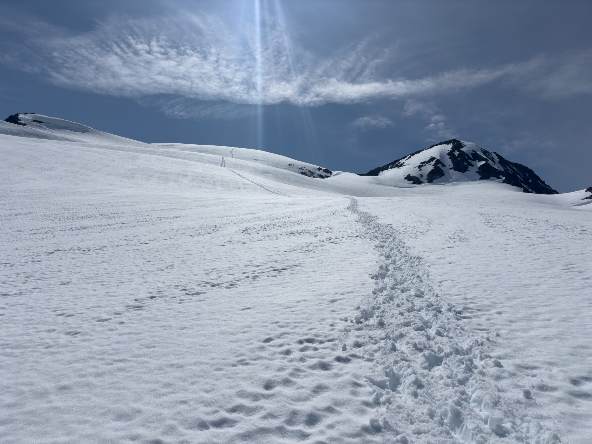
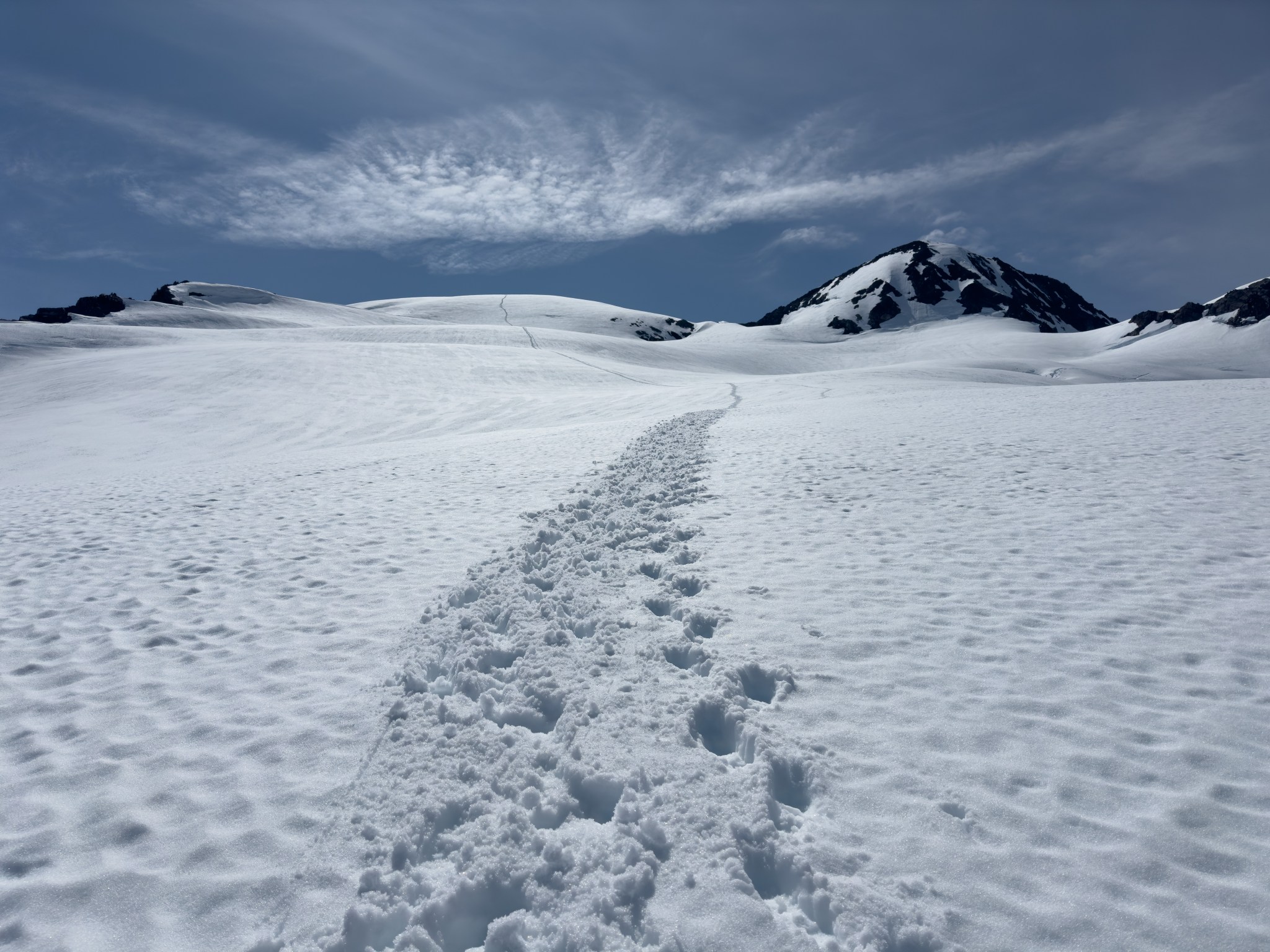
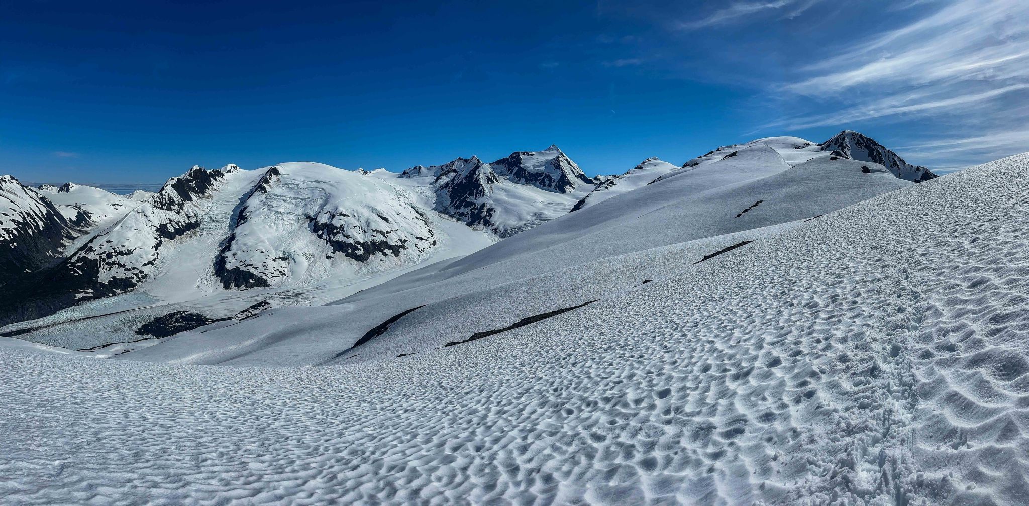
We continued to climb southeast until reaching the north side of the ridge, gaining the ridgecrest with ease due to the MASSIVE amount of snow on the ridgetop. I had underestimated the amount of snow accumulation; the cornices were 50′ tall in places. From the ridgecrest to the summit, there was nothing but snow, with a few rocks poking out. After taking photos, we hiked and debated whether skis might actually have been prudent, the snow was perfect corn on top of the ridge, both soft and supportable. We eventually decided we’d need lighter skis and boots to make it worthwhile.
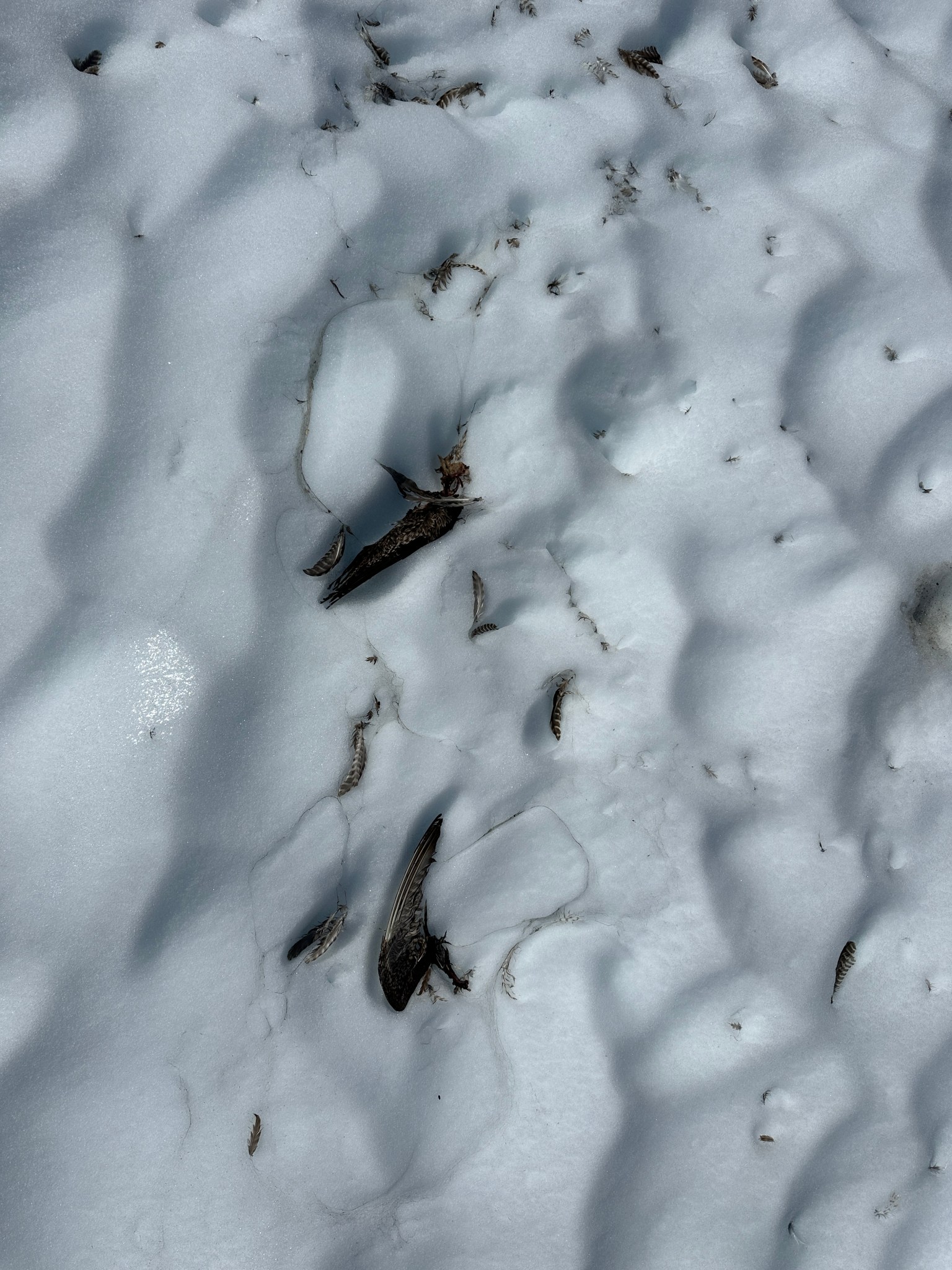
Looking a few miles down the ridge, the snow-covered toe of the summit glacier was roughly the same 3,200′ elevation as the ridgecrest, so as we made our way south and up the ridge we aimed to preserve as much elevation as possible. We crossed over a few drainages as we made our way south, staying entirely on the east side of the ridge and away from the terrifyingly-corniced west edge. The snow-covered ridge made travel incredibly efficient, we cruised over a solid plane of snow and did not have to contend with hiking over rough terrain and loose rocks. The weather was perfect, with only a few clouds in the sky and barely a whisper of wind. We found the shredded remains of a ptarmigan and wondered what predator lived up here (our guess was a wolverine).


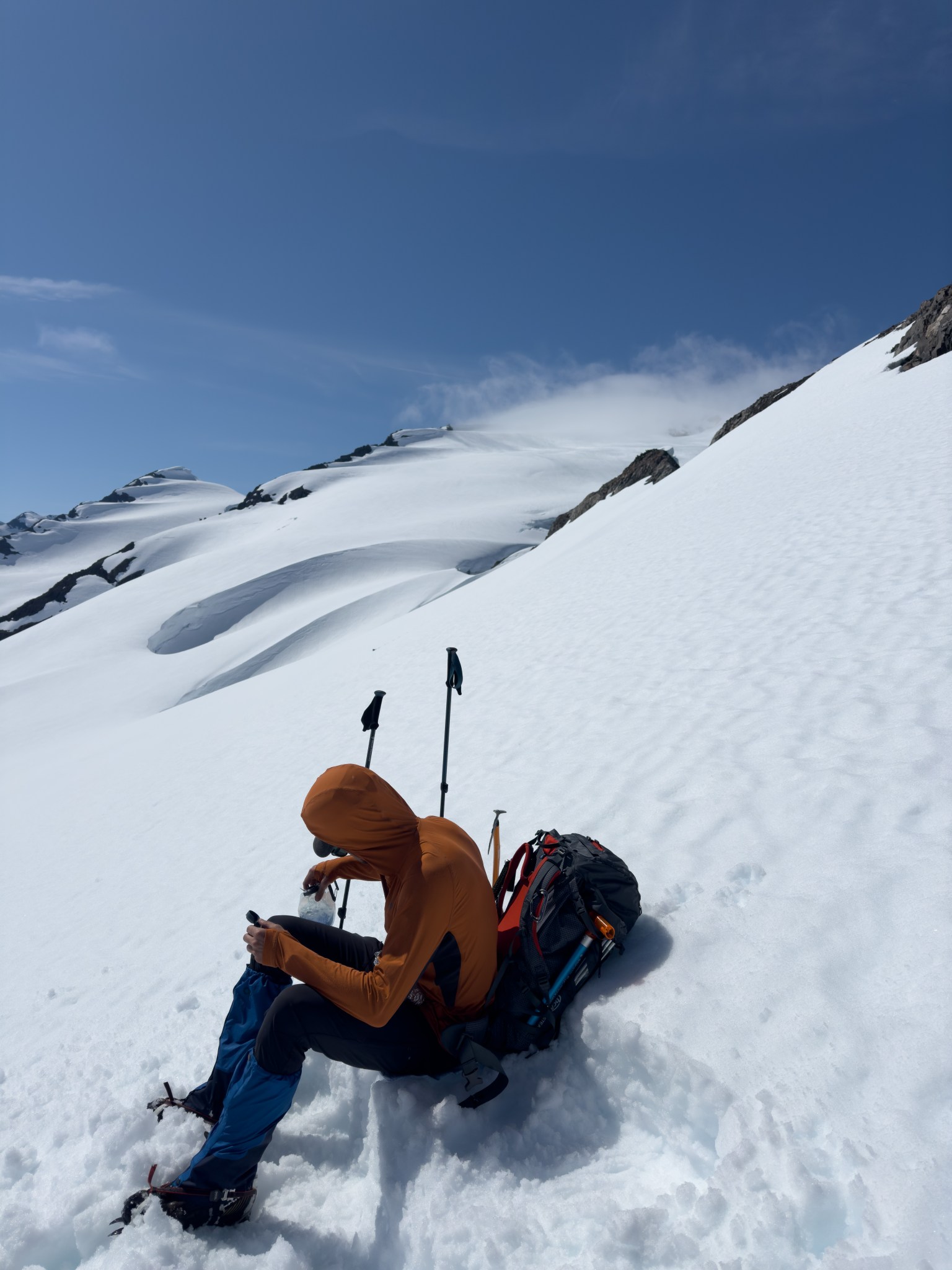
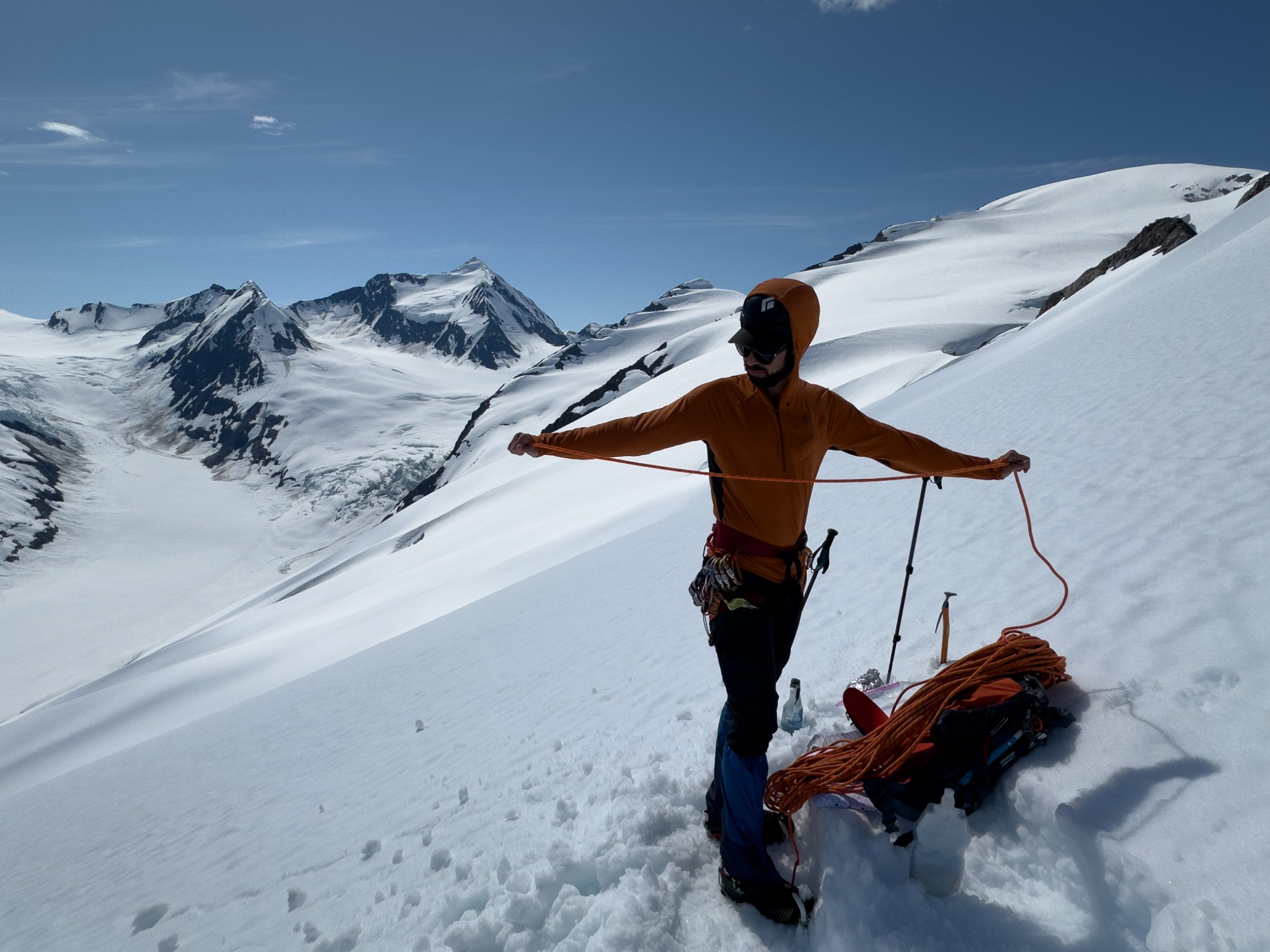
Before the last downhill to the glacier, we roped up for glacier travel. The summit of Byron clouded up within the few seconds I looked downto put on my harness. It cleared up before we started moving 10 minutes later. As we moved downhill around 1PM I texted Claire and Brittany (Emre’s partner and our wedding officiant!) that we were making good time and might be on the summit in 2 hours. Claire, Brittany, as well as my mom were all following our progress on Find My Friends.

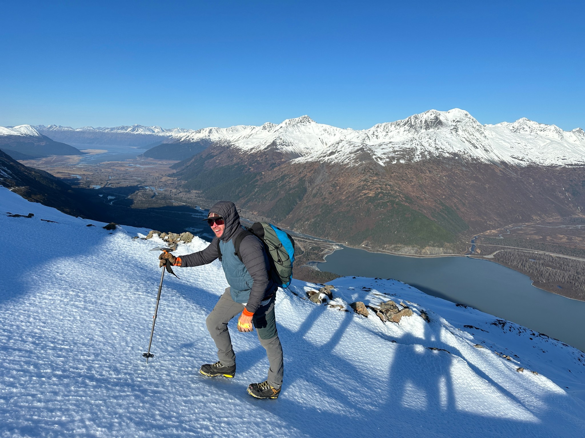
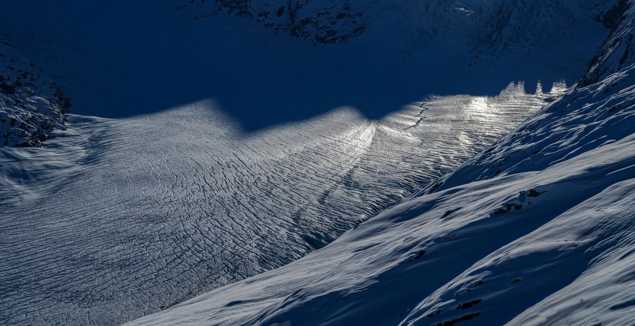
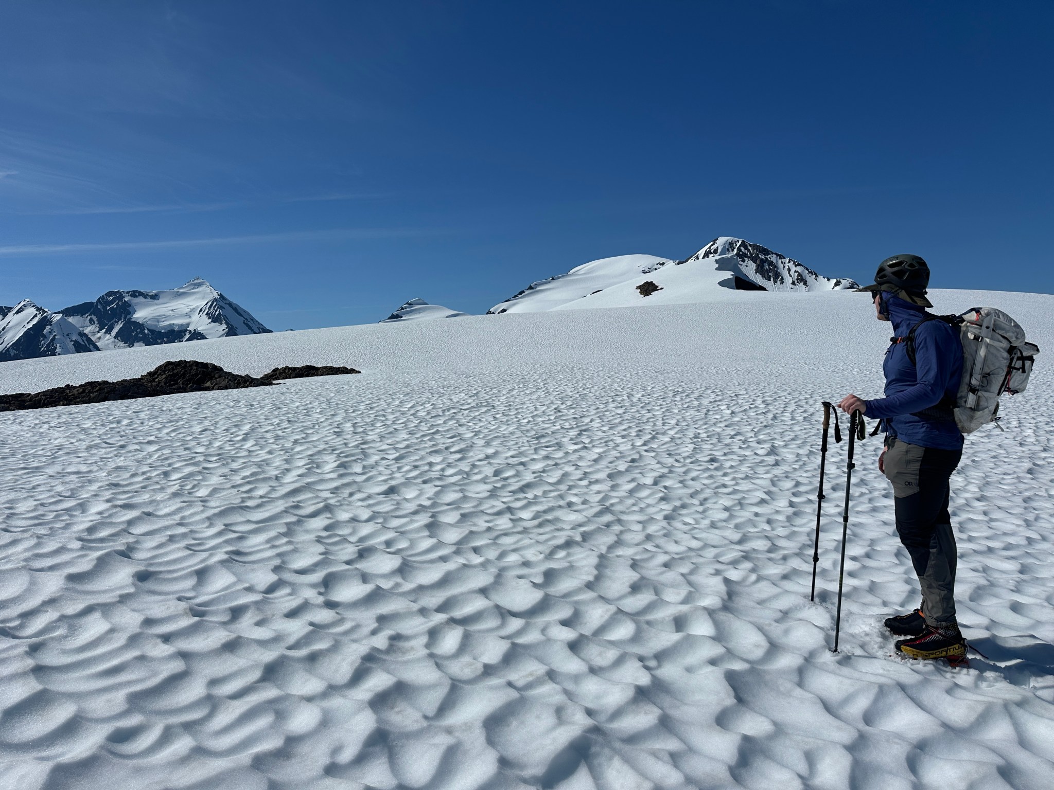
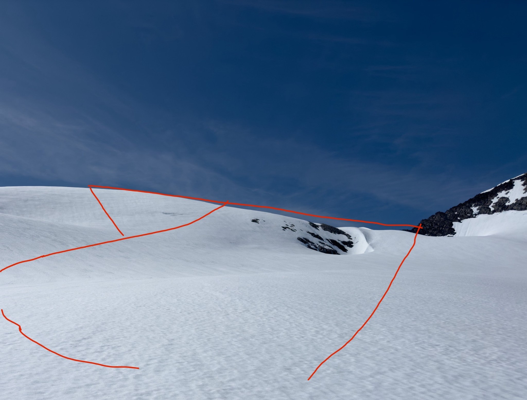
I took the lead and followed the GPS track I had laid out nearly two years ago while scoping out the summit glacier. We climbed the middle of the toe of the glacier and ascending the obvious ramp, covered in at least 10′ of snow. The glacier consisted of multiple steps, the grade of which was hard to judge, but the initial ascent was easy and followed my GPS track exactly. When our progress brought us above and perpendicular to the middle of the NW icefall, we turned off the track to the south to continue gaining elevation. The glacier looked like it was sustained by massive drifts of snow, formed behind the various bumps on the relatively short east ridge that borders the south side of the summit glacier. Given the cornices on the NE ridge were consistently 50′ thick, we felt fairly reassured the crevasses on the summit glacier were buried quite deeply. Despite the low-snow winter at lower elevations, there had been significant accumulation up high and the mountain was holding more snow than it had 3 years ago in July. The summit clouded and cleared a few times during our ascent.


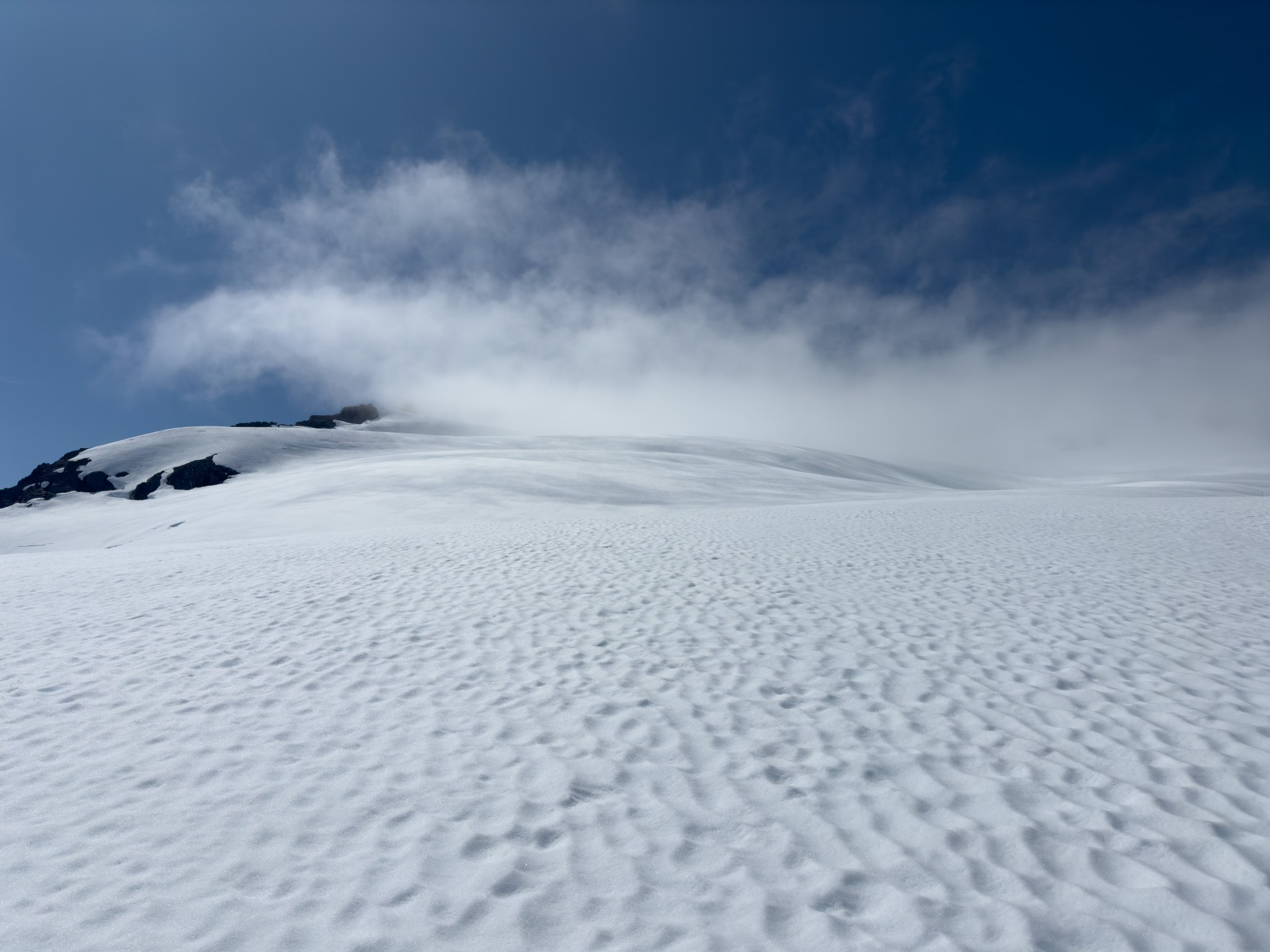

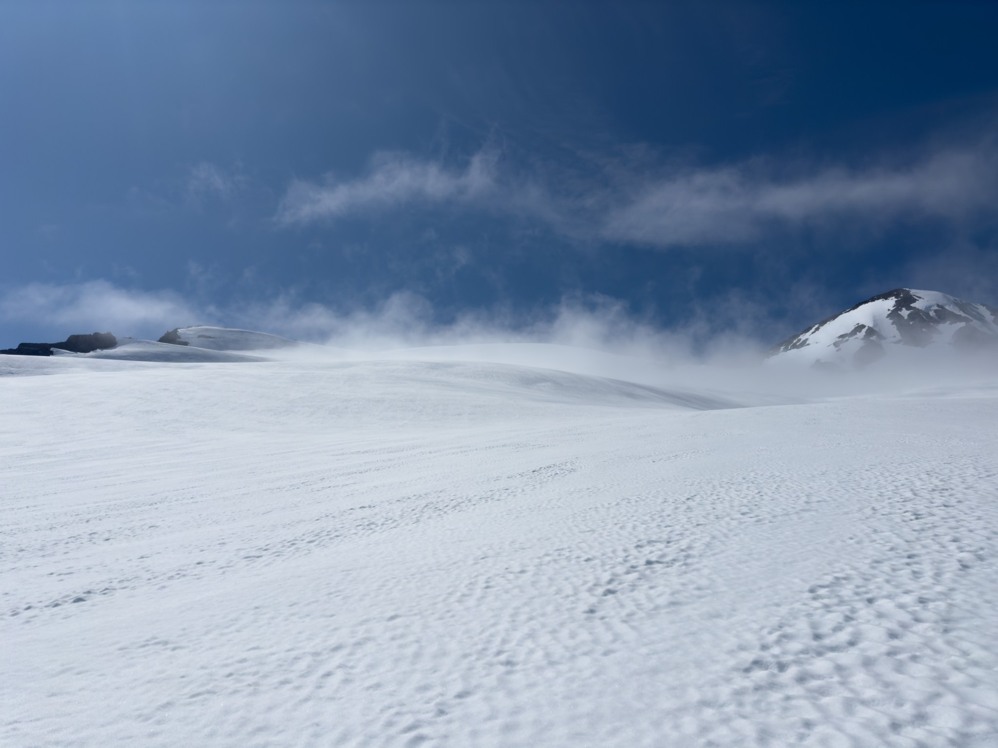

As we crested the final glacial snow-drift below the summit, we came upon a depression that we hadn’t seen from below. Obviously this was one or many crevasses, so before proceeding we took some time to consider. We would have to go around it, either left or right, determined by how we intended to access the summit. I knew beyond these crevasses there was a sizable bergshrund at the base of the summit cone, which slightly worried me. I also knew there were strange and unpredictable crevasses on the summit cone, so I suggested perhaps going right and gaining the col between the east and west peaks then walking the ridge to the summit. The summit cone clouded and cleared (again) while we debated. The boys wanted to head up the summit cone directly, which eventually seemed like the best route as it avoided 1) walking along a potentially massive cliff and 2) traveling on snow-covered rocks. The only type of avalanche we worried about was a wet slide, which was more likely near rocks that would warm in the sunlight even while buried. There was definitely rocks on the right side of the summit cone and near the col, so left around the crevasses would be the path. We contoured south around the previously-unseen crevasses and slowly we made our way up the left-hand, glaciated part of slope.
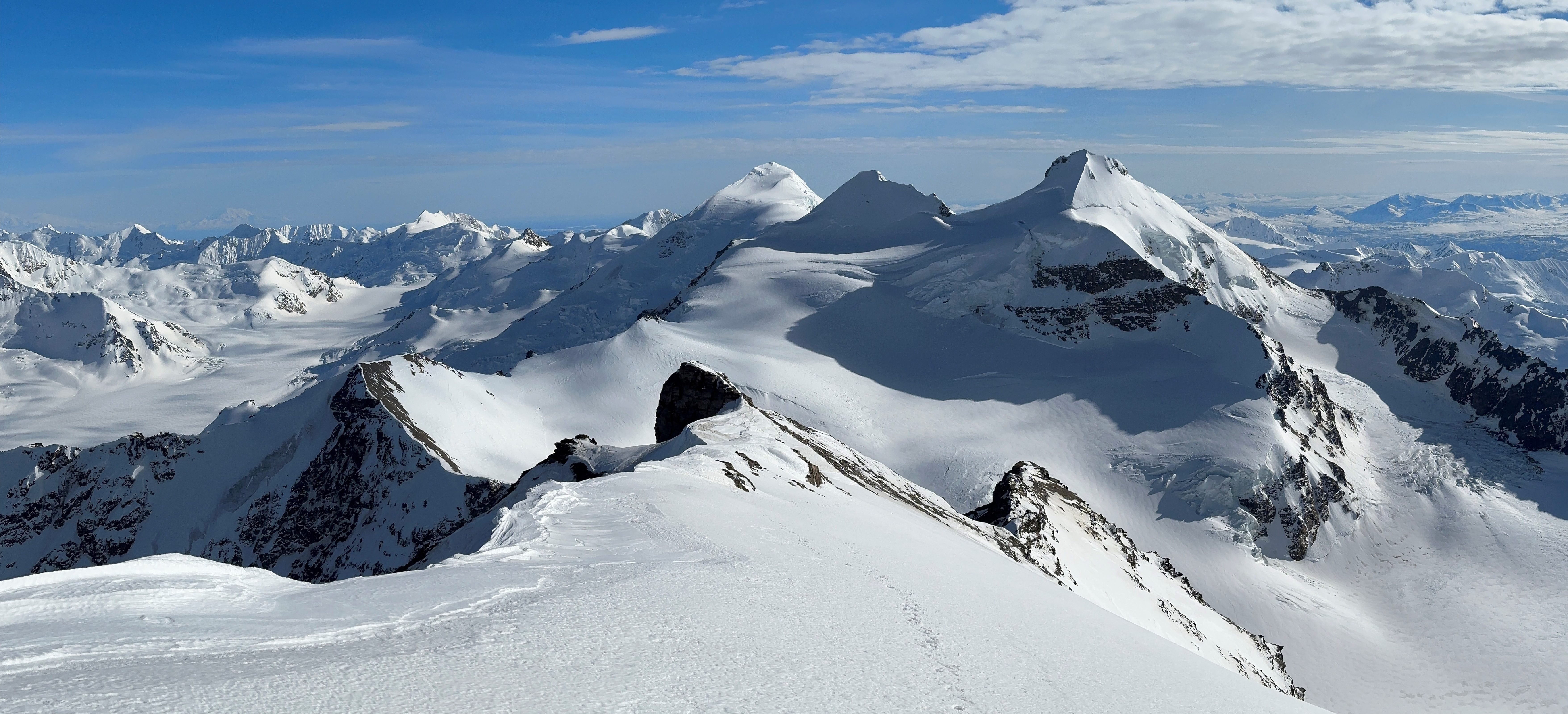
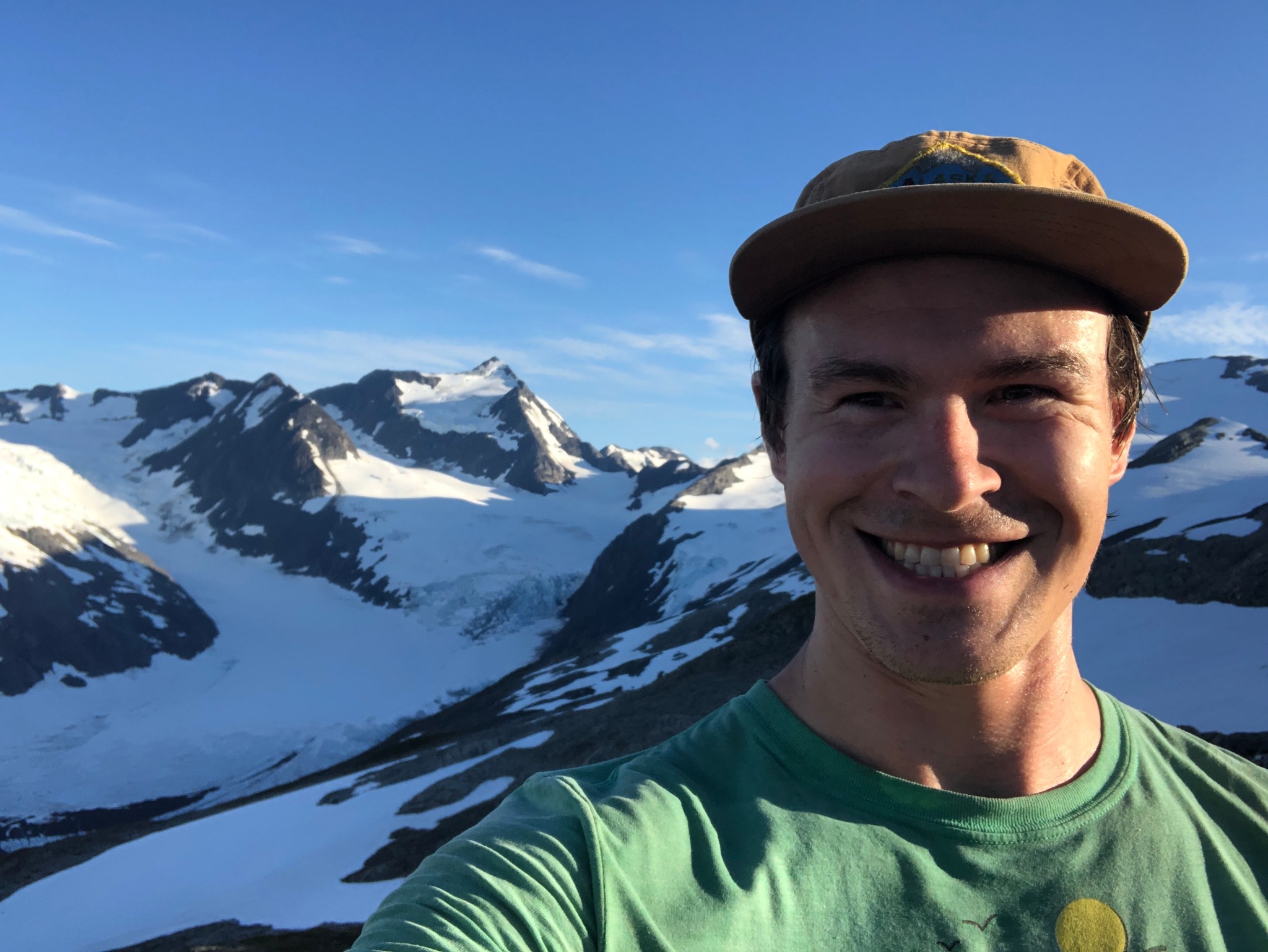
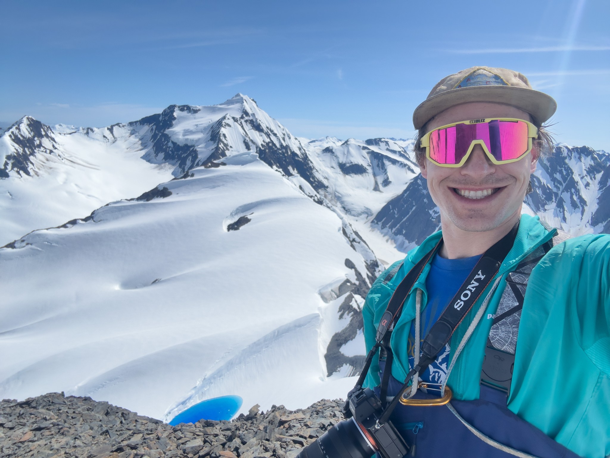
As we climbed the summit cone, it seemed like the slope would never end. It was difficult to tell where the true high point was as the horizon above us leveled out. I hadn’t done any research on the nature of this summit, I assumed it would be buried in snow and might be glaciated. There was some sort of cliff on the other side and I was wary of topping out on a cornice, so I figured we might not even reach the true summit. As I ascended the summit cone I tried choosing a line that both avoided visible crevasses as well as rocks, since the snow on the lower ridge had been perfectly supportable except when we stepped close to rocks. Our boots sank about half a foot into the perfect corn snow as we climbed the summit cone, finally seeing rock as the summit rolled over at last! Around 3PM we walked over to the rocky summit, noticed the summit register, and tepidly peered over the edge of the 3,500′ cliff into Skookum Valley. A feeling of elation came and went, and I was left with a feeling of peace that, at long last, I could rest.


Of course, I couldn’t relax quite yet. We still had to get down. We spent 45 minutes on top, taking photos and updating the summit register. Emre flew his drone around while Zach napped in the sun, dreaming of beers specifically with people who weren’t myself or Emre. I walked over to the southeast edge of the summit and got a phenomenal view of Carpathian Peak with a sapphire-blue lake in the foregroud. Before roping up to descend, I spread some of Kiro’s ashes I had carried with me on Denali and during Claire’s and my wedding. Kiro’s nose cancer was one of the life changes I was distracting myself from while bushwacking up Byron’s NE ridge in 2022, and they were with me each night on Denali in the tent with Zach; it was cathartic and meaningful to spread his ashes on this peak.
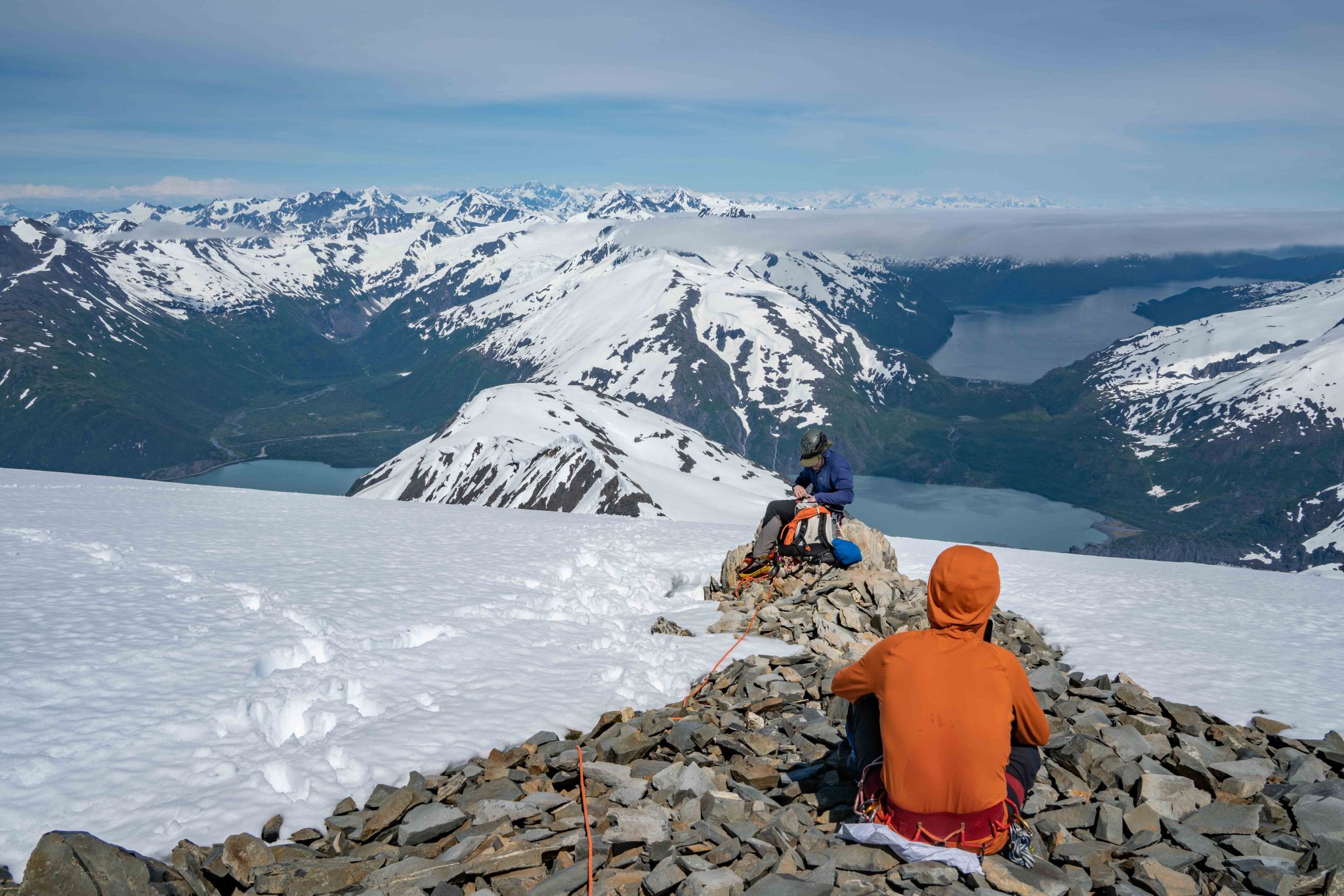


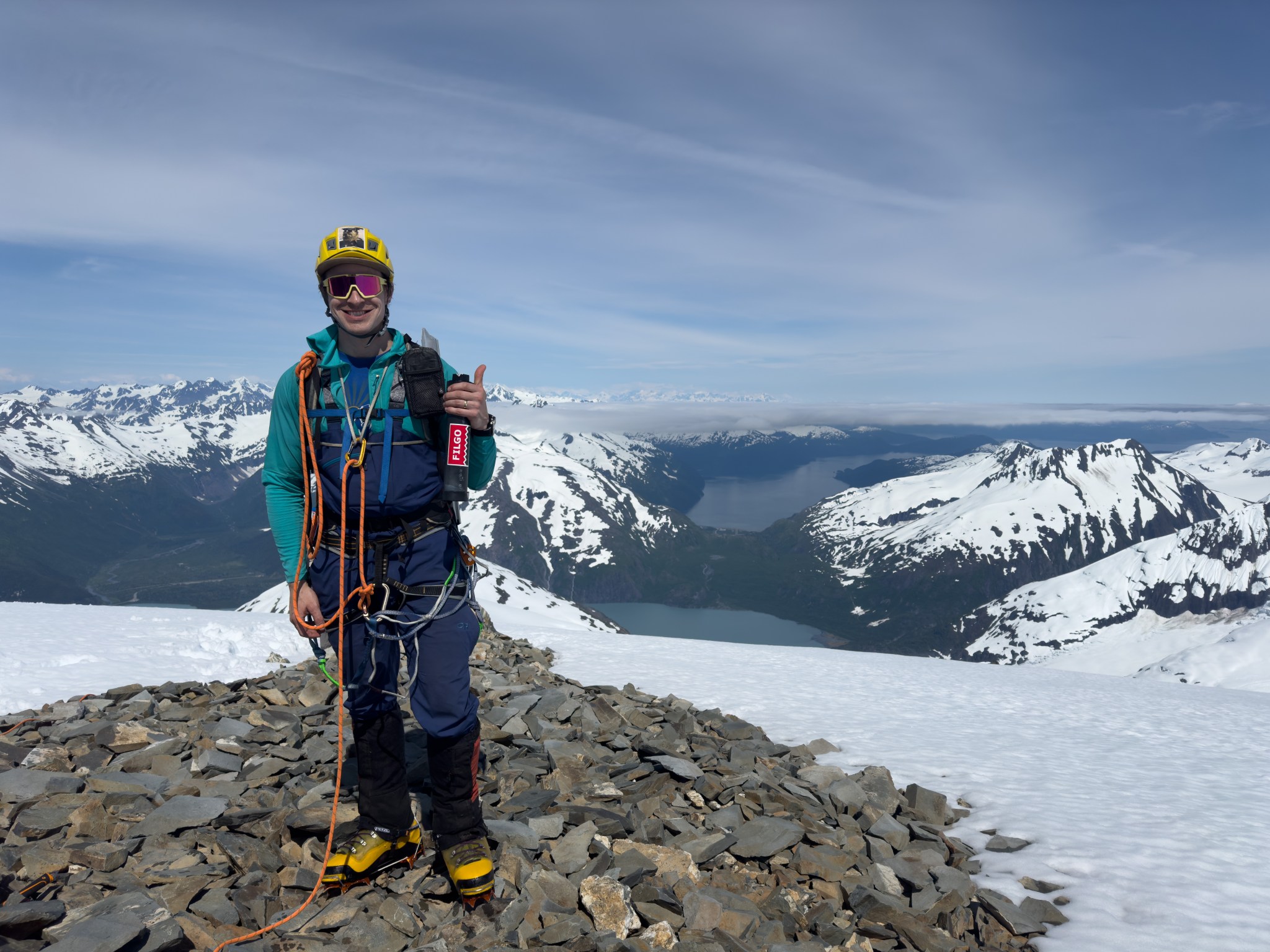
The ascent had taken roughly 6.5 hours, the descent took about 3.5. We descended the glacier with haste, not quite running but plunge-stepping with speed. Once unroped I lagged behind to take photos, apparently the boys waited for 45 minutes but I think it was actually an hour of cumulative downtime. I took one last stop at the ridgecrest to take afternoon photos, then I put my camera away and we descended the ridge.


We found our boots and put away our mountaineering equipment, glacading down the afternoon-softened snow. We had just crossed the traverse between the massive cliffs and were descending the grassy gully when Zach spotted the fattest black bear I’ve ever seen in my life just a hundred feet below us. Once again, Emre attempted to take a photo but Zach and I scared off the bear before he could get his phone out. We made non-stop noise for the next hour as we descended the rest of the route, getting back to the truck just after 7PM, bringing our total time to 10 hours 43 minutes; 4,770′ and 8.53 miles. We could see our trail from the lake, with my camera’s zoom.
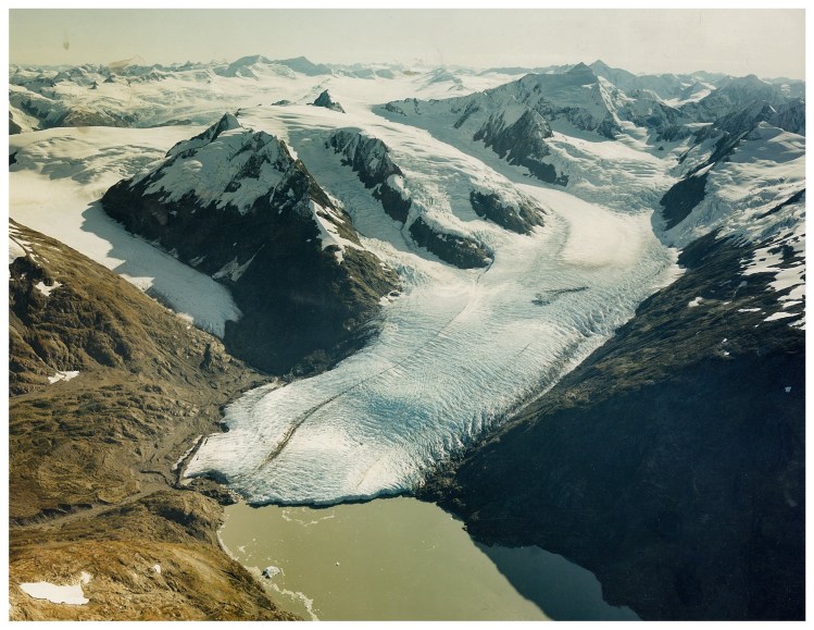
With this ascent, I intend to retire from this project. My new wife Claire is happy I’m done, she worried every time I ventured up the ridge. I hope someday someone will repeat this ascent, and maybe someday I’ll go back up to the ridgecrest with a few friends to see how Portage Glacier has changed. I’ve already seen some changes over the past 3 years on Carpathian’s north glacier, Portage Glacier is mostly changing where it meets the lake. Soon the west face of the glacier will no longer sit in the lake and maybe the glacier’s retreat will slow.

I believe this might be the safest route to climb Byron Peak. The other routes ascend either the col west of the west summit, the northern detached piece of Byron Glacier, or the eastern flanks via Portage Glacier. There’s been three deaths on the first two routes, and the third route is uncommon and usually only done as part of a larger traverse from Carpathian. Ultimately there is no “good way” up Byron Peak, but this route is pretty nice: it avoids steep corniced ridges, rotten rock, as well as navigating an icefall. The steepness and bushiness of the initial ascent may discourage others from repeating it. I do hope that’s not the case; the route is beautiful and feels remote, despite being easily accessible and within cell service. The bears are manageable with enough people. If the top of the ridge is snowy, the travel is extremely fast and efficient. The summit glacier travel is easy and fast, we brought pickets but never felt the slopes were steep enough to place them.
(An update from later in the year: Kaleb Notty and crew repeated the route in early August 2025!)
While doing this write-up, I found a report that, at age 48, the legendary Grace Hoeman climbed up and over the end of Byron’s NE ridge in August of 1969 during the first ascent of Bard Peak (done solo). She then reversed her approach after climbing Bard!
“The problem with Bard Peak in summertime is crossing the Lake and unless one is endowed with divine power (water conveyances being verboten) one somehow has to get to the base of the mountain the hard way. Looking over possibilities I decided to work myself over the end of the NE ridge of Byron Peak, down to Portage Glacier, across the Glacier, up Burns Glacier and Bard Peak’s west face along the WNW ridge to the summit.”
– Grace Hoeman, September 1969 Scree”

https://www.arlis.org/docs/vol2/screeak/2001/Scree-v44no12-Dec2001.pdf
Archival Photo
If the brush was just as thick 53 years ago then I imagine she took a line similar to mine, as it utilizes obvious mountain features to avoid brush, follows the least-steep aspects of the face, and navigates through the only feasible gap in the cliffs below the brushline. Perhaps someone else went up the ridge in the intervening 53 years, but I have found no record or evidence of such an ascent.
For anyone who wants the route, here’s the kmz file:
https://drive.google.com/file/d/1El6NHWspW9uZgOPbAVJwv1qbnWUvGAW2/view?usp=sharing

Well done (for the hike) and well written! I’m proud of you!
oops, guessing should have logged in. That was from Mom. 😊