
“Oh hey Wayne, how’s retirement from the Deltas going?”
“Oh pretty great, Galen and I went up Rainbow via the road last weekend.”
Did someone say RAINBOW ROAD!!!?


With my birthday weekend looming and one solid day of good weather on the horizon for the Deltas, I figured making some sort of effort in the Deltas might be worthwhile. I set my expectations pretty low, and created the belief I would still have a good weekend even if I didn’t get out of town. I reached out to a number of partners about getting after a Delta peak in a day; Galen took my bait and we rolled out of Anchorage around 1:30PM Friday the 19th. Exactly one year previous, I climbed Institute under phenomenal weather, we were hoping to have similar luck this trip. Galen and I hadn’t climbed in the Deltas together since April 2017, we’ve climbed Triangle, Silvertip, and ascended to 300′ shy of the summit of Blackcap.
Rainbow, McCallum, Silvertip, Institute, Minya, White Princess, M’Ladies, Snow White
We made it to the empty pullout by Michael Creek a little before 8PM and had the tent set up, dinner eaten, and were warm in our sleeping bags within an hour, planning to get an alpine start at 2AM. We had some discussion around how technically difficult the route might be, as well as concerns around ascending potentially windloaded slopes a few miles up the creek. I laid in my bag, fairly anxious and feeling fear, unable to do more than lay still and try to find comfort in non-movement. Around 10:30PM some very loud and chatty folks rolled into the pullout and talked a bunch about dragging a sled to a cabin 1/3 of a mile up the creek. Galen and I both struggle with falling asleep and both resisted the urge to yell at these people.
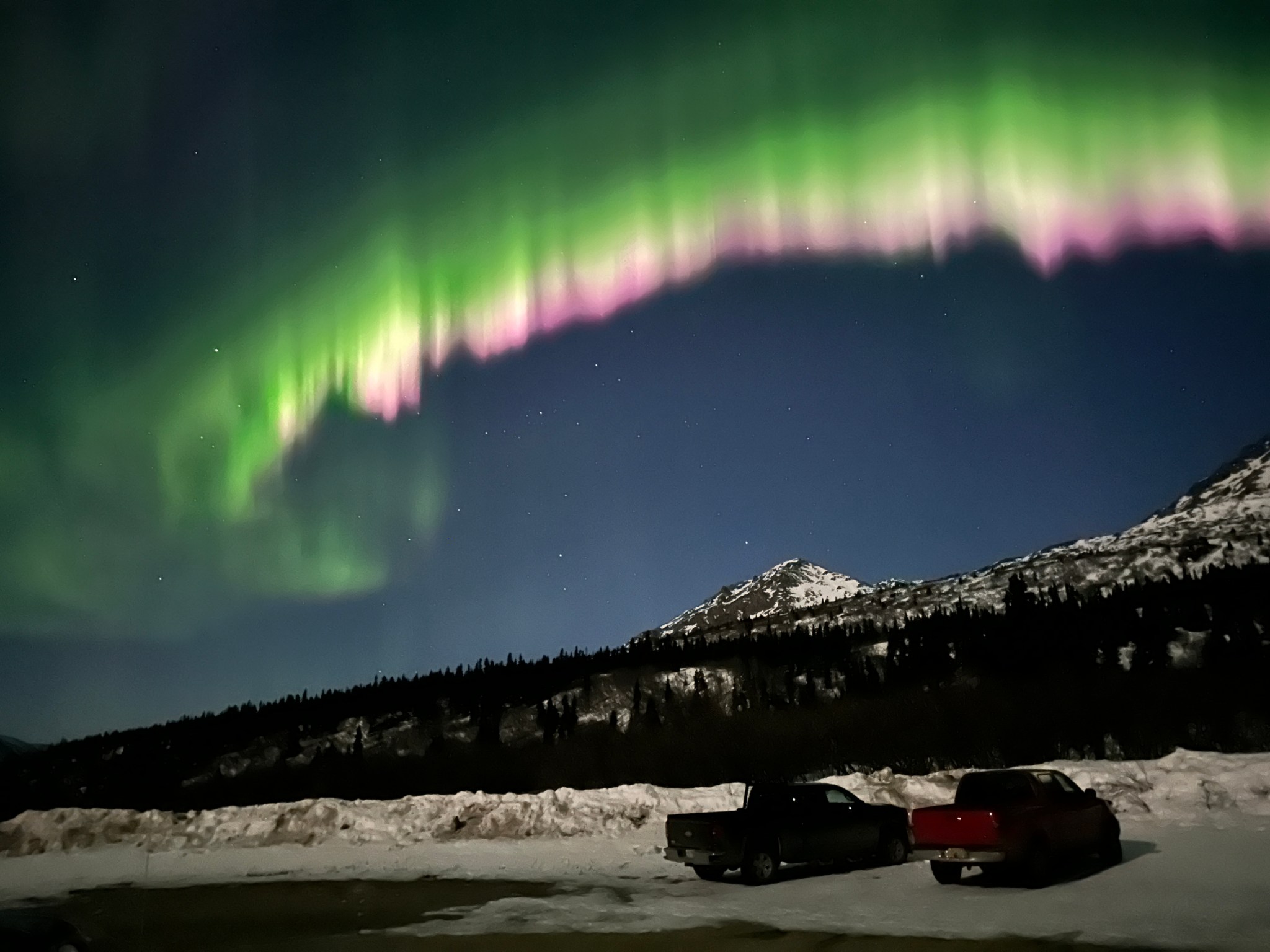
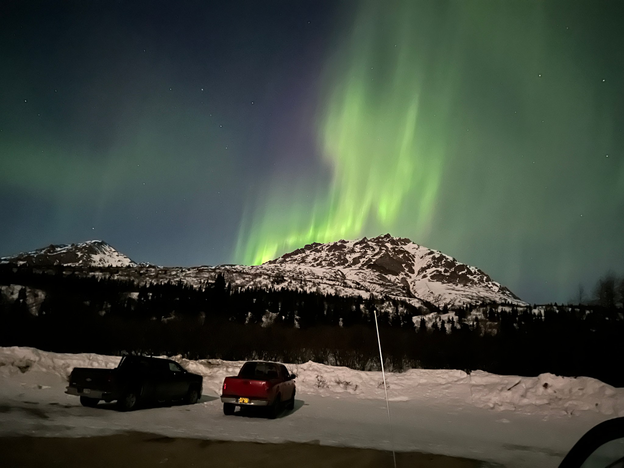
2AM came way too quickly, my classic Danger Zone alarm roused us and we began the slow process of starting the day. At 2:08AM I unzipped the tent to find a friendly moon lighting our valley from the west. As soon as I stepped out of the tent and looked up, I yelled “GALEN GET THE F*** OUT OF THE TENT RIGHT F***ING NOW!”
There was an incredible flare of aurora directly above our tent, spanning nearly half the sky in the valley between the Delta and Hayes foothills. I’ve never seen pink aurora before; the green that shows in the photos was not very apparent in real life, I saw more yellow and pink than anything else. The aurora diminished over the next couple of minutes, but continued to burn across the sky as we decamped, ate food, and prepared to move.

At exactly 3AM we skied out of the parking lot and noted the post-holes from the chatty party. Before we went to bed Galen had confirmed the isothermability of the snow, plunging up to his knee in places. This morning the crust had refrozen enough to support weight, but as we continued to ski we noted how thin and brittle it was. At most it was 2″ thick, mostly less than that. Not entirely reassured, we slogged up the creek 3/4 of a mile until Galen expressed his doubts about the feasibility of skiing out on thin warm crust this afternoon. I was able to punch through the crust in some places merely by jumping. It seemed like the creek was not nearly as full of snow as was typical, and the previous night we had taken notice the west ridge of Item Peak was more wind-scoured than we’d ever seen it.


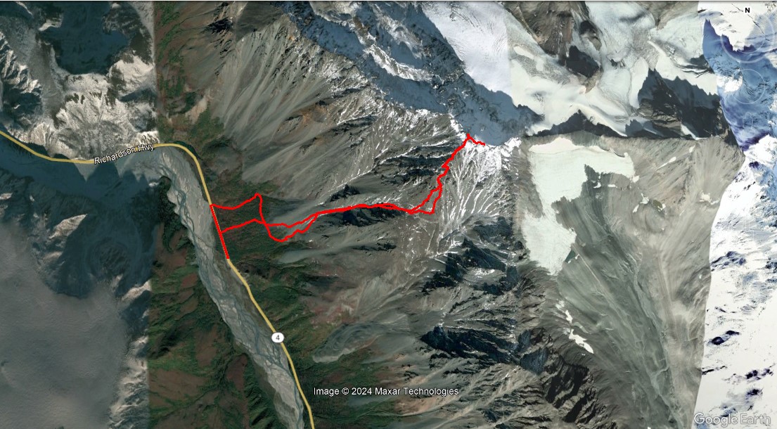
Trying to remain open-minded and adaptable, I proposed an alternative. “The day is still young, it’s barely 3:30AM”. We decided to turn around and seek better conditions elsewhere. We got back to my truck and drove roughly 10 miles south and looked up at what for years I’ve been calling RAINBOW ROAD: climbing 4200′ from the Richardson Highway directly up the slopes to Rainbow Peak. I scouted out the area after my first moose hunt last September and had saved a theoretical GPS track based on Stan Justice’s beta on the route:

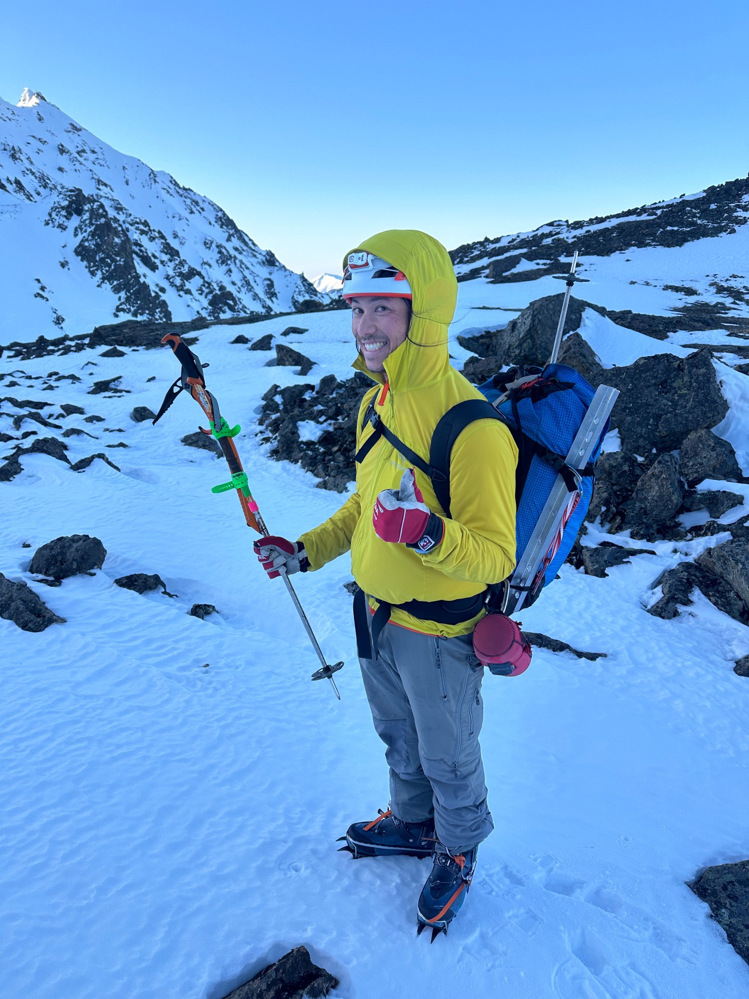
Galen had previously attempted Rainbow Road via a slightly different route but turned around on top of the SW shoulder of Rainbow. We parked at the first pullout on the west side of the road just south of MP 209, opposite a large rocky road cut, elevation roughly 2,600′. We left my truck around 4:20AM and carried our skis north along the highway until the brush on the east side of the road thinned out, then skinned our way to the obvious gully north of the 5,800′ SW shoulder of Rainbow we referred to as “the Flattop-lookin’ hill” because the more we looked at it, the more it looked like Anchorage’s Flattop. I took off my skis before Galen and started crampon-crunching my way up towards the gully. We dropped our skis around 3,900′ in hopes of either having a sweet ski out…or at the very least not post-holing through breakable crust.


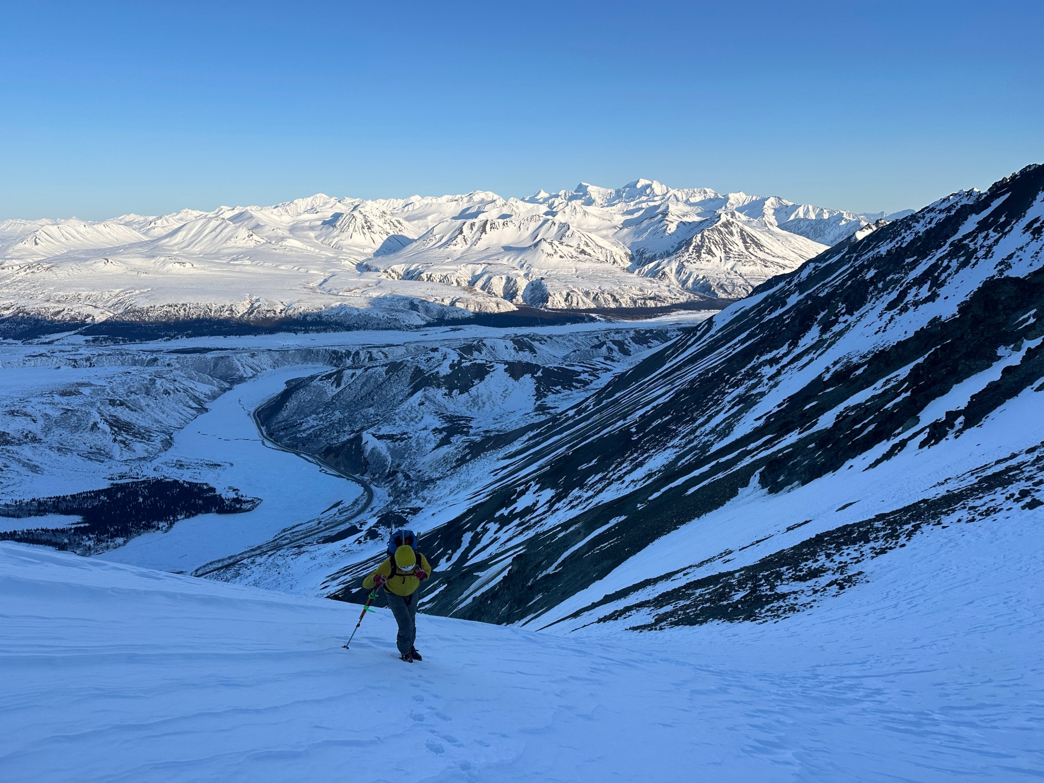
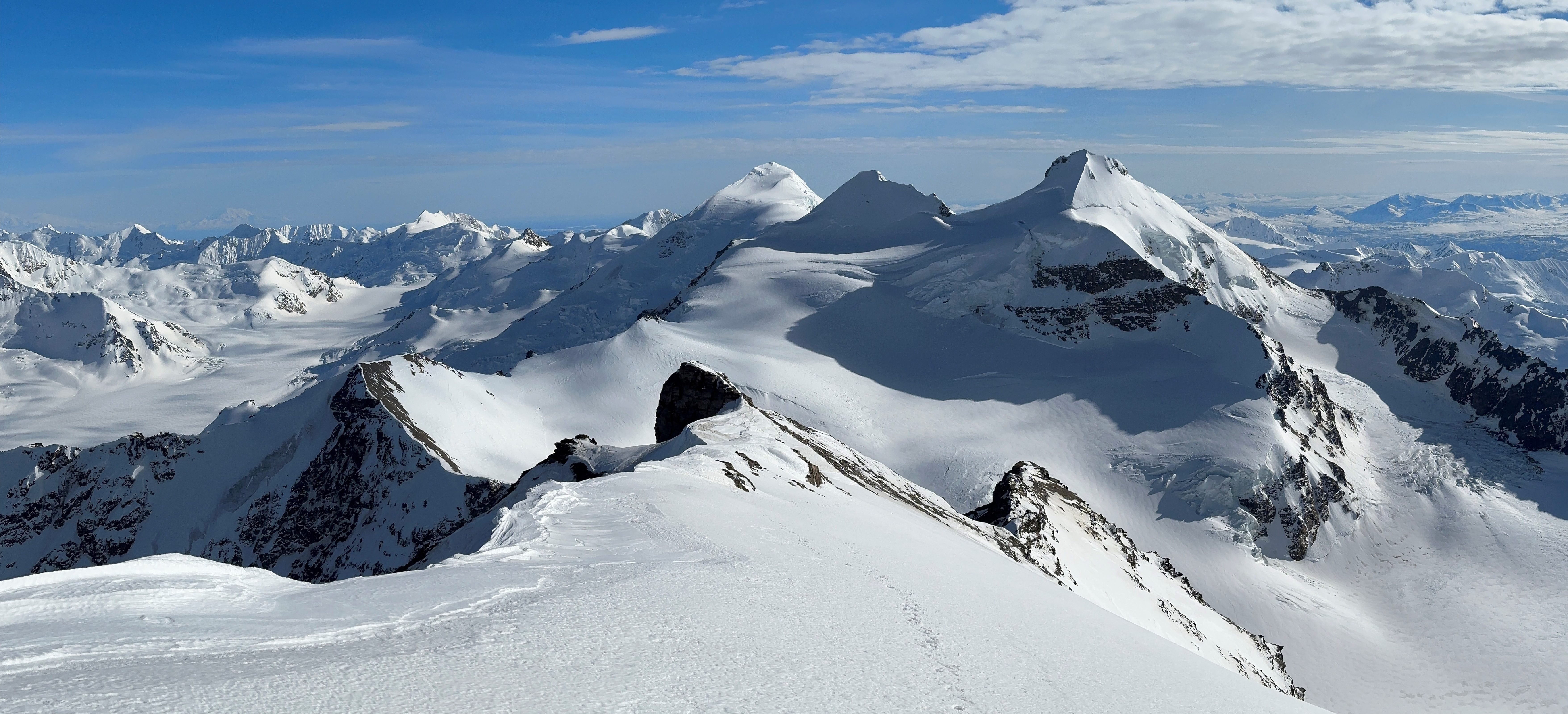
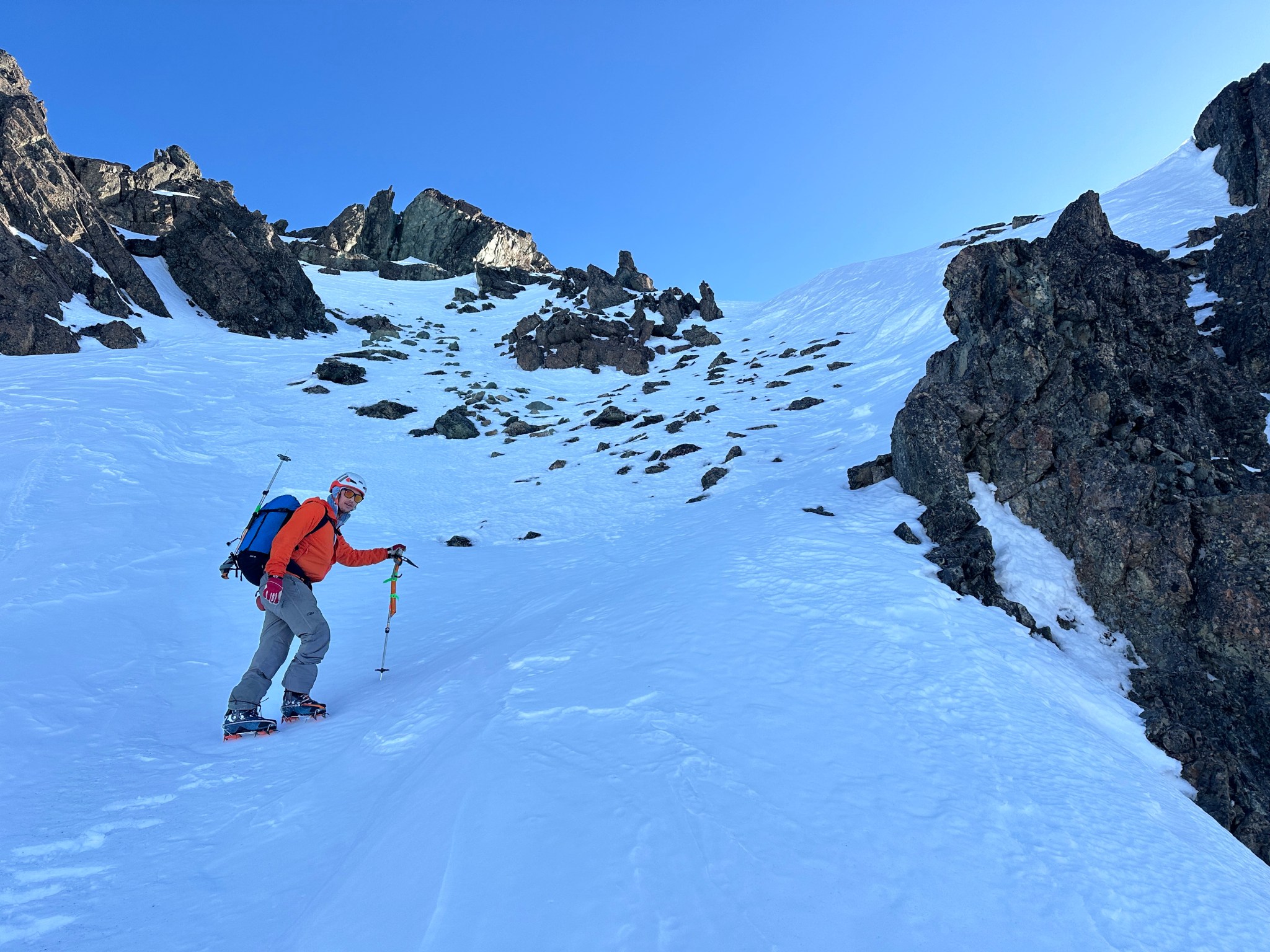
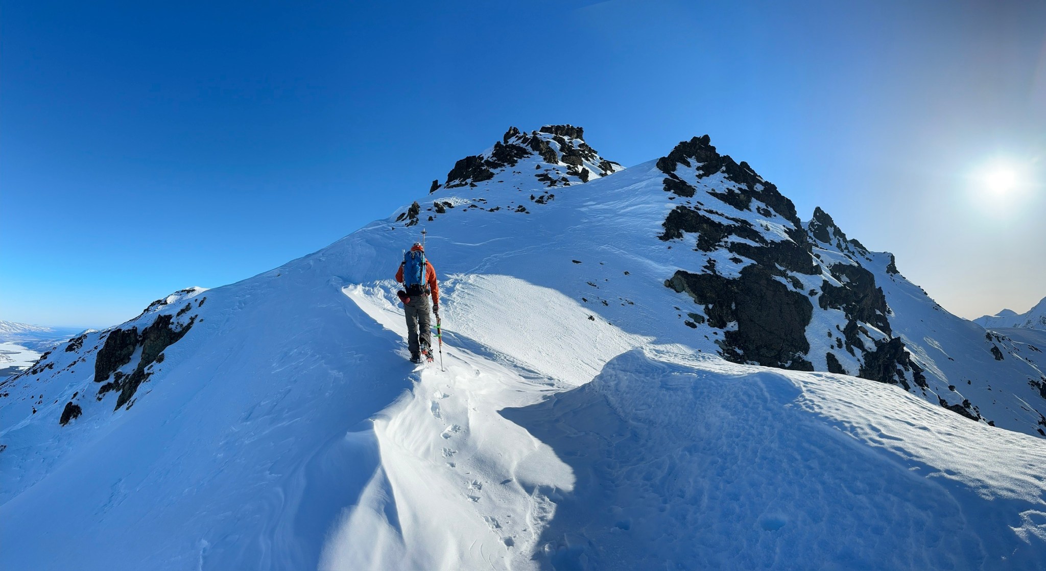
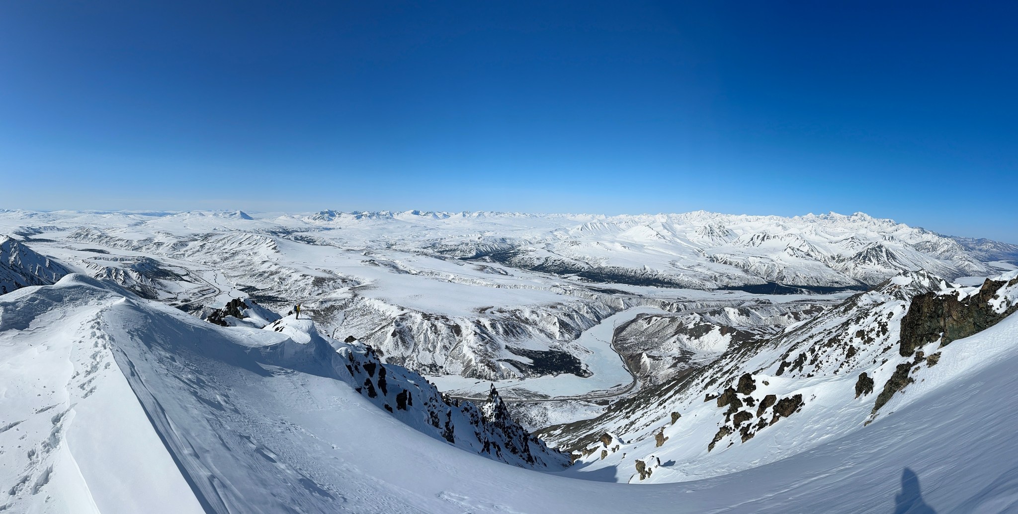
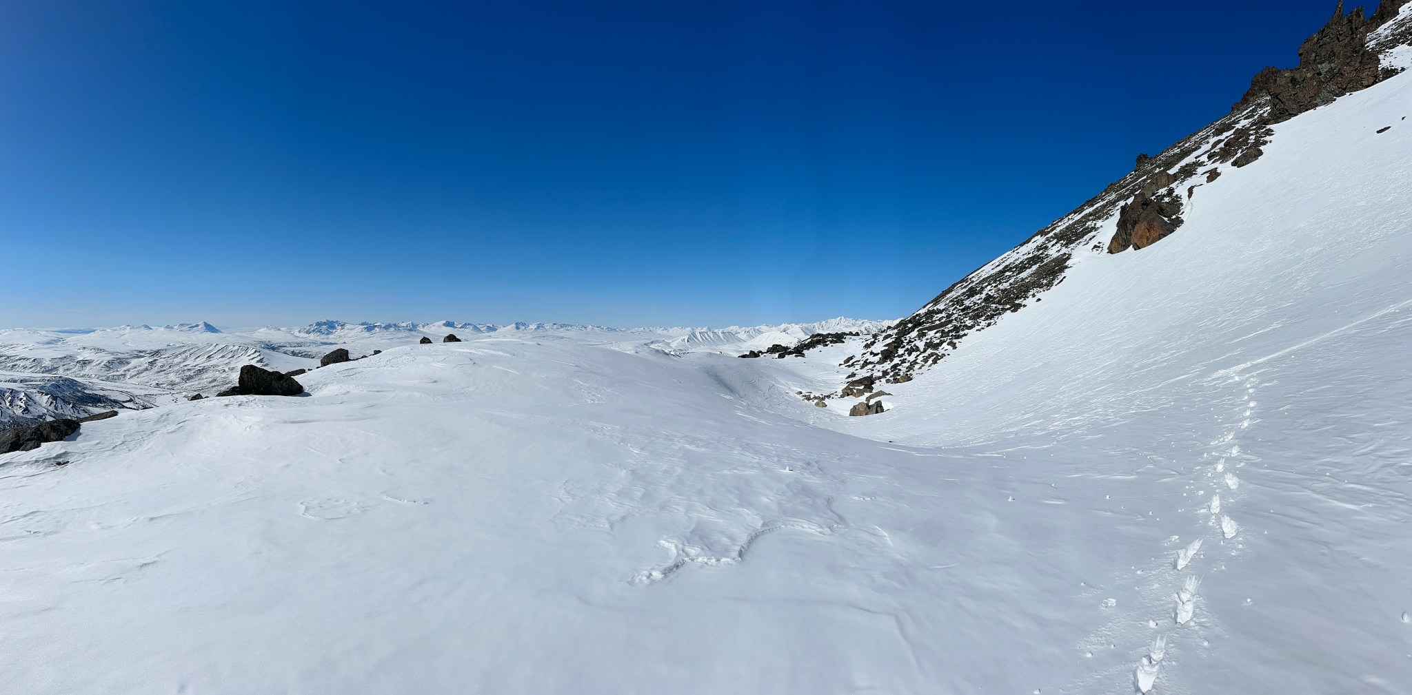
The gully climb was smooth and quick, easy snow to climb with mountaineering axes and crampons. There was at least one other set of bootprints from a previous ascentist. We topped out at a large col behind the Flattop-lookin hill, where Stan’s rock glacier route intersects our route. There’s roughly 1,200′ of elevation between this col and the summit. We scurried up to the next slope, anxious to get as high as we could before the sun hit the snow. We aimed for a gap between two rock towers we could see, climbing the southwest slopes of Rainbow.
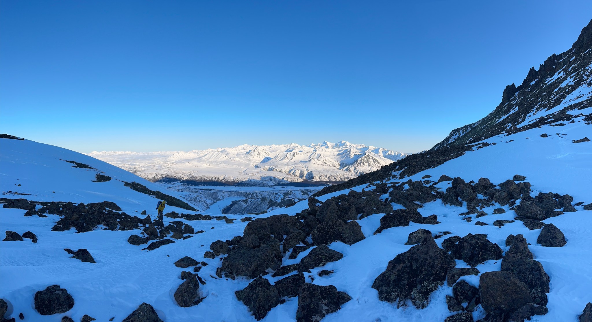
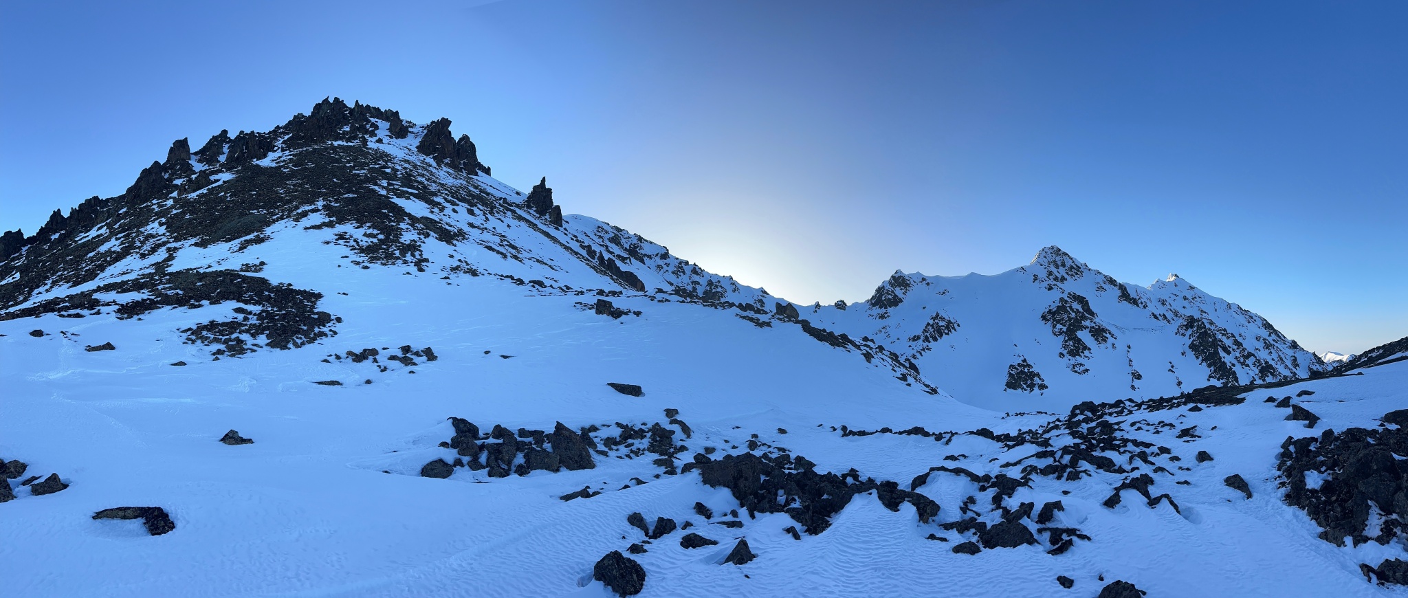


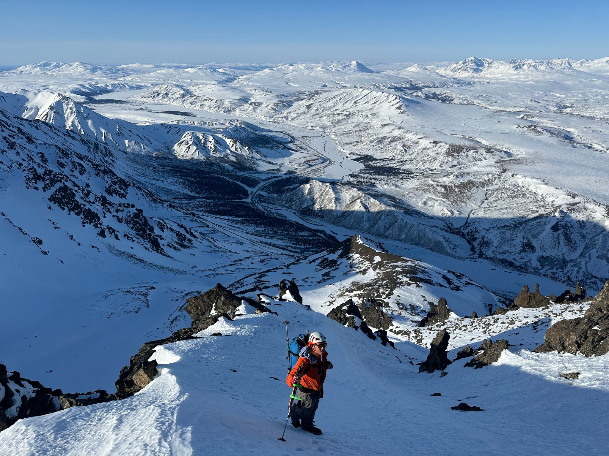
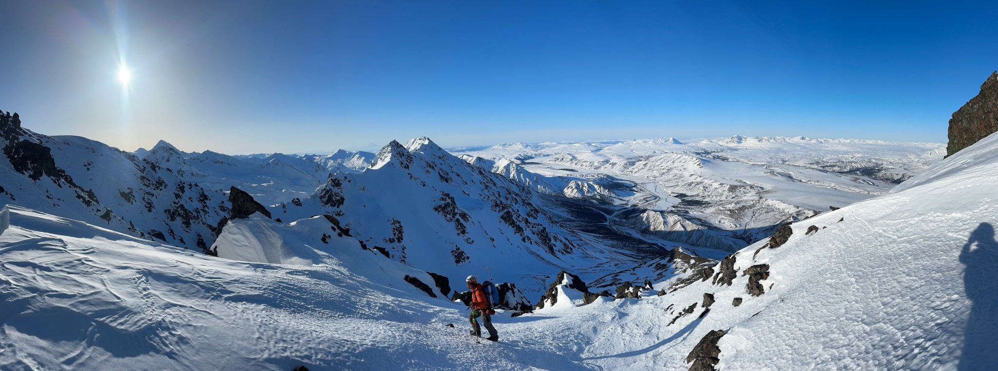
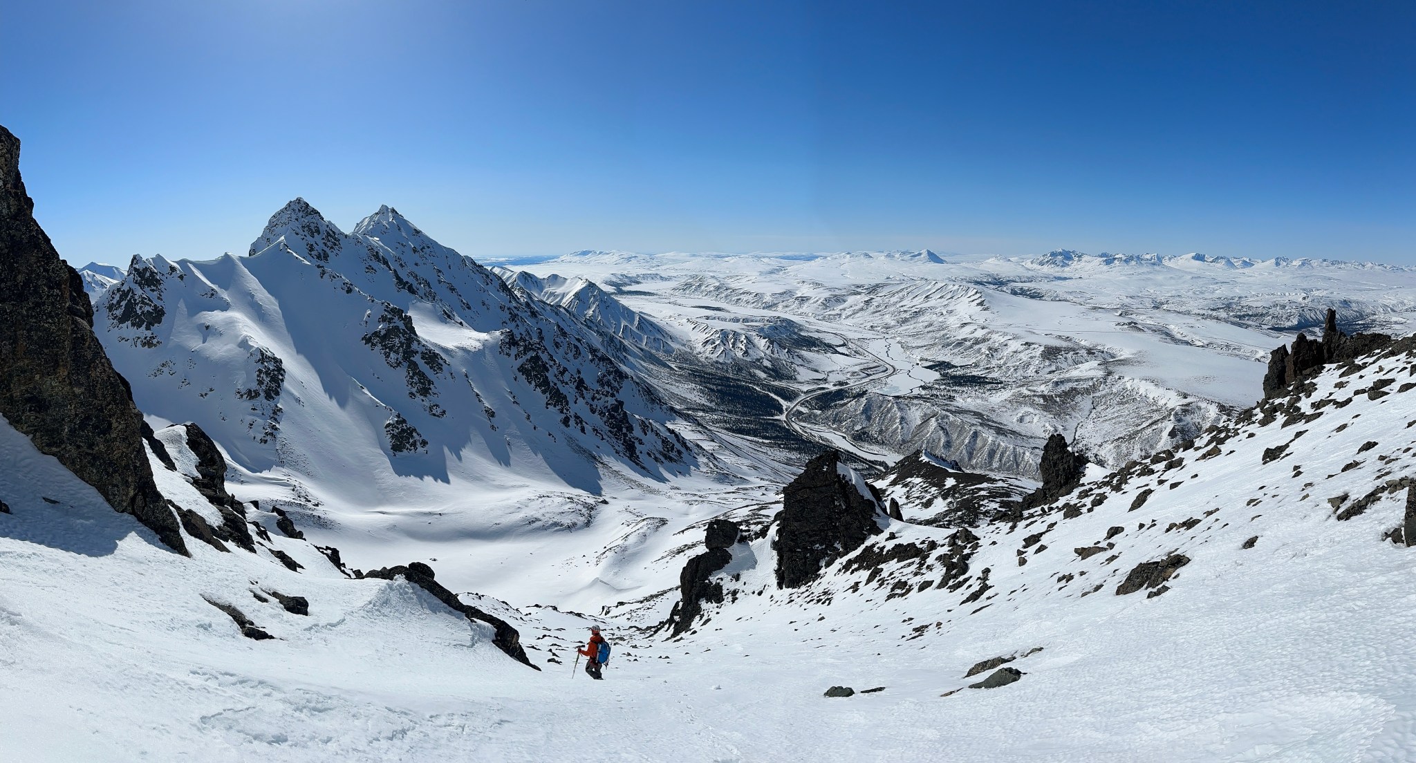
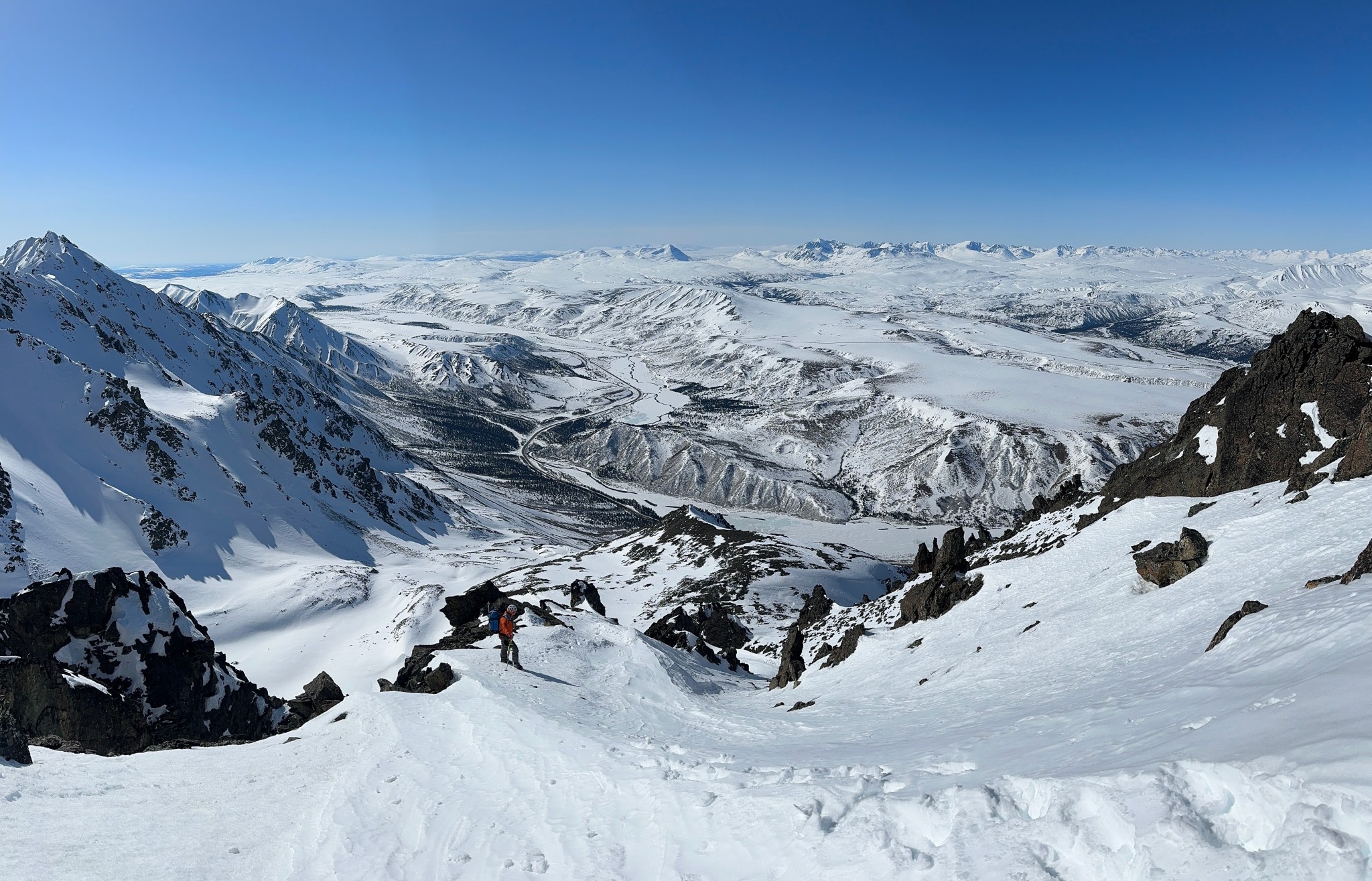
We angled up and left after passing the first tower on our right, crossed a snow ramp and ascended it upwards to the left, then when we saw rocks near the top of the snow ramp, and eventually cut through and topped out at the right side of those rocks. From this craggy section we could see the summit. The only steep bit was a few rock moves (5.4 ish) to cross to the left side of the rocky ridge pictured below. After climbing up the rock we descended the other side a few feet to the west side of the ridge, traversing below the rock on snow. We crossed over to the right side of the rock ridge once it mellowed, climbed up a short steeper section and continued to follow the ridge upwards, reaching the summit around 9AM.


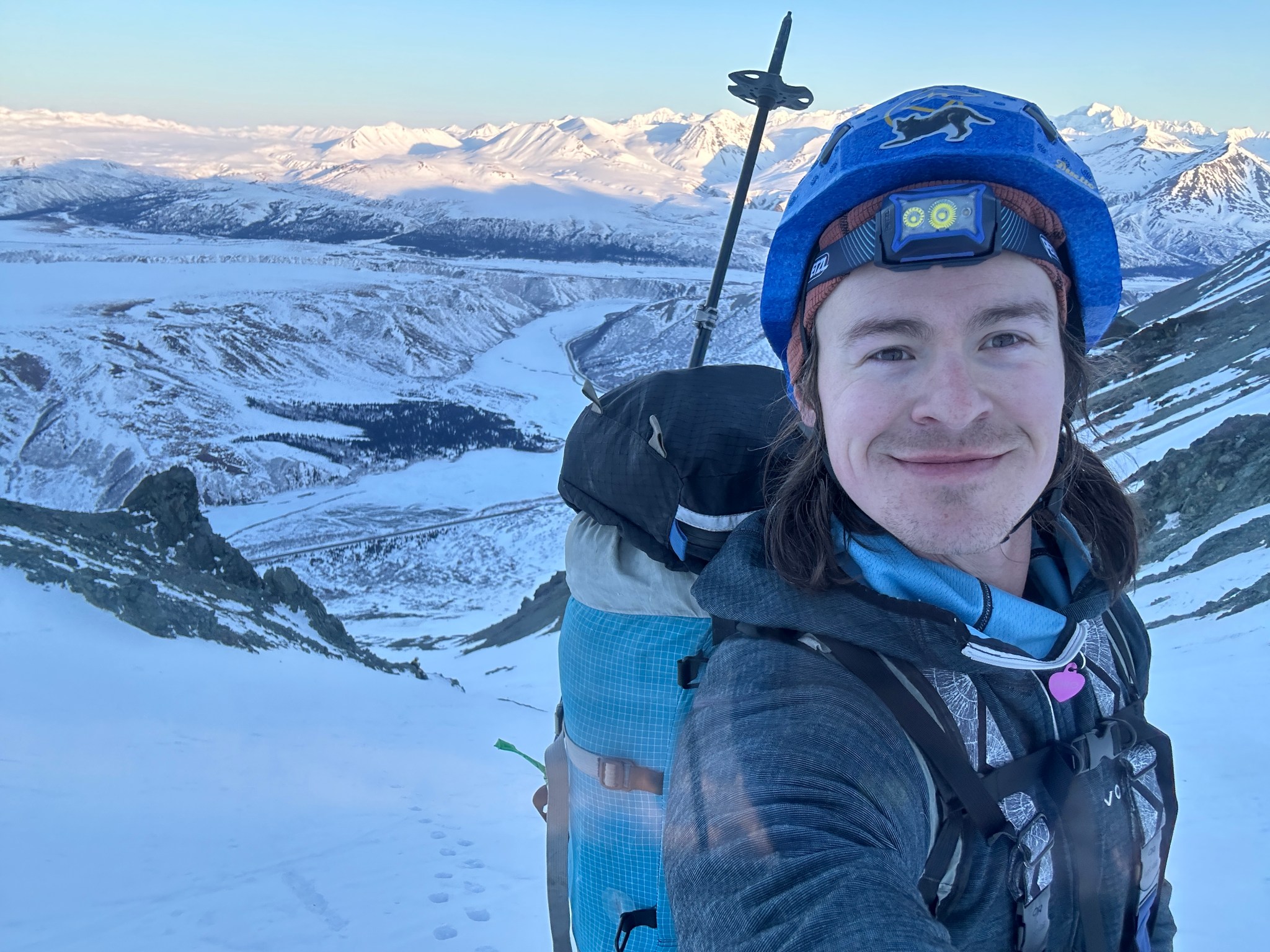
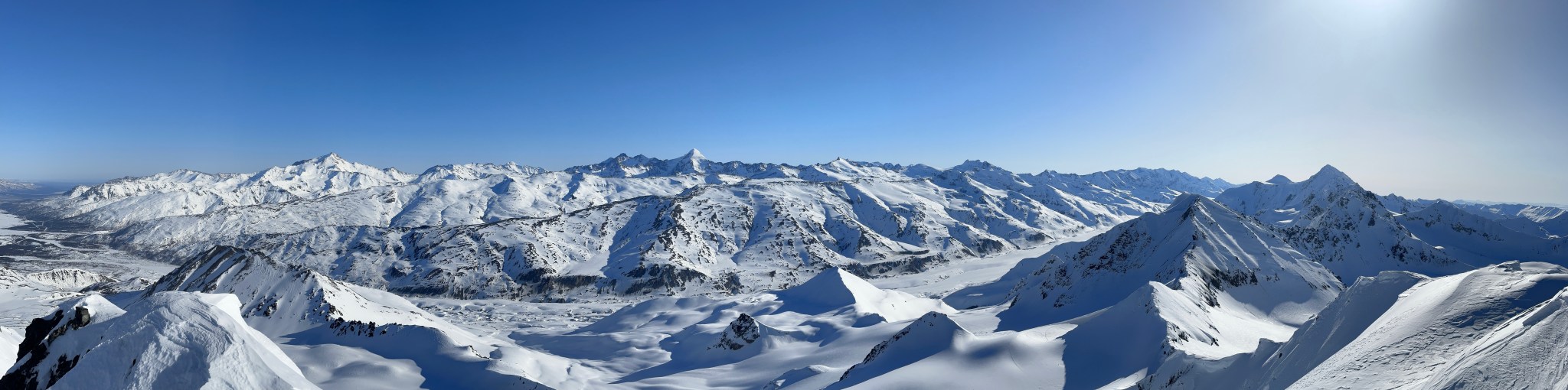
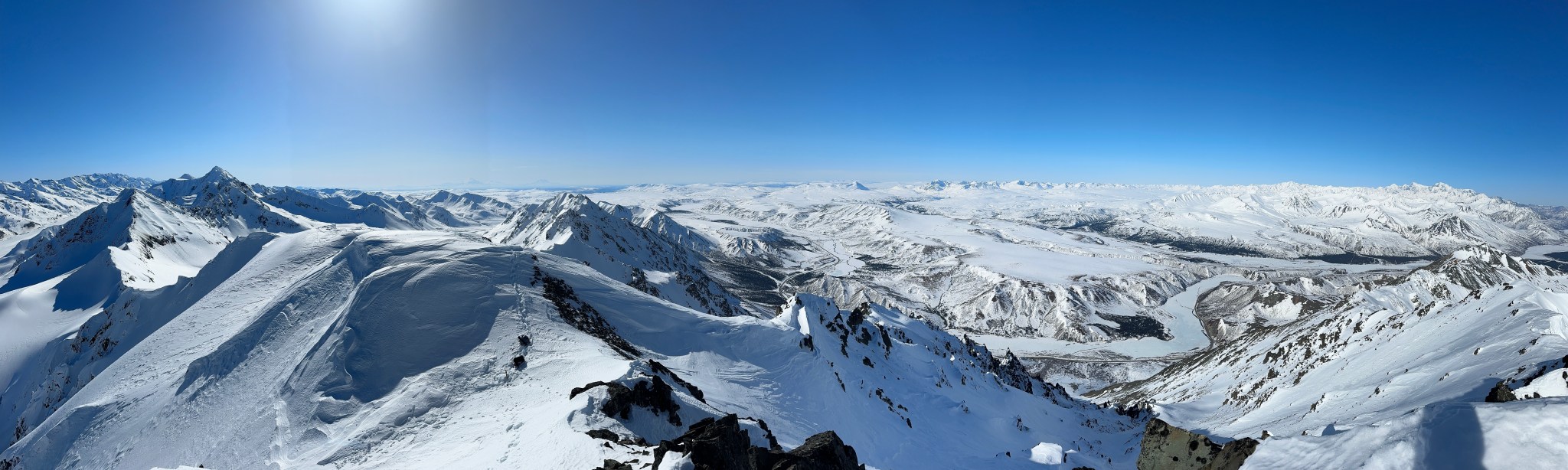
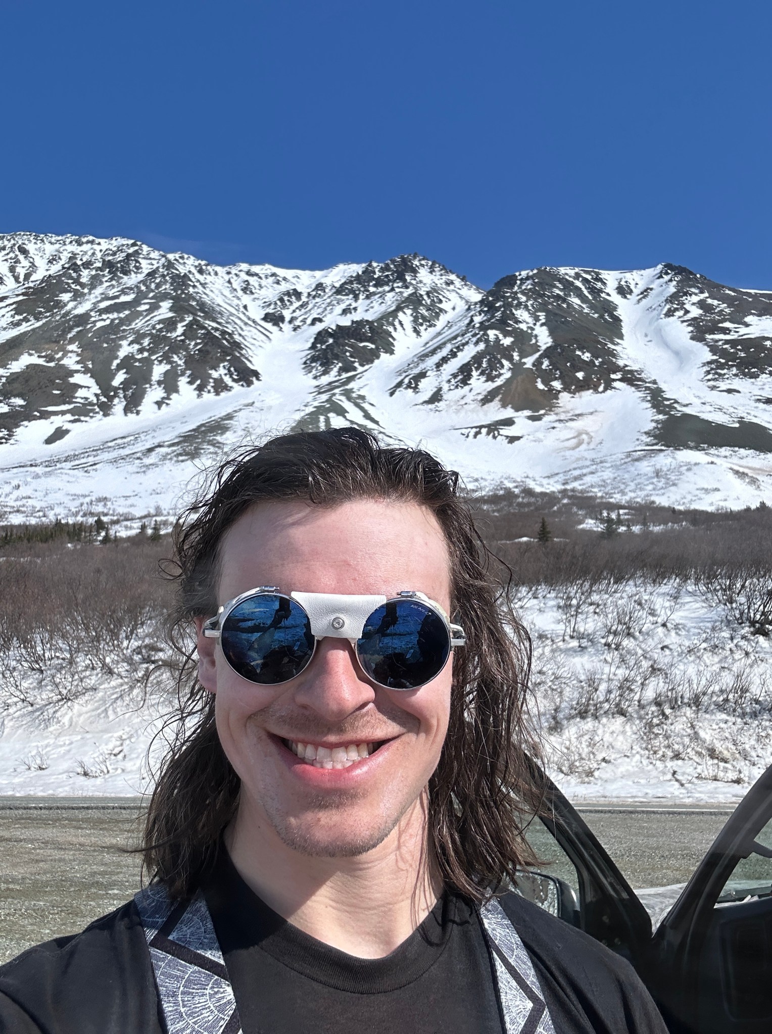
We spent two hours hanging out on the summit and the summit ridge taking photos and refueling. It was extremely pleasant weather, though there was a bit of a brisk wind which as no longer enjoyable once we stopped climbing. I had with me a carefully-packed spoonful of Kiro’s ashes I’d prepared the day before. I’ve wanted to start spreading his ashes for over a year, but the thought of doing so was unimaginable until very recently. I took some time to dig a hole in the summit snow until I reached rock and sprinkled a bit of Kiro directly into the summit, churning it with my mountaineering axe to ingrain him therein. I let some of his ashes fly free into the wind on top of Rainbow and handed the bag to Galen to liberate the rest; Galen was one of Kiro’s favorites. I’m glad to have placed a bit of him in the mountains I love most in the world; “Rainbow” seemed very fitting.


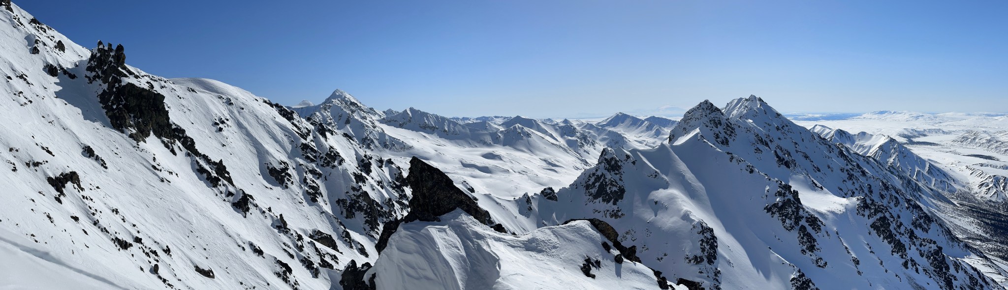
We moved from the small summit to the east summit ridge proper, finding a spot out of the wind to enjoy the sun. I could see the valley where Claire and I camped the previous spring; I recall looking up at Rainbow and considering climbing it before deciding otherwise.

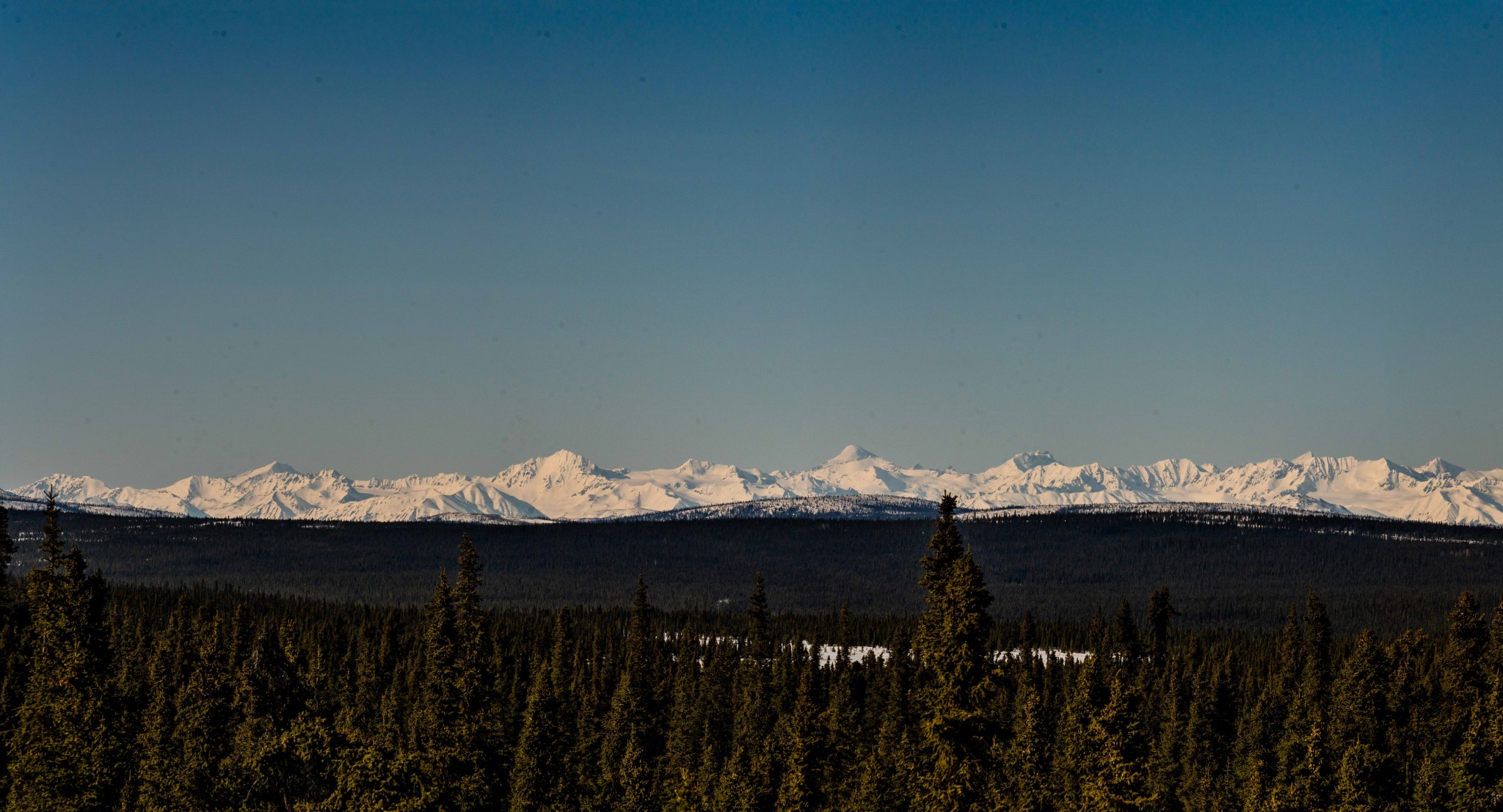
There was apparently a windstorm in the Deltas the previous week (peak of 60mph from the south Wednesday). The major high peaks of the Deltas were all as stripped of snow as I’ve ever seen them; Old Snowy was had no snow, Blackcap and Little Princess were mostly exposed rock, White Princess sported an impressive stripe of bare ice across the base of the summit pyramid.


A little after 11AM we turned around and began the descent. Nothing of note occurred except our crampons started balling considerably on southern aspects of the top 1,200′. We trended west when we could to avoid this problem but it plagued us until we reached the col near 5,800′ Flattop-lookin’ hill. After this we were gratefully in the shade for most of the gully descent, we were able to plunge-step our way down the majority of it.


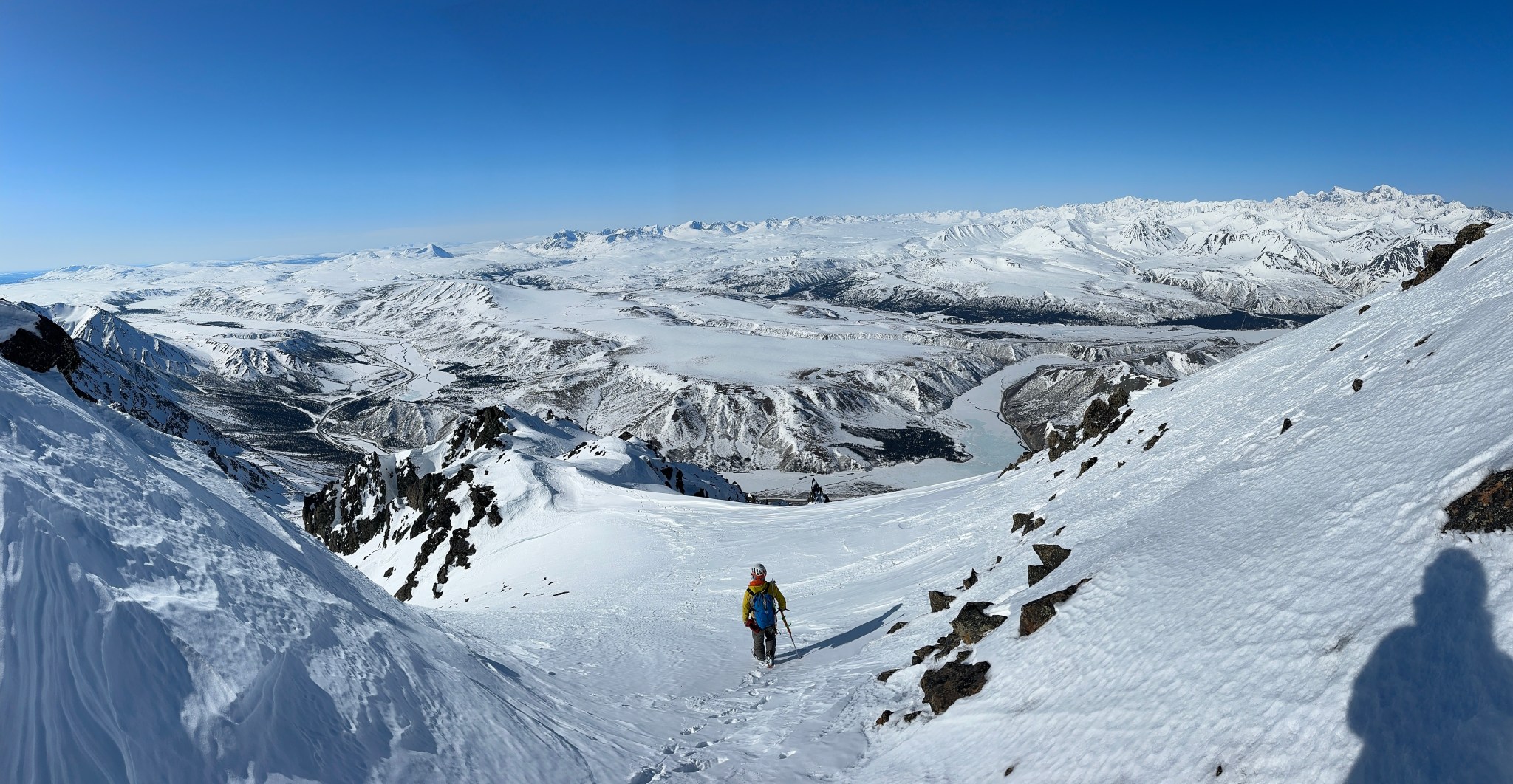


Rocks began to chase us down the gully as we neared the bottom, we were eager to be out of the line of fire. Collecting our skis and continuing to dodge rocks, we diverted hard skier’s left until we were out of range of most of the rockfall. We stripped our skins and extra layers, clipped in and had a wonderful ski on soft snow to the road, arriving back at my truck just before 2PM. Rainbow makes my 7th successful Delta summit (if you don’t count Rum Doodle), which is pretty cool. It was fulfilling to climb a line I’d been eying for 5 years. I don’t expect to be back in the Deltas until summertime, when I hope to find the tundra free of snow and full of sun. We drove back to Anchorage that evening, leap-frogging various military convoys, and got to sleep in our own beds that night! Of course I stayed up until 1AM importing/compiling/editing photos. The next day Claire treated me to a wonderful birthday full of plants, flowers, and friends.


2 thoughts on “Rainbow”