


The reification of a mountaineering trip can be reduced to a series of coincidences, otherwise unrelated until they all occur simultaneously. At any given time, the probability of a person standing on the peak of a mountain is an unknown value, but can be assumed to be near zero. What increases these odds? Good weather, stable snow conditions…recent summits, holidays, weekends, and in my case: work lulls and interpersonal coercion.
Enter me: Tuesday, frantically refreshing four different weather forecasts over 9 different tabs at 9:24AM. And 9:27AM. And 9:35AM. You get the idea.
“I think I’m gonna leave town Wednesday, unless weather changes substantially. Then I’ll leave tonight. I’ll decide by the end of work.”
Claire is having her first experience with the onset of my desperate, manic, impulsiveness that typically comes with mountaineering season. It’s been a weird spring, far colder and snowier than normal. There has been very little crust to ski upon, a truly frustrating sentiment in late April when we felt we DESERVED crust and sun as a reward for the extra cold and snowy winter.
The anxiety I feel during this part of the year has become normal to me, it’s a kind of superpower. Given the coinciding factors have a narrow but predictable window, it’s easy to stay chill when weather is bad. However, the inverse is getting skunked by bad weather on my free days. Regardless I’ve learned this anxiety is a form of motivational energy that’s not always available, access requires maintaining a certain level of fitness and flexibility in scheduling, subject to change on short notice. Once I feel the mountaineering potential, it’s hard to ignore and the anxiety starts to build. It feels like fire in my blood, a storm of energy pushing me to drive, ski, climb, move. With this energy and the required 5 hour drive to the Deltas, I find I can operate in the mountains on 4 hours of sleep, and 2.5 if I can have a nap midday. It’s like many endurance sports for me, once it starts my body wants to keep moving.
Claire and I spent the previous weekend in the Deltas, my favorite place. I knew the weather would be good there, but sadly no one could go mountaineering with me. Most of my climbing partners are getting old and domestic, their eyes drawn to snow-covered slopes and cabins rather than rime-blasted ridges. I can’t blame them. But this obsession keeps driving me to the eastern part of the state. I’ve never climbed anything on the southern side of the Deltas, they’re totally new to me (sans some tepid Gulkana Glacier exploration).
I figured maybe I’d try to climb Rainbow Peak from McCallum Creek; my climbing mentor Jeff proposed taking my ladyfriend Claire to camp. After I thought about it for a bit, this struck me as an awesome idea! Since she doesn’t design her lifestyle around mountaineering, some strings would require pulling. Mainly finding dogsitters and appropriately burley skis. Jalen at AMH was very helpful getting her set up with backcountry skis, complete with cute polar bear skins.
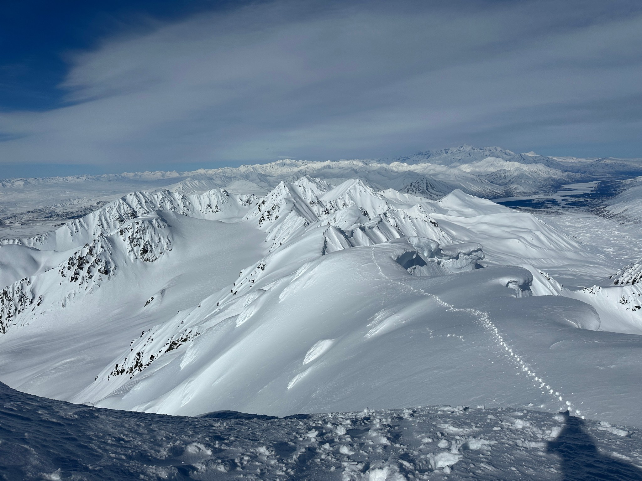
With these acquired, we set off for the Deltas early Saturday morning after seeing Ghostland Observatory the previous night. We arrived at the McCallum parking lot around noon and were greeted by the presence of another Subaru. Happy to have a skintrack for at least a few miles, we had a pleasant sunny ski up towards the McCallum moraine. As I suspected, the folks who made the skintrack turned right towards the West Gulkana Glacier drainage, which serves as access to Institute Peak. Sure enough, as we broke trail on the left fork that leads to McCallum Glacier I spied climbers on the west ridge of Institute! I hurriedly skinned to a better vantage point and snapped a few photos.


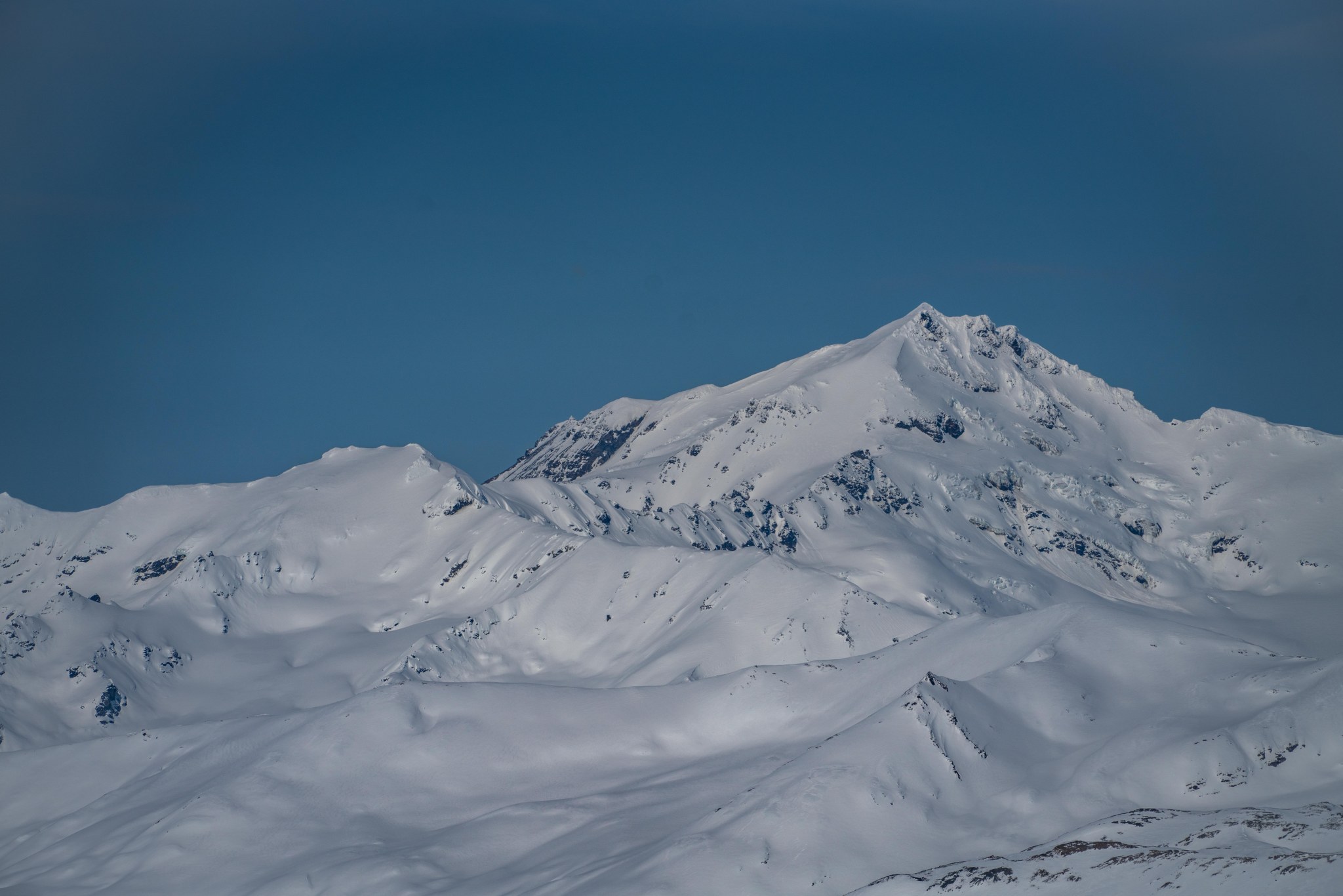
The left fork (and Osiris), towards Rainbow and McCallum Peaks


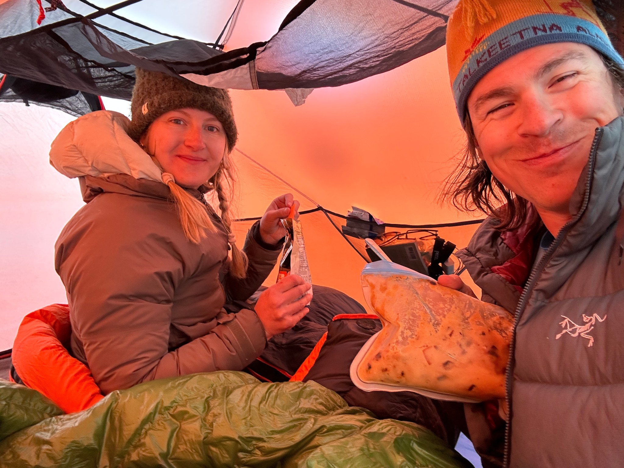
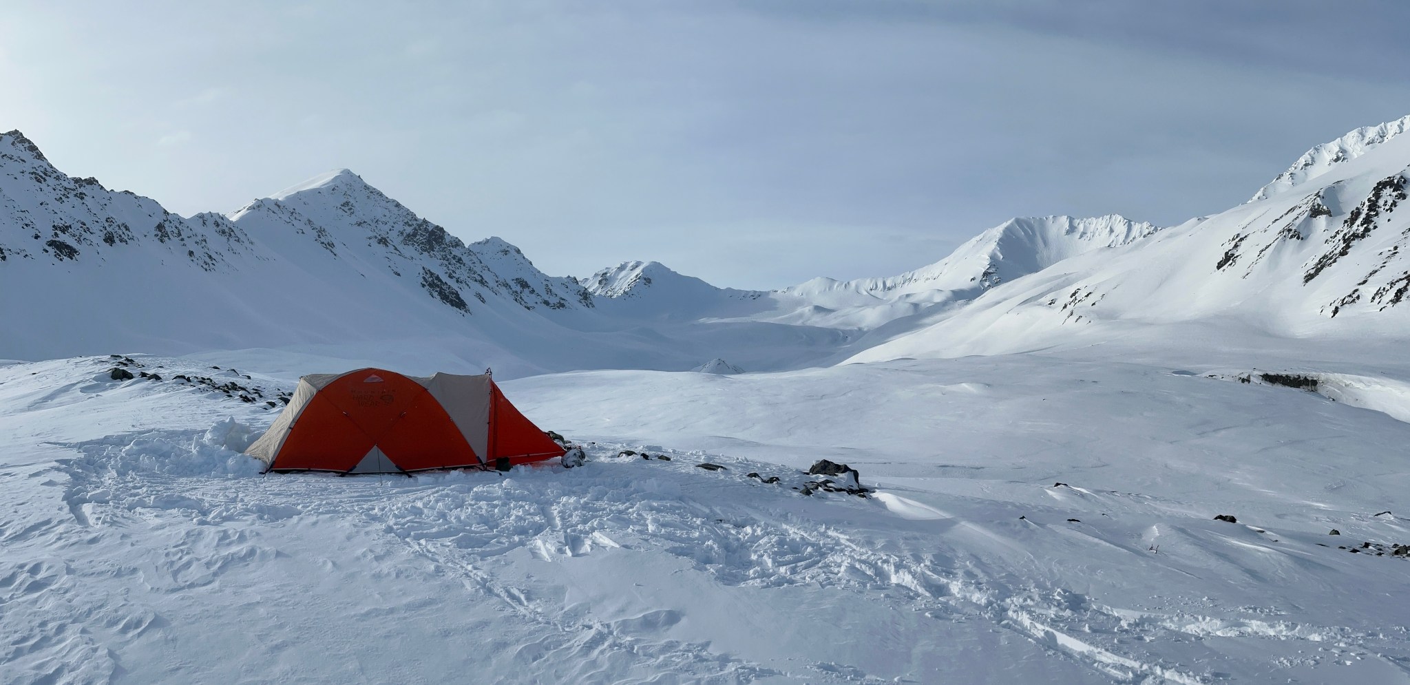
Claire and I kept skiing until we reached the moraine, then gained it via a low spot on the west. I had thought about skiing further up the valley, but eventually realized the best vantage point was the top of the moraine. I assumed the moraine’s high point would be further back up the valley; instead it was about halfway up the valley or less. Claire was happy to be done skiing with a pack! We spent half an hour getting a tent platform stomped and leveled, and then set up the tent. I started the snow-cooking for dinner and water, then left to go dig the latrine. Around 8PM I spied new ski tracks descending the West Gulkana Glacier and was suddenly tempted with the idea of ascending Institute the next day, rather than Rainbow or McCallum. Analyzing the various risks associated with soloing the mountain, I determined they weren’t much greater than Rainbow, trading steep slopes for glacier travel. After discussing my idea with Claire, she had no objections (though she did wonder what she was going to do with herself until 3PM). We ate dinner and fell asleep. Osiris the husky had trouble getting comfortable and insisted we share the double sleeping pad; eventually she and I negotiated a truce where she laid at my feet and I rested my legs on her.


At 2AM I was up, skiing by 2:30. The clear weather that had tucked us into bed had vanished, replaced by clouds of unknown elevation. Skiing entirely in the dark for many hours would have been eerie, but this was far from my first nighttime trek in the Deltas. It helps to have a trail to follow! I noticed yesterday’s ascentists had skied out the previous evening. Nothing of note occurred, I gained the West Gulkana Glacier tongue and made my way to the ridge. The ridge was the only object not engulfed in clouds. I could have begun my ascent by 6:30, but judging the swirling storms, I decided weather was going to deteriorate. I did climb up the ridge a little to see what the snow was like, playing around with the idea I still could make an attempt. I let my mind free to weigh all the risks and rewards without my conscious input, and the conclusion it came to was pretty clear.


A bit bummed, I decided even if the ridge remained clear the ascent would be an anxious one with no views; a pyrrhic victory. I made what I believed was the smart decision to turn around. I had an alright ski down the glacier and tongue, but it was a bit too dark to be enjoyable. Also, my legs were pretty beat from carrying a heavy pack 4.5 miles (my most heavy milage since hip surgery). I retuned to camp around 8:30, noting Institute’s west ridge had been consumed by clouds. We packed up camp and had a very pleasant ski to the car. Institute poked it’s nose out a number of times, making me question my initial judgment. Ultimately I was happy to be out in the mountains with my partner and not climbing a ridge in clouds.

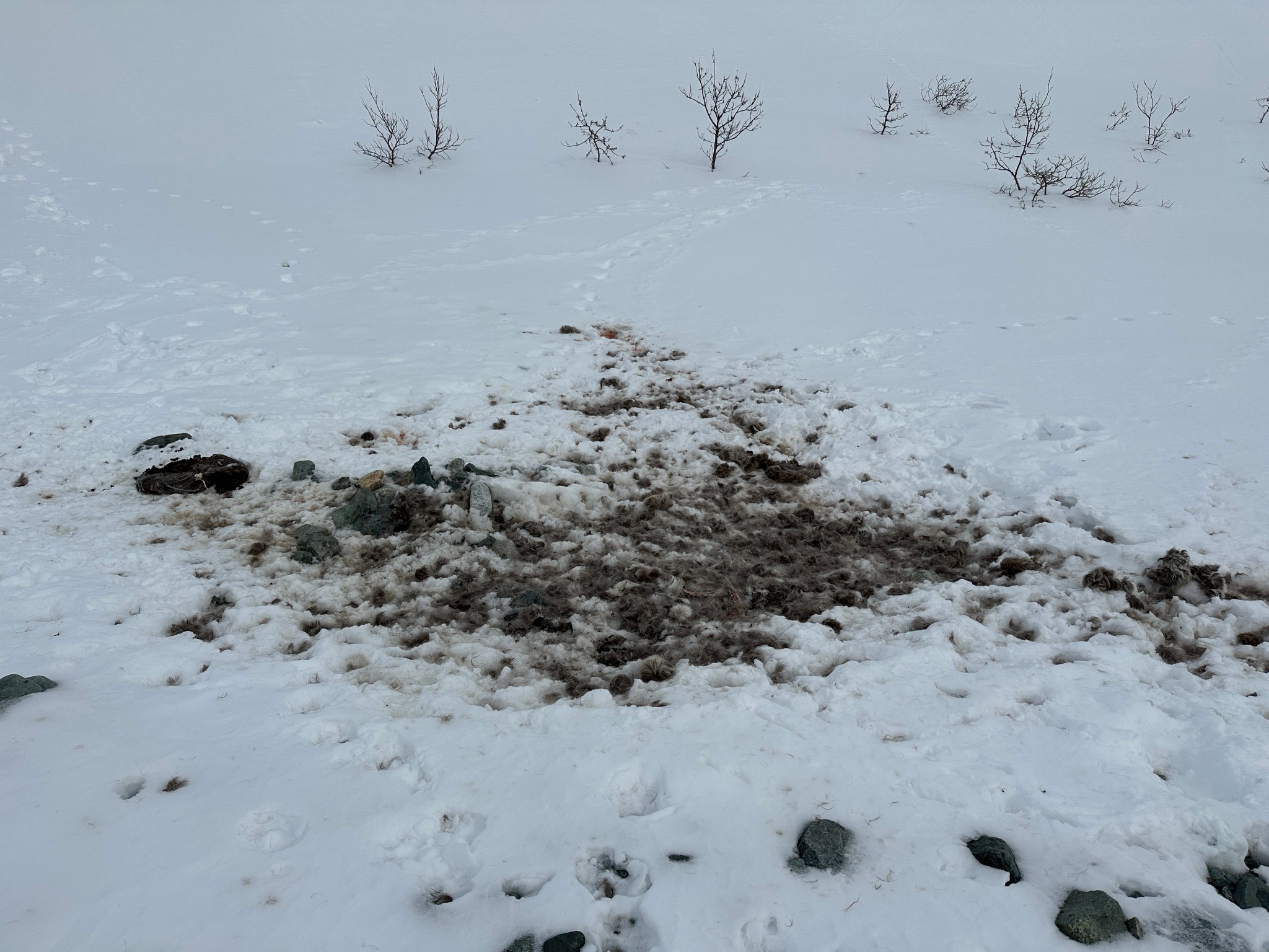
Osiris was pretty beat from going on a ski trip just a few days before this ski trip

*********************
When we got back to Anchorage, I posted some photos of the climbers I saw on the Alaska Alpine Club facebook page. I heard back from the previous ascentists, who gave me some reassuring information about the ridge. A second group ascended the same Sunday we skied out, but via the east ridge on the opposite side of the mountain! Mind still formulating a plan, I texted various friends about climbing Institute in a day. No one was available. Determined, I settled on soloing.
I’ve only soloed in the Deltas a few times before, on Rum Doodle and Triangle. Rum Doodle had no crevasses; Triangle has both avalanche and glacier dangers but is considered relatively benign. Institute would be a bit of a step up in terms of steep snow, but I felt confident the climbing would go smoothly without the aid of a partner. Both of these danger factors should be mitigated by the nature of the route, which traverses just below the top of Institute’s west ridge and only involves about a mile of glacier travel total. There’s a certain glory, joy, and efficiency to soloing in the big mountains but it’s much more enjoyable to share the experience with another person. However, if the risks and conditions merit climbing alone, better to climb alone than not at all.
On Tuesday afternoon, the storm I had been watching moved closer by a day. On Monday, the forecast for Friday was bluebird; a day later it was stormy. Wednesday still had good weather, if a little cloudy to start. At this point, it seemed greedy to wait to climb until Thursday when I felt Wednesday had good enough weather. The worst-case scenario I hoped to avoid involved waiting until Wednesday to leave town and waking up Wednesday morning to find the weather window would close Wednesday evening. This thought gave me so much anxiety that I started packing Monday evening.
Tuesday afternoon I saw a one of my many weather sources, NWS, report change during the day: bumping the storm barely into Thursday evening. Mind finally decided, I took care of my remaining work tasks, finished the packing I started the previous night, and rolled out of town towards the Deltas. Worst-case scenario: Thursday has better weather than Wednesday.
Had I not stopped to take photos, I would have made the trip to the Deltas in just under 5 hours. Hard not to stop and take pictures of Institute Peak, as it kept peaking out at me from the distance. During the drive I was in talks with Jeff, who recommended starting at 2AM. Laughing, I had just finished talking myself OUT of a 2AM wakeup; as it’s late April and the skies were supposed to clear after noon! 6 hours to the ridge; off the ridge by 8PM; estimating 8-10 hours on the ridge, my wakeup time would be 4AM. I did wake up at 2AM, only to smugly decide I needed more sleep.
Skiing that early in the morning was nice, my brain wasn’t fully online, but also wasn’t dulled by a day’s events. Around 4 miles in, I noticed the lower strap for my left boot had lost a screw, rendering the strap useless. I up-tucked it out of the way, as the flopping was getting annoying.


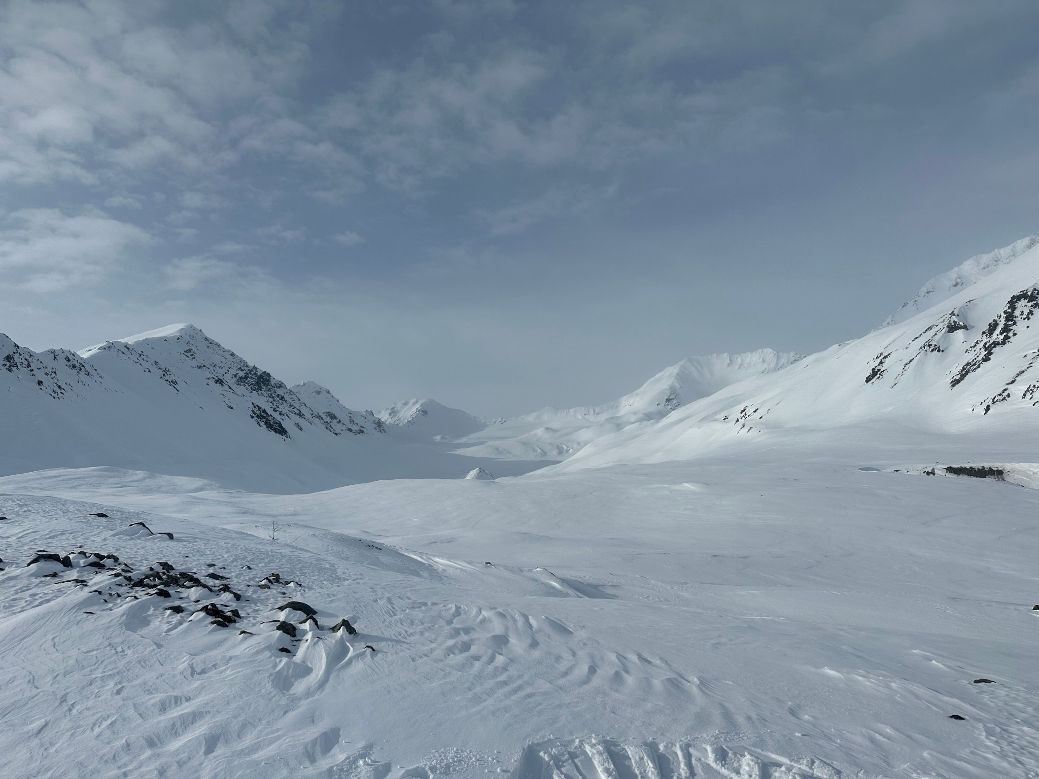
I took note of the soft snow that had filled parts of the previous weekend’s skintrack, as well as mounded over the trail in places. As I skied up the valley and took the right fork towards West Gulkana Glacier, the valley started to gain a bit more elevation. The skintrack mostly trended to the right side of the valley but eventually cut left onto a moraine descending from the glacial tongue (covered in snow).
Looking up at the glacial tongue

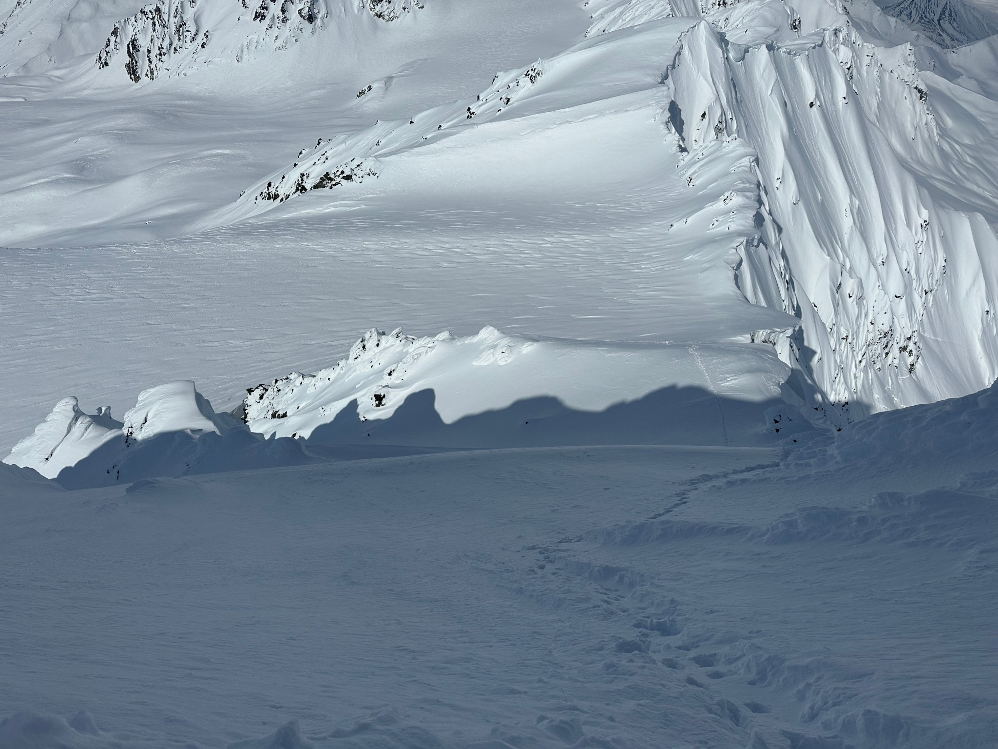
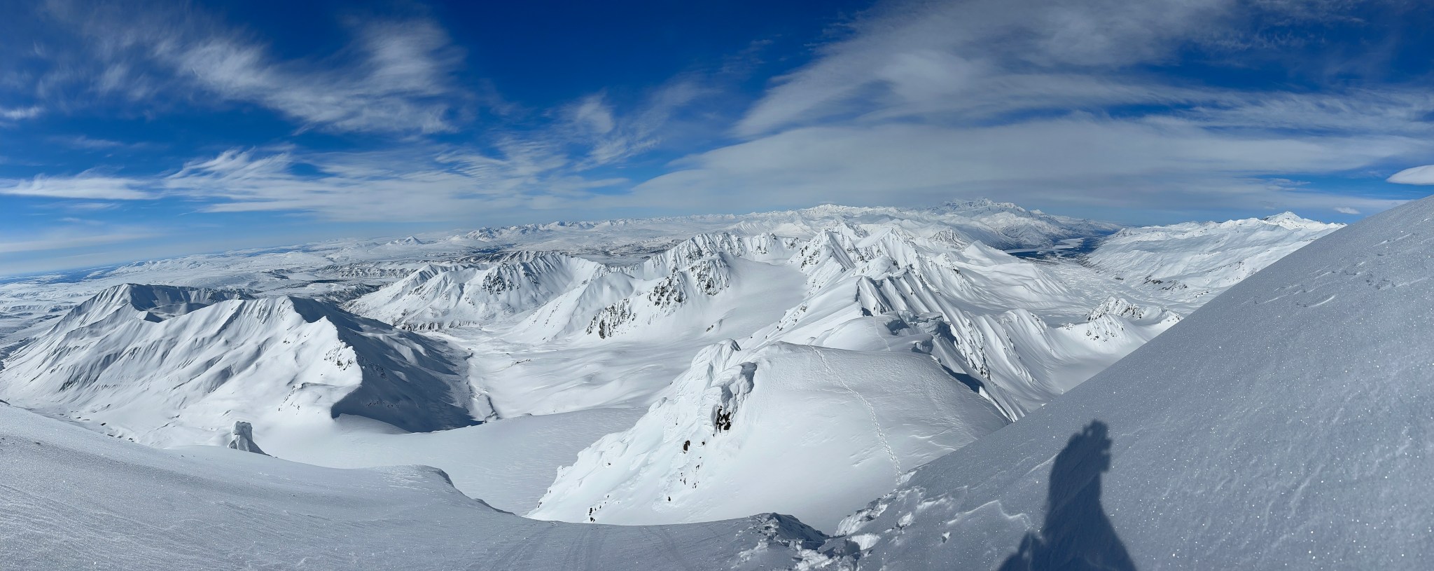
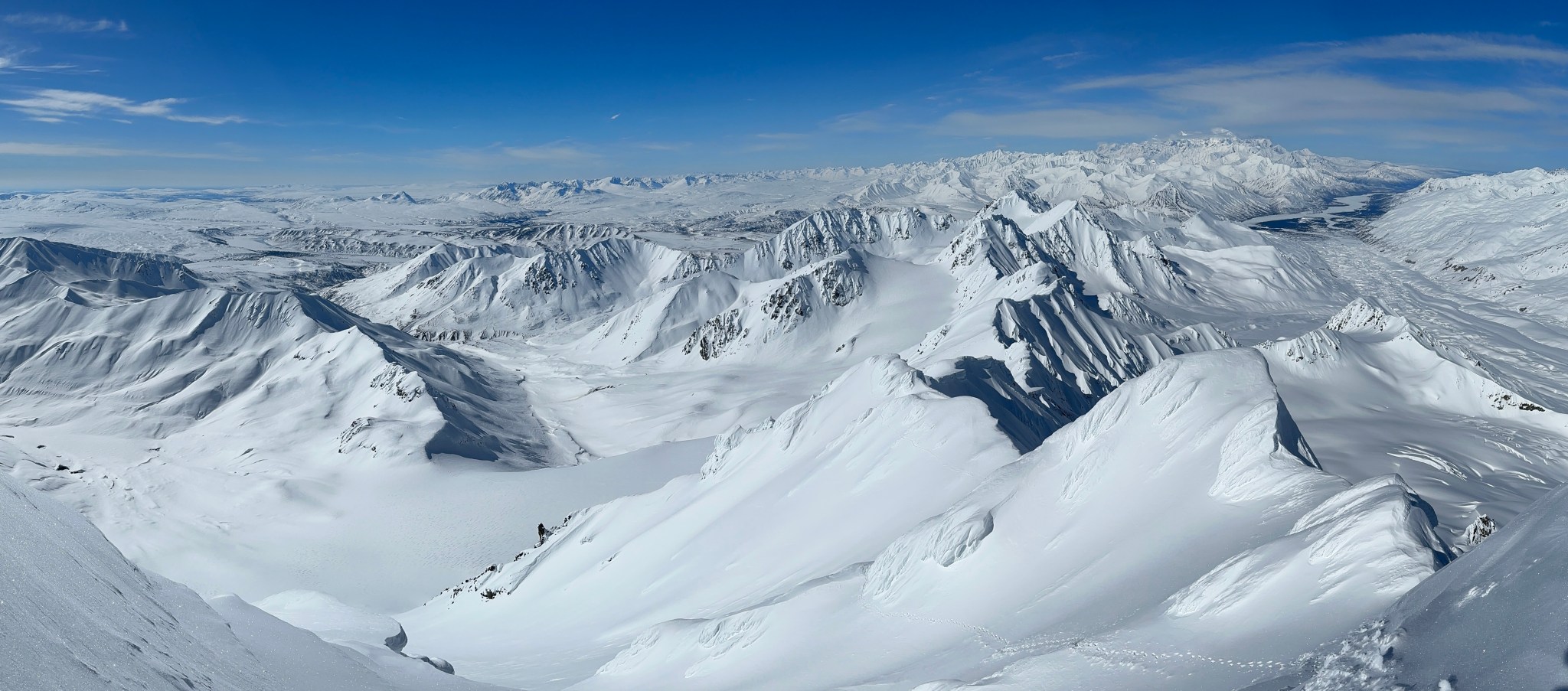
As I followed the trail up the glacial tongue, the skintrack would entirely disappear at times. The snow that filled the skintrack fractured and slid easily on the 30ish degree slope, making me wary of relying on it too much. The sun hit my face as I crested the tongue and moved onto the glacier proper, though it was quite buried in snow. I reached the ridge and stabbed my skis deeply into the snow, up to the bindings…just in case.
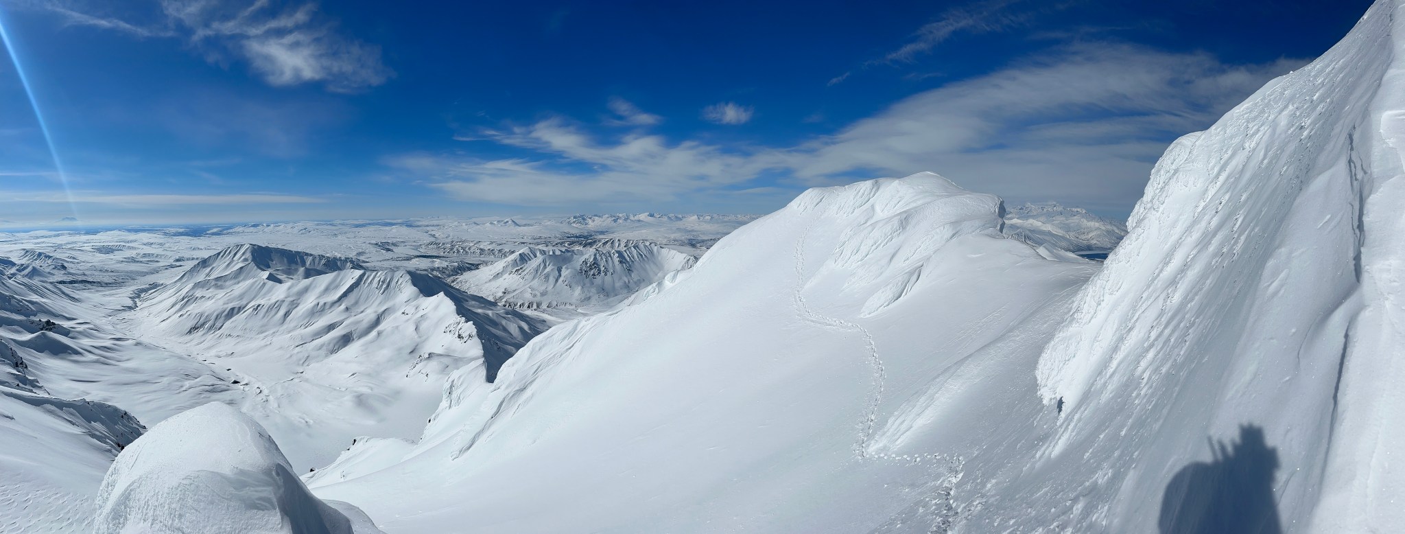
The West Tongue of the West Gulkana Glacier (foreground), Institute’s West Ridge (background)

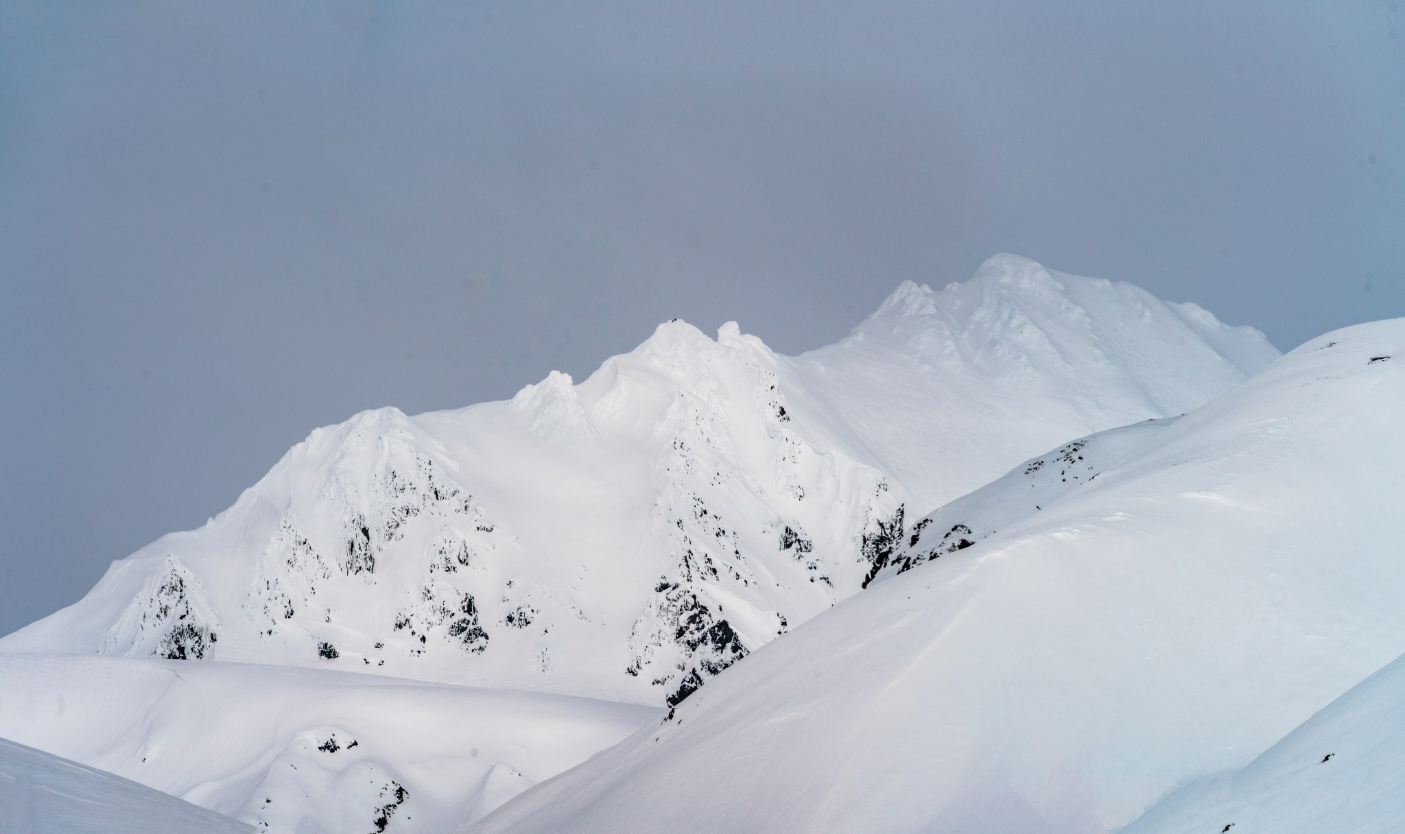
I did a fair amount of photographic research of Institute’s west ridge after my initial attempt on Sunday. I like to have a feel for the shape of the mountain as I ascend. The ridge can be roughly divided in two, with an obvious false summit and col at the midpoint. The first third of the mountain involves about 5 “swoops”, where the snow steepens exponentially as one climbs up it, only to break horizontally until once again steepening up to the next swoop. After the first third of the ridge, there’s a bit of a traverse to a rime formation that must be surmounted, followed by 3 more swoops. The second half of the mountain is mostly a traverse, with some steeper rime bumps to climb, but surprisingly less-challenging than the first half of the ridge.
I begun climbing the ridge as I had done previously: by staying out of the bootpack. The skintrack was wonderful to follow, but kicking steps is an entirely different matter. The virgin snow was surprisingly solid, with a very hard layer 6”-8” down and crusty-rimed snow on top. Great for bootpackin’! As I ascended the first swoop, I found it necessary to traverse a bit to the right and climb the mostly-filled bootpack. I had tried climbing the bootpack already, but the snow that had filled it kept breaking off below my feet, making it unclimbable and overhanging, nearly impossible to kick steps. The next 4 swoops went by in a similar fashion, sometimes making use of the bootpack but usually stomping my own path.


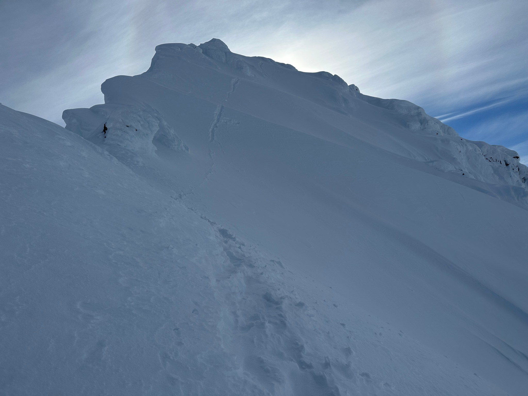
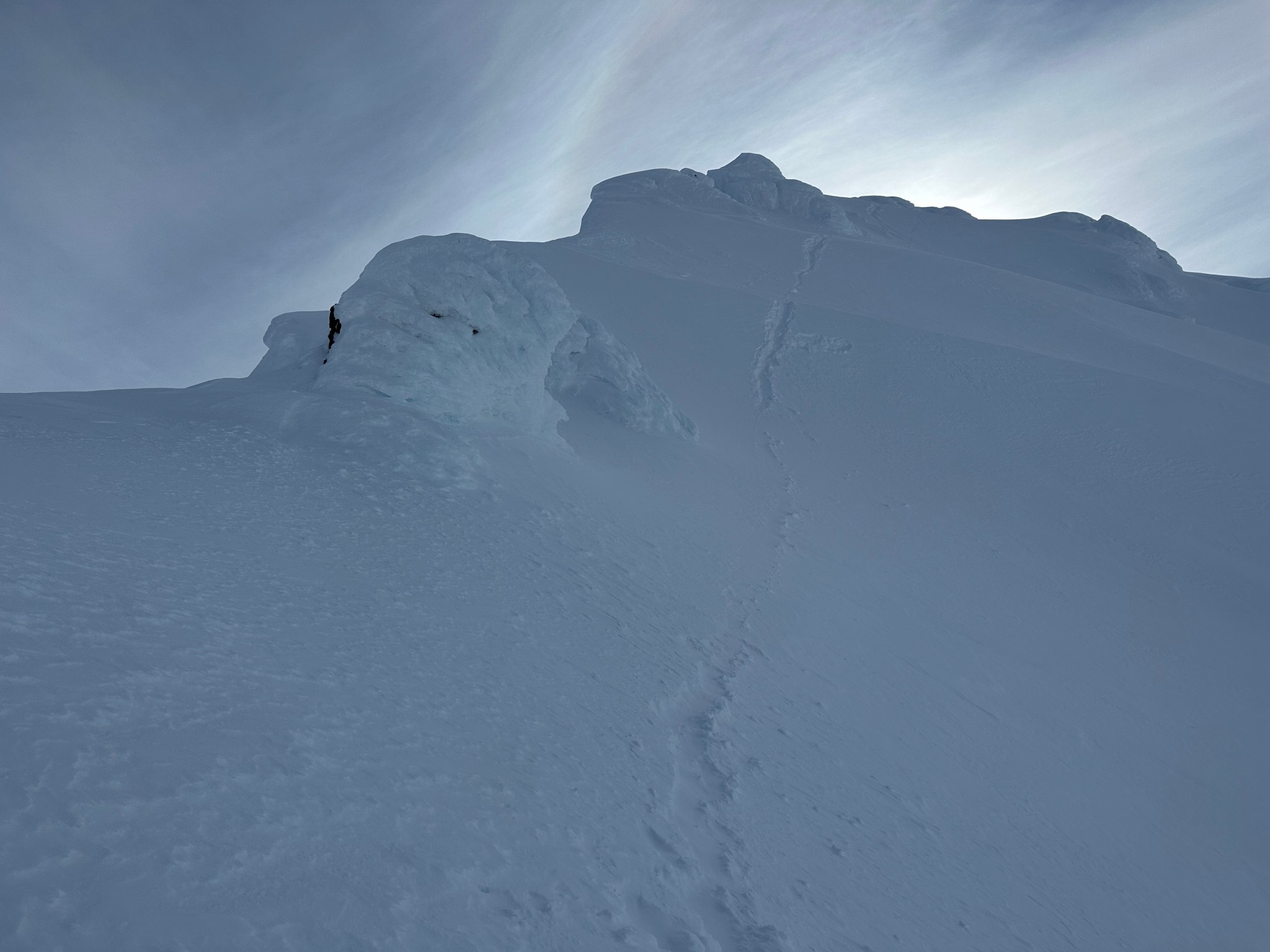

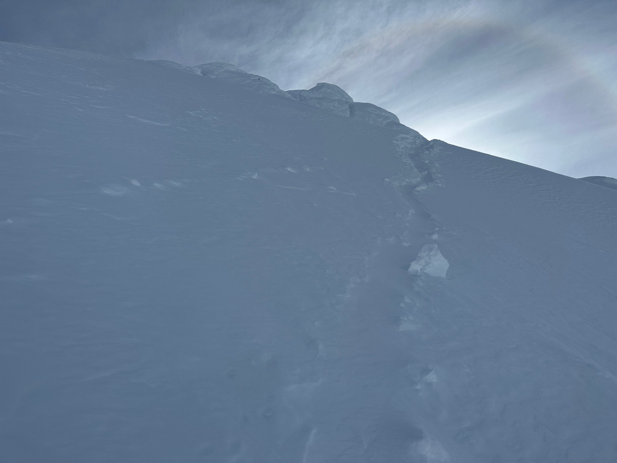


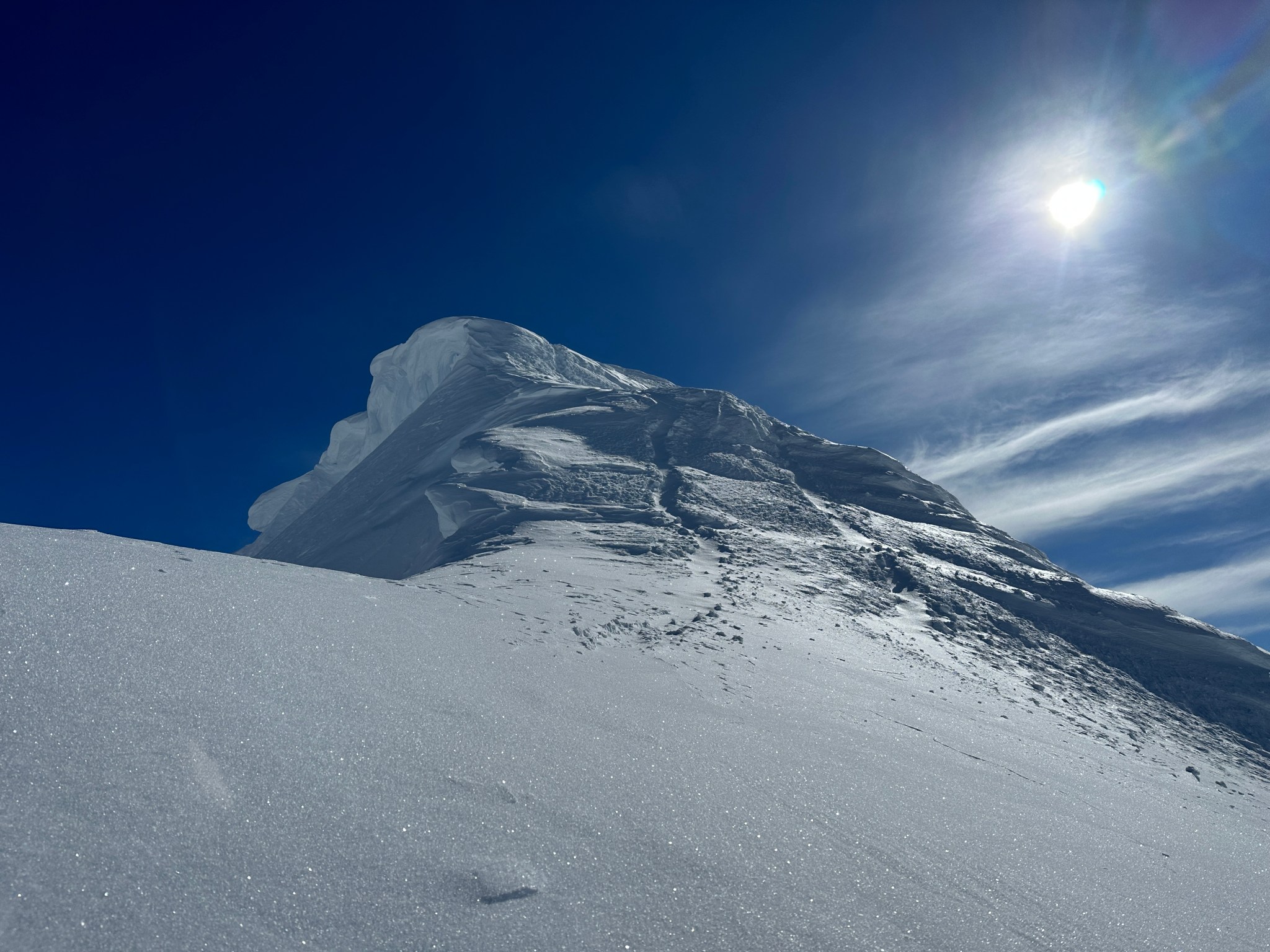
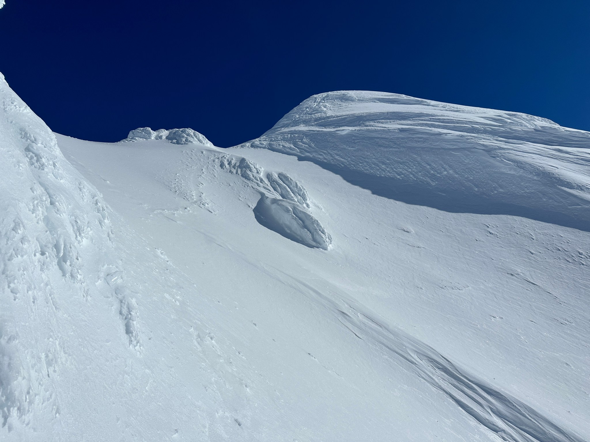
I reached the false summit and took a short break. From here, I thought I could see the true summit but cautioned myself against believing such folly. Foreshortening is a tricky devil, and what would be the point of forming some sort of belief or expectation? I traversed the inside of the ridge, near but not quite on top (to avoid breaking off cornices). I tended to stay above (left of) the old bootpack, for avalanche safety. Being so high on the ridge had me fairly comfortable with the potential avalanche danger; they tend to pick up speed as they move, and if I happened to set one off the potential for getting free seemed high.
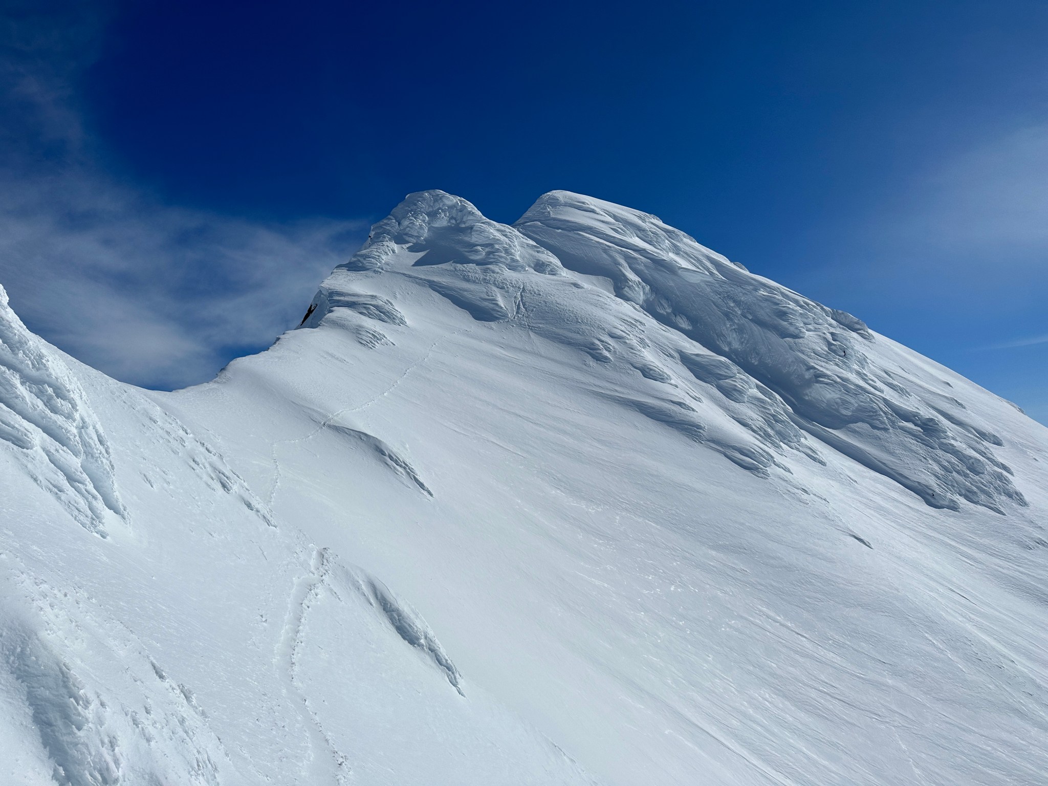
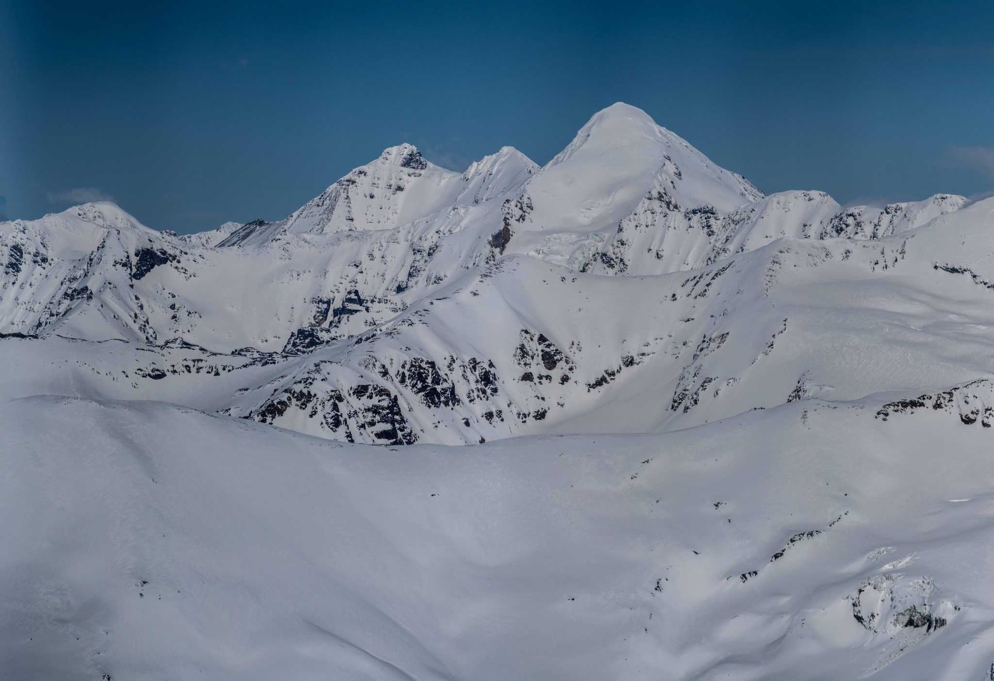
At the false summit looking east/southeast.
Like the best climbing trips, nothing eventful happened. I did take an alternate path at a particularly steep section, but that was the extent of my creativity. Mostly I just kept walking up.
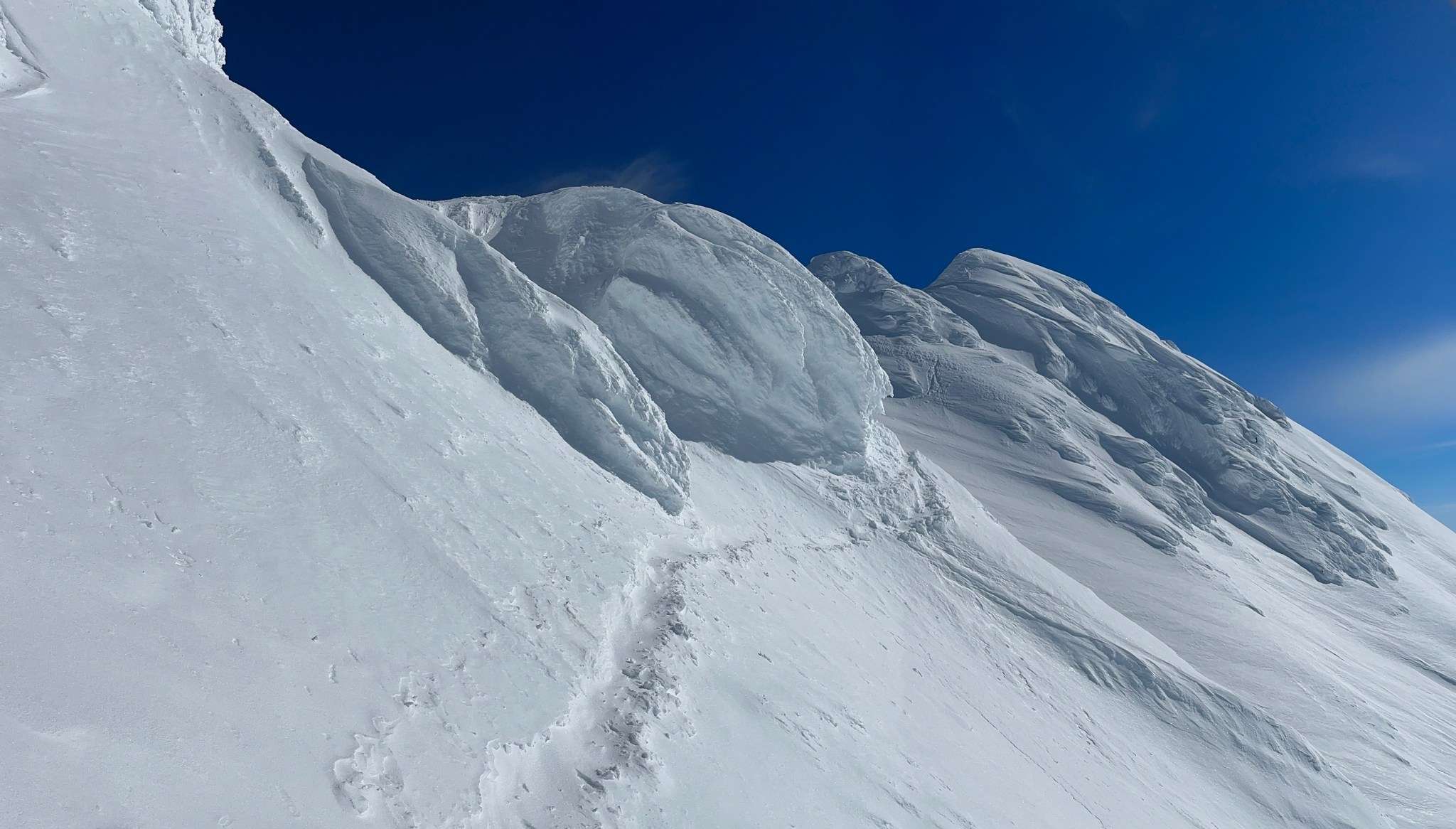


This rime formation looks like some sort of alien weapon.


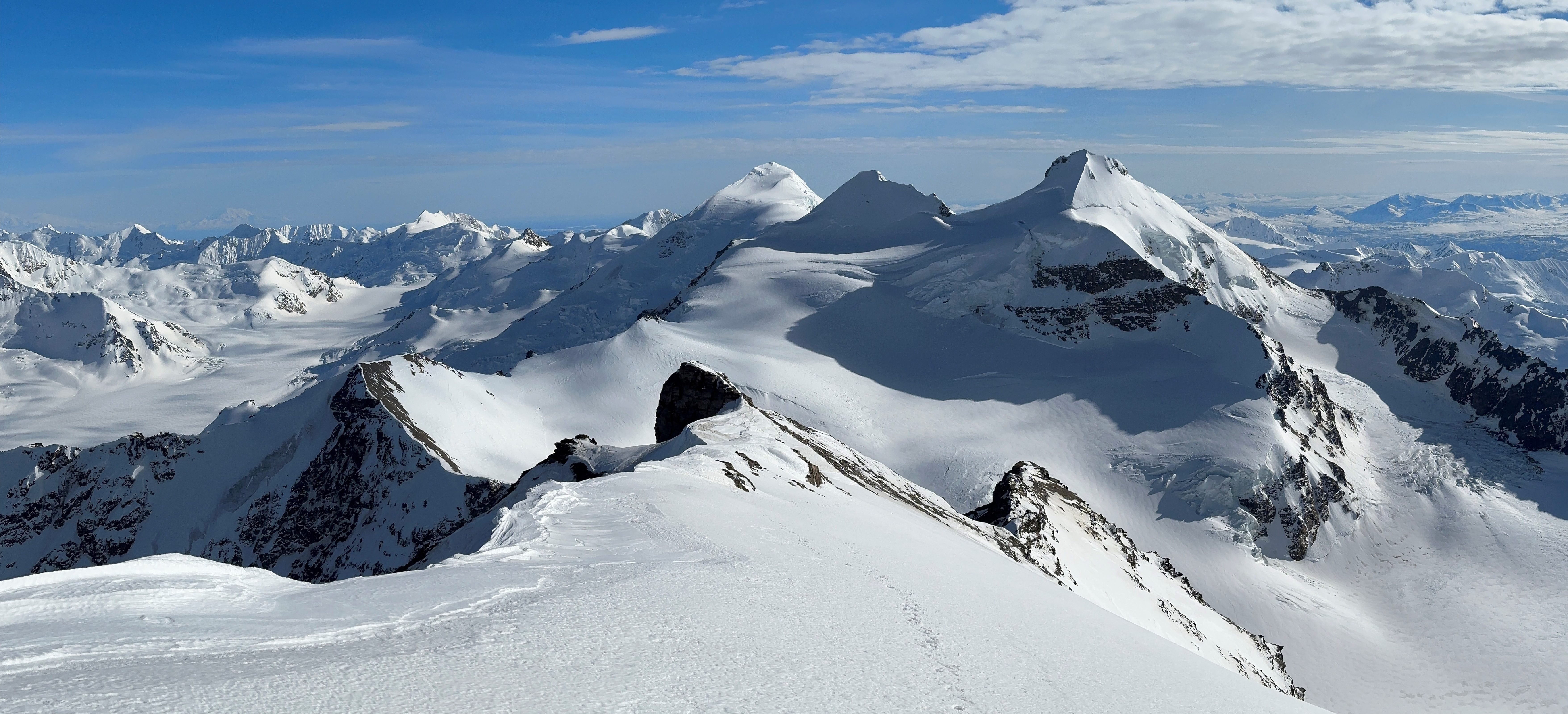
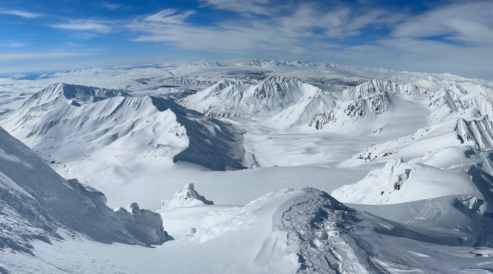
The final climb to the summit took more time than expected. Even on an 8000’ peak (relatively small compared with Silvertip or White Princess), things are bigger than they seem. I reached the top around 1PM and hung out for about an hour. The wind picked up as I reached the top, for the first time in the day. It had been pretty eery climbing the ridge in clear and still weather, with the occasional breeze blowing by to cool me down. I took hundreds of photos (final count for the trip was 1,715) while I hung out on the tiny fin of a summit, watching the clouds slowly burn away and the shadows move across the valleys. I could see the Wrangell Volcanoes, Mount Sanford and Mount Drum, 80+ miles to the south. To the north I could easily see the north side of the Deltas, from Item all the way to Snow White. Gakona and the unnamed peak next to Snow white were fairly engulfed in clouds though I did spy the Yeti’s Cap’s southern aspect for the first time. Mount Kimball, the highest peak in the Deltas, was visible as a distance mass of rock and ice. Beginning to feel stiff, I promised myself “okay only a few more pictures” a couple times before beginning the downclimb.
Looking west down the ridge and towards the Hayes Range
Item and Silvertip
The Castner Group: (Double Exposure,) Blackcap, Little Princess, White Princess
Tusac and Snow White

Looking east towards Minya, the attention-deprived neighbor of Institute.

Kimball 27 milse away in the distance, Icefall Peak 7 miles away directly beneath the high point on Kimball.


Snow White’s south ridge, to the northeast
I understand why the previous bootpack was so hard to ascend: the previous party had slid down their own path. While this was also an option for me, I found glacading down fresh snow more enjoyable when I didn’t have to downclimb. I reached my skis around 4:30 and had a very pleasant break. Finally off the steep terrain, part of my mind could relax. I used Claire’s jetboil to make some water for myself while I ate, removed a layer, and texted. The unexpected cell service might have been due to the coinciding Arctic Man event. Strapping my boots tight, I prepared to ski back to my truck.

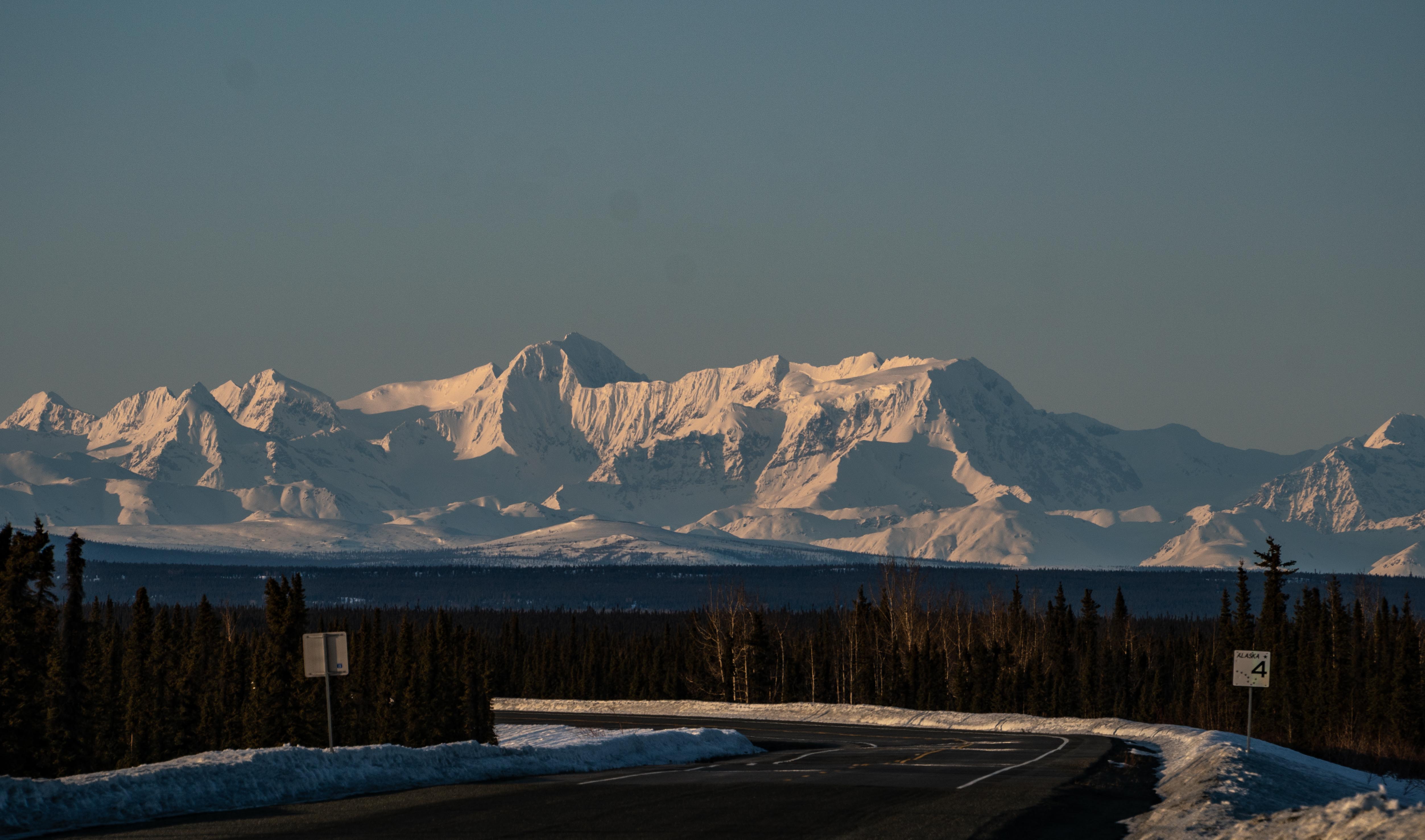
What followed was the most fun I’ve ever had on backcountry skis, bar none. There’s simply nothing more pleasant than skiing warm, soft snow in the sun! That unbroken bliss quickly changed as I approached the glacial tongue; soft sun-baked snow yielded to not-quite-soft-enough wind-affected variable snow. I made my way down the same slope I had spied ski runs on that Sunday, mostly survival skiing, eventually finding an open path to untracked and mellow slopes. I did eat it once down the steeper slopes, but managed to hold my own until I reached the flats. Removing my sweater and lathering the sunscreen, I kept skiing. I once again found myself sideways on the snow after a particularly dramatic fall involving one ski breaking through the crust while the other was unable to penetrate said crust to arrest my trajectory. I skied very carefully after that, not wanting to gain too much speed but also not wanting to attempt turns. I made it from the top of the glacier to the fork with McCallum Valley in an hour, and in another half hour I was at my truck. Just about 14.5 hours car-to-car. I drove south for an hour or so, stopping every now and then to admire Institute Peak and Mount Kimball from a distance.
Mount Kimball

5 thoughts on “Institute Peak”