
Galen and I decided to climb Pioneer Peak’s north face approximately half a day before we left the truck for the ascent. Weather was perfect, the bootpack was set. It was time for some vulture alpinism.
Word travels fast these days, and we heard a rumor at least a team of two had done the ascent in the last week. The snow was (mostly) stable and hard.
Partner, weather, conditions? Check. All that’s left was to find a dog-sitter.
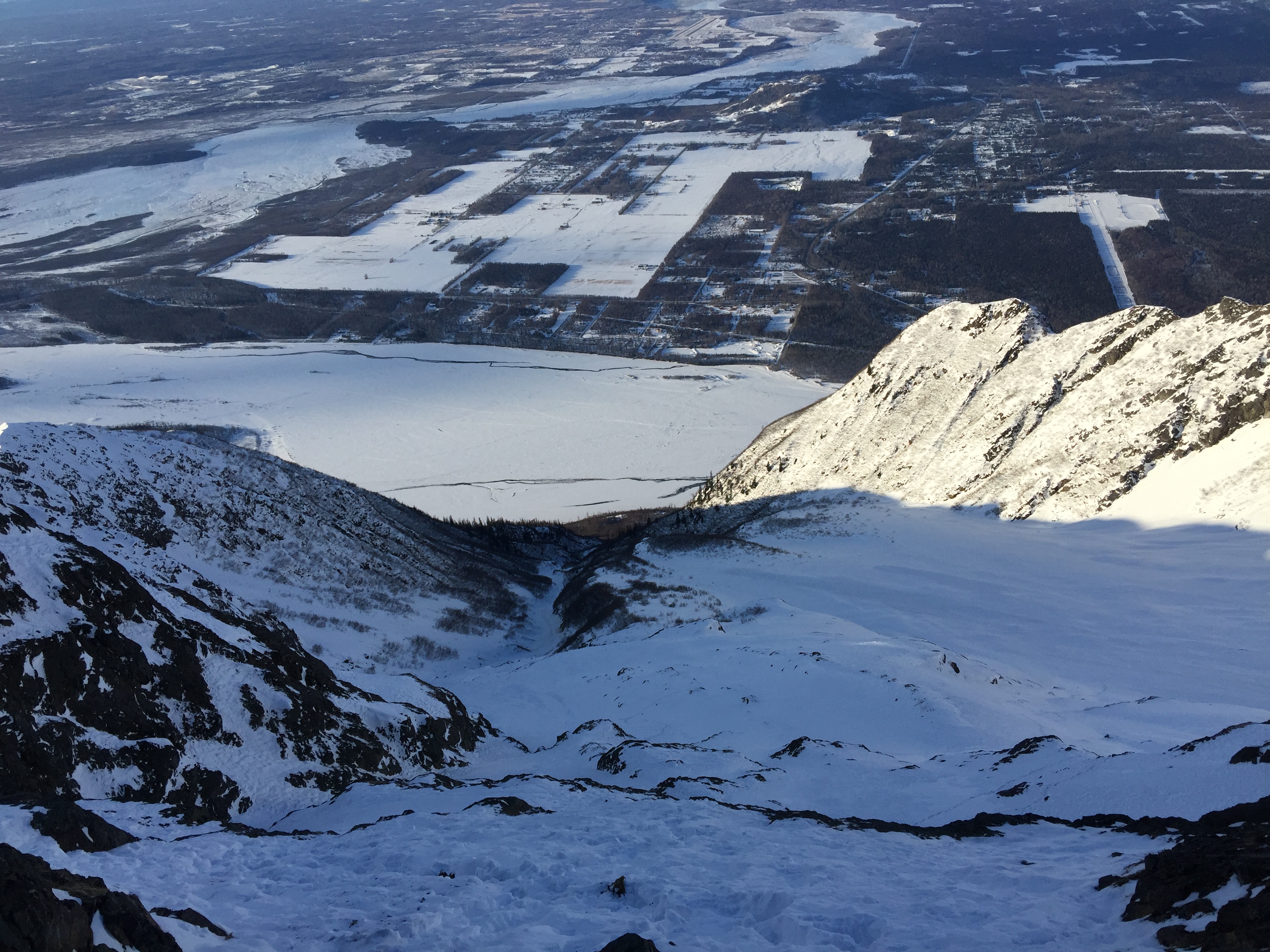
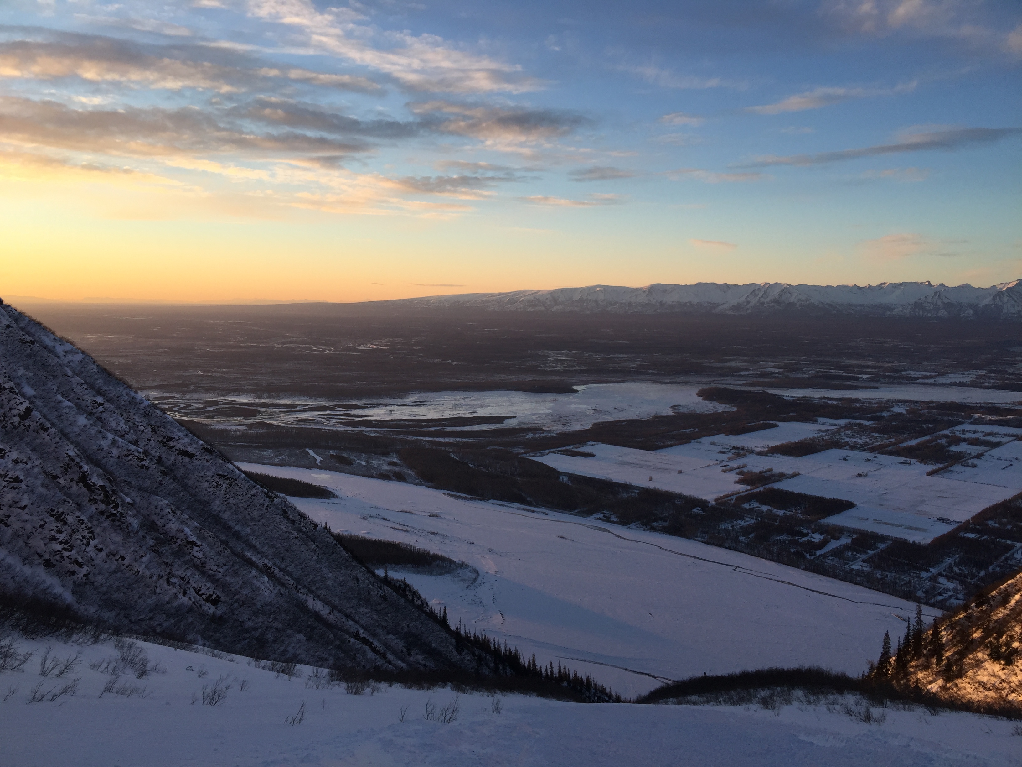
Wednesday morning found Galen and I drinking strong and butter-powered coffee in the morning as we drove towards the base of Pioneer Peak. There is no parking lot, just a widened bend of the road that borders the Knik River named Knik River Road. Go figure.

The approach for the climb is literally walking across the street.
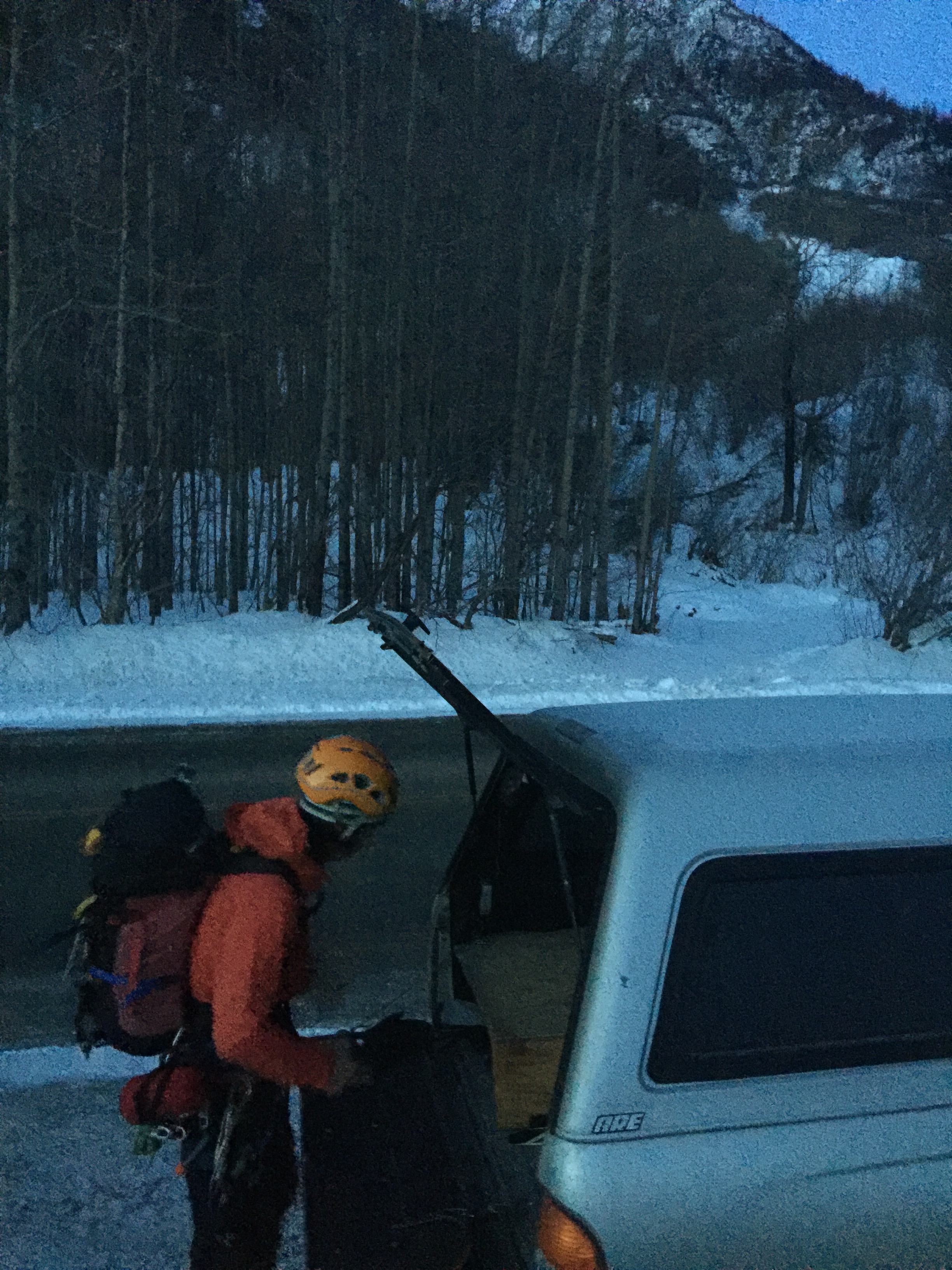
We extinguished our headlamps as we left the truck and made our way up the lower slopes of the mountain a little after 7AM. We made it up the first 1000′ in good time, a few hundred feet of bushwacking led us to the base of the giant avalanche slope that is the north face of Pioneer.

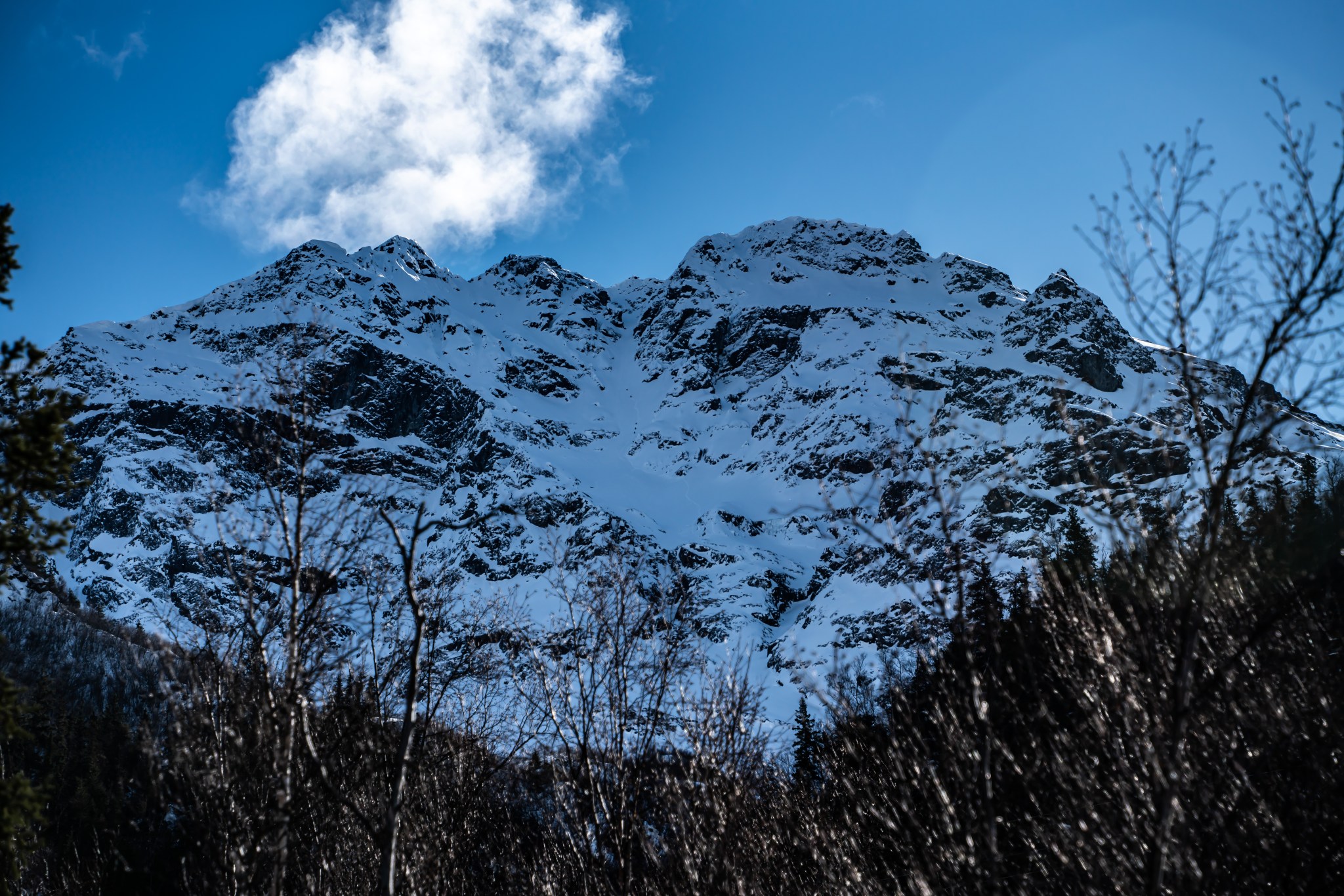
The most direct route down the mountain coincides with a large portion of this route. Avalanche chutes are efficient ways to gain elevations quickly, provided conditions are stable.

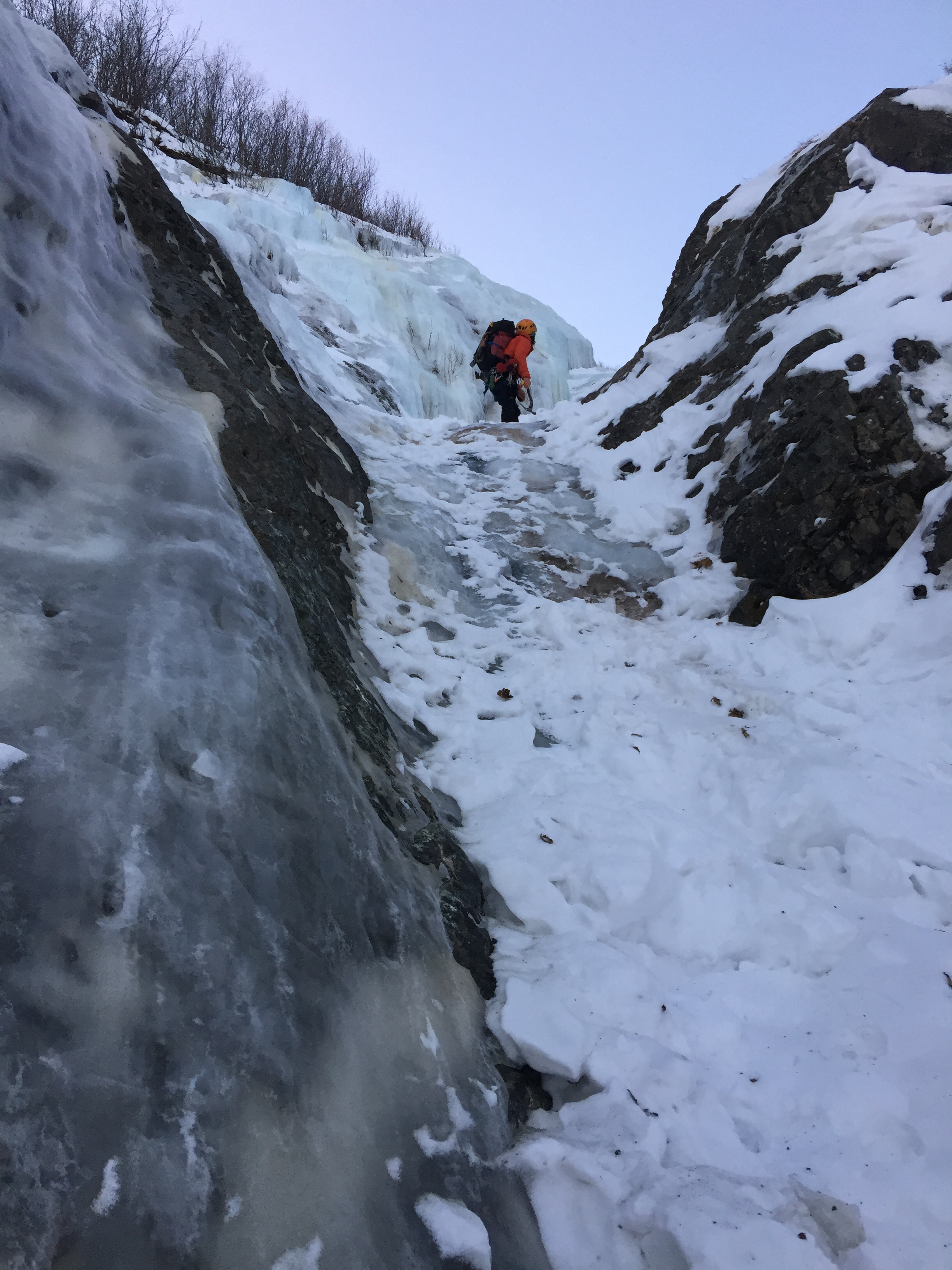
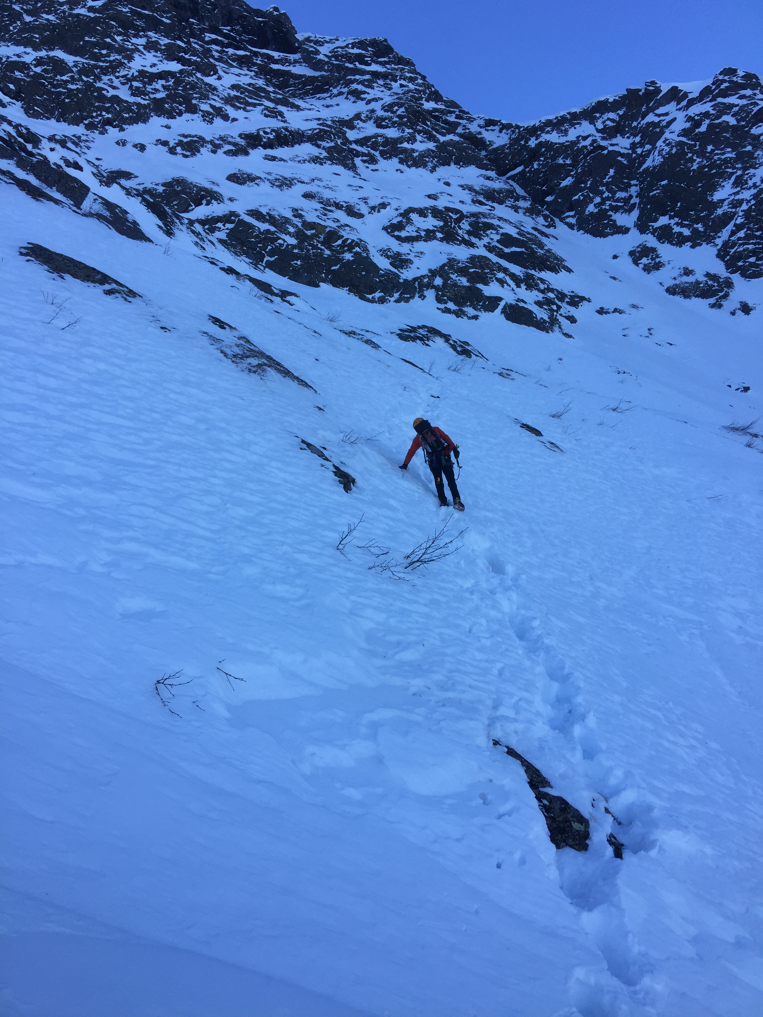
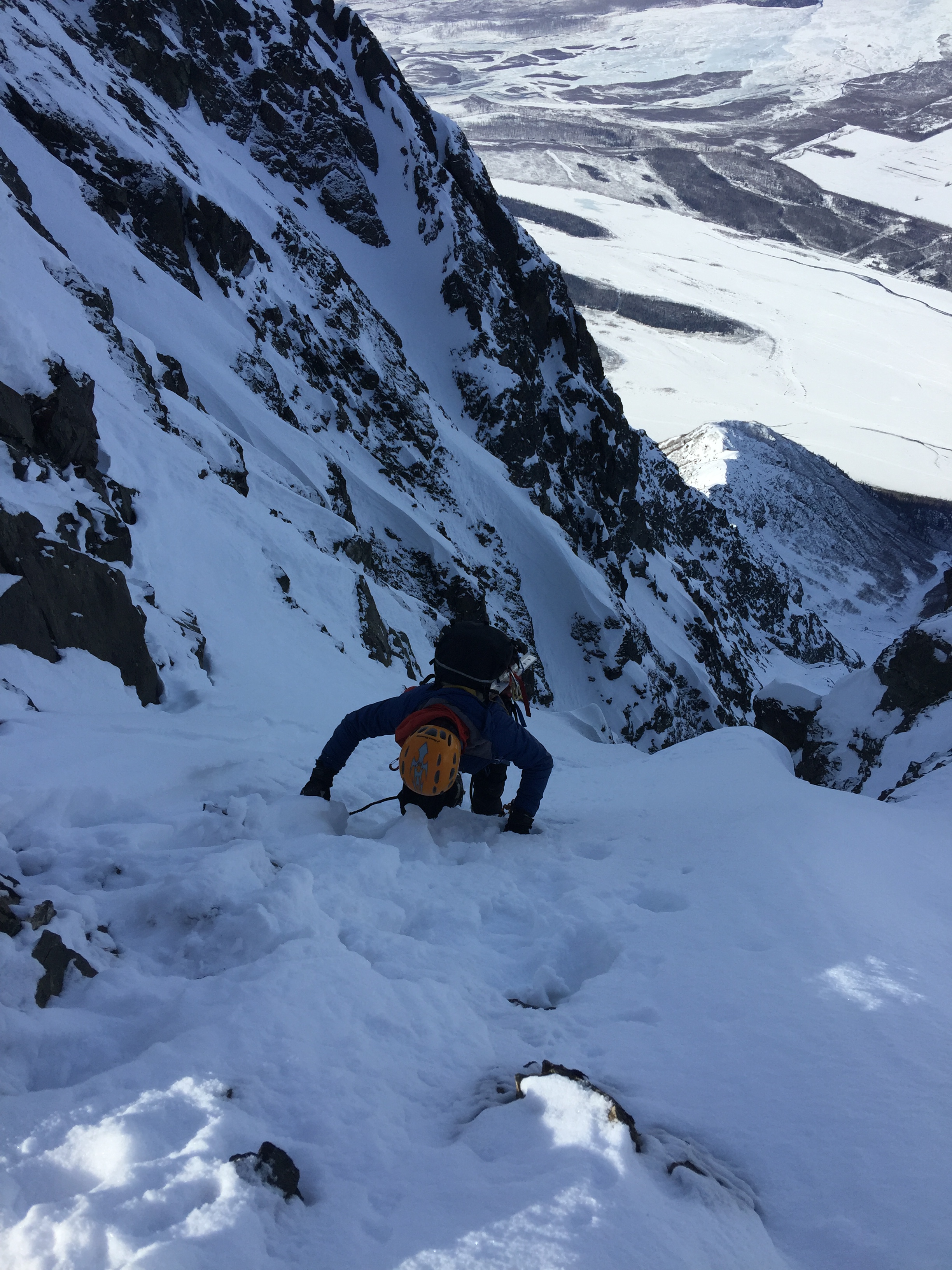
We made our way to the first ice band at around 1100′. We free-soloed up the first baby step as well as the steeper step.

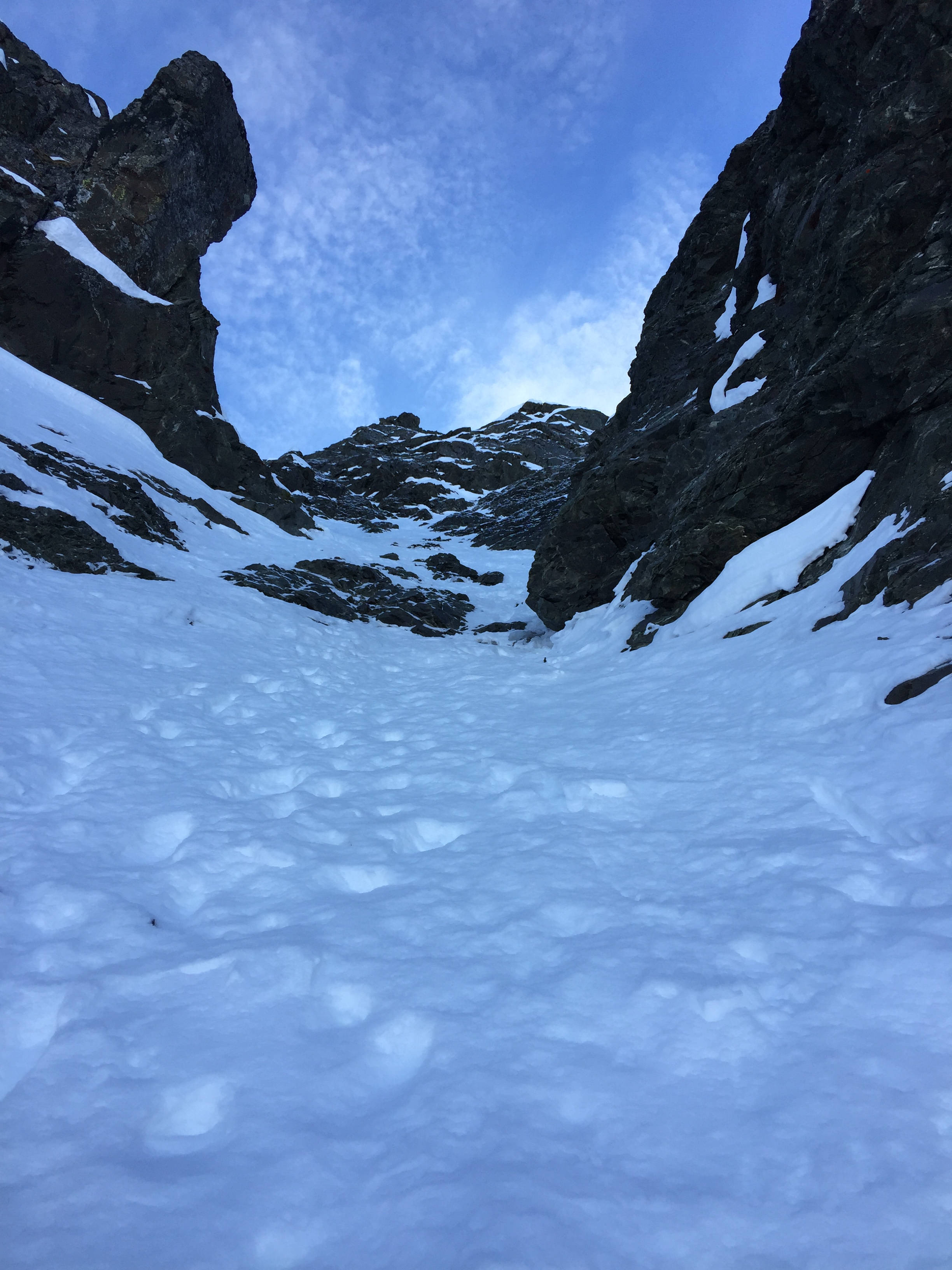
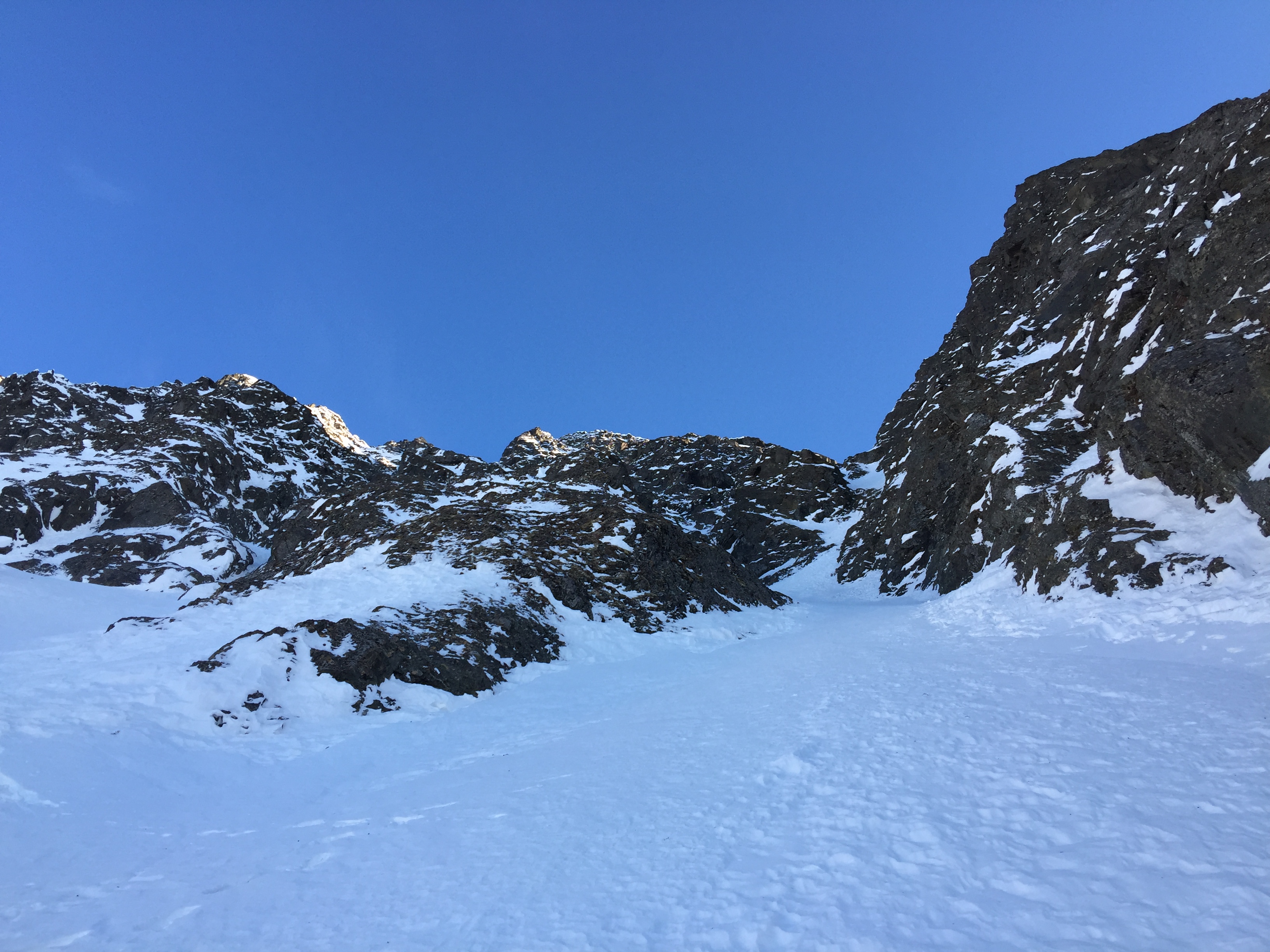
Making our way onwards, we traveled up a narrowing gully with some weird snow slab conditions up high as we got near 2000′ elevation.
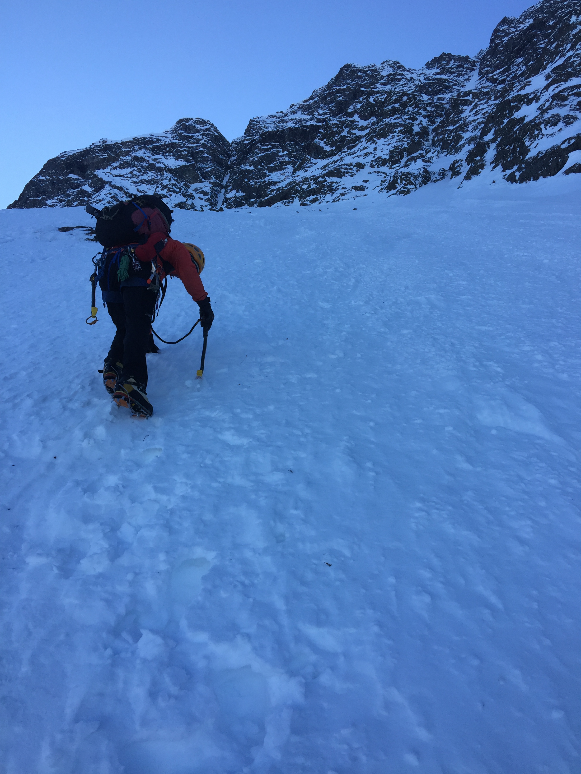
This part of the route is boring. You just keep going up. And up.
And up.
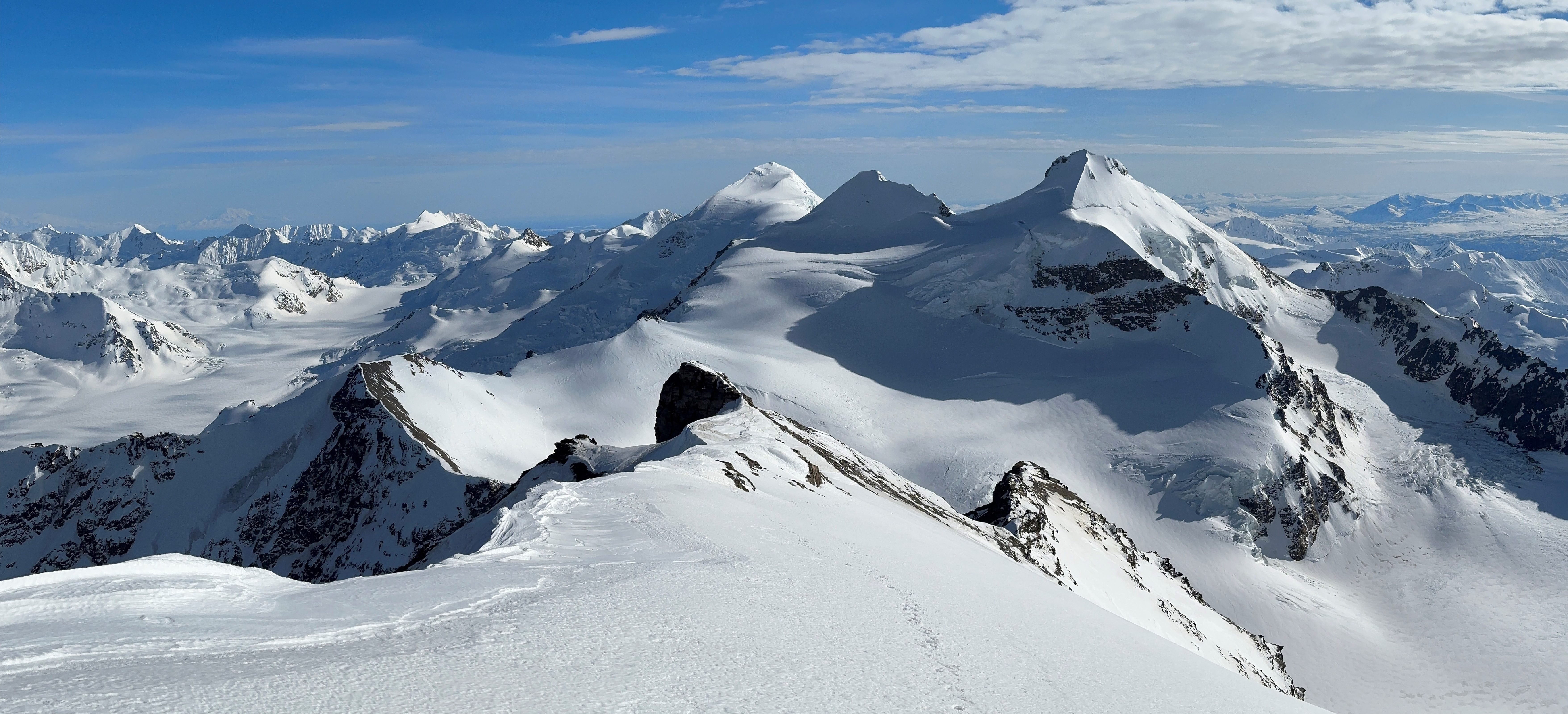
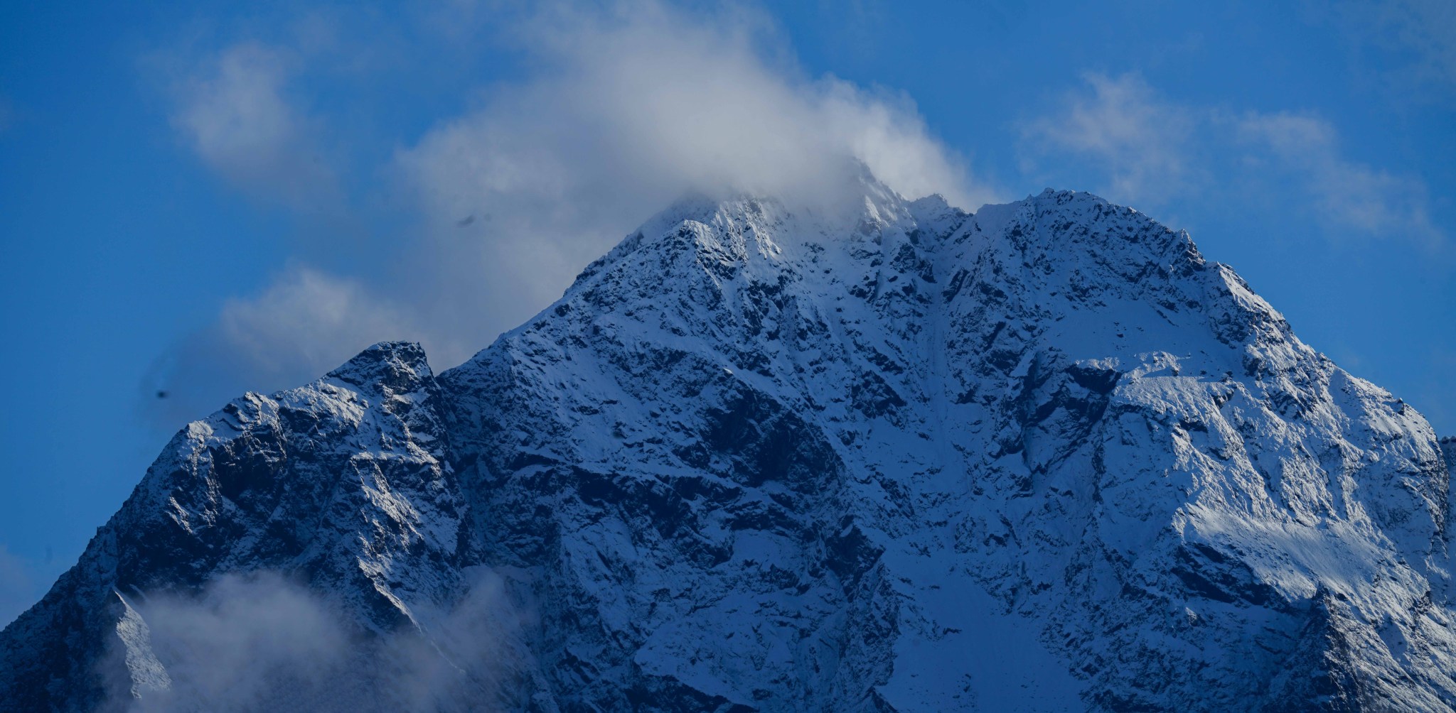
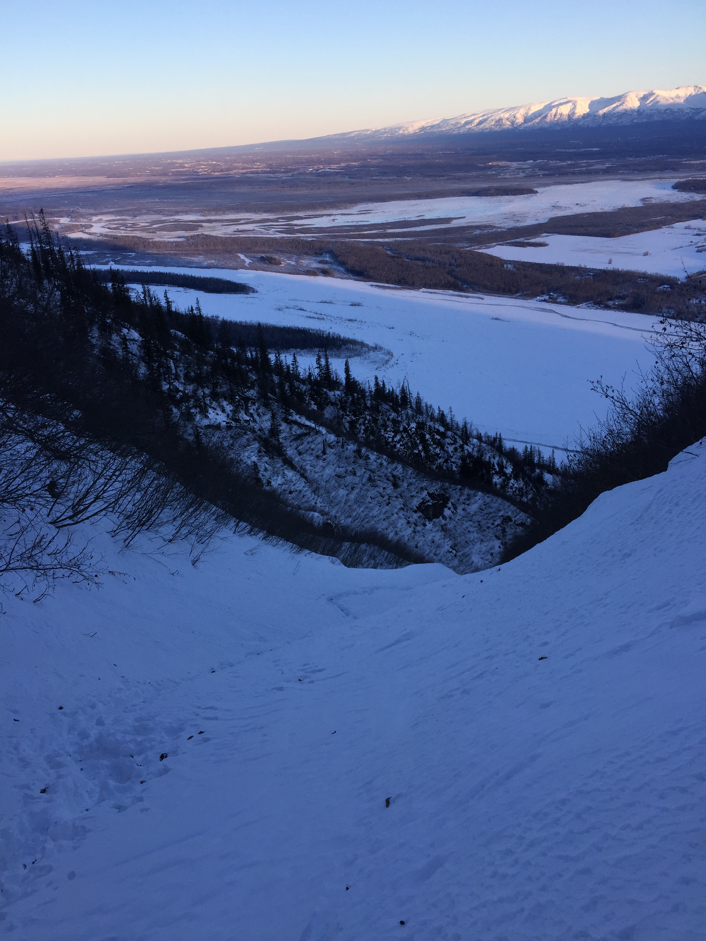
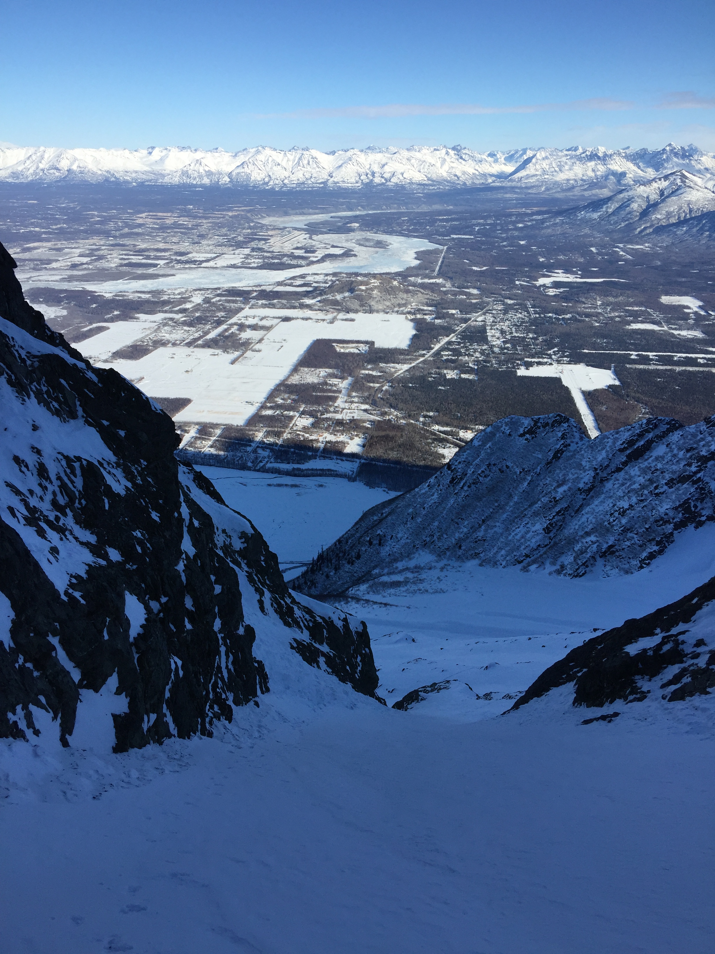
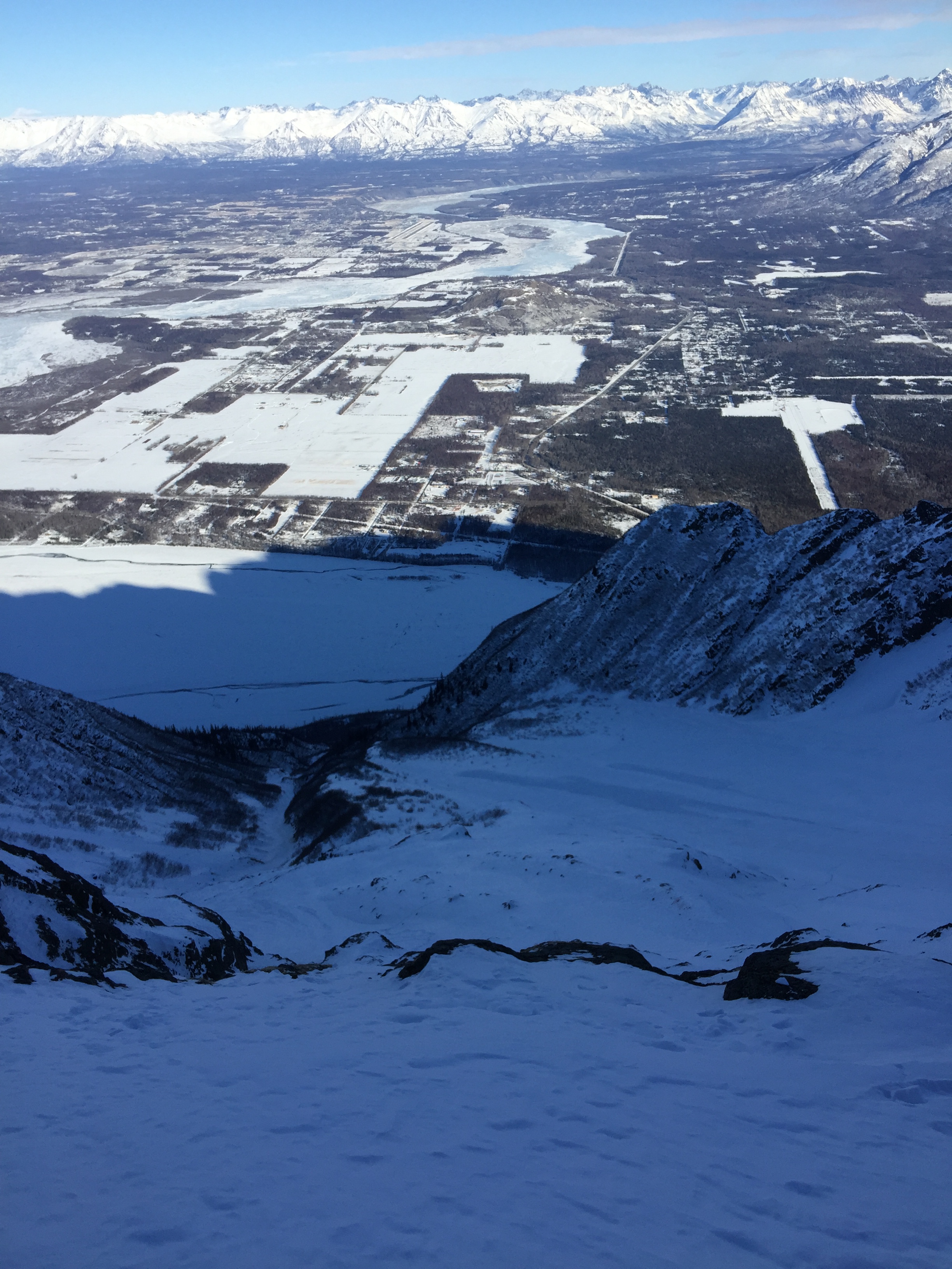
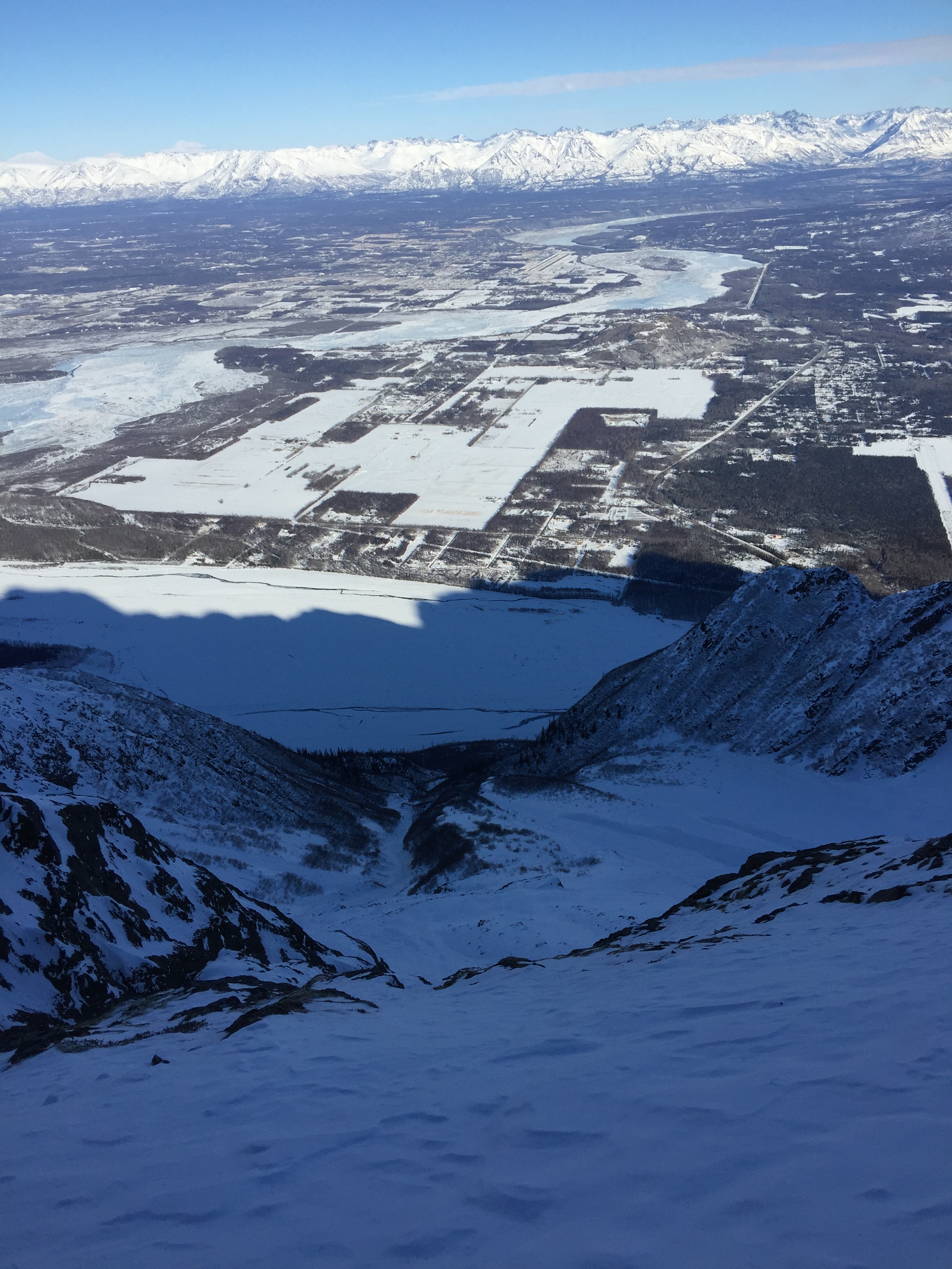
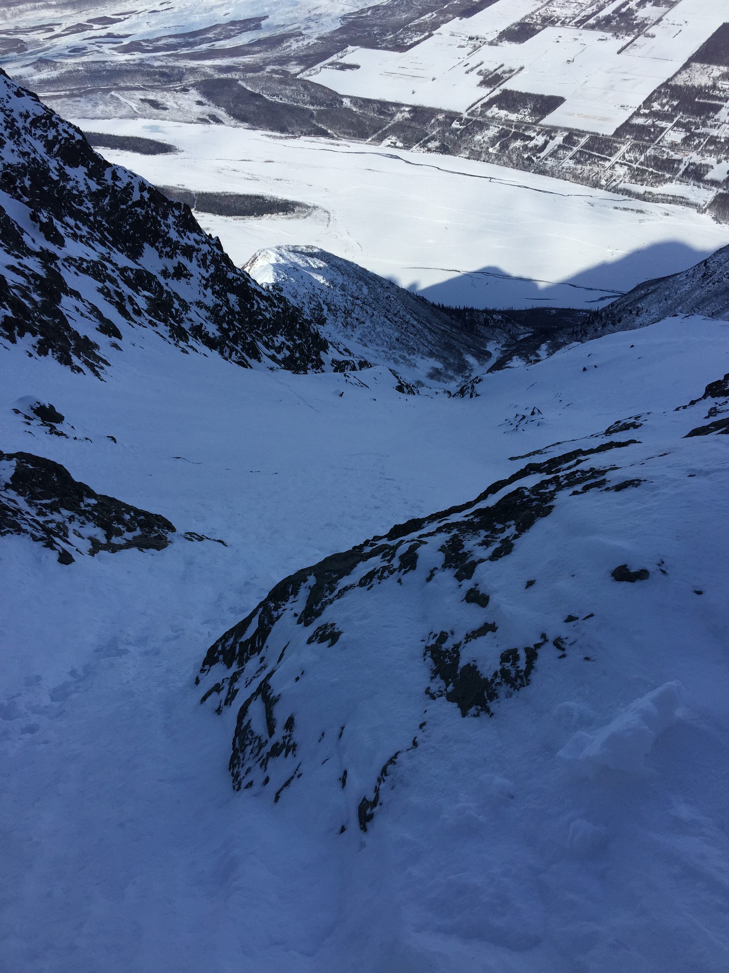
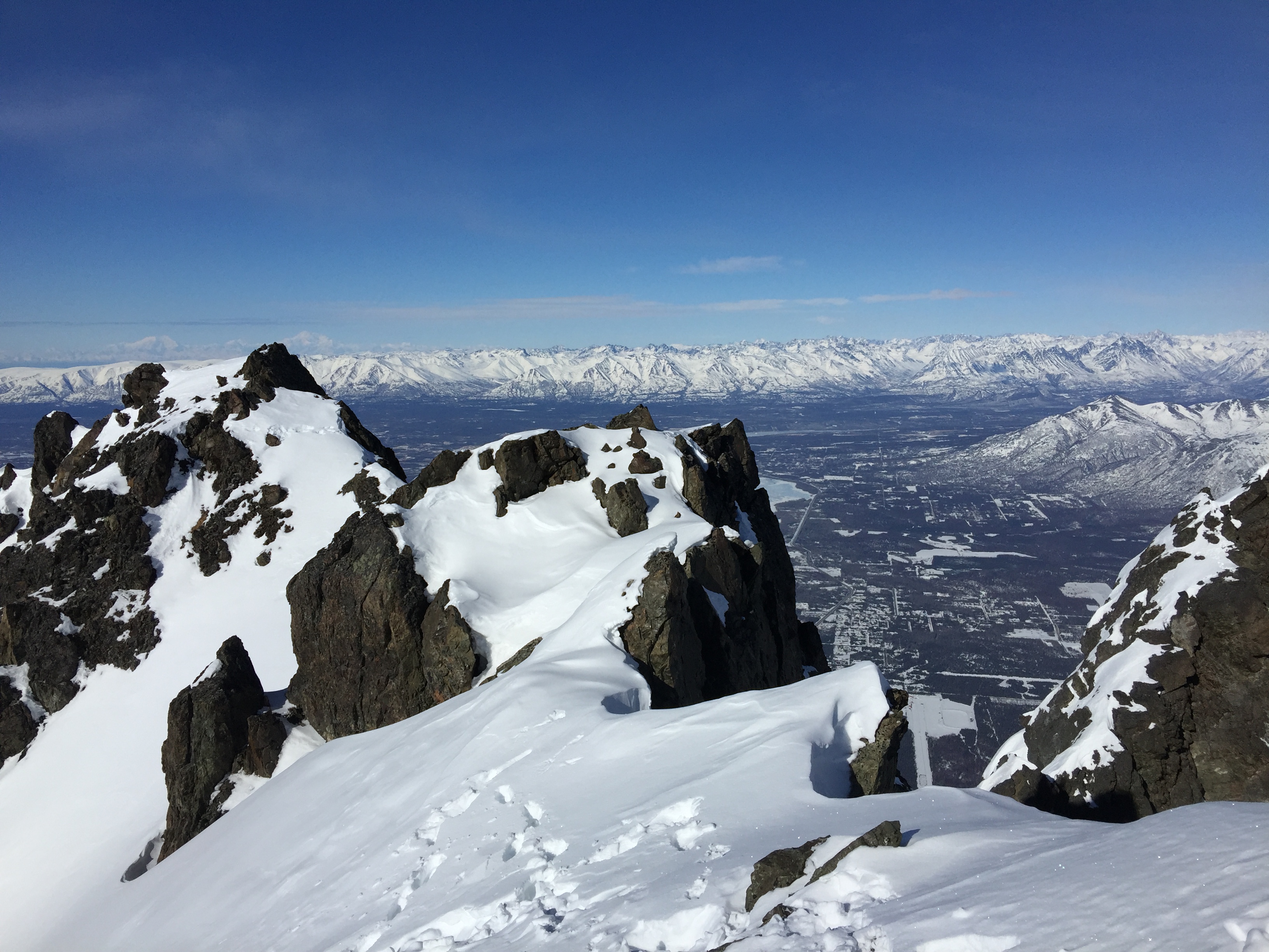
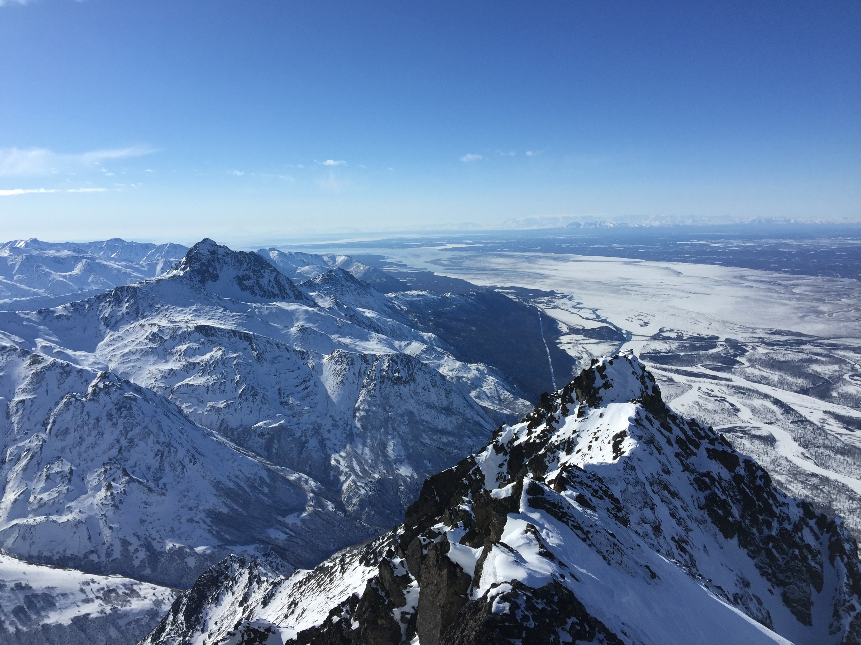
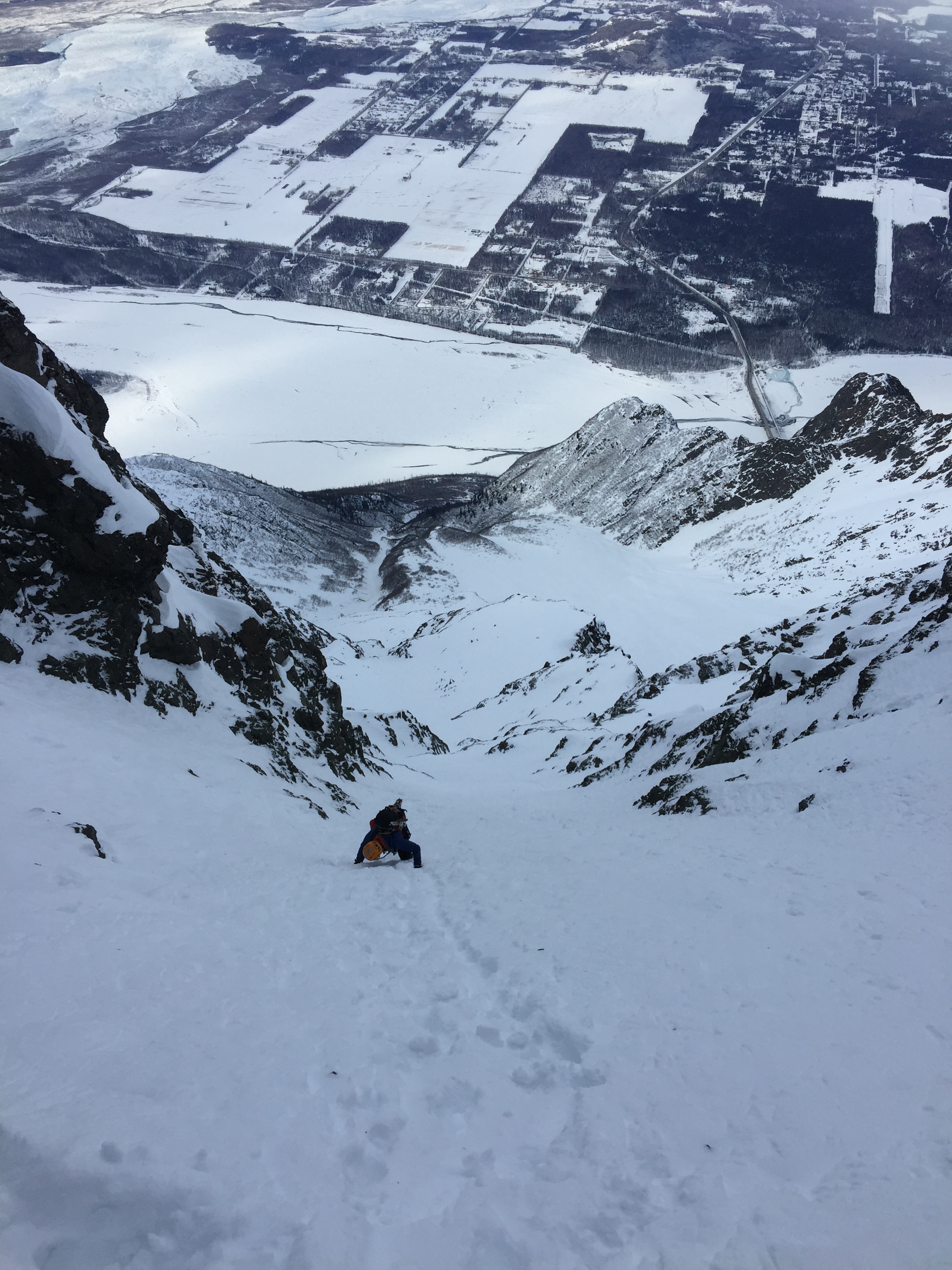
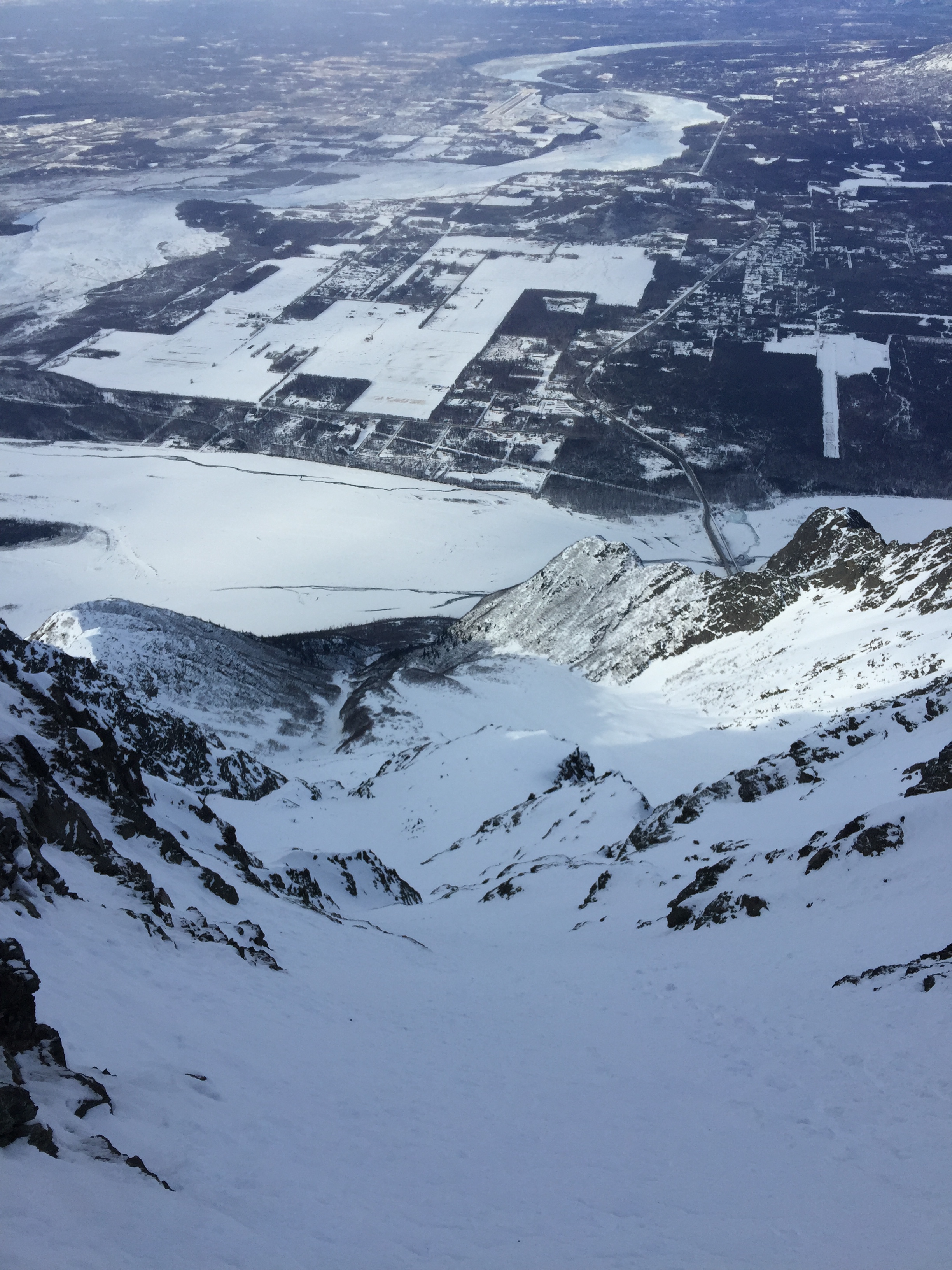
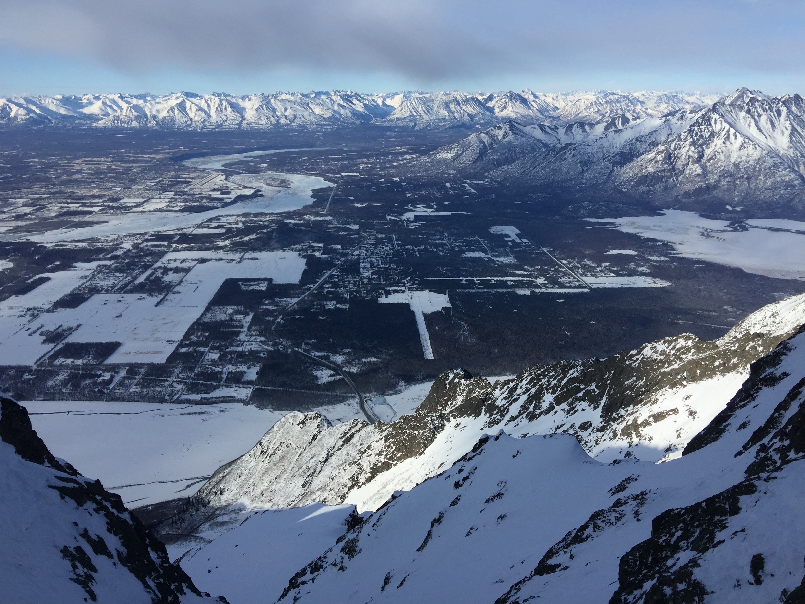
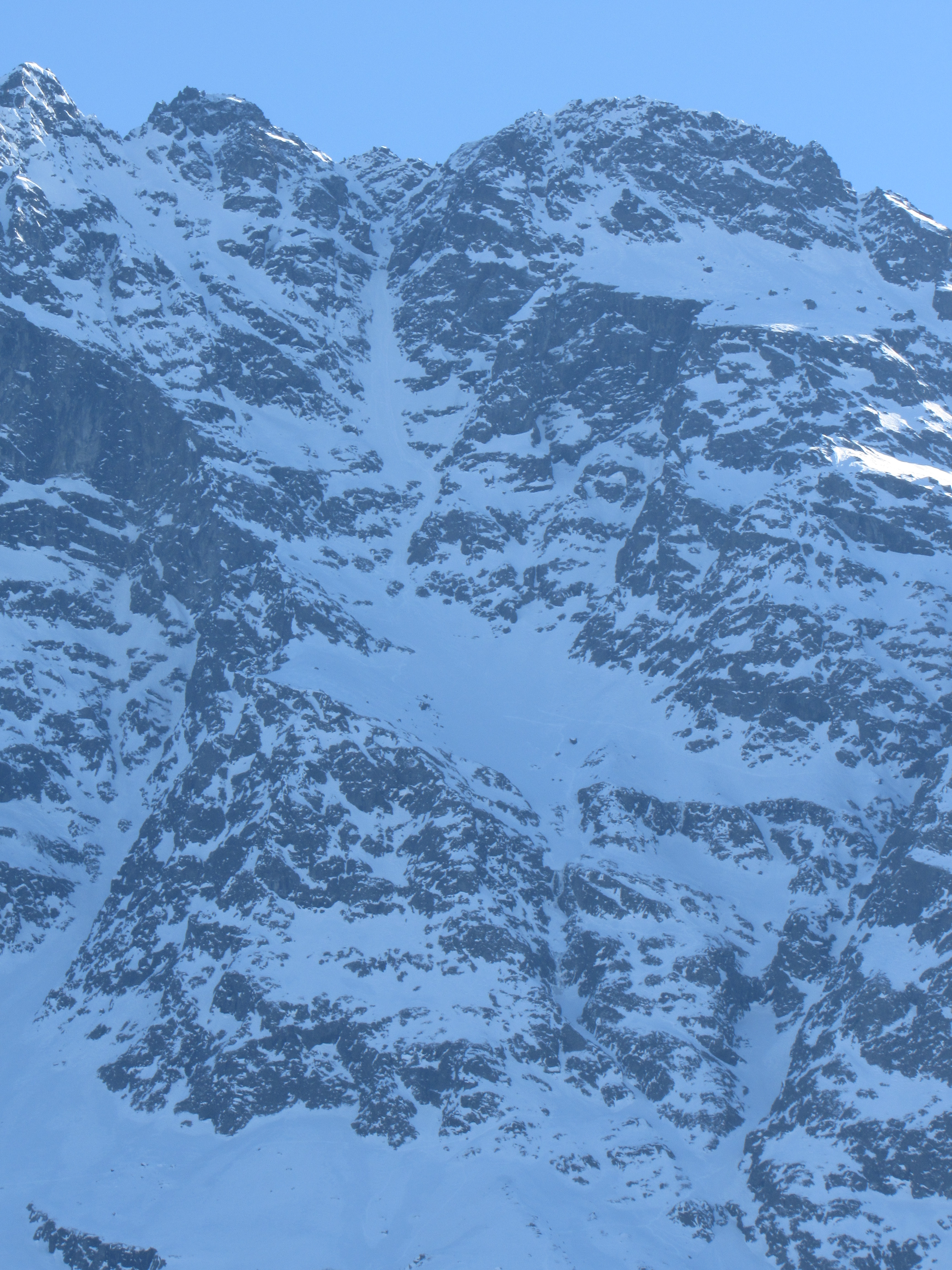
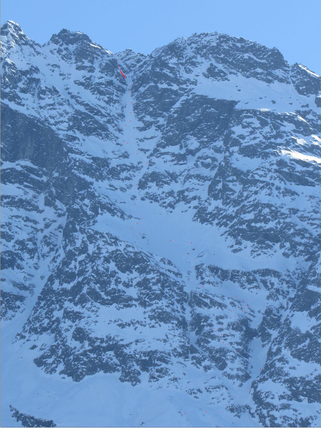
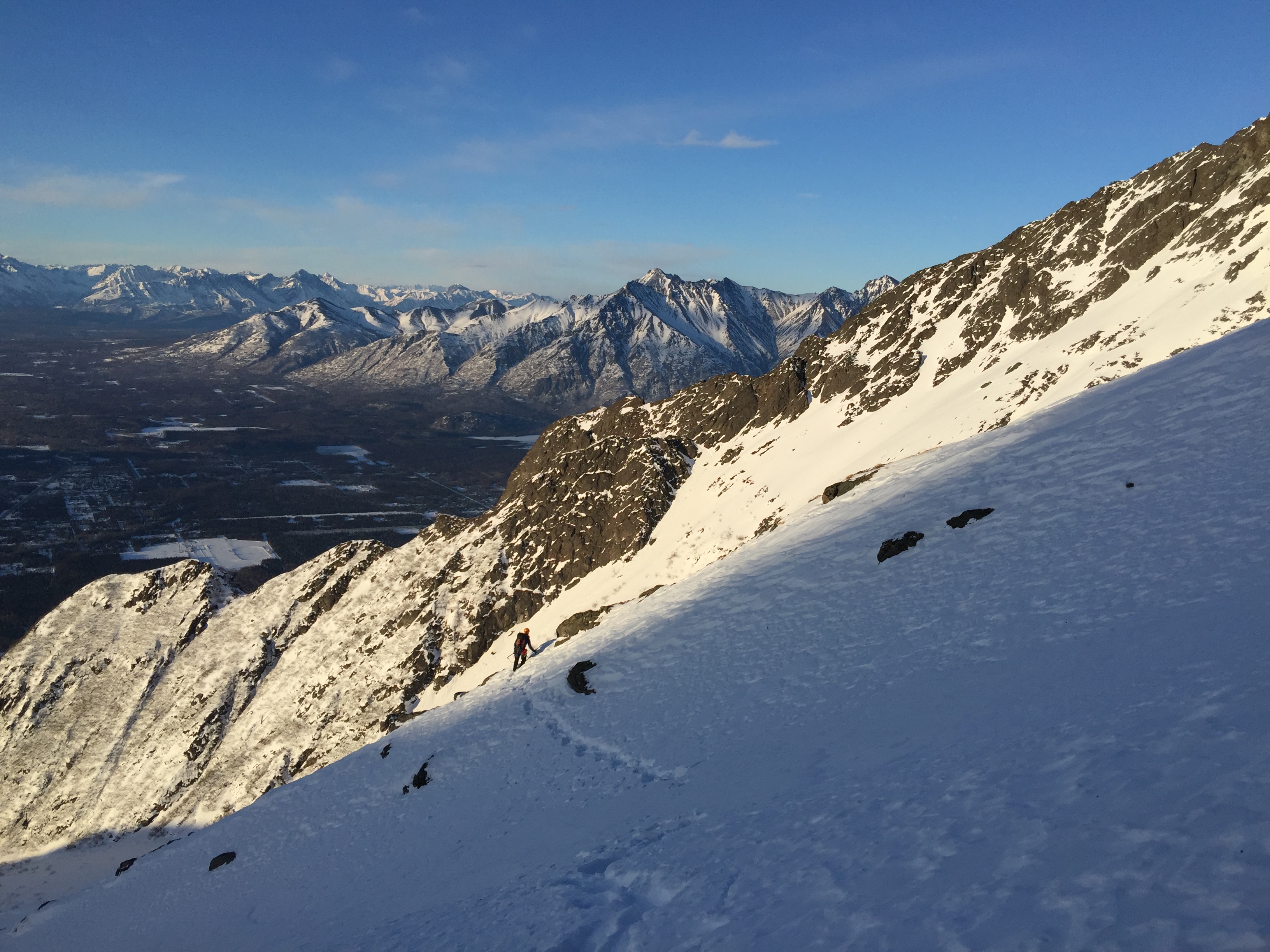
Around 9AM we finally got to the base of the lower bowl that funnels into the gully we just climbed. The rocks bands above and on either side of us were enormous; the two bordering bands run a mile long, and the bowl they formed was more than half a mile wide. 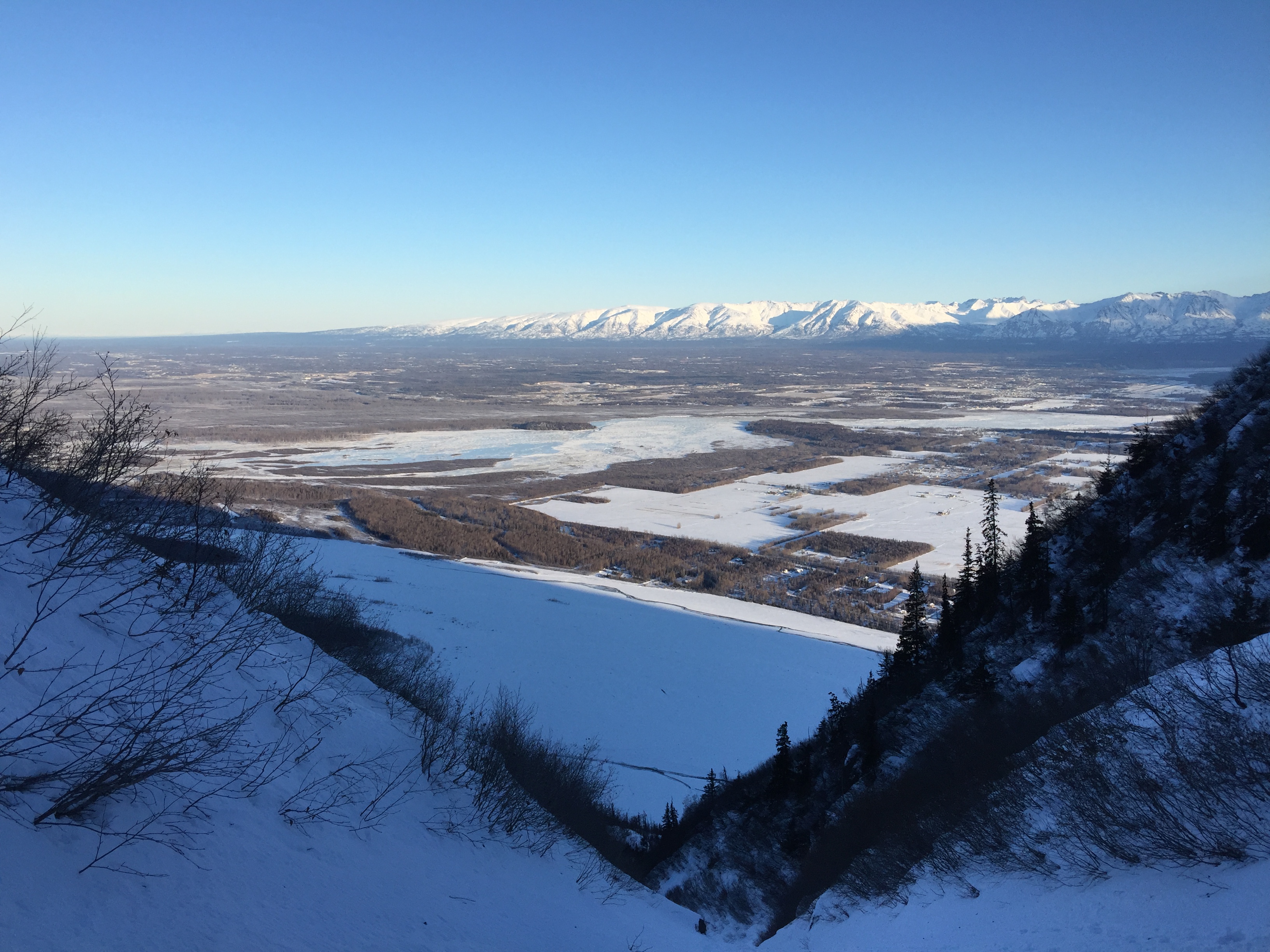

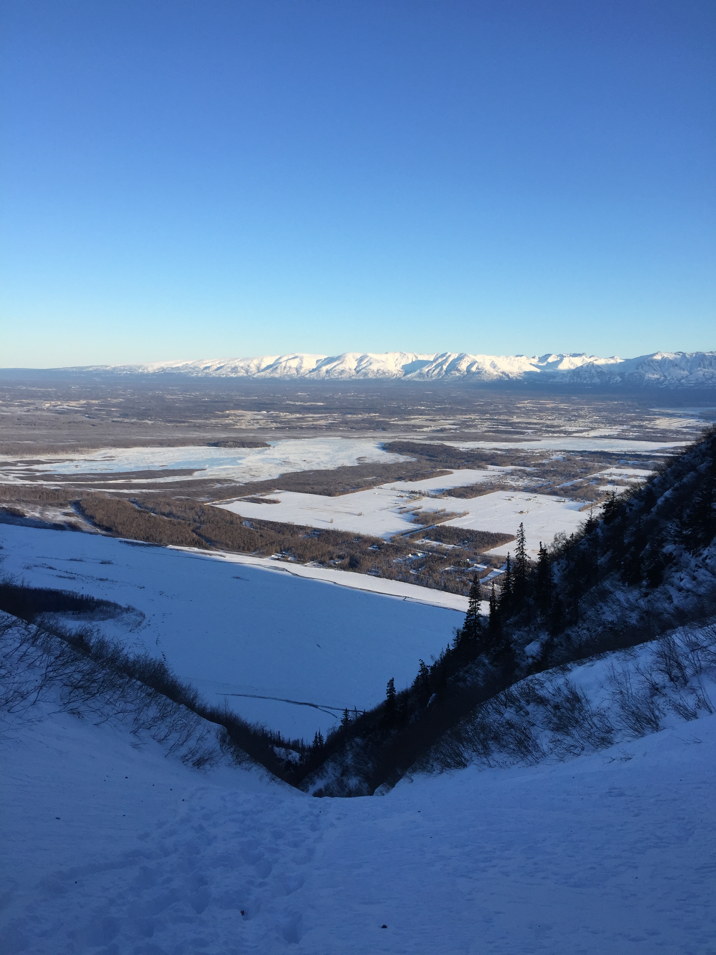
As we wandered up the wide avalanche slope, we noted how big the route had become now that it was in view. We could see up past 6000′ elevation, where the crux of the route (as we would later determine) lay. We called it “The Gun Barrel” because of it’s shape and immense capacity to release the potential energy of objets.

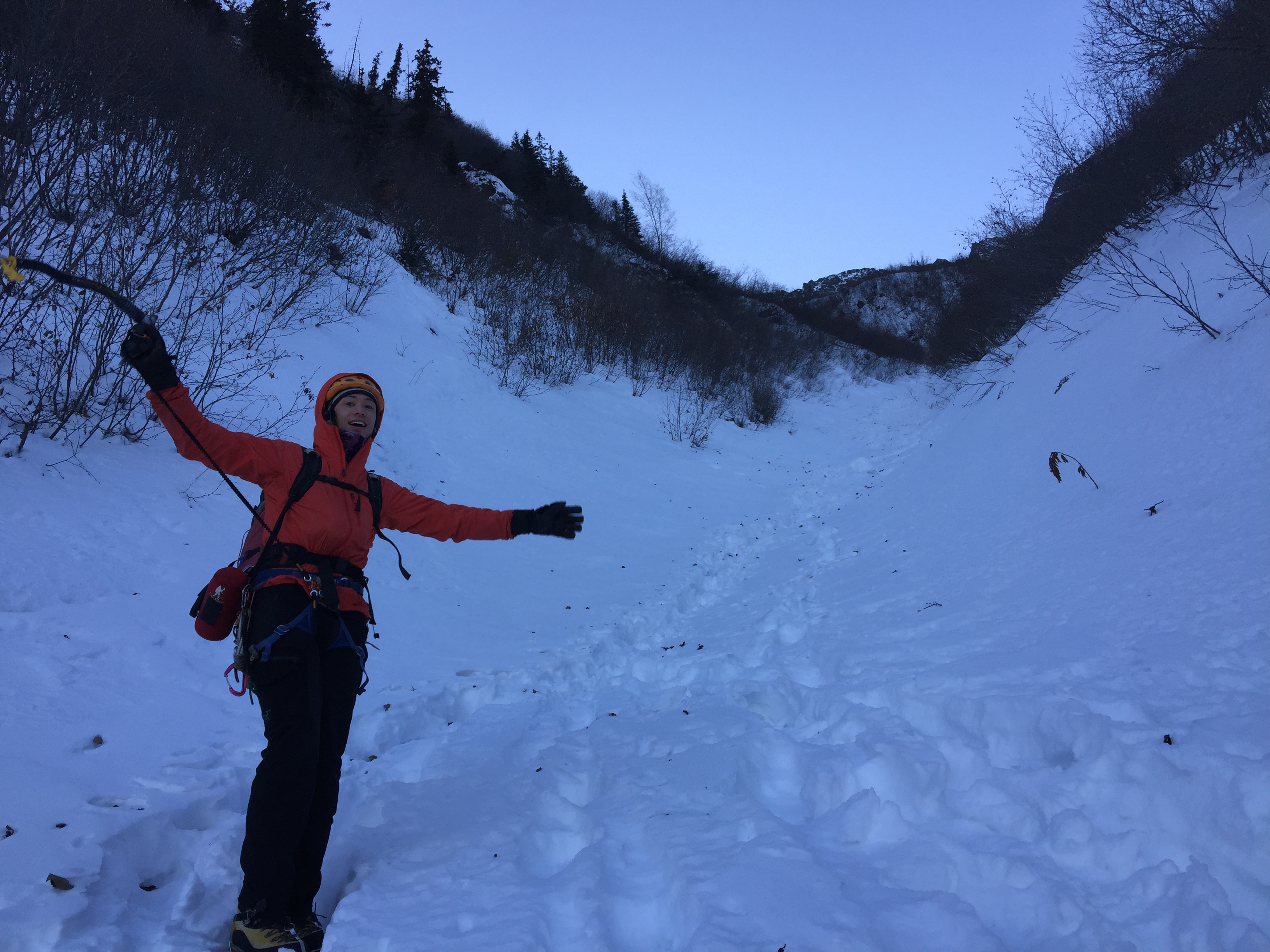
We followed the bootpack as it crossed the days-old avalanche debris. It cut across the field and up a slope with alders. We took a different route that more closely kept directly below the rock band as the snow on the trail was collapsing beneath us.


There was an avalanche slope flowing down the right side of the rock band, so we climbed up it for a ways.


Near the top of the rock band, our route would narrow and curve a bend as the rocks closed in around us.

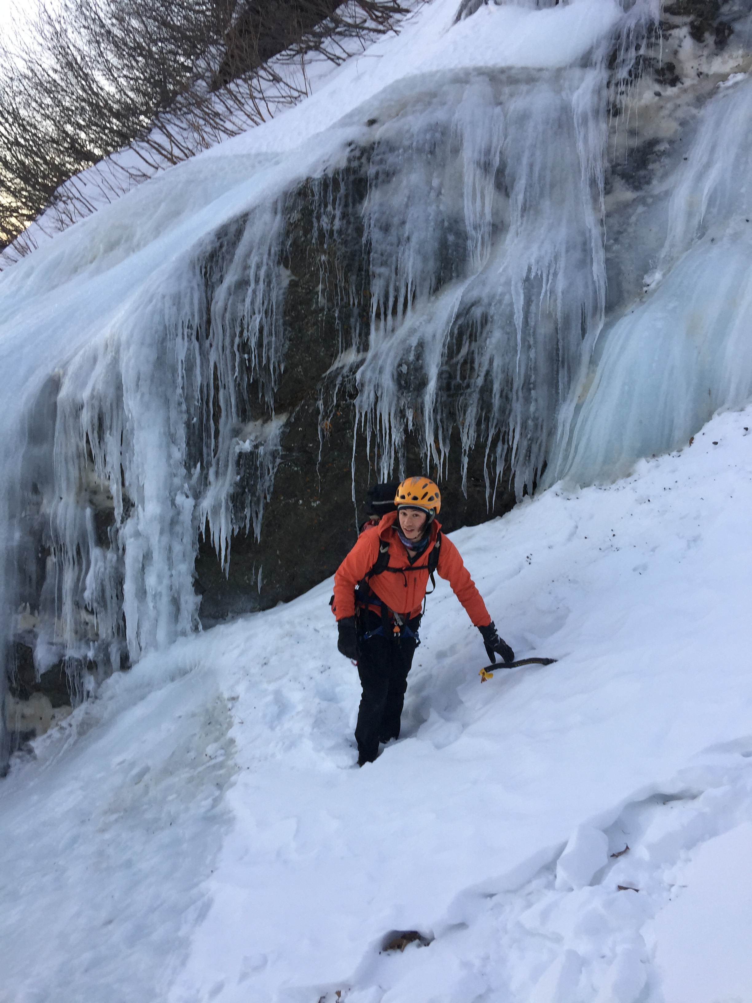
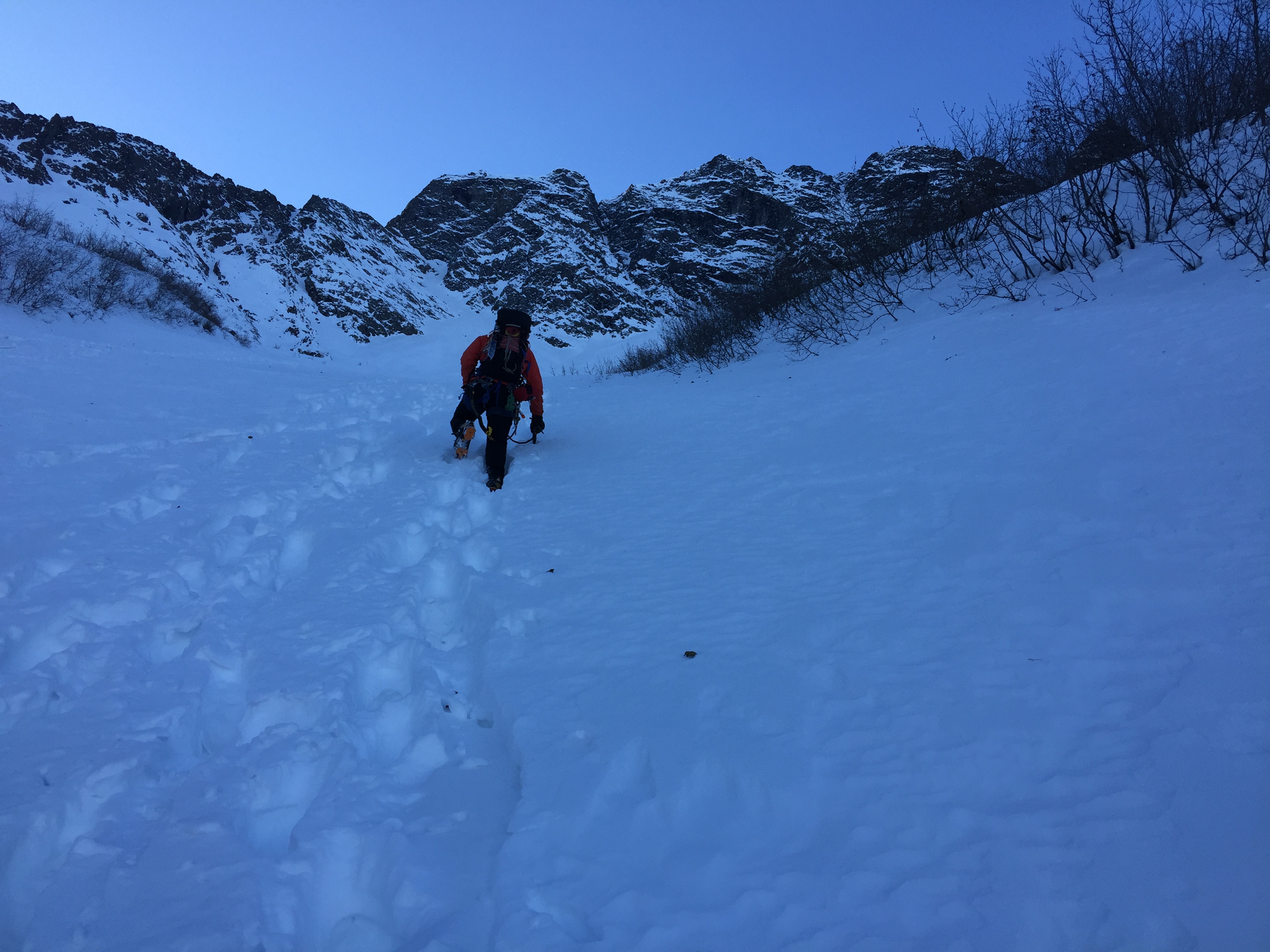
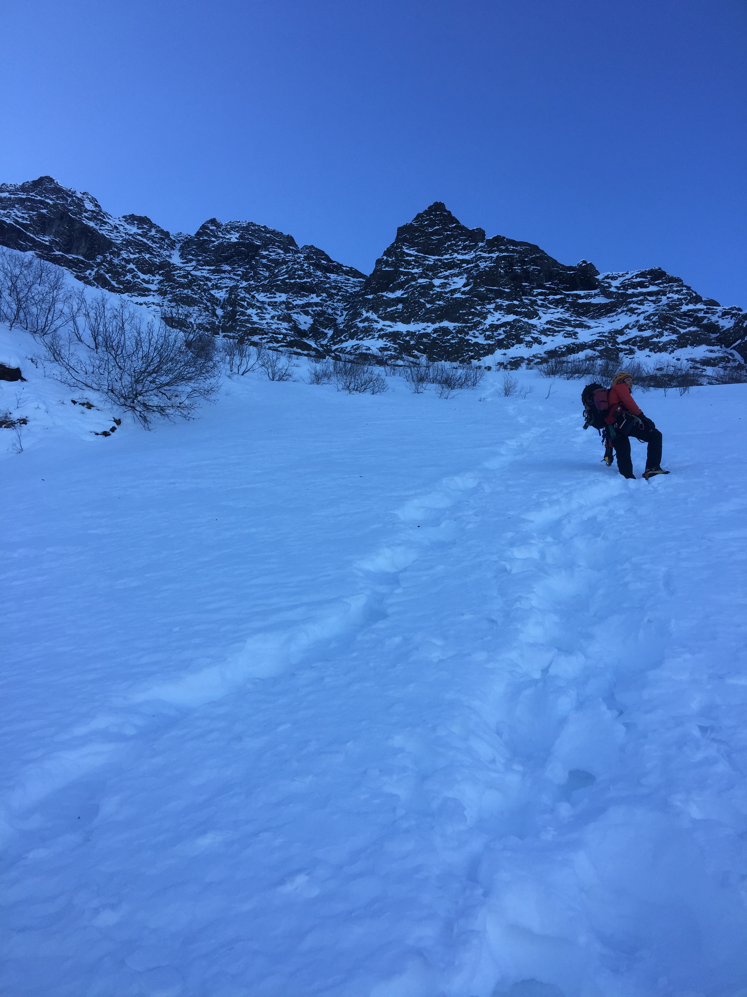
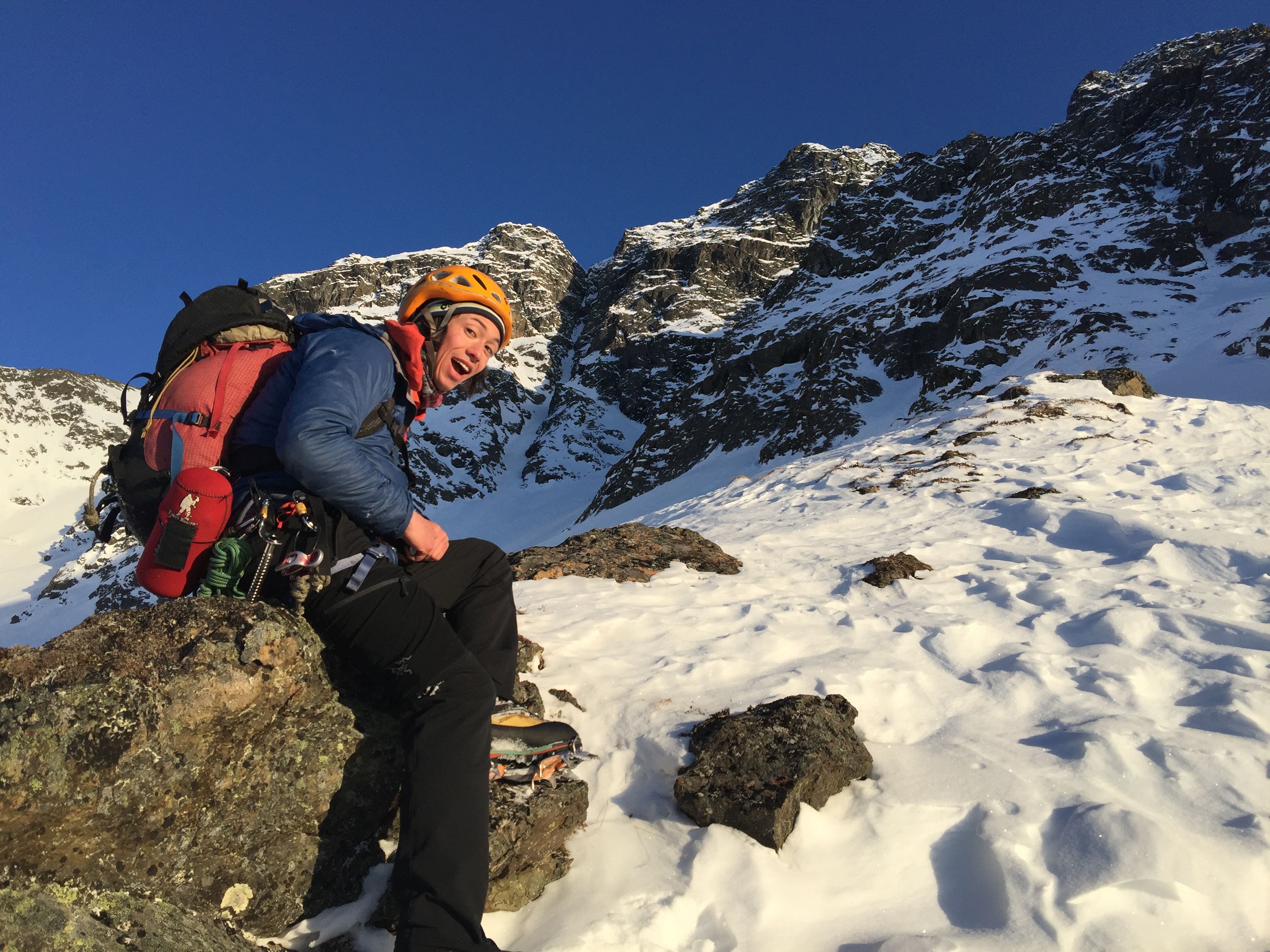
Galen thought this a fortuitous time to relieve himself (the coffee had taken effect). I continued upwards towards the second ice step.

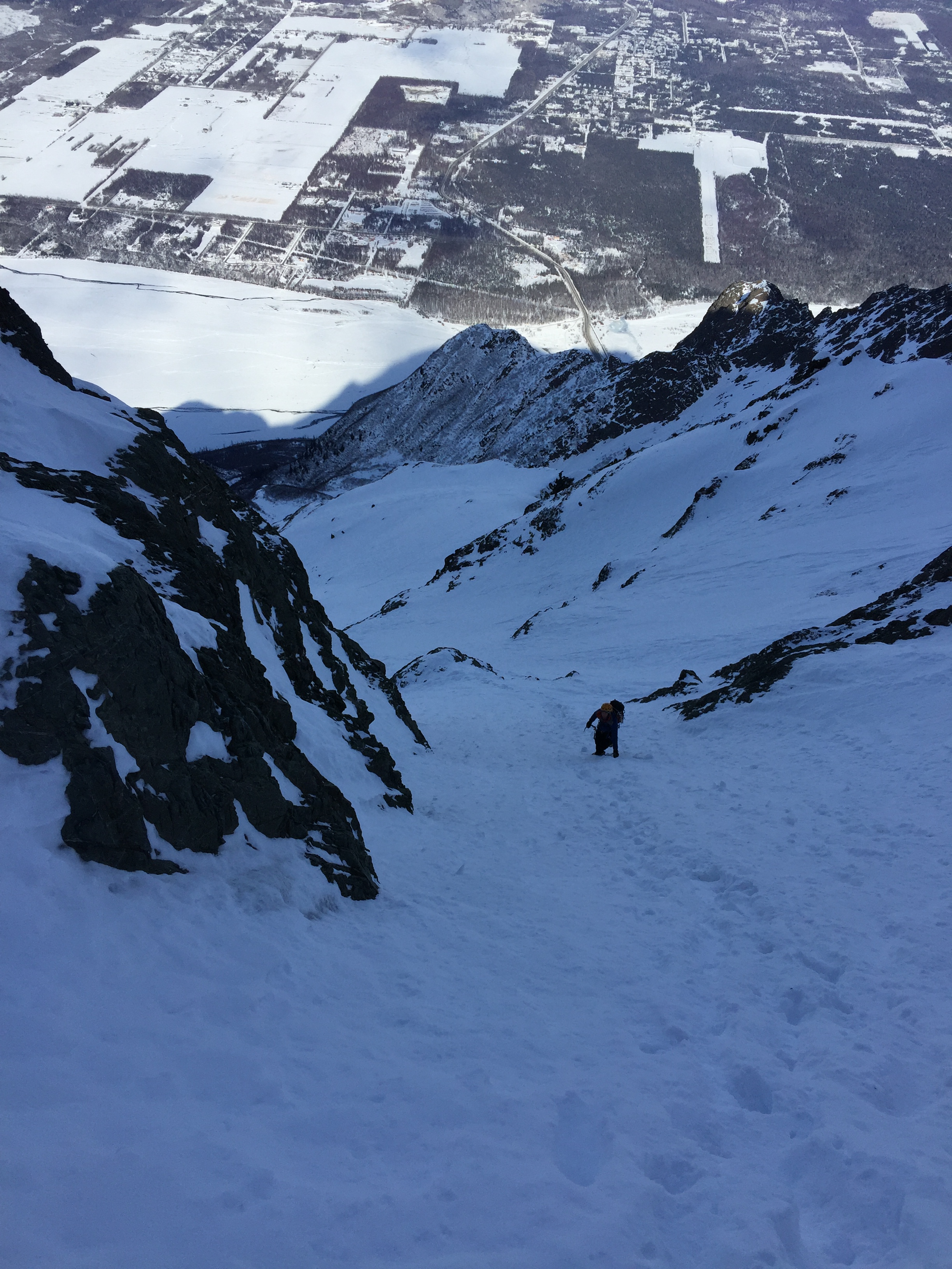
When Galen returned, I had made my way up the gully a few hundred feet. The gully was split by a large rockband with snow sticking to some of it and exposed rock in other places. The left gully contained the ice we…mostly Galen, desired to climb. The right gully looked promising, but I could not see the whole thing. I decided to climb up the center rock band to see if I could get eyes on either the left fork’s ice or the right forks passability.
I traveled up…and up and up, until I realized I was going to be above the ice. Galen was going to climb up the left fork to see the ice from a lower perspective. I got past a rather steep section of rock through some dry-tool-trickery around 4000′ elevation and after zig-zagging my way upwards, found myself above the top of the left fork’s ice. The ice had nothing to anchor to as it topped out and rolled over into snow at the top.

I made my way back to Galen and told him to find a way to me. He climbed up a snow gully and we followed my bootpack to the top of the ice.

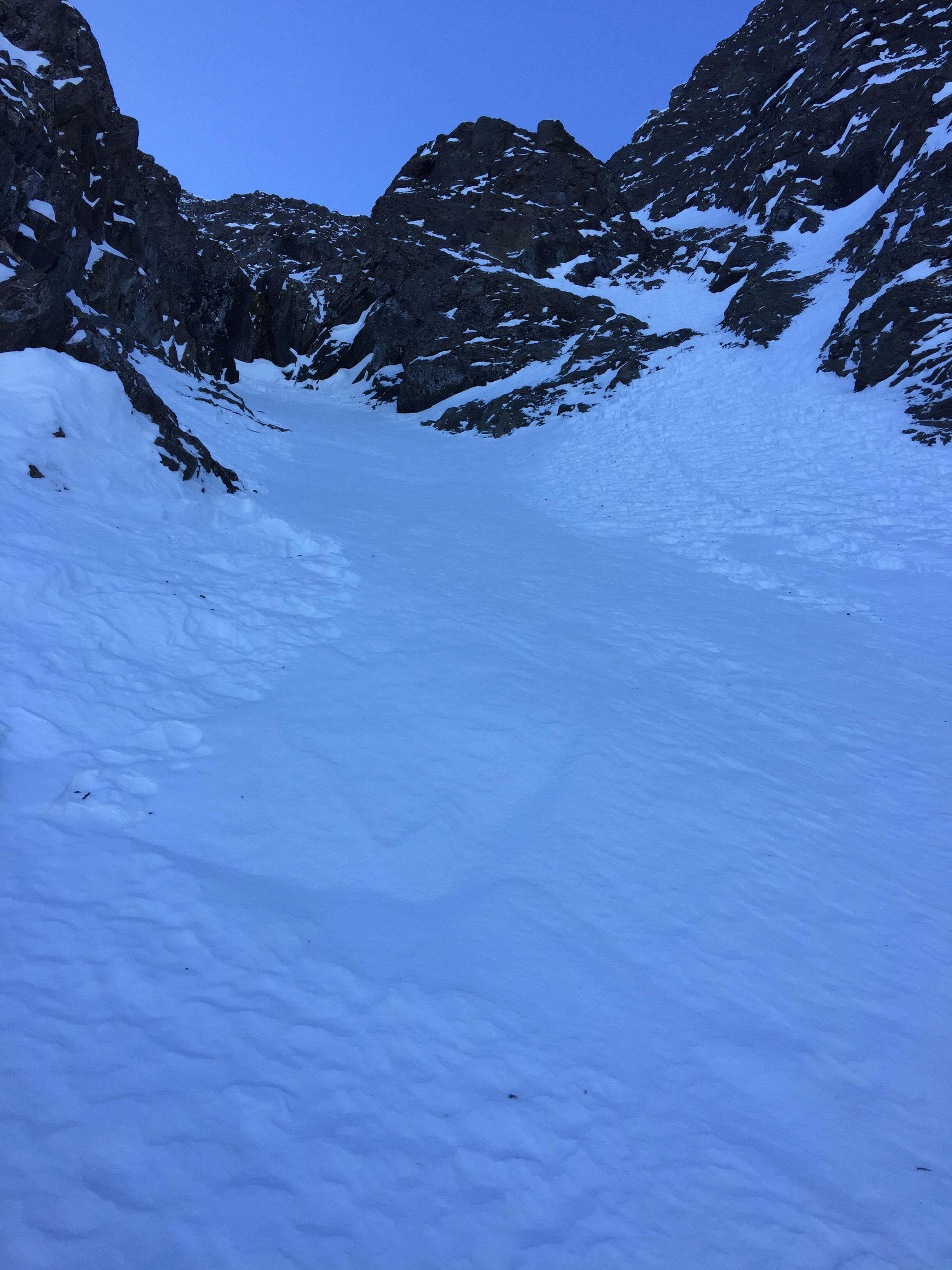
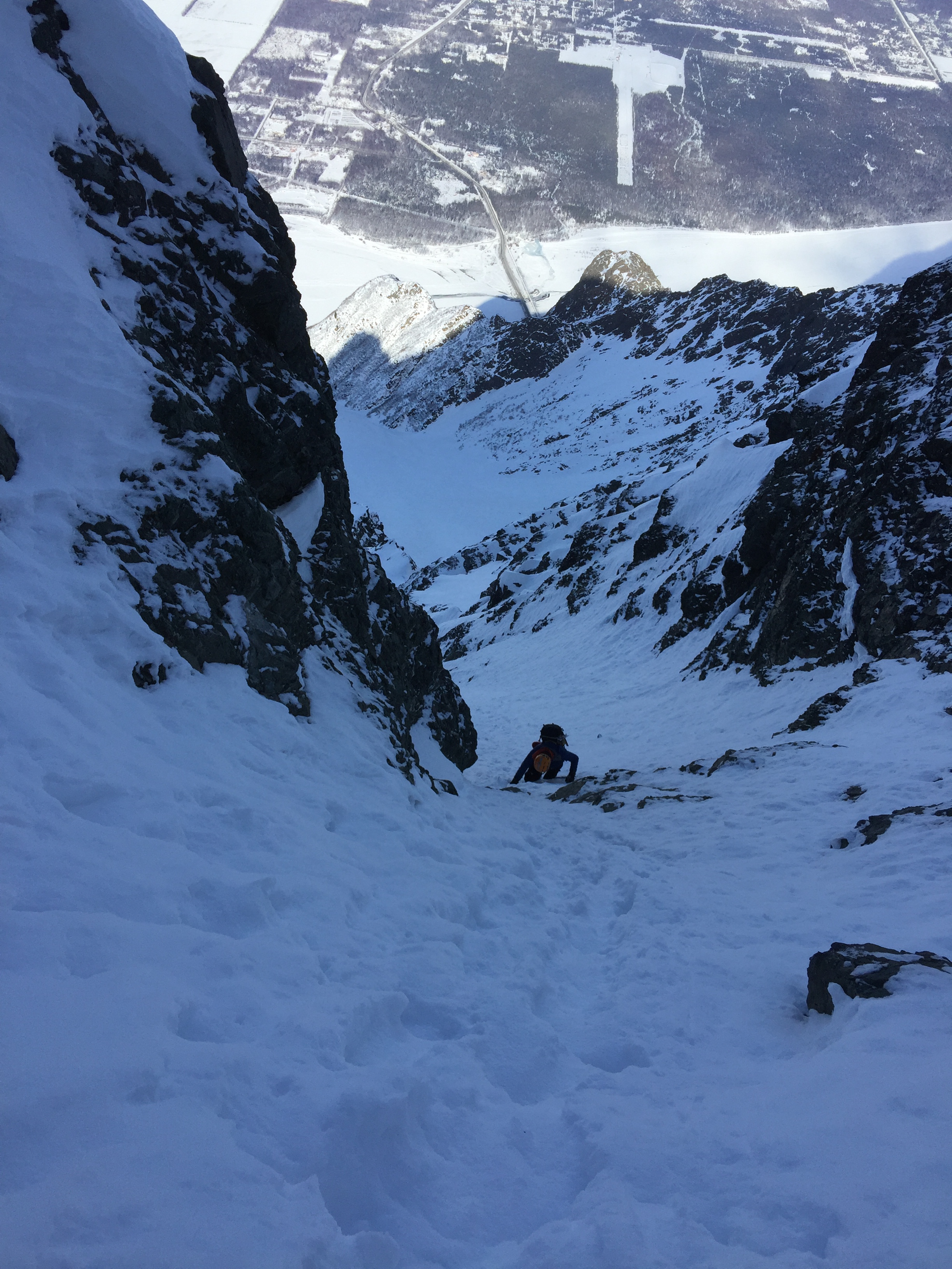
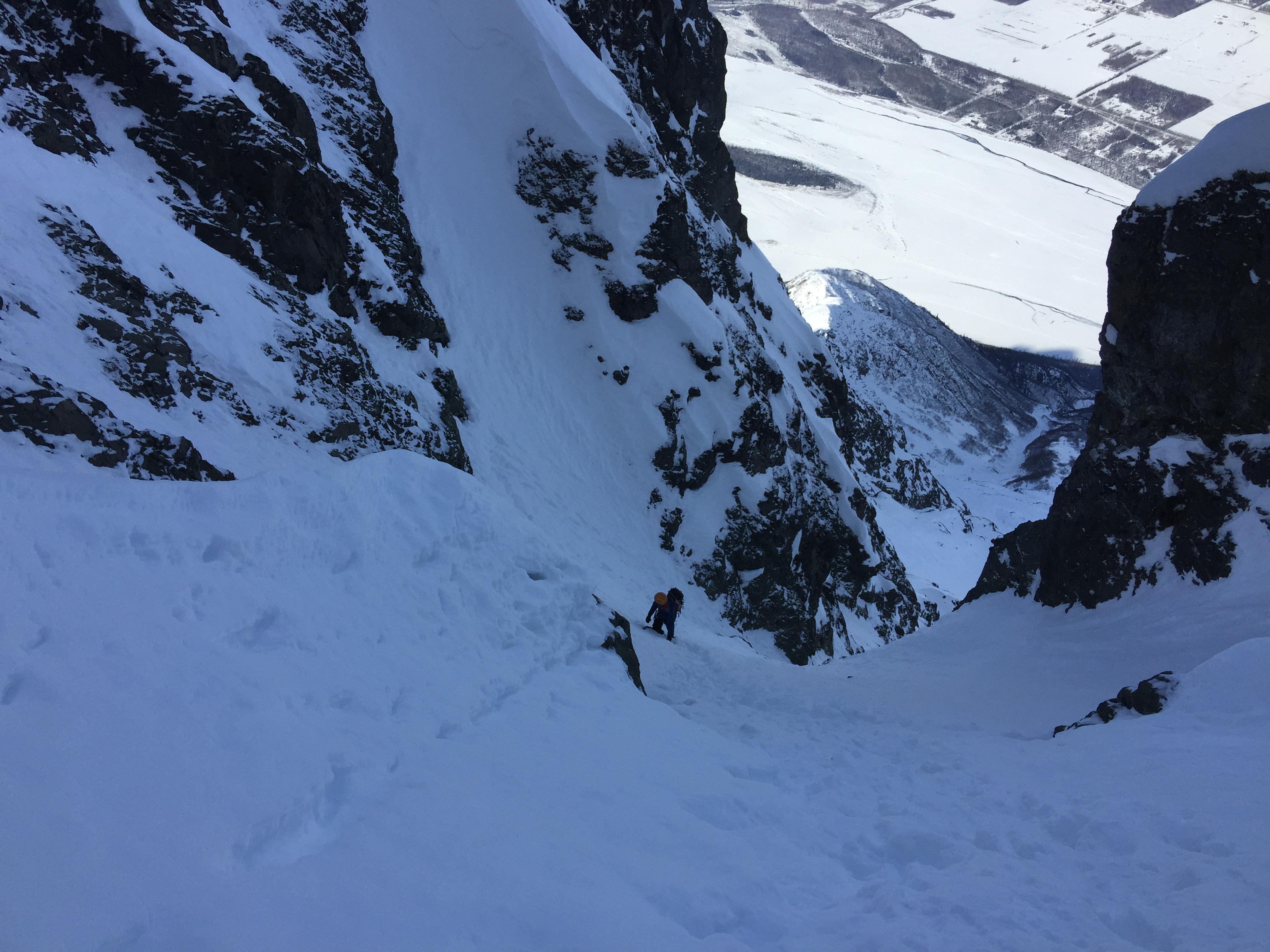
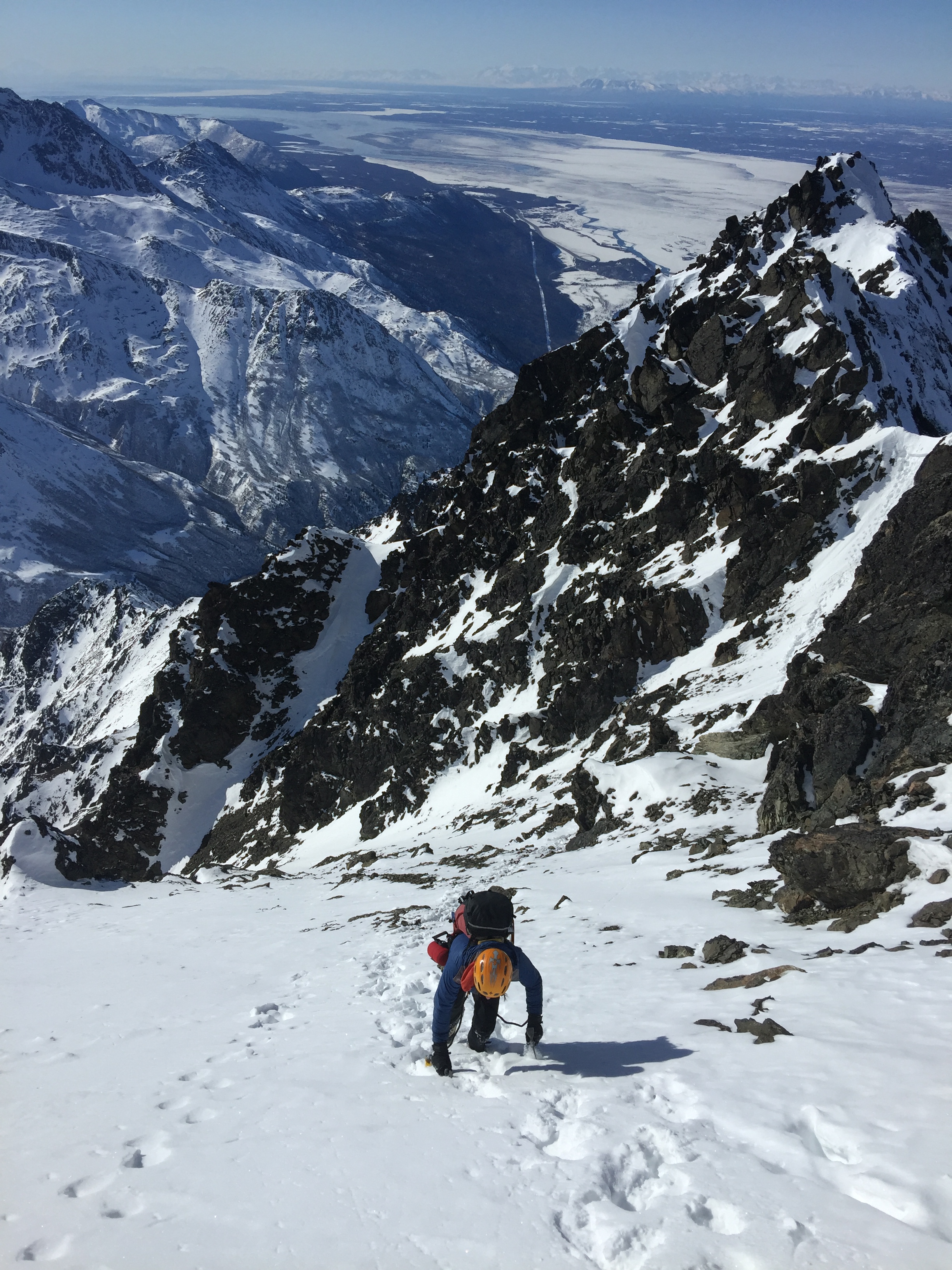
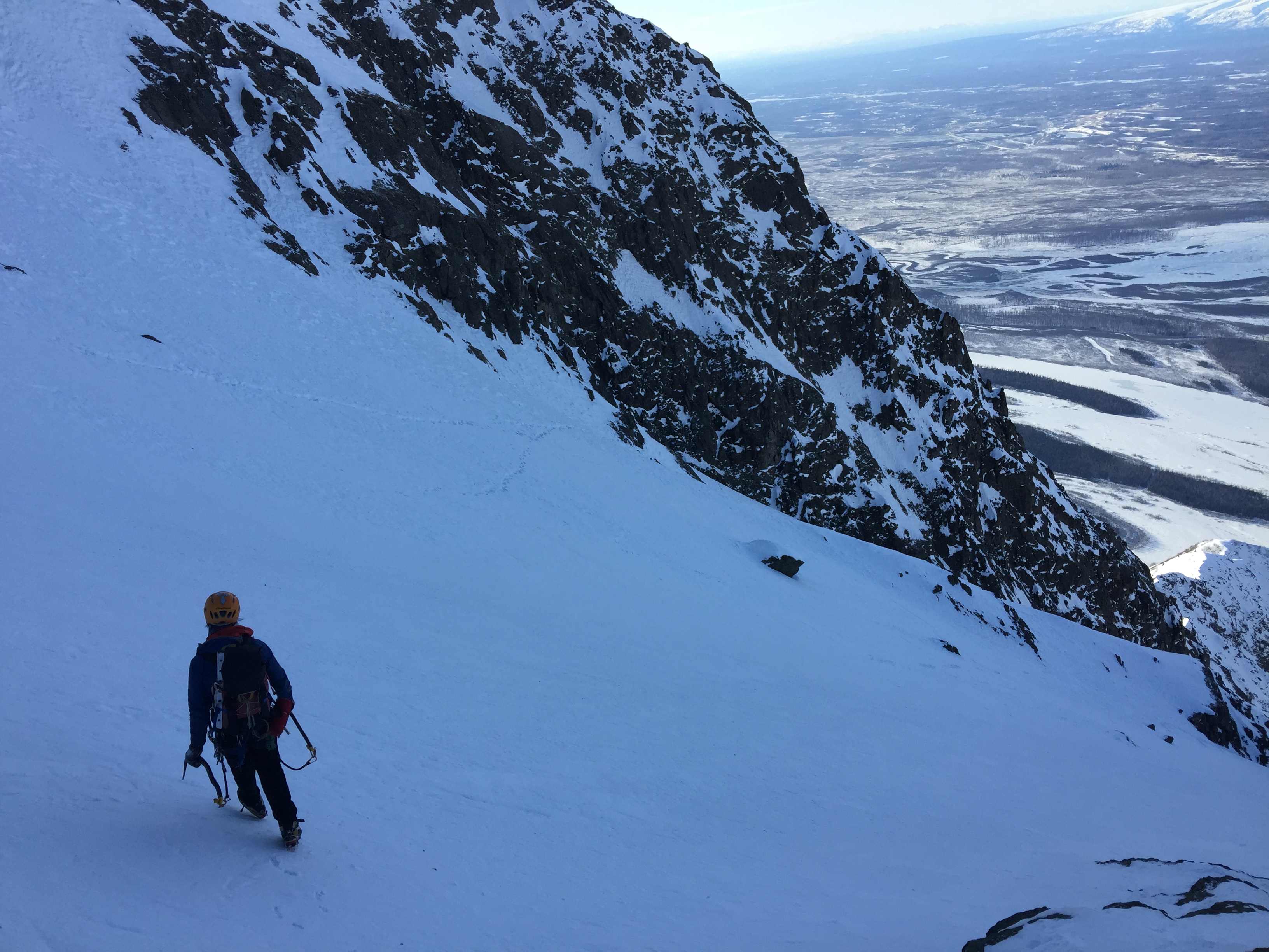
As we looked upward, a gully constricted briefly as we topped out of the major rock band that cuts horizontally across the north face.
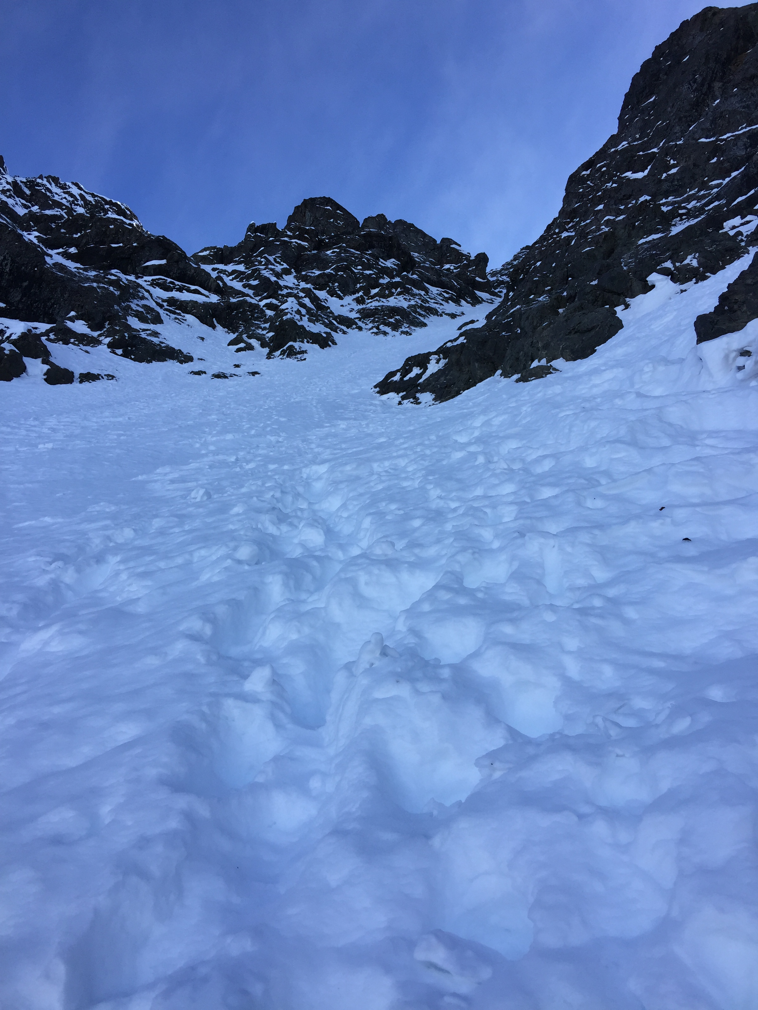
After the constriction, we entered the Upper Bowl of the north face and tried to find the slabbiest snow to crampon-crunch up. We did post-hole for a while before finding the optimum path.

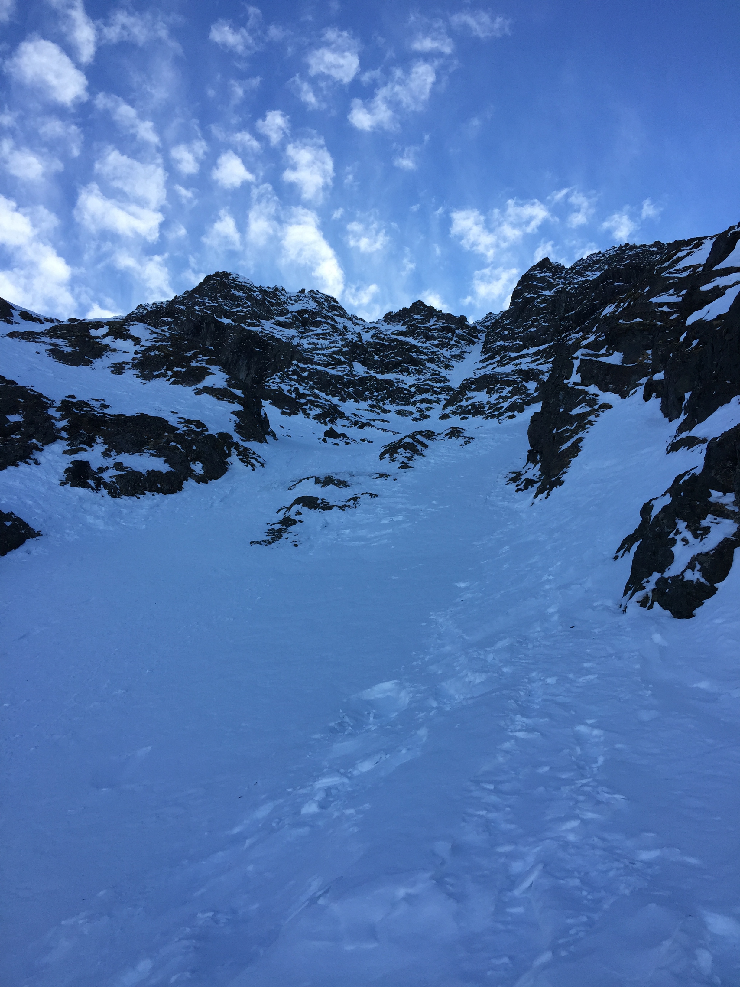
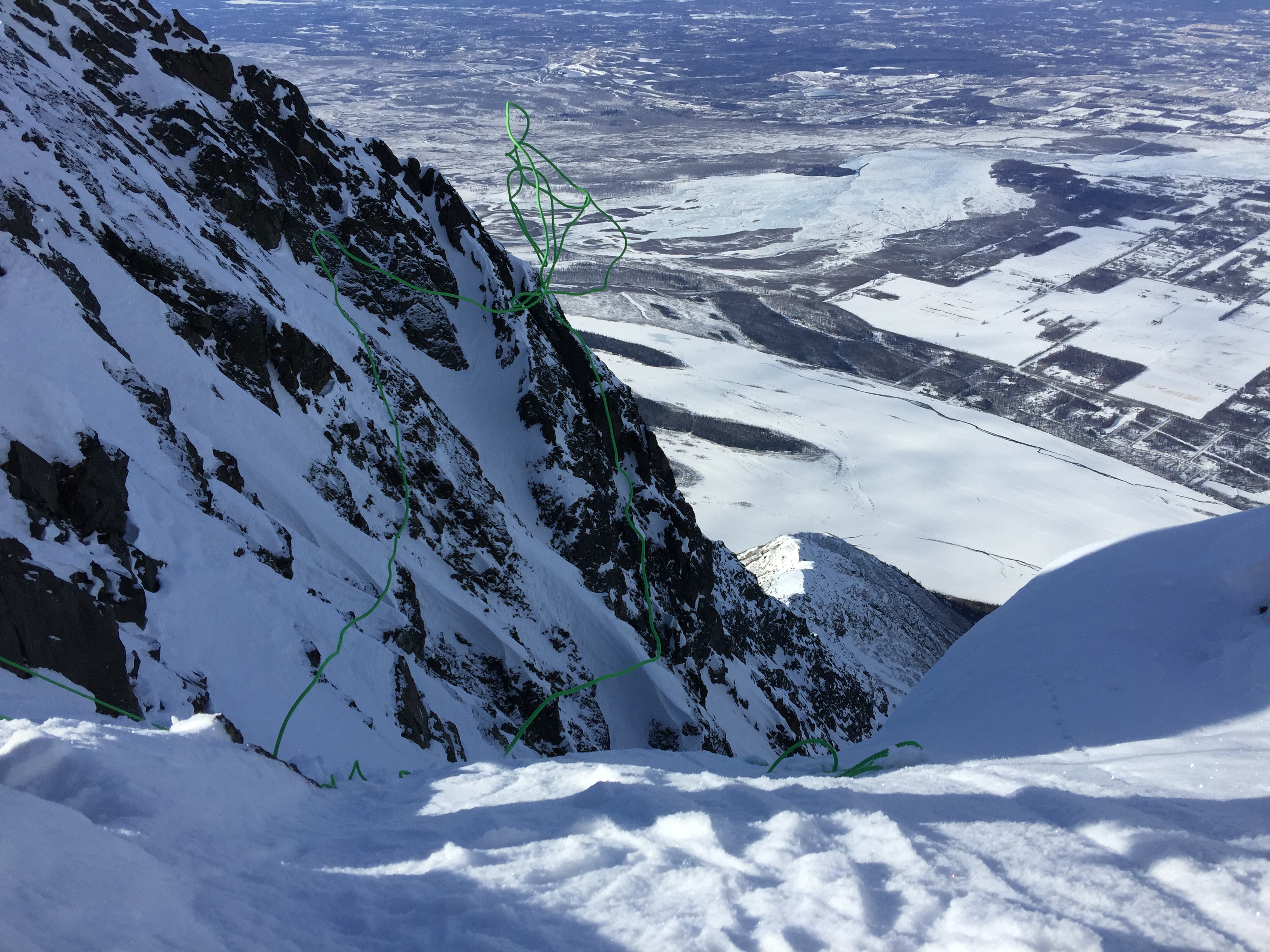
At the top of the Upper Bowl, the route does what I called a “Whoopti-doop”, where it travels through and up a series of rocks at the base of the Gun Barrel.

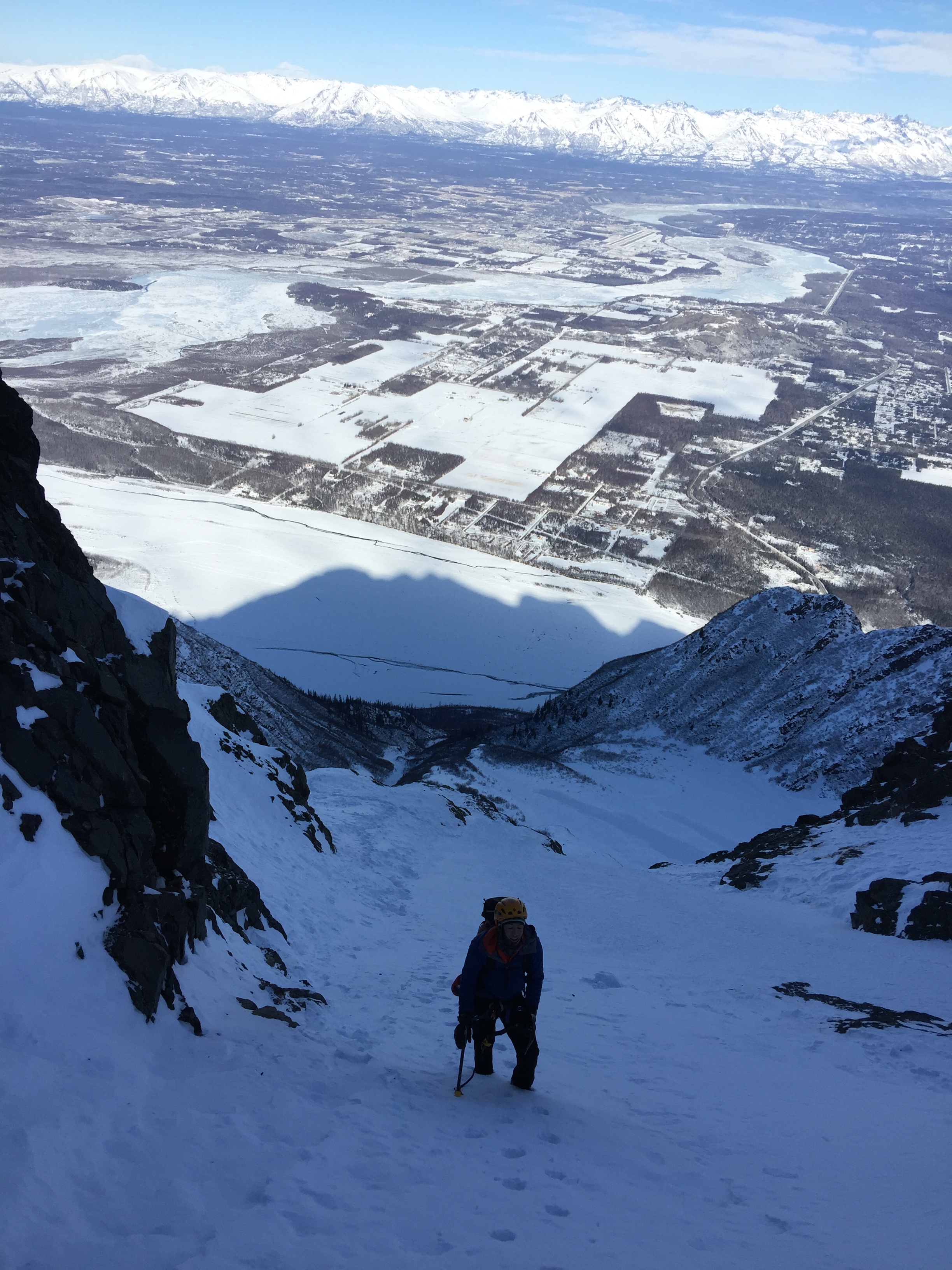
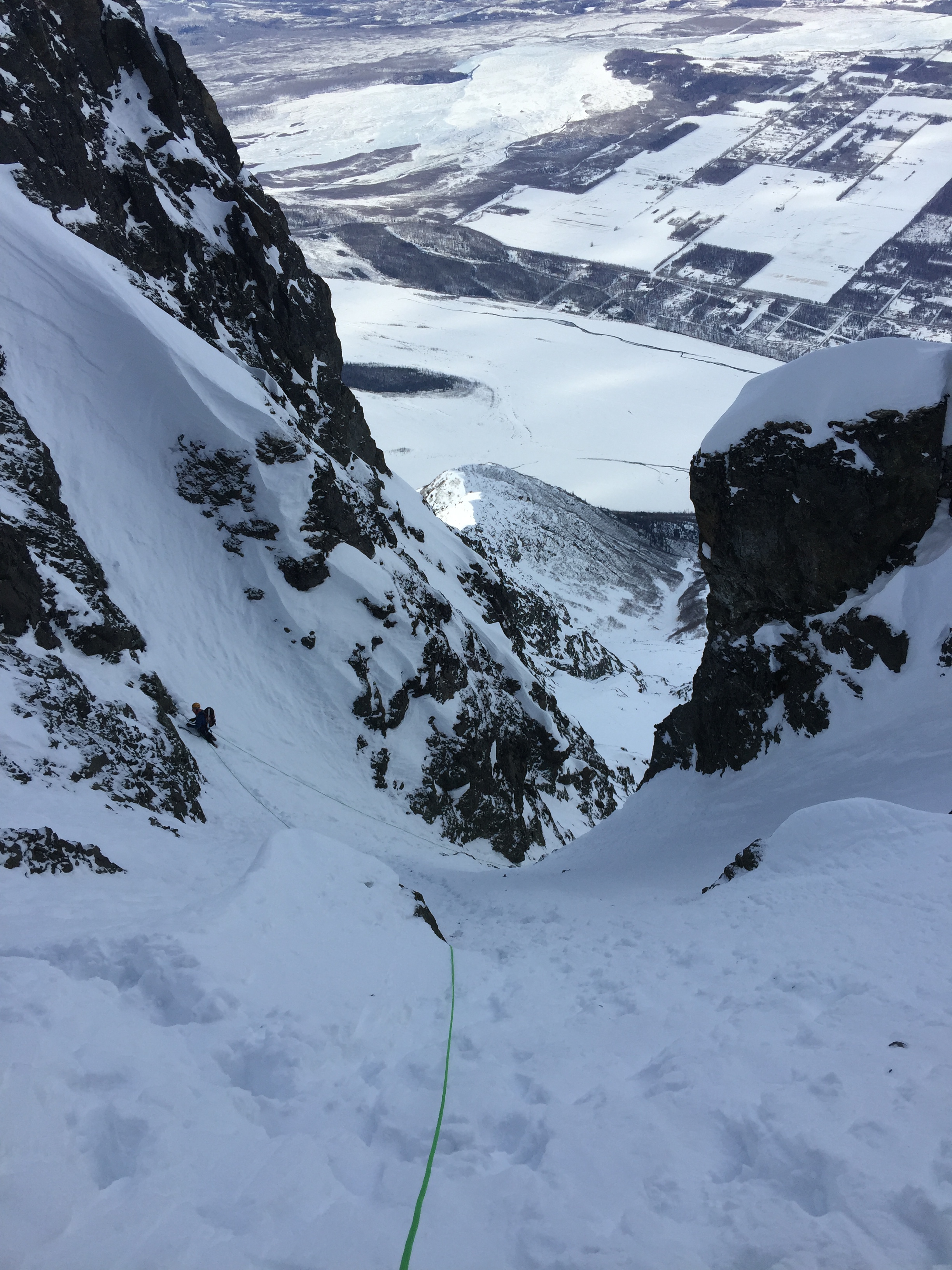
The Gun Barrel is a couple hundred feet of steep snow climbing, exceeding 60 degrees. Its base is met after more than a mile of vertical gain has been climbed.

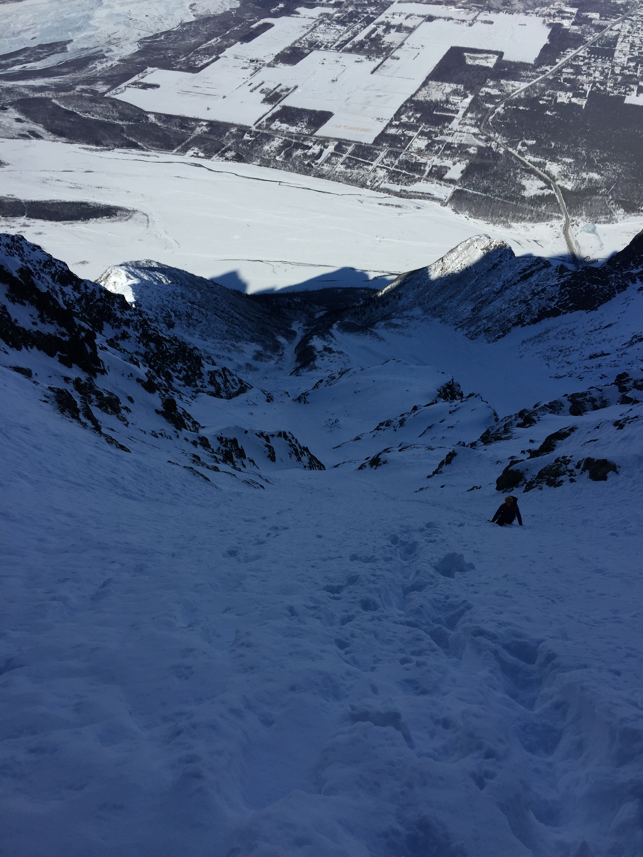
Upward progress feels extremely slow. At one point I yell in anger that the top hasn’t gotten any closer in the past 20 minutes.

The bootpack has ceased to be useful; it is easier to stomp our own trail as we pass 6000′ elevation and near the small corner with ice flowing around it. 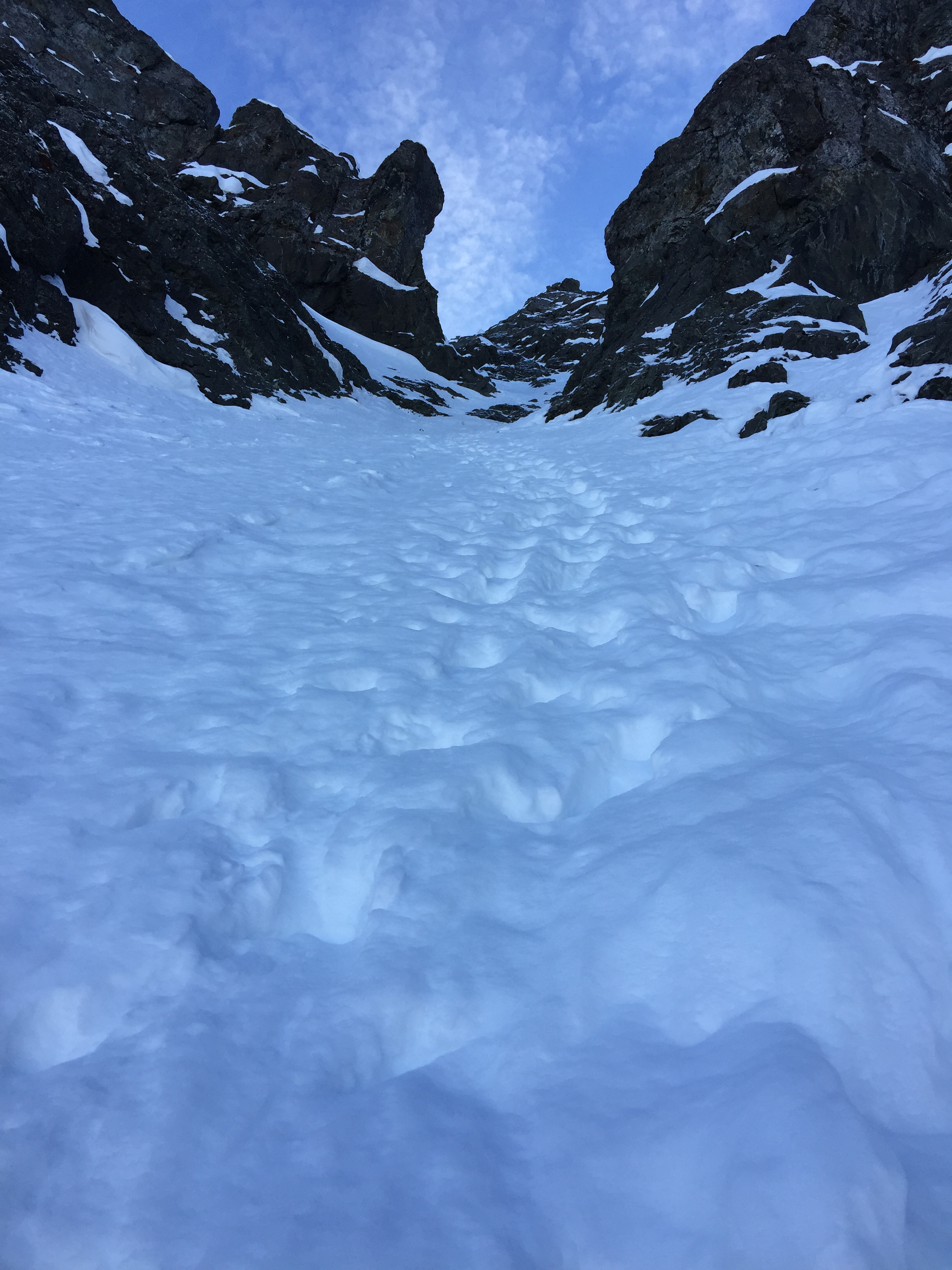


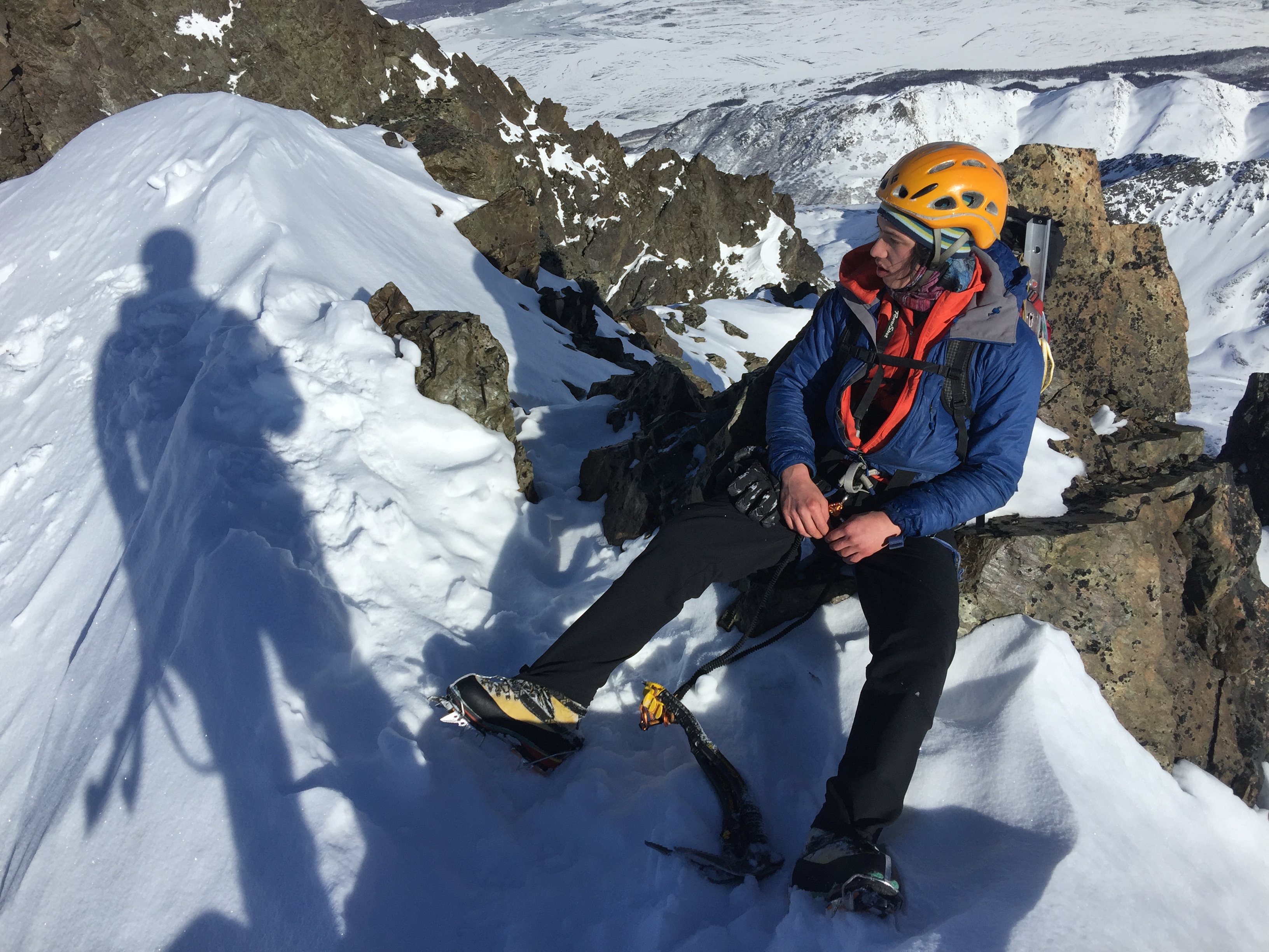
Near the top of the Gun Barrel, around 6200′ elevation I ran into a boulder problem. There was scarce snow covering this boulder and I couldn’t figure a way up it.

I managed to slowly inch my way up between the problem boulder and the one to it’s right. At one point when I could not find a handhold on the slabby rock, I froze my left mitten to the rock and pulled on it to move upwards. Some grunts later I found myself topping out of the gully. But it was not the summit.


The double-peaked north summit was about a small climb over a col and a traverse up some snow to the top, about 10 minutes away. We enjoyed the warmth of the sun as we cruised to the more southern of the two summits.

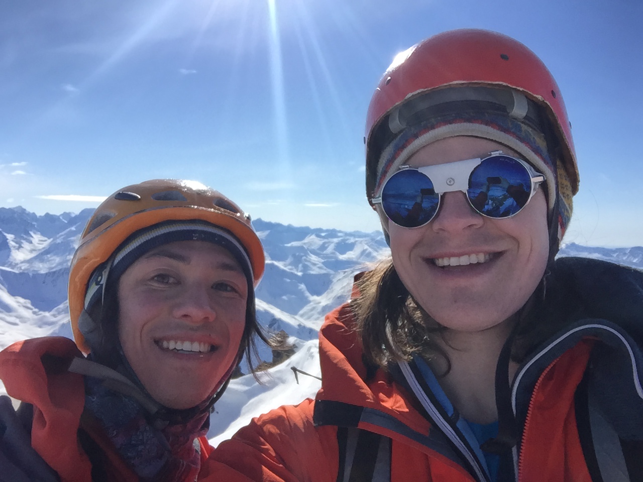


We hung out on the summit for the better part of an hour, then began the trip out. It was disheartening to leave the sun.

We rappeled past the small ice step and began down-climbing the Gun Barrel, then the rest of the route. It was uneventful and beautiful.


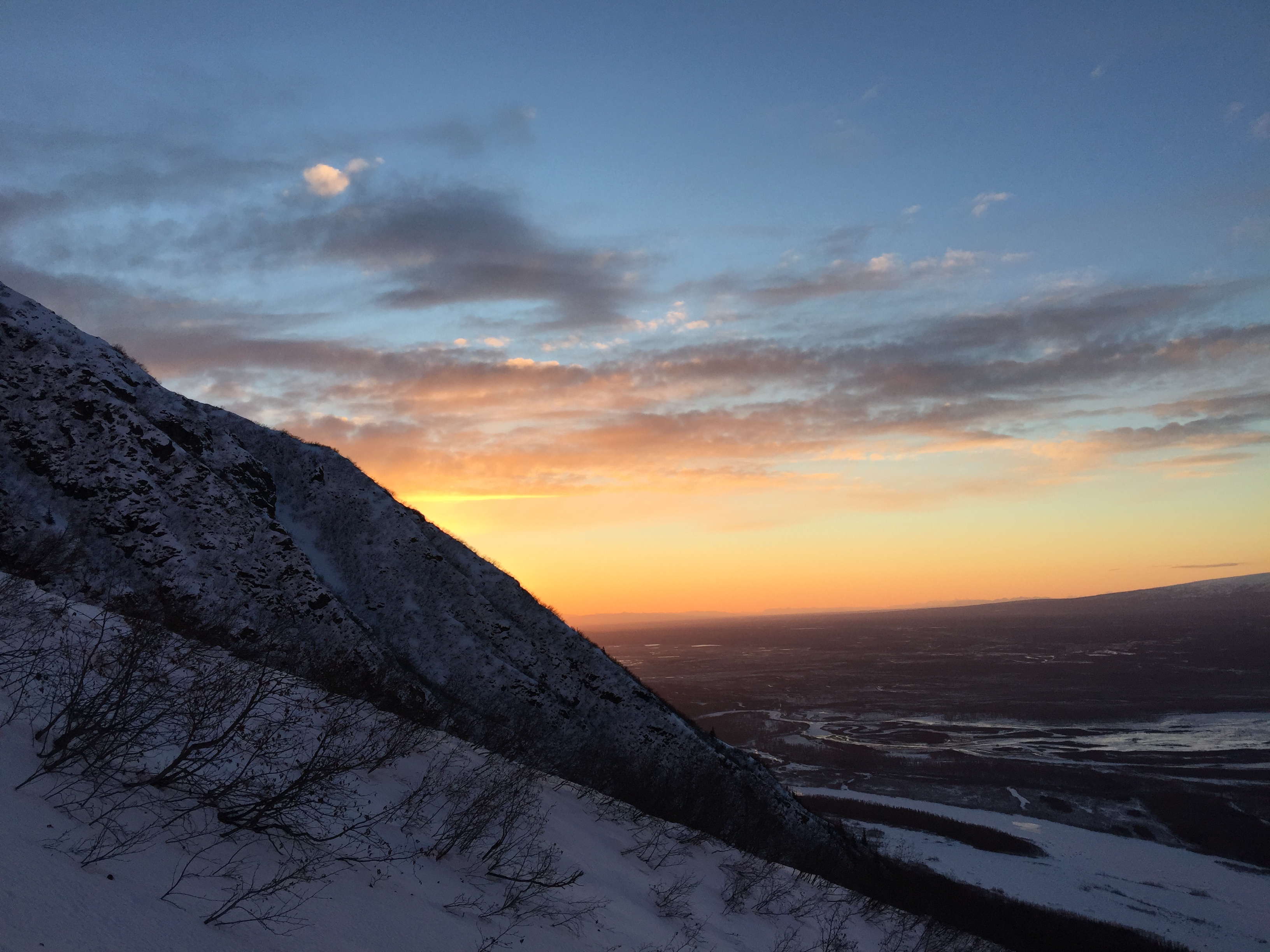


We made it back to the car a little after 9PM. Considering we left a little after 7AM, the trip time came to 14 hours.


Great stuff! I’m planning a trip up in April. I really appreciate the pictures of the route.