

I’ve never been able to leave town to climb in the big mountains without more than a few day’s notice. The process of divining good weather, coordinating/coercing climbing partners, finding a dog-sitter, begging managers for time off work, buying and preparing food, as well as organizing/repairing/borrowing/buying/packing/re-packing gear always tends to result in unexpected delays and a hardened resolve to get out of town. This trip was no exception.
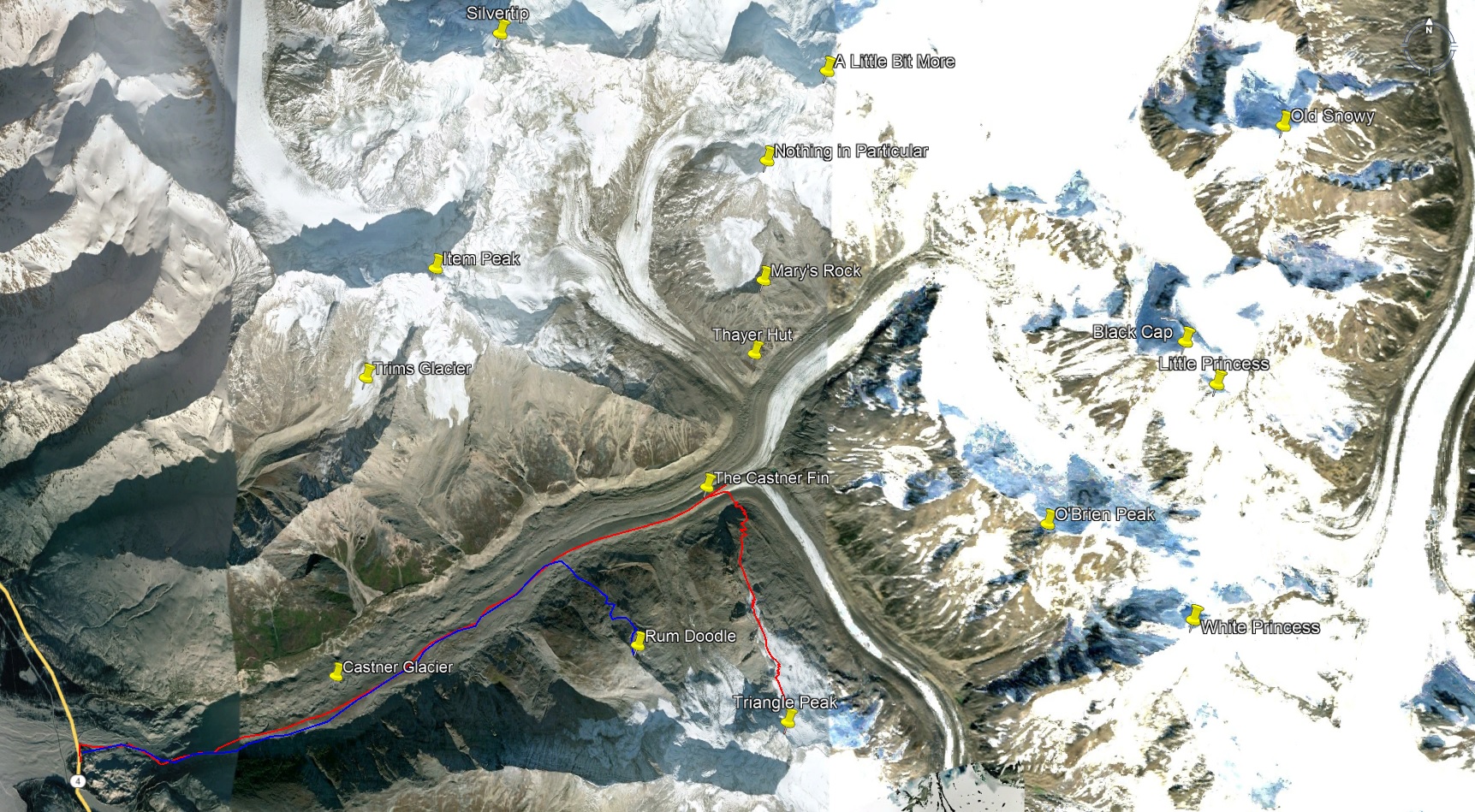
From Fairbanks, driving to the eastmost Eastern Alaska Range, colloquially known as “the Deltas”, takes a lazy 3 hours. During my time in college I would make frequent day trips to the range to climb the many frozen waterfalls that form on the walls of a multitude of cold, dark valleys that line the western ridge bordering the Jarvis Glacier. Less frequent trips were ski-mountaineering oriented, with the goal of climbing to mountain summits. One or two trips per season was all I could fit into my spring semester without failing classes. Inevitably my obsessive tendencies honed my mountaineering focus to the Castner Creek, which flows from the Castner Glacier. My first mountaineering trip up the Castner valley was in 2012, and I’ve walked/skied up it nearly every year since.
Though I don’t live in Fairbanks anymore, I still have a strong attachment to the Deltas, the Castner in particular. For half a decade I’ve had a topographic map of the Eastern Alaska Range (comprised of 10 smaller maps pieces together with tape) hanging on the wall of every place I’ve lived. These days I live in Southcentral Alaska and, if I manage to make it out of town, from Anchorage it’s a 5 hour drive to reach the eastern Eastern Alaska Range (faster if it’s a weekday evening and there are no cops on the road).
The winter of ‘18/‘19 saw my obsessive tendencies turn towards my first love, skate skiing. For the first winter in 5 years, I had no romantic partner in my life and my love for skate skiing was fully-realized. I logged more than 130 days on the trails/crust by the end of May. All of this to say: when spring came I felt strong desire to make good use of my hard-earned fantastic aerobic fitness.
March brought the regular drought in billable work at my job that I’ve come to expect after submitting work before a deadline. I asked my manager if I could take a long weekend, a request of which he approved. As I skied around the trails of Kincaid that morning for my daily dose of snow therapy, my mind turned again towards the Castner valley, I hadn’t visited in more than a year. Checking multiple weather forecasts and webcams, I deduced reality was once again tempting me to the Deltas. I relented and started contacting potential mountaineering partners, none of whom were available on such short notice.
In past years, a lack of a climbing partner tied me to town. This time was different; without romance in my life, I found myself liberated and comfortable venturing into familiar terrain even with the uncontrollable danger of avalanches and crevasses present. Without forming expectations about snow conditions, I decided I knew enough of the glacierscape to turn around if I sensed danger. I just want to get out of town and into the mountains.
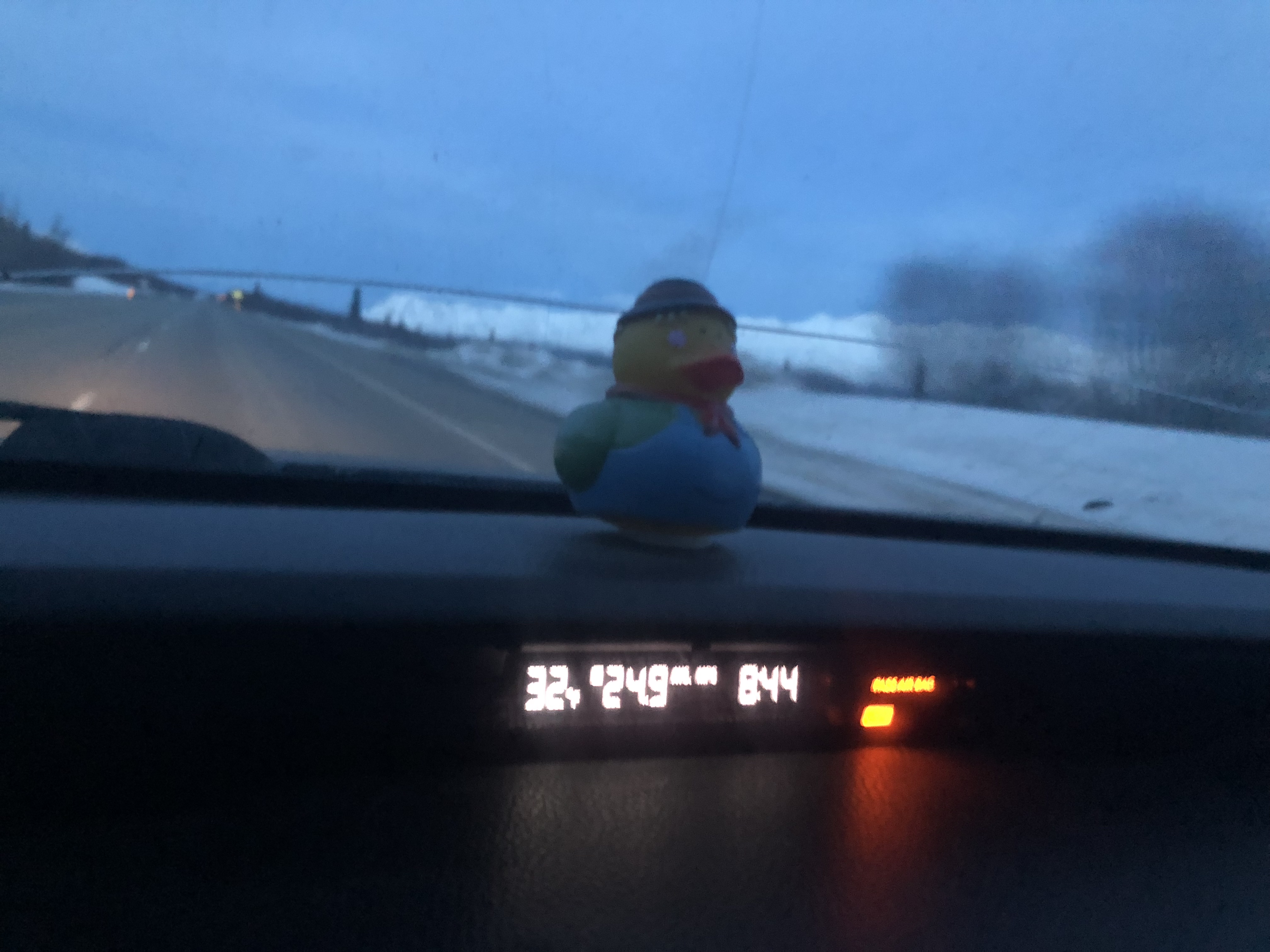
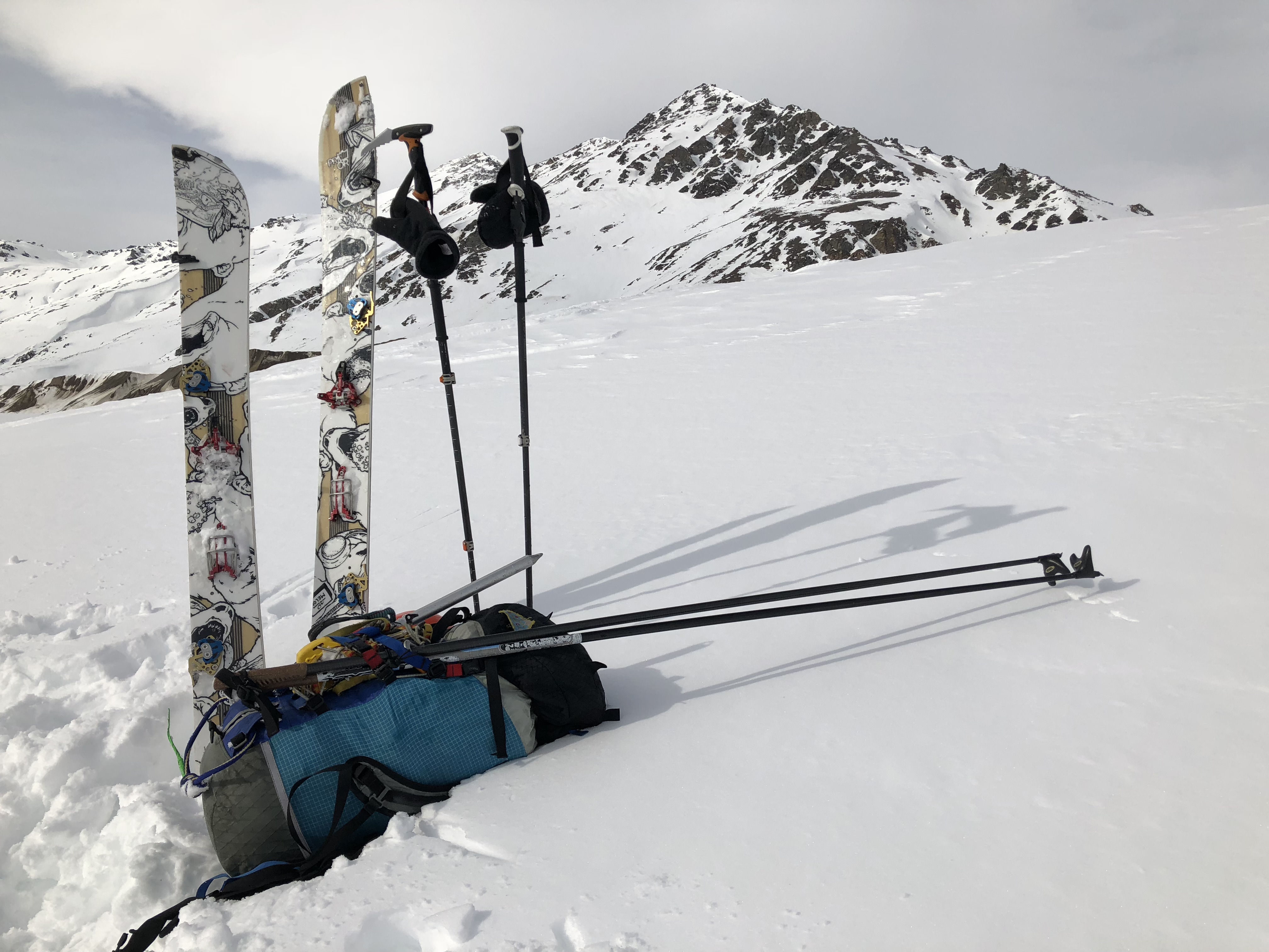
7 hours after I solidified my decision to leave, my dog was with my roommates, my Subaru was packed and I was ready for any mountain adventure my mind could desire: multiple pairs of skis, five ski poles, three types of ice axes, three pairs of boots, a splitboard. A large bag of impressively-strong dehydrated espresso powder, a multitude of prepared meals, and a giant bag of chocolate-covered coffee beans would be my fuel.
The nice part of alpine-style soloing from the road is there is no need to haul camping gear or glacier gear. There’s really no reason to have a rope if there’s no one to save you from a crevasse fall. I kept my mind away from such morbid thoughts, for the most part.
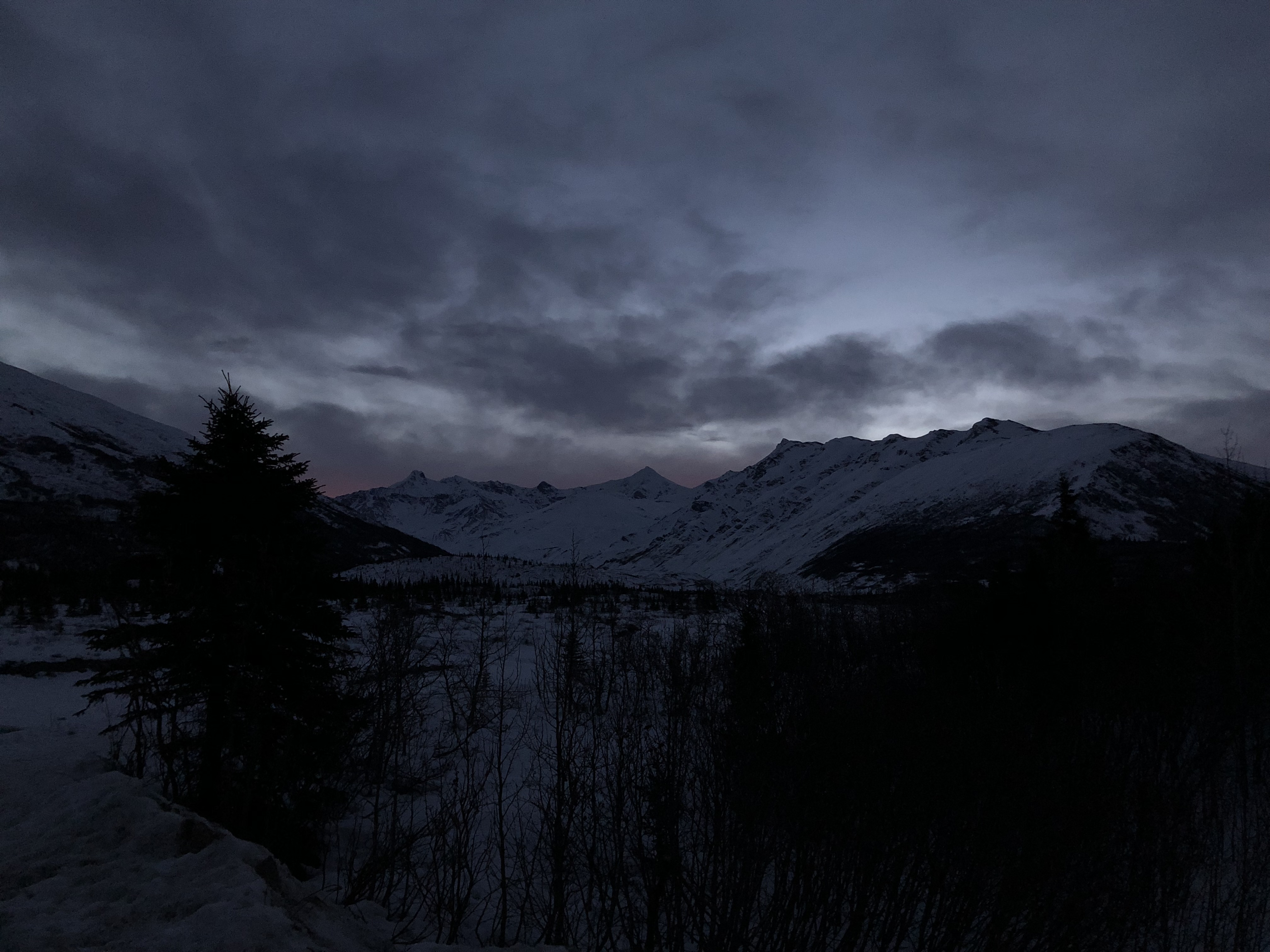
Wednesday evening, I was off like a rocket around 7PM and made it to the Deltas before midnight. I set my alarm for 3AM, giving my future self 3 hours of rest before heading up the Castner.
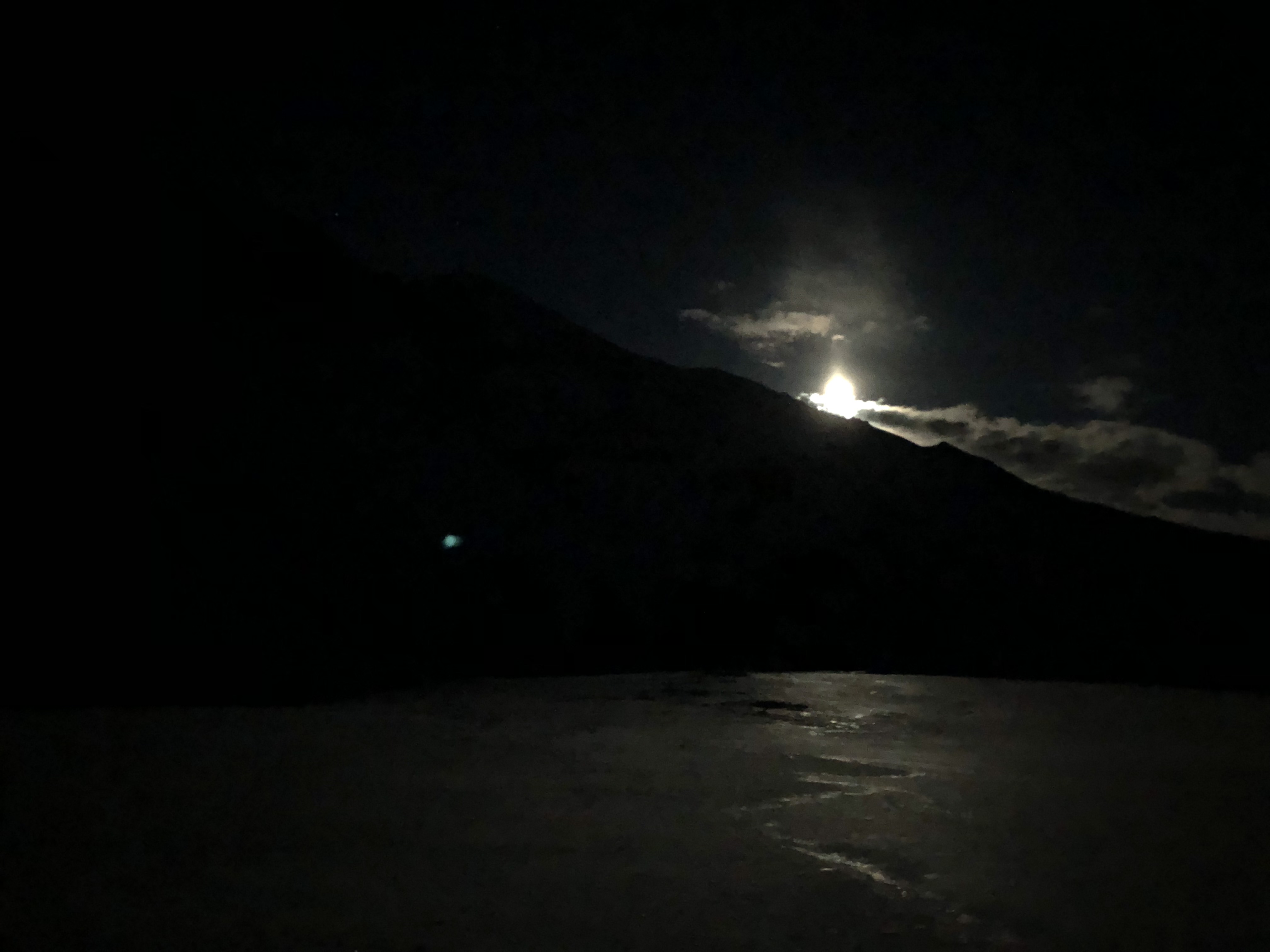
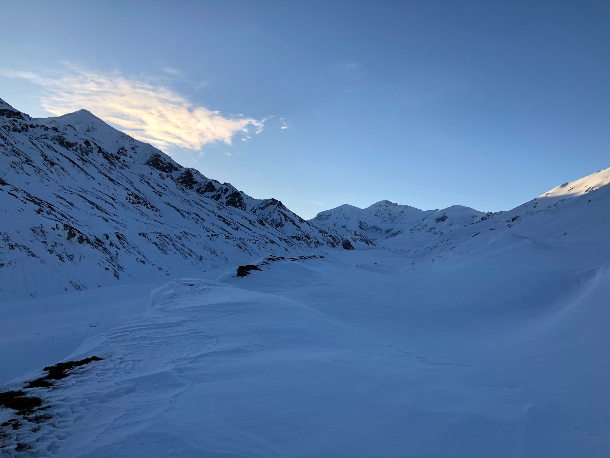
The version of myself that woke up at 3AM did not appreciate the decision made by my past self 3 hours previous, and delayed the wake up time until 6AM. Leaving the car always takes about an hour, for whatever reason. Headlamp not really needed due to the fullness of the moon and my late start, splitboard attached to my boots, and cross country ski poles lashed to my pack, I began the ski up the valley. The reason I visit so infrequently, besides drive time, is it becomes increasingly-difficult to mentally work myself up to ski the 7+ miles up the glacier necessary to get any worthwhile mountain climbing done. It usually takes at least half a year after a trip before I can convince myself I want to do it again.

2019 was a weird winter, and lucky for this trip crust season came early. A strong layer of sunmelted snow had refrozen a few centimeters thick and made travel easy and fast, aided by my very light backpack.
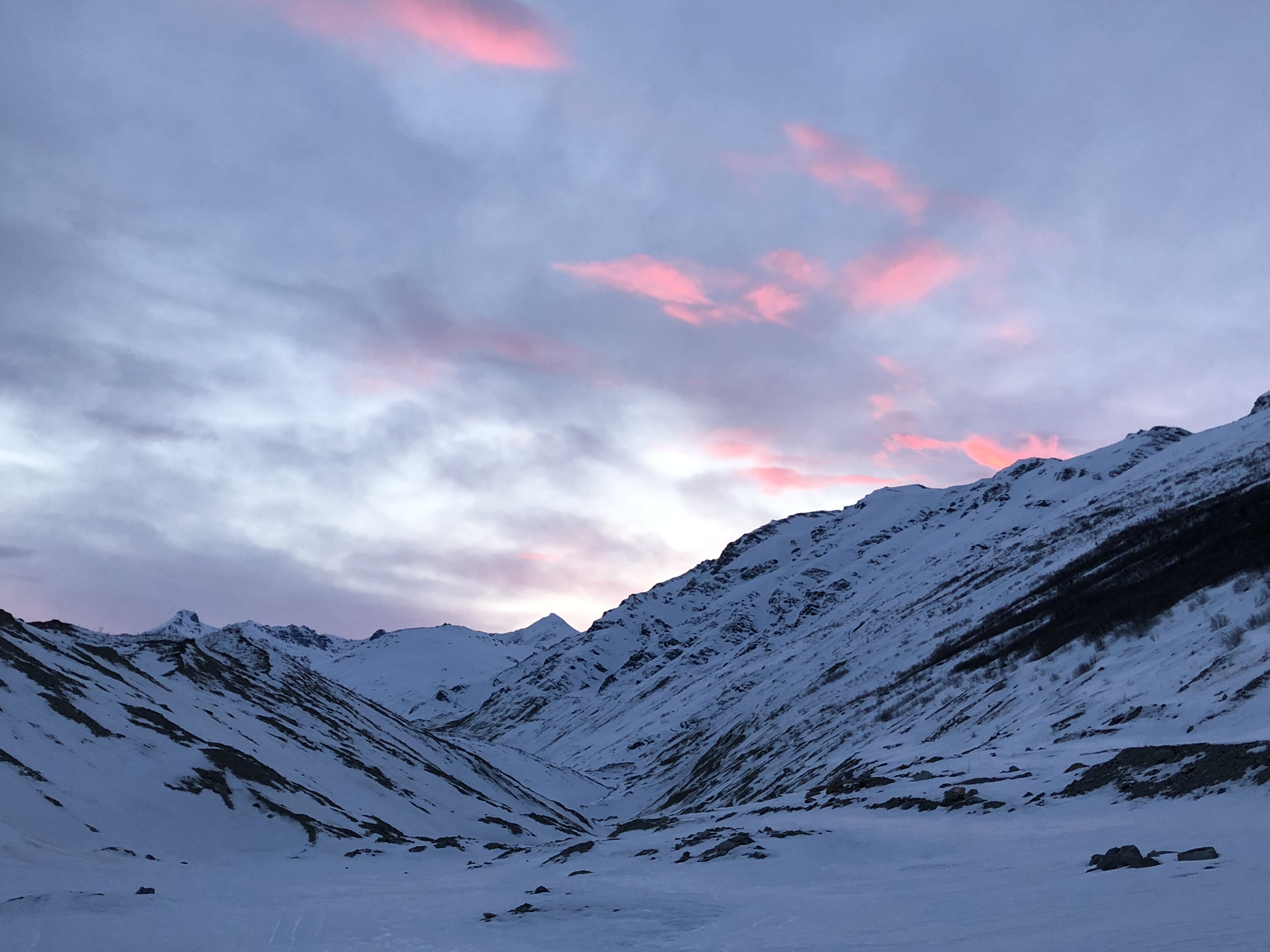


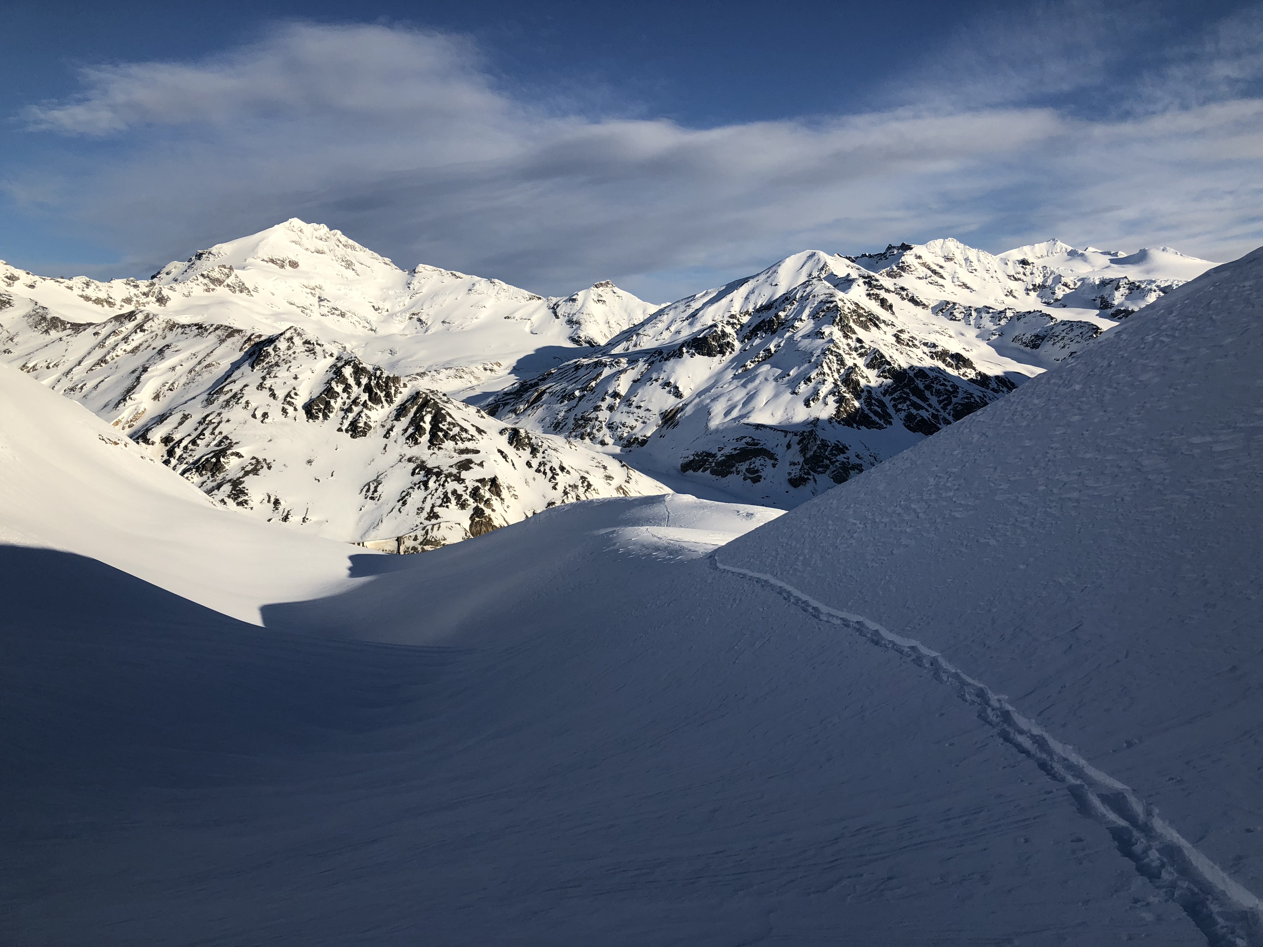
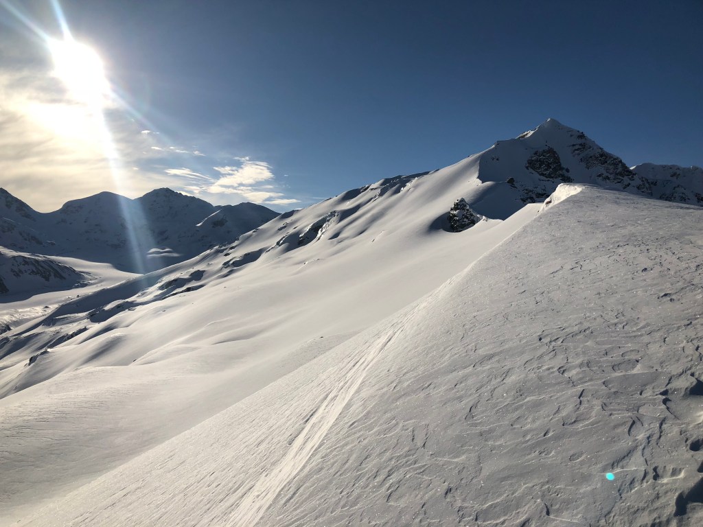
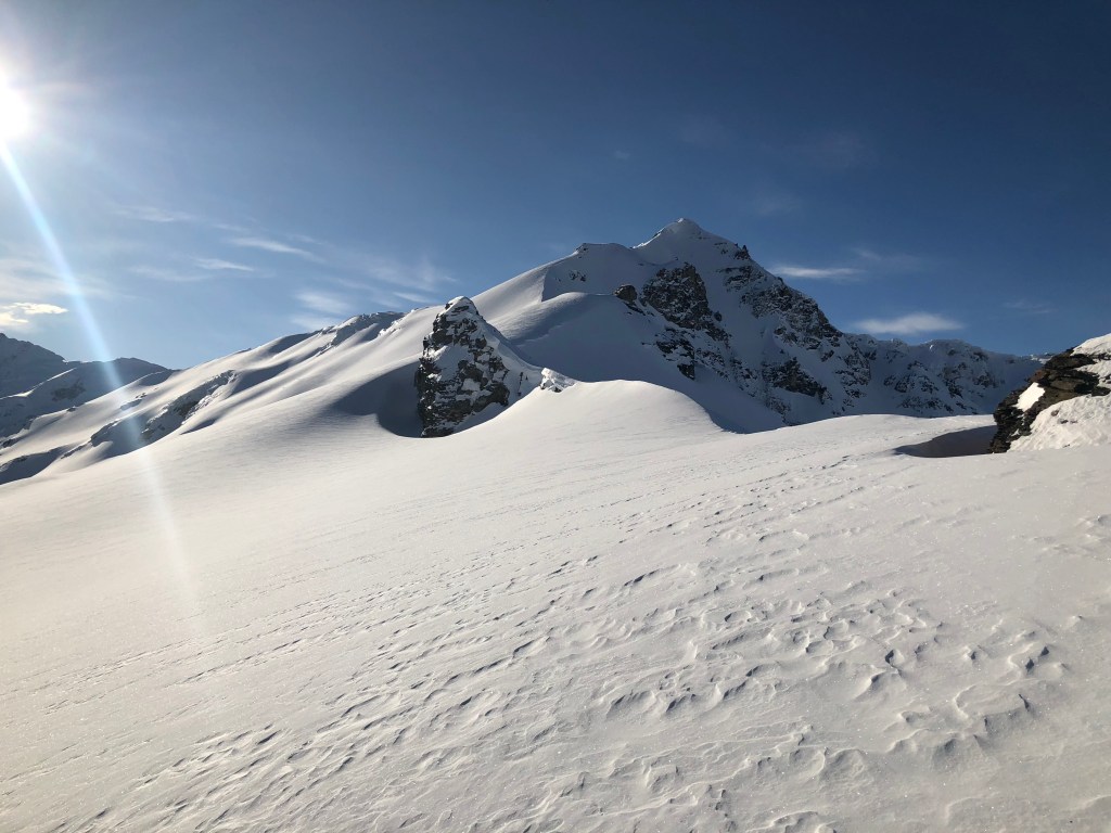
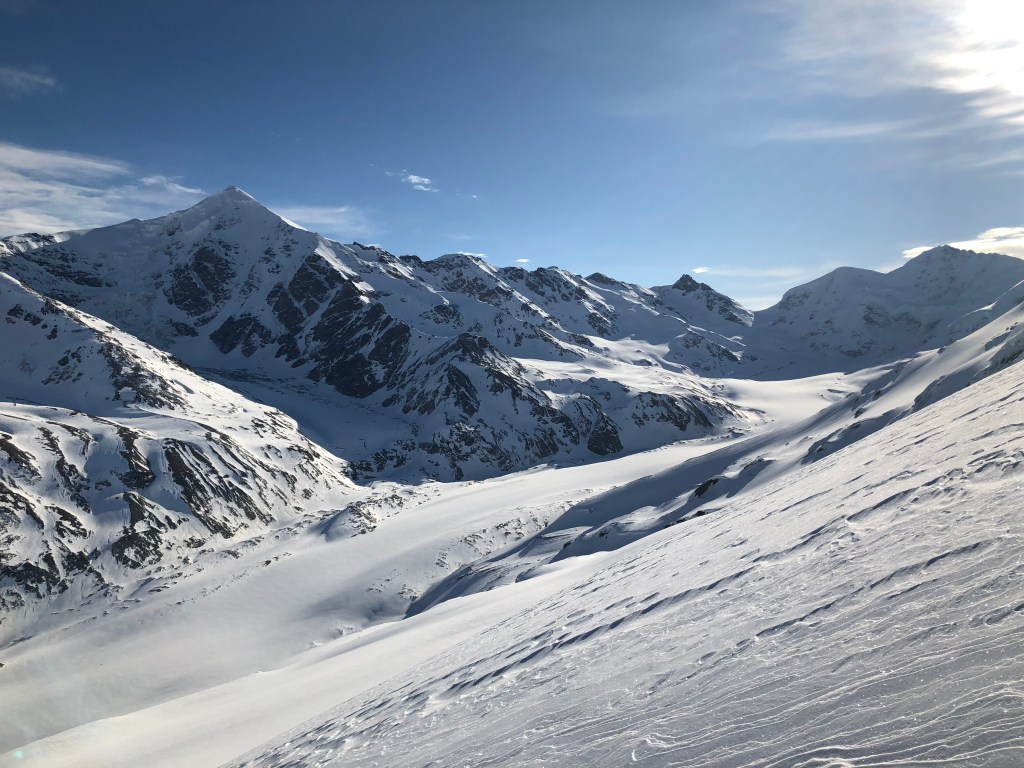
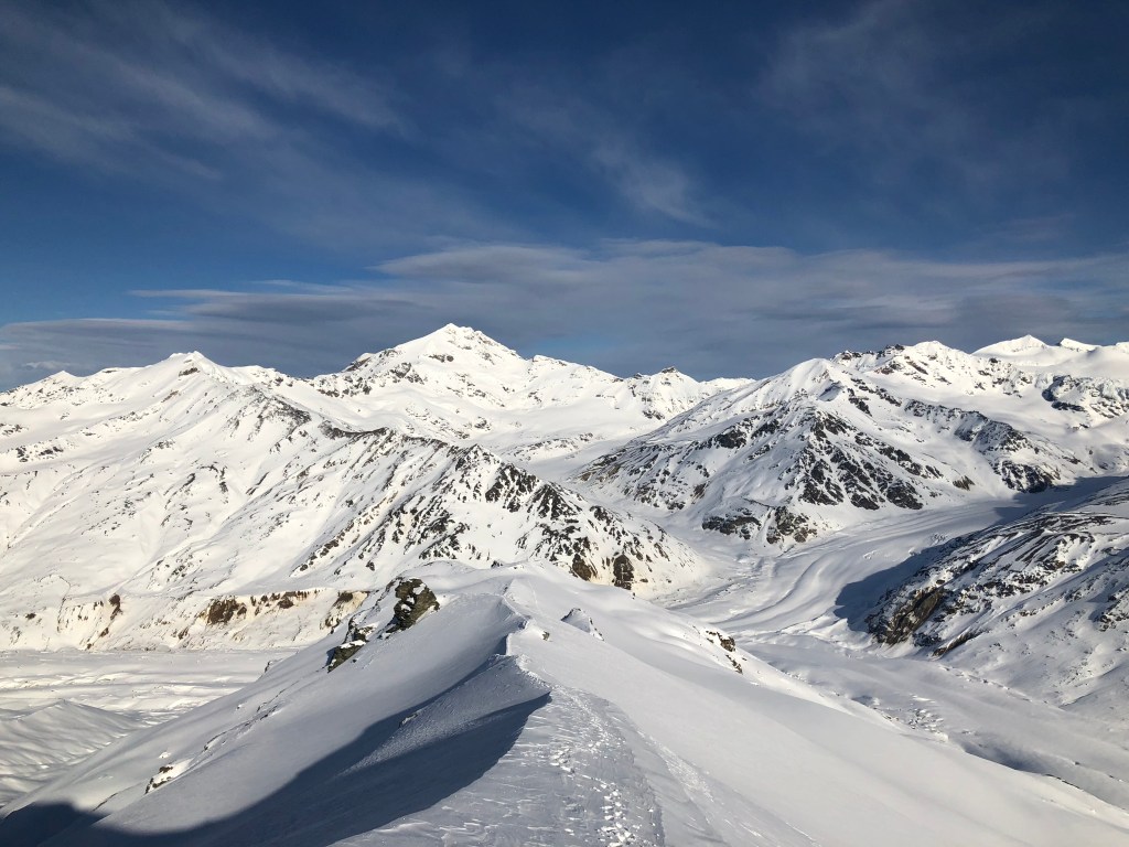
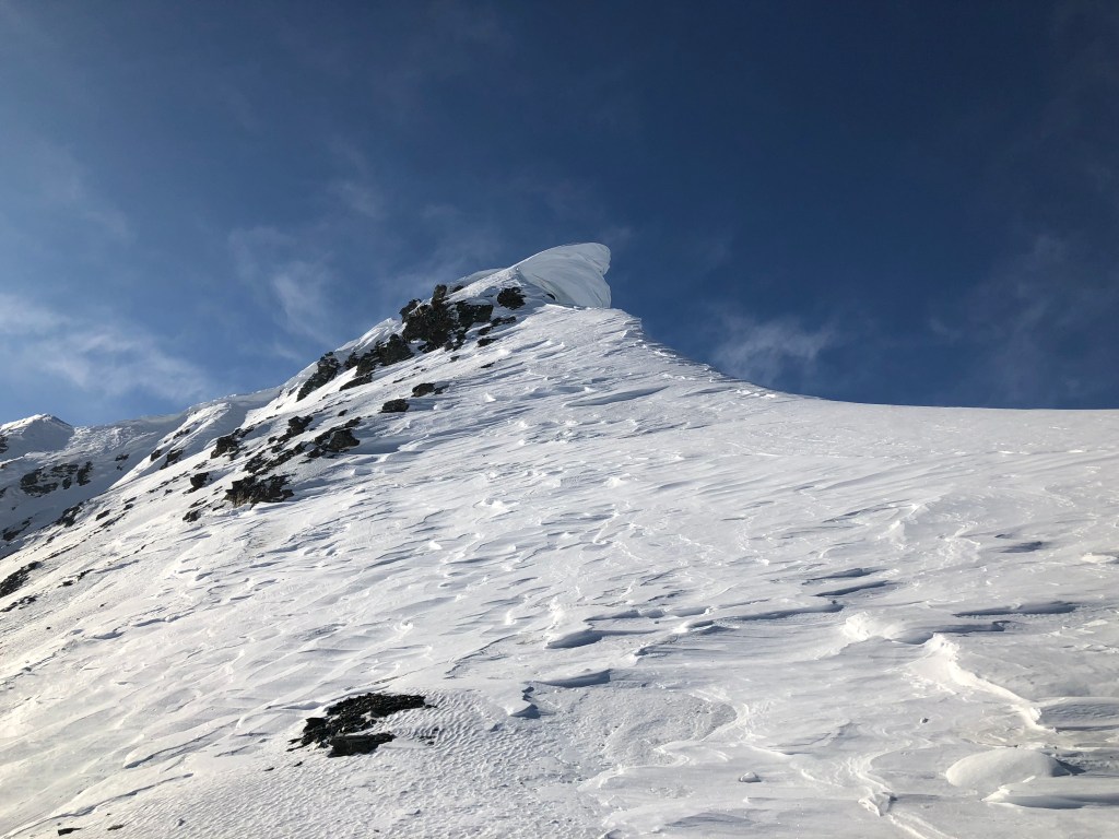
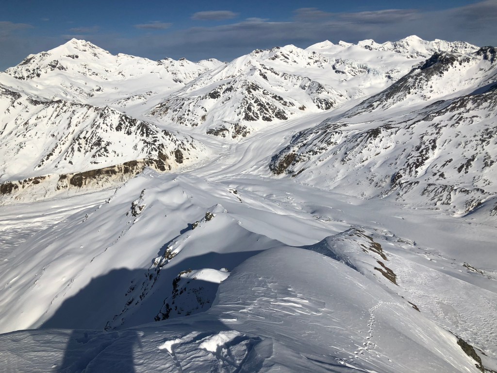
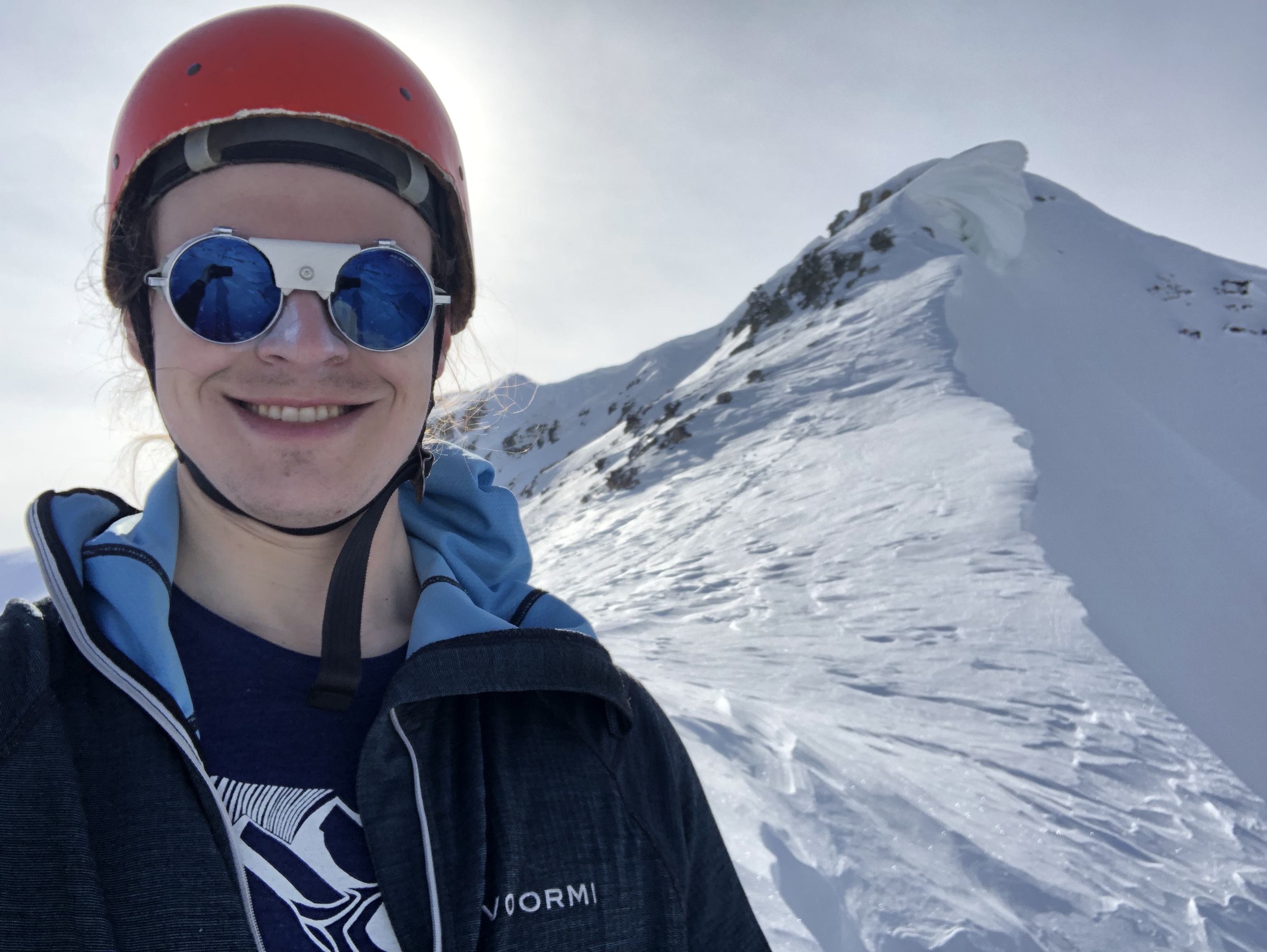
As I made progress from the valley floor to the terminal moraine of the glacier, the peaks became lit with alpenglow, sharing light with the rest of the landscape before the sun touched it directly. In my hubris, I had let my mind venture onto the idea of climbing Triangle Peak on my first day in the range. Discarding this idea around 9AM due to my evaluation I already had insufficient time to climb that peak, I turned my interest towards a small bump in the range about 2-3 miles closer, a tutorial peak known as Rum Doodle. Despite it being one of the most commonly-climbed peaks in the Deltas, I had never ventured up it; I was always in pursuit of higher objectives.
Many climbers find their way up this baby peak as their first foray into the Deltas; though “official” route information is scant, a climber can take nearly any path to the summit their eyes can find.
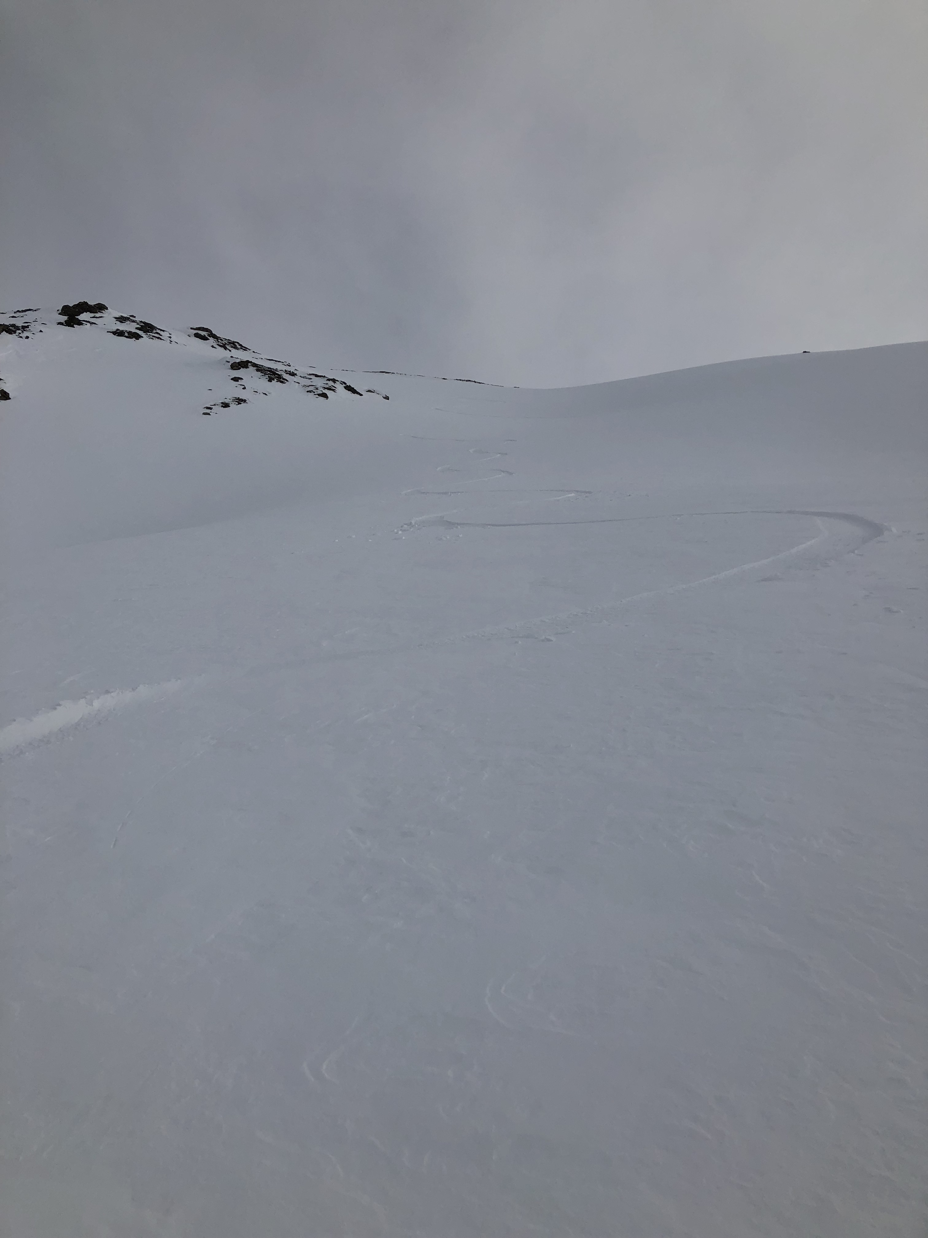
I made my way off the moraine and to the lower slopes of Rum Doodle via an ice bridge formed from an old glacier fracture filled in by snow via wind and avalanches. Pointlessly turning my avalanche-rescue beacon on, I skinned up towards a concave slope to reach a rock band that traced a barely discernible ridge up the mountain. The temperatures were unseasonably warm for March, and much of the snow had begun to deteriorate from the heat. On the same concave slope, I also encountered bulletproof snice. After a while I was unable to ski over the terrain, so I took off my splitboard and alternatively broke through the crust into deep snow or kicked steps into the snice, depending on the mood of the mountain. After I reached the rockband, I strapped my board to my pack and donned crampons.
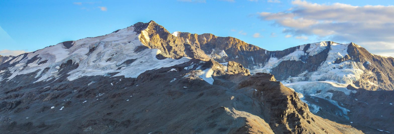
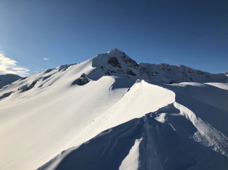
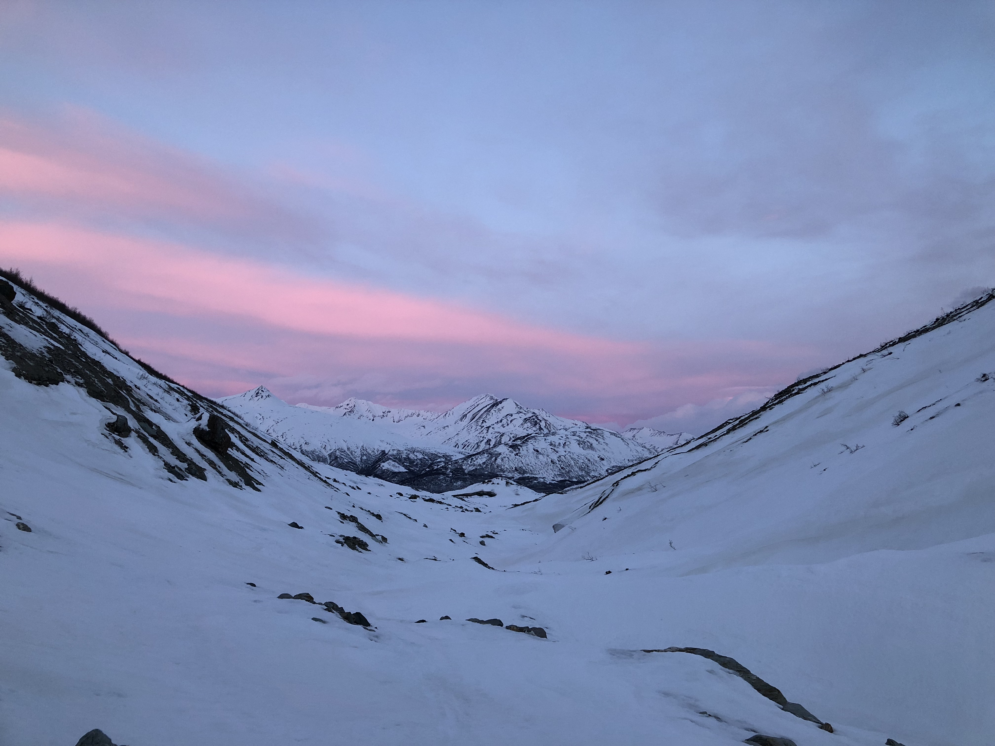
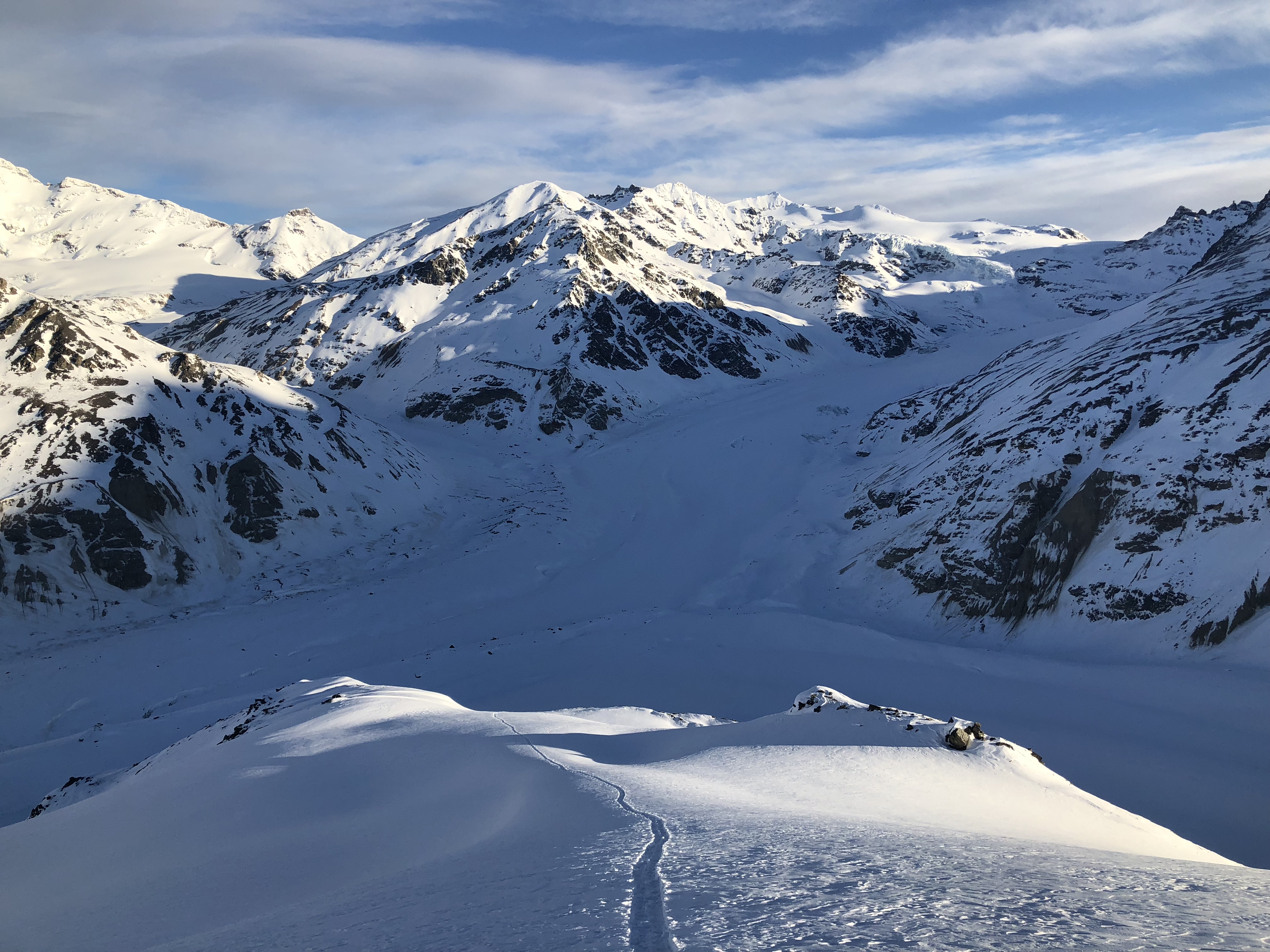
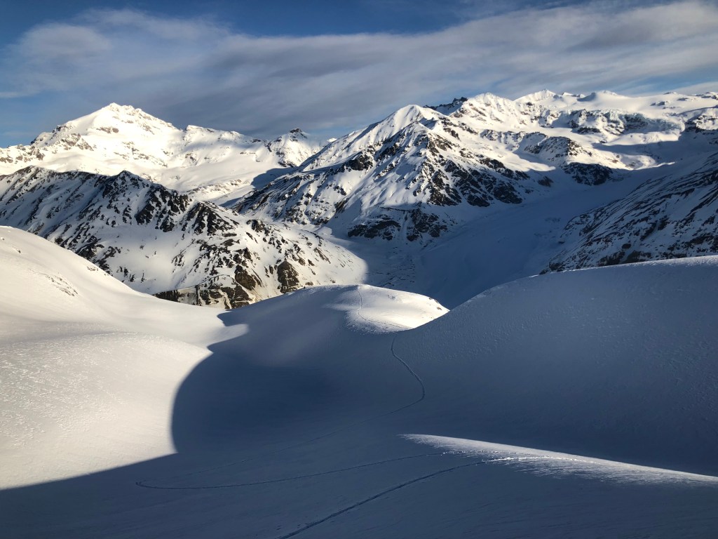
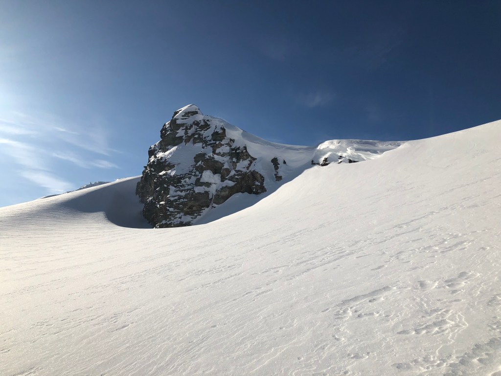
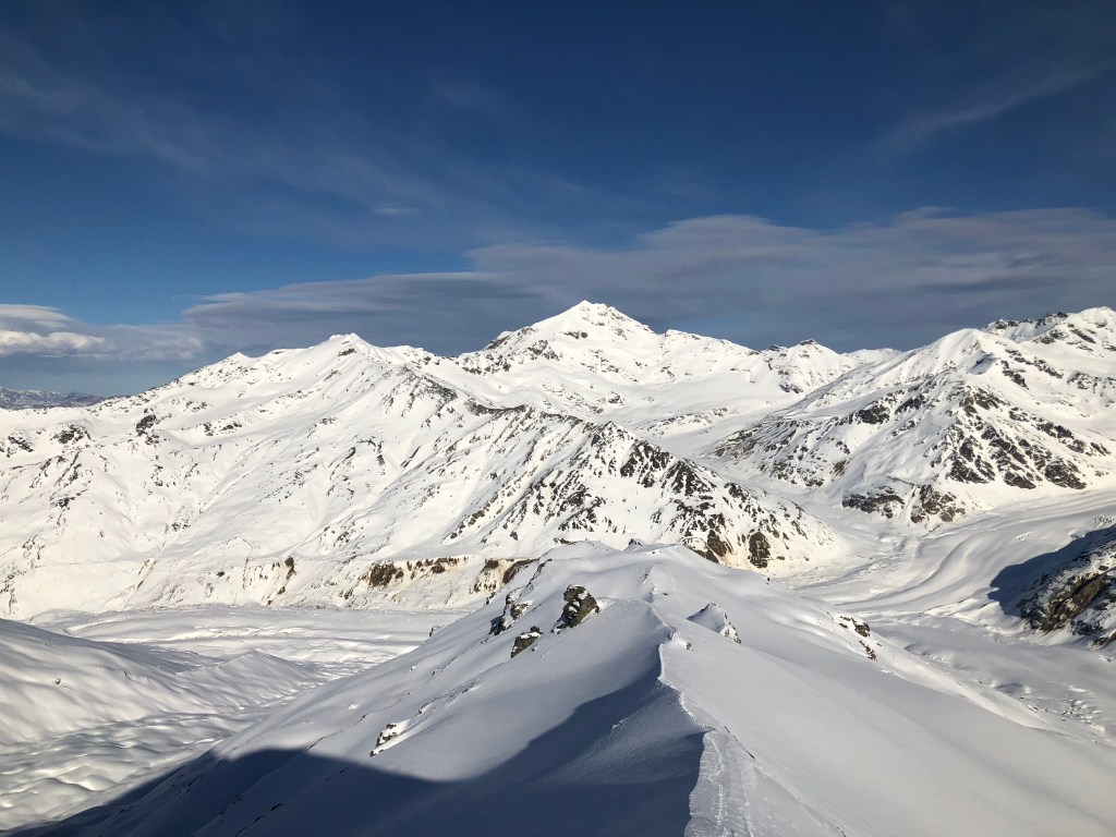
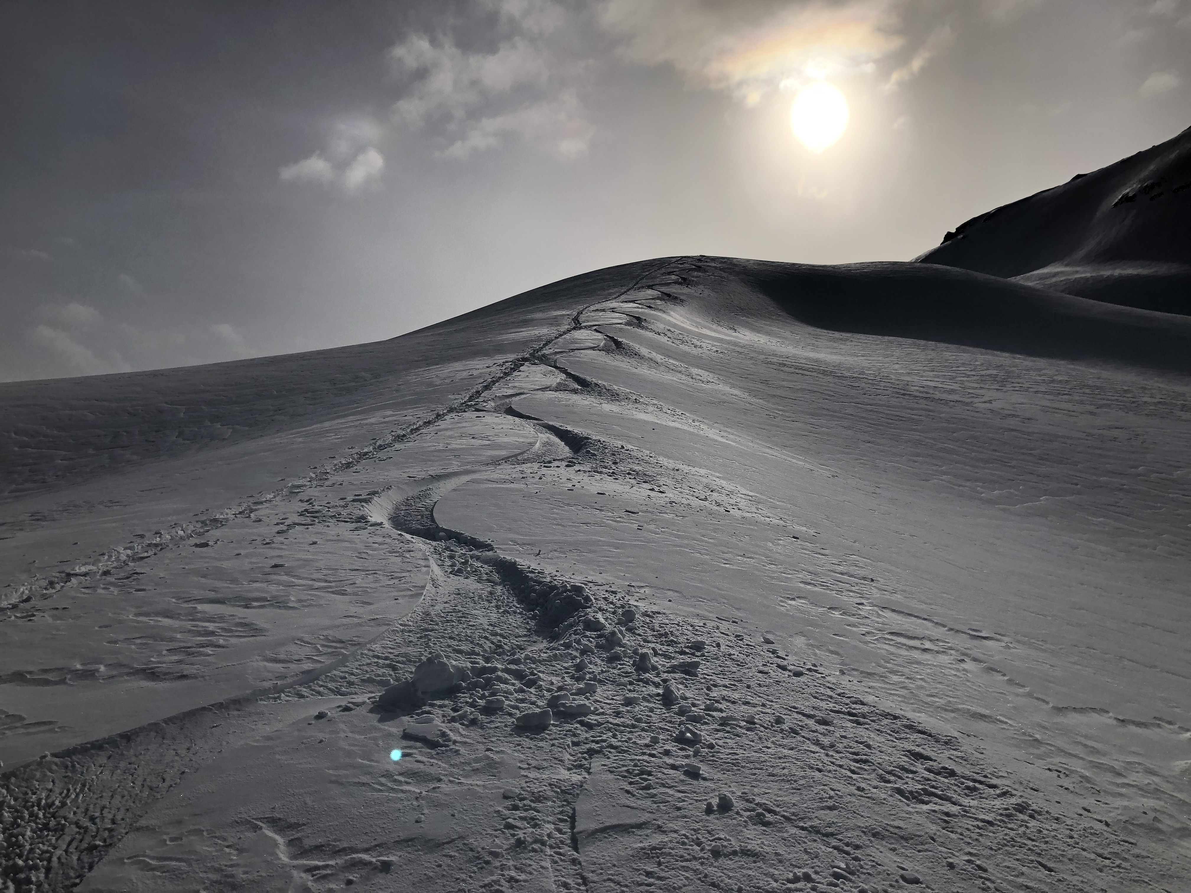
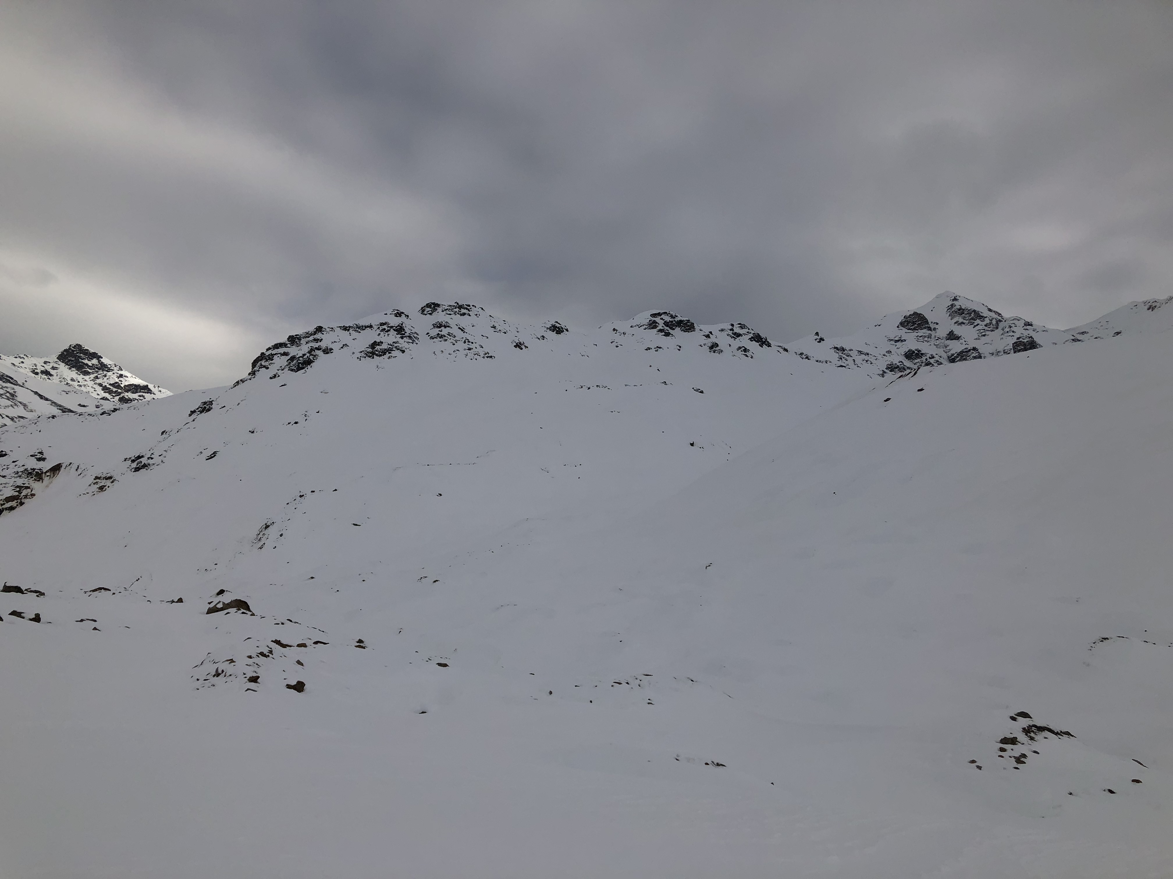
as seen from Rum Doodle
As I moved up the mountain, the snow became more consistent and trustworthy. As I broke over a lip near the middle of the mountain and gained sight of the summit, I swapped my crampons out for my splitboard and continued skinning my way towards the top.

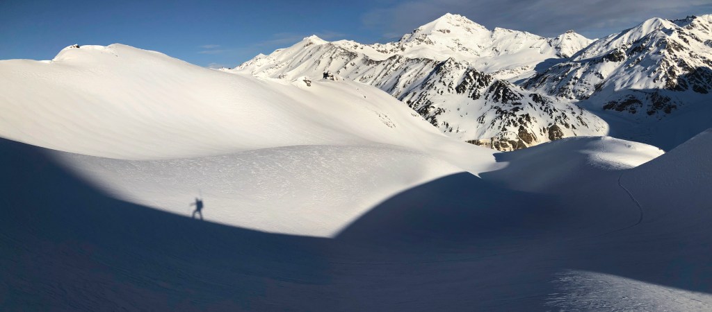
I rounded the north side of the mountain and saw a feasible way to the summit ridge, where a few large rocks I was not going to climb marked the true high point of the mountain. About 10 vertical feet from the ridge, the snow became too steep and soft to continue skinning, so I had to dismount and reach the top on foot. The sun kissed the top of the mountain and illuminated the previously unremarkable southern slopes. Taking a break on top, I realized I never left my skate ski poles at the base of the mountain like I had planned. As they effectively weigh nothing, I didn’t see a reason to care.


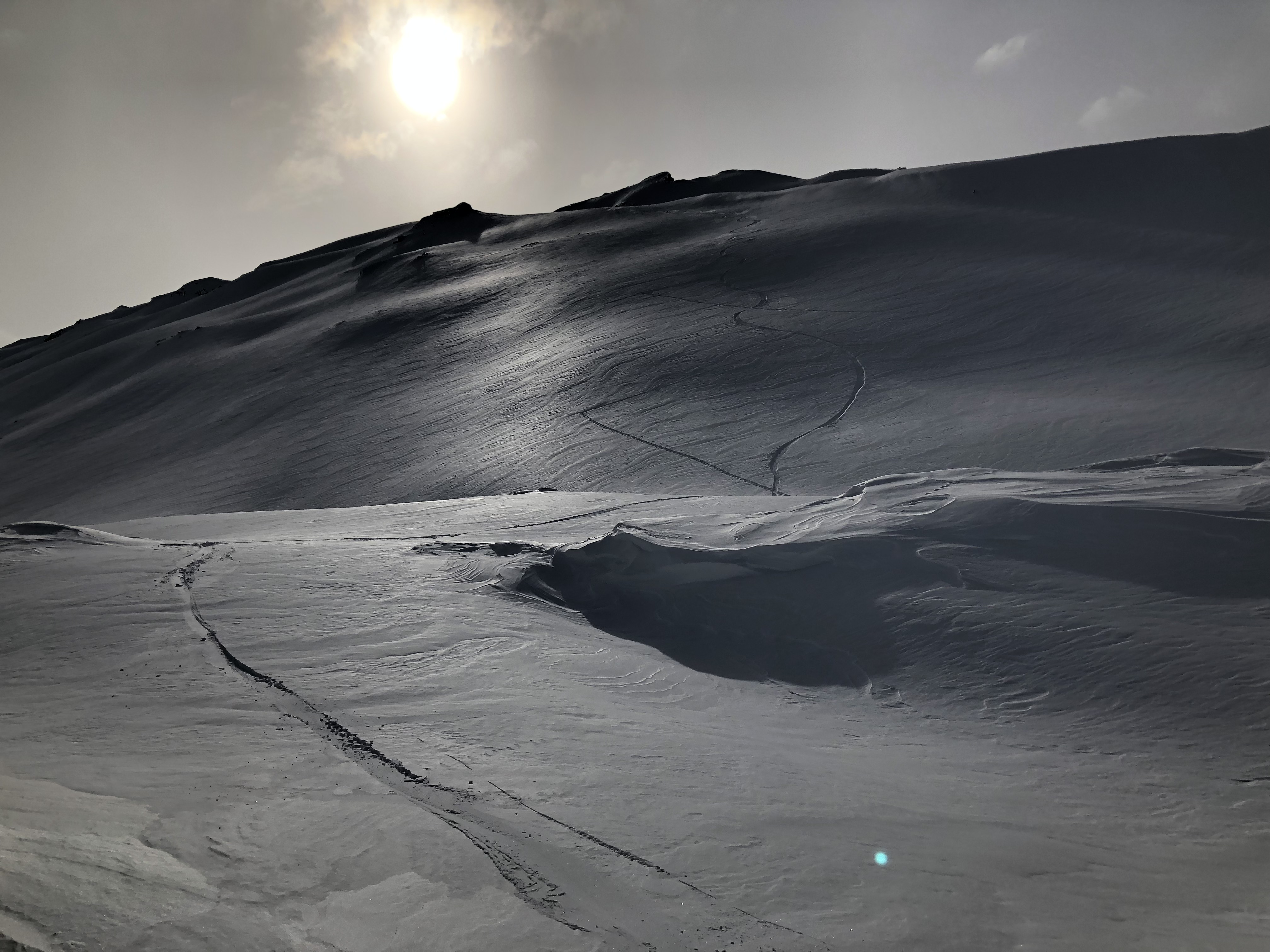
The steep but continuous southern slopes offered a sunny descent I couldn’t deny myself, so I packed up, removed the skins, assembled the two pieces of my splitboard into one and dropped in. From safe locations, I tested the slope a few times by gaining speed and stopping suddenly to load the slope. No signs of instability; from what I had examined there was a few feet of condensed powder coating this side of the mountain. All I had to do was manage the snow that sluffed off from making turns, typical. Time to send it!


The snow became varied and windpacked near the lower slopes of the mountain, but I managed to drop straight down the tricky slope to intersect with my old trail. I deconstructed my board, attached my skins, and made my way out on the still-intact crust. I used the skate ski poles I had meant to leave on the glacier to propel myself down the valley with much more leverage than the short mountaineering poles could offer.

I reached my Subaru by late afternoon and had the idea of climbing Silvertip Peak solo, another familiar mountain I climbed in years past. Parking at the access creek, Michael Creek, I went to bed early for a 2AM wake up.
I woke before midnight to relieve myself, and noticed the crust I was hoping would be created during the few hours of freezing temperatures at night had not yet formed. The air temperature was still in the 40’s and the snow was isothermal: it wouldn’t support weight. Upon later waking up in the darkness of 2AM, I bailed on this idea and retreated to the relative comfort of the Castner.

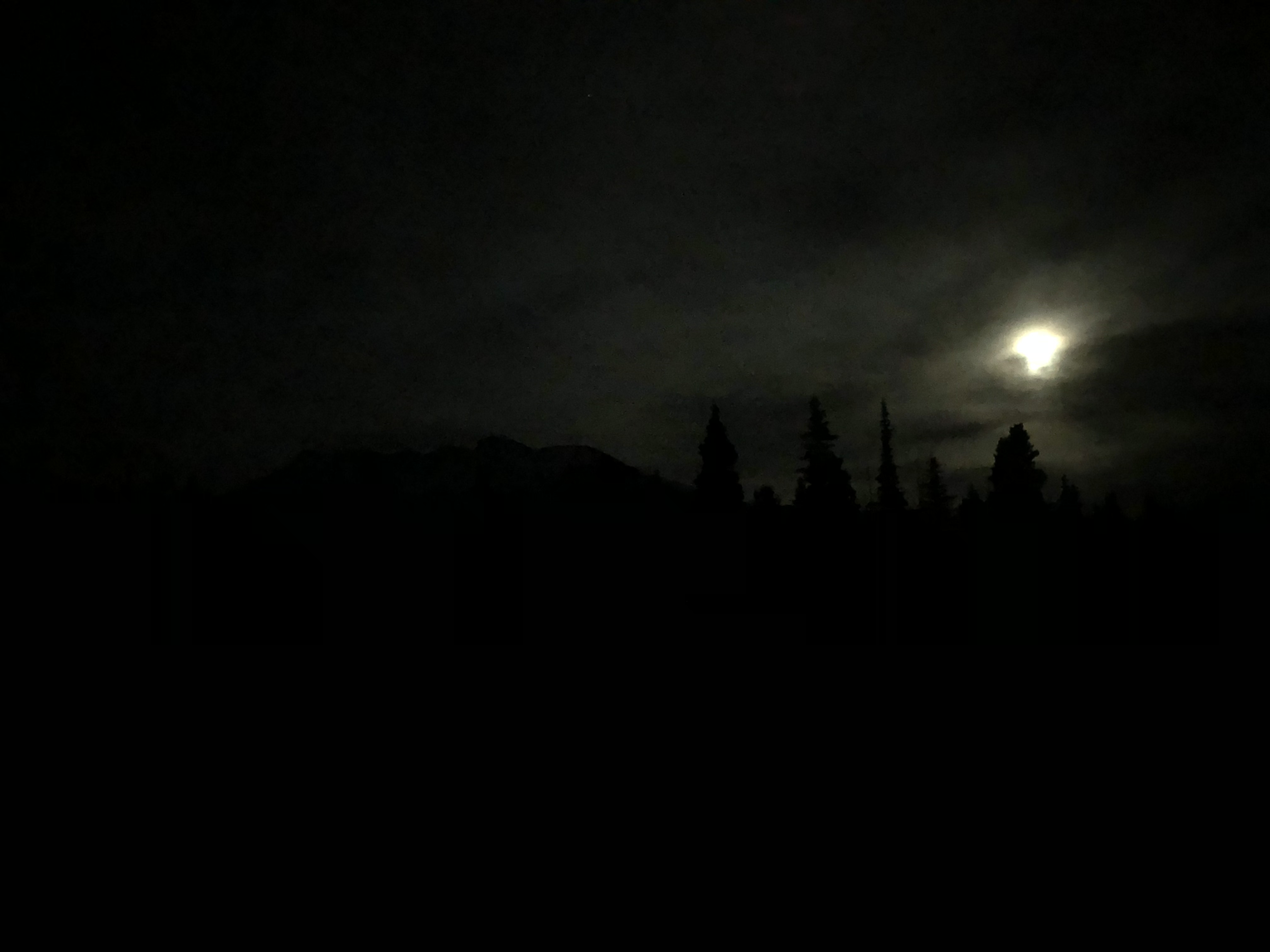
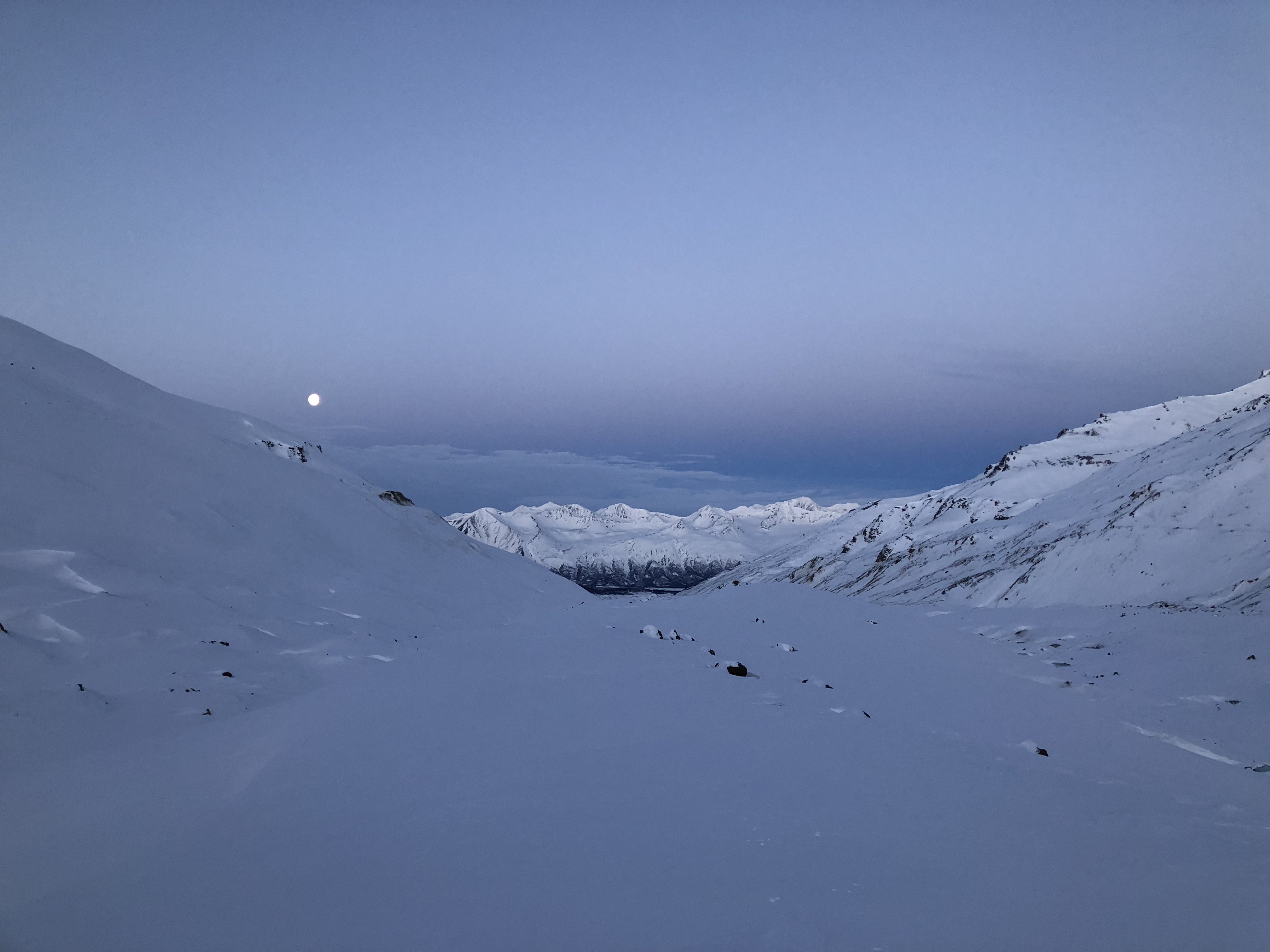
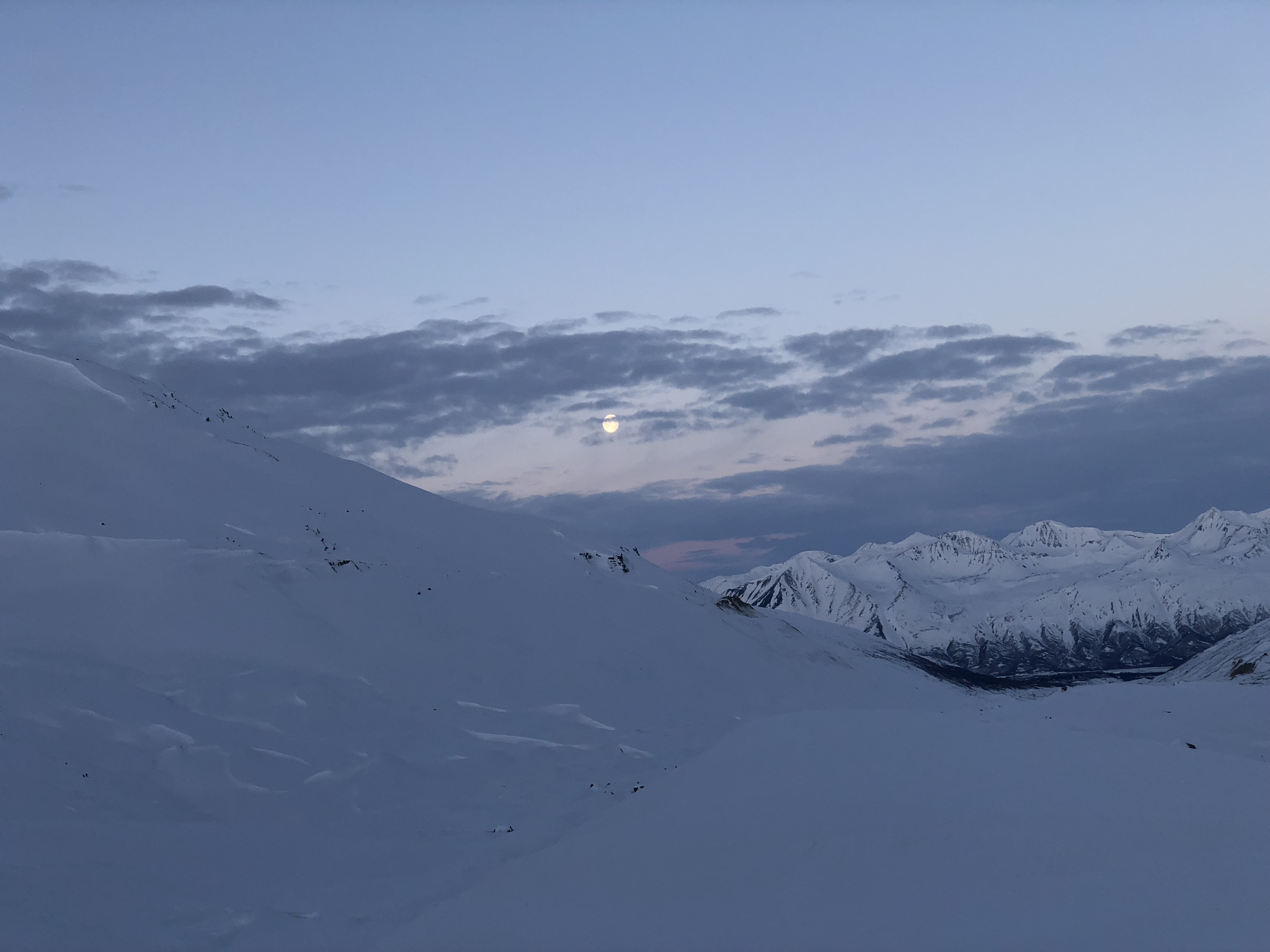
With such a light backpack and the thankful existence of wind/sun crust, for the second time in 24 hours I happily made my way up the valley. As I traveled up the glacial valley with the modest circle of light my headlamp provided, I noted the sky was evolving from black velvet with pinholes for stars to deep purple and blue. I switched my headlamp to red light to prolong the darkness. To the east, I saw what I thought might be aurora.

As the night faded and the sky brightened, the potential-aurora had barely moved, but my mind was still clinging to the idea until eventually I laughed, realizing I was actually just watching dawn rise through clouds. As I continued up the valley, I disappeared from the moon’s glow for a while into the shadows.

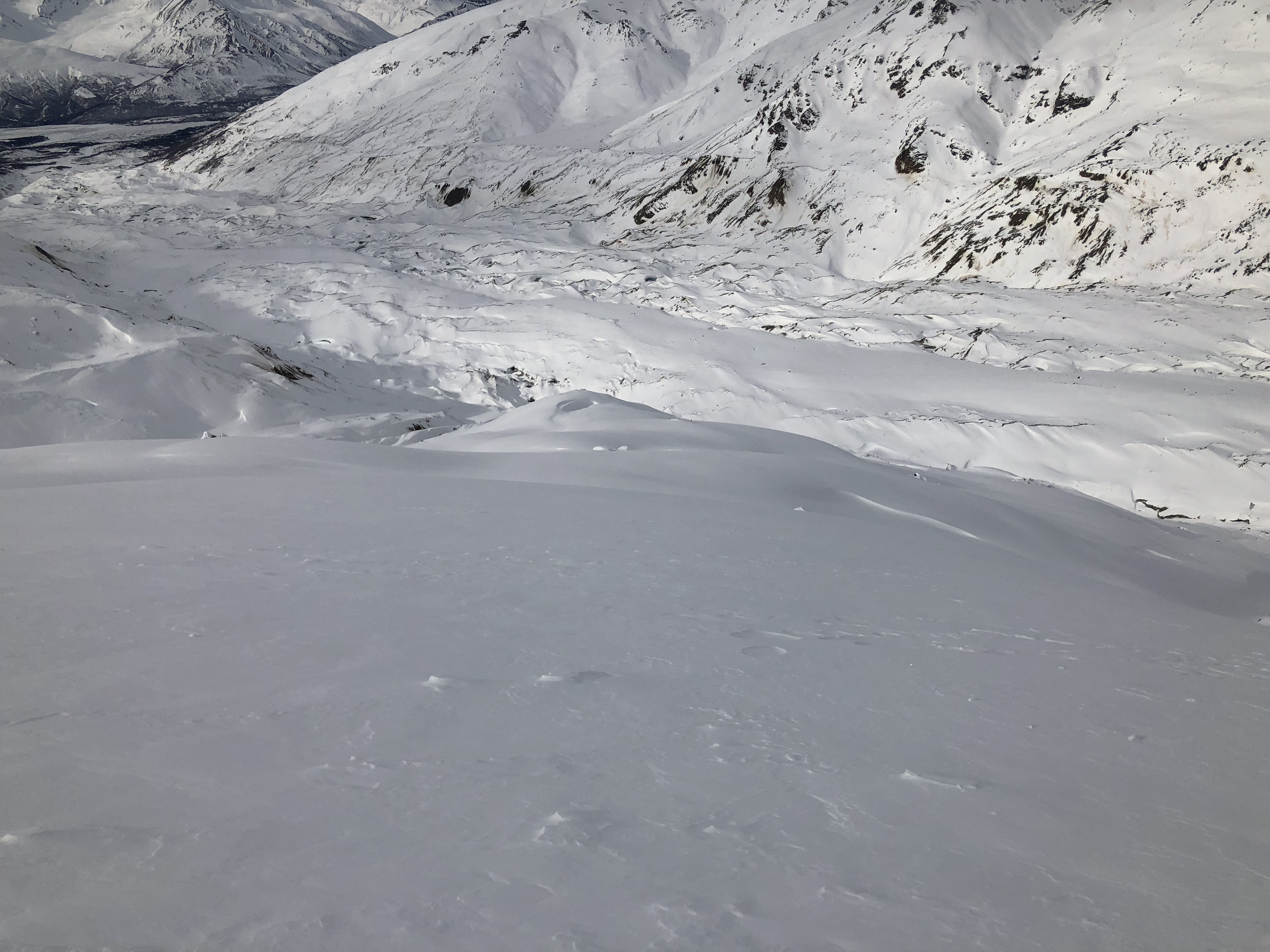
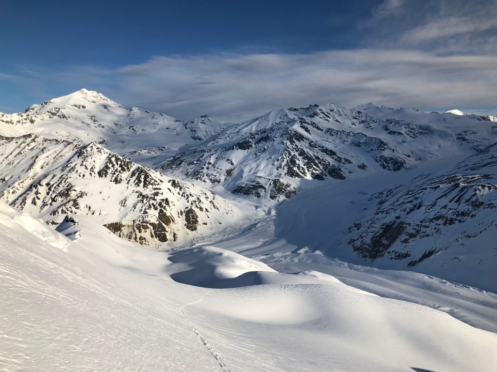
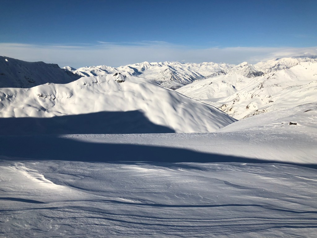
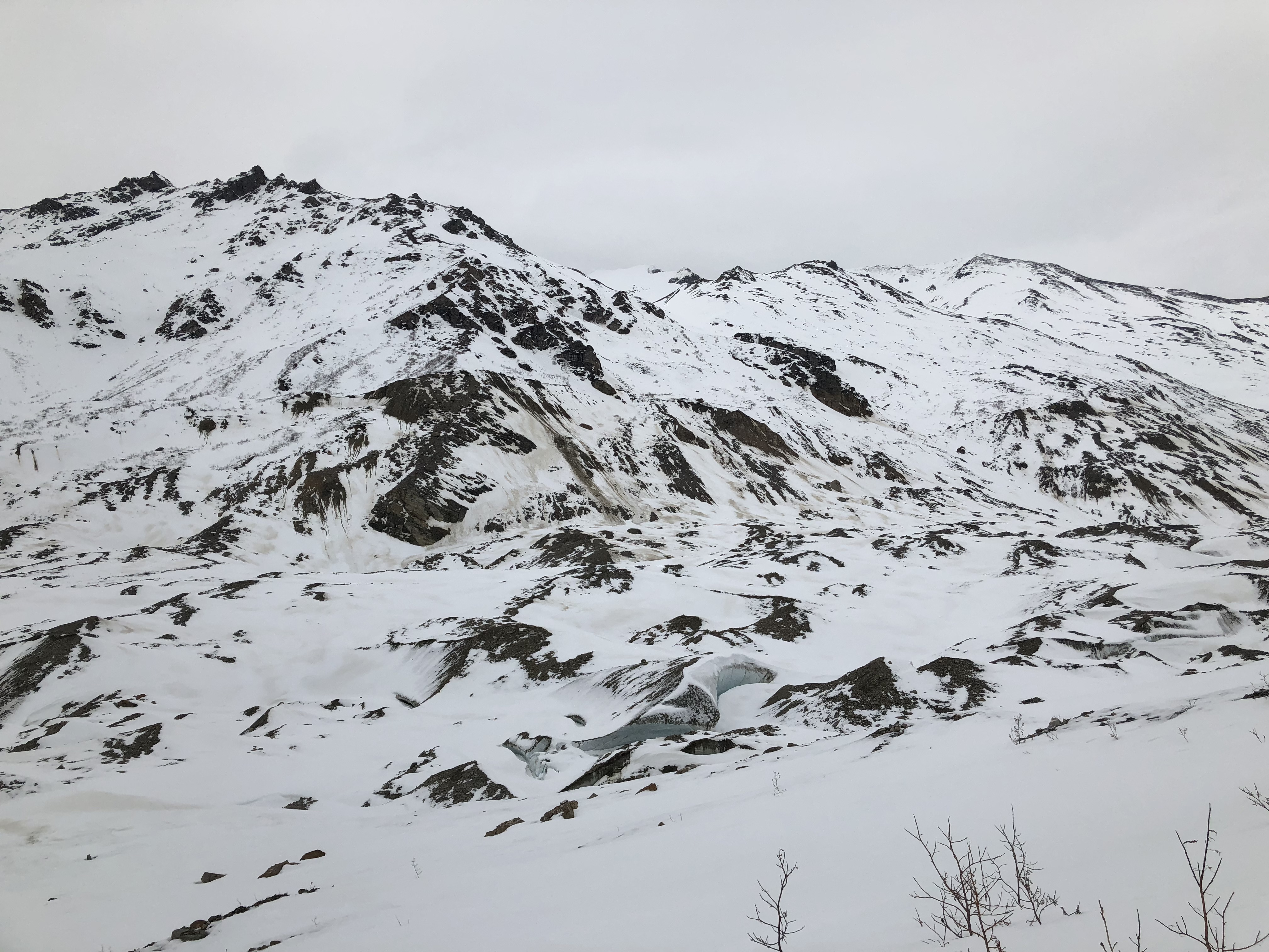
About seven miles and four hours and after leaving my car I reached the Confluence of the three branches of the Castner, an again-familiar site where the rocky surface of the moraine transitions to bare glacial ice, observable in the summer. Over the years I’ve traveled it, the Confluence has indeed dropped in elevation as the glacier melts away, though I believe the glacier itself has dropped less in recent years even as the moraines overtake the bare glacial ice and move up the valleys. The Thayer Hut sits on a plateau between the the Silvertip and White Princess branches, the glacier used it be ~100’ below the plateau. There is now close to 400’ of elevation difference between the two. Terminal moraines continue to advance up the glacier; the rock on top of them absorb thermal energy from the sun and cause the most change in landscape over time. At least, that’s my observation.
Leaving the medial moraine and skinning across the terminal moraine of third branch, the M’Ladies Branch, I noted a new melt feature, an apparent break crossing perpendicular to the valley which had somewhat filled in with snow.
Don’t ski across that.


I made my way to the lower slopes of Triangle, armed with knowledge from the previous day that this part of the mountain would likely present the worst snow conditions of the day. Not accounting for cliffs, the lower slopes of these mountains are often the steepest, as the glacier has had more time to grind them down more than the rock at higher elevations. If I encounter signs of avalanche danger, I’ll just turn around. If you form expectations or you risk being disappointed by outcomes.
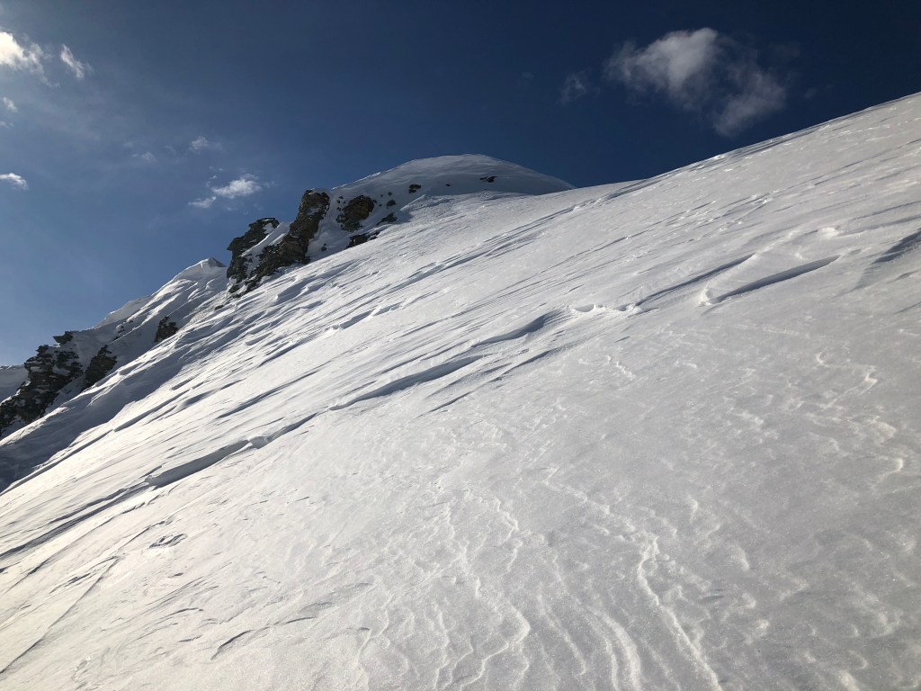
I zigged and zagged up a microridge on the corner of the mountain, finding variable terrain but nothing dangerous and not a single red flag indicating avalanche danger. I had to briefly switch to crampons to surpass some hard-packed snow. Climbing above glacial features is usually as temporal is it is scenic, I was happy to be out of range of a fall into a crevasse.

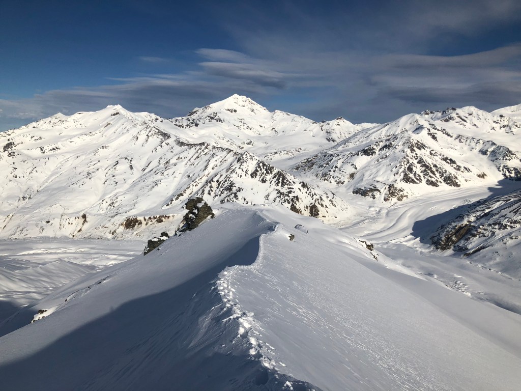
Reaching a glacially-carved valley lip roughly the same elevation as the Thayer Hut plateau, I traversed the middle slopes of Triangle and continued the zig-zag pattern up the side of the mountain to the main ridge proper.
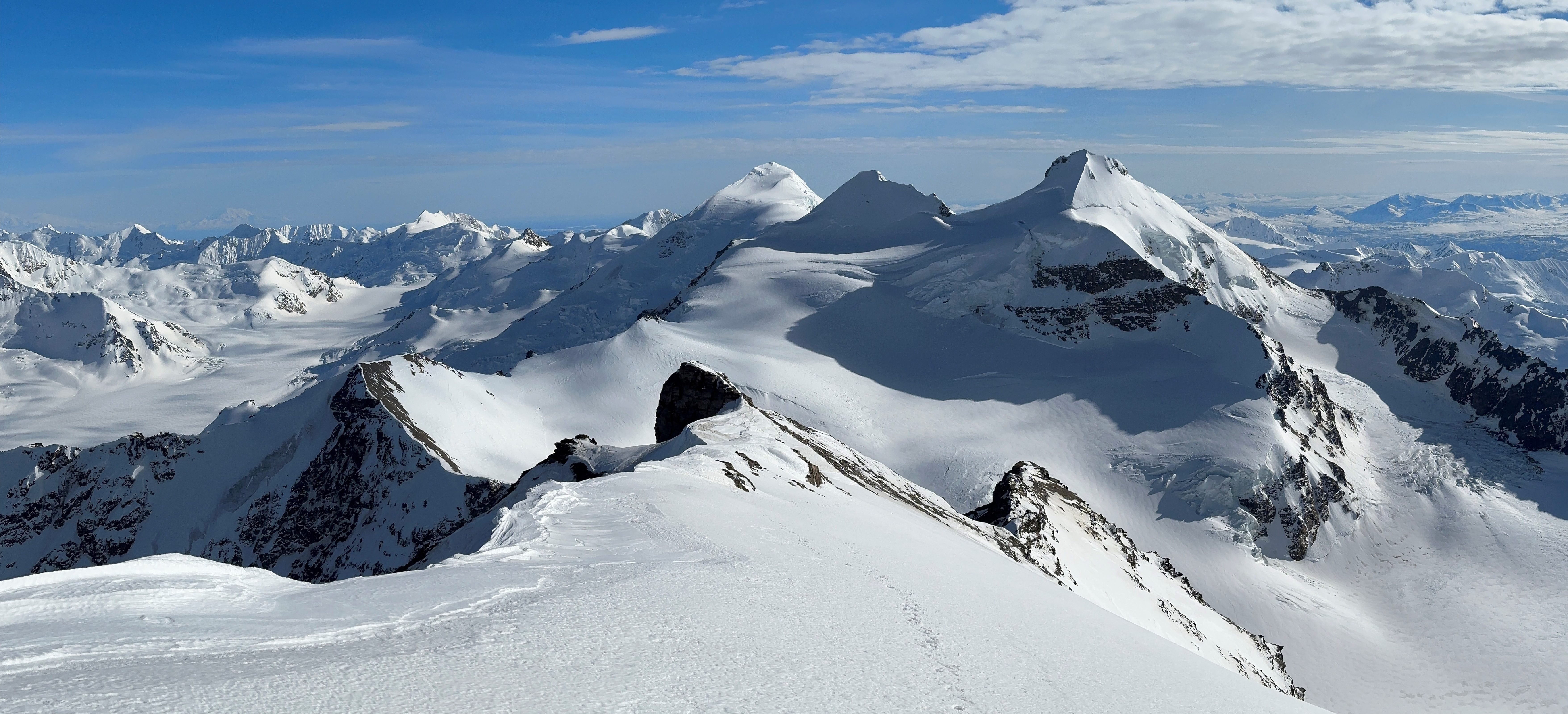
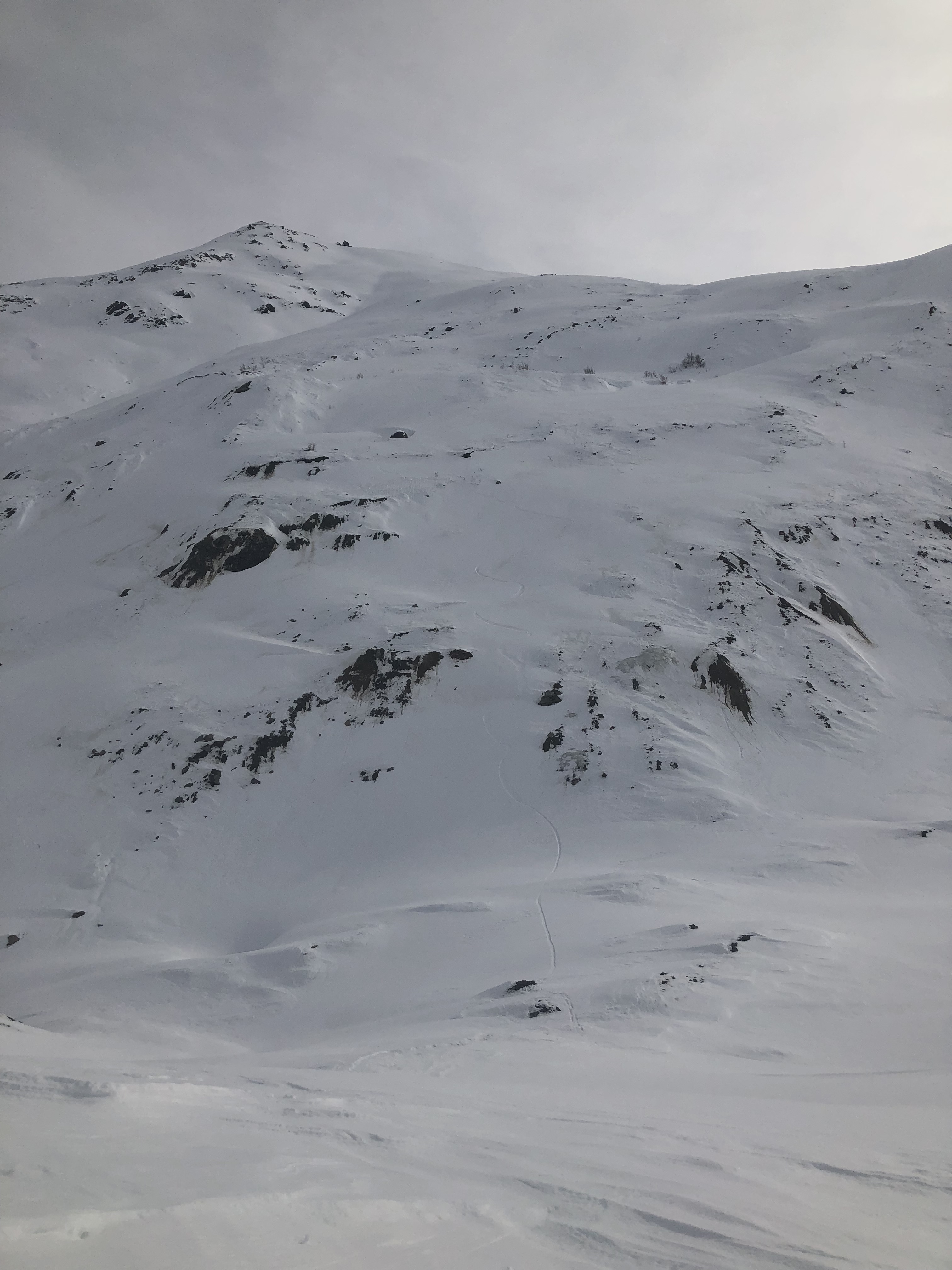
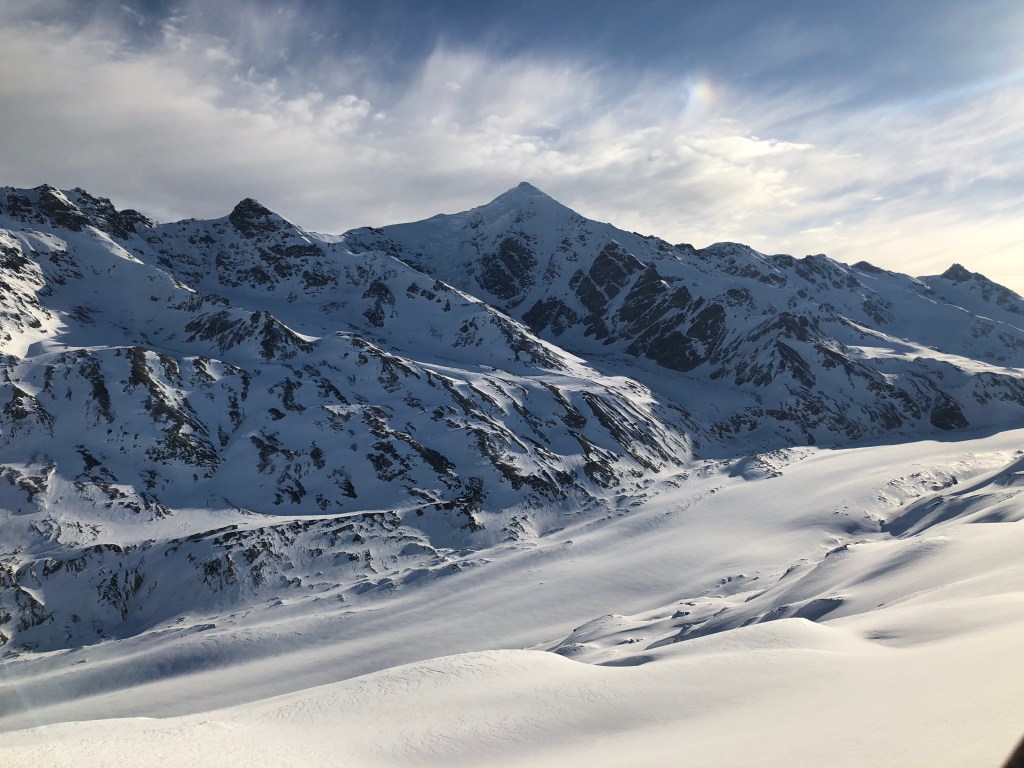
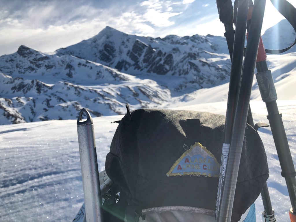
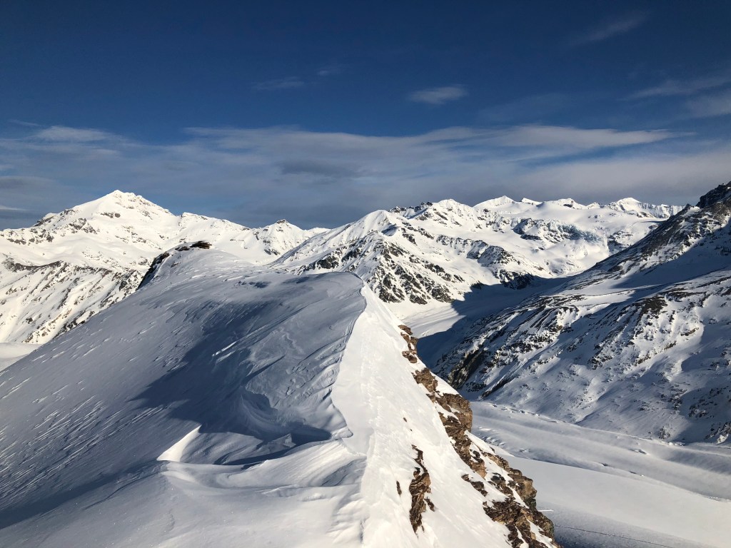
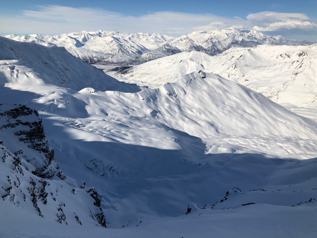
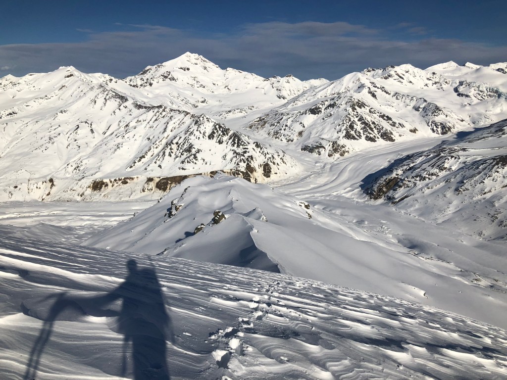
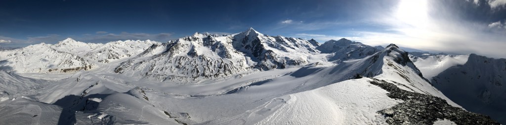
The surrounding 8000 and 9000’ peaks were spectacular. Skinning into the sun for the first time today, I lathered my nose in sunscreen. Forgetting if I should travel left or right at one point, I took one less-efficient path but got a good photo. It’s hard to get lost once on top: it’s a ridge, you go up it. I could see the Eastern Alaska Range, the Hayes group, 30 miles to the west.


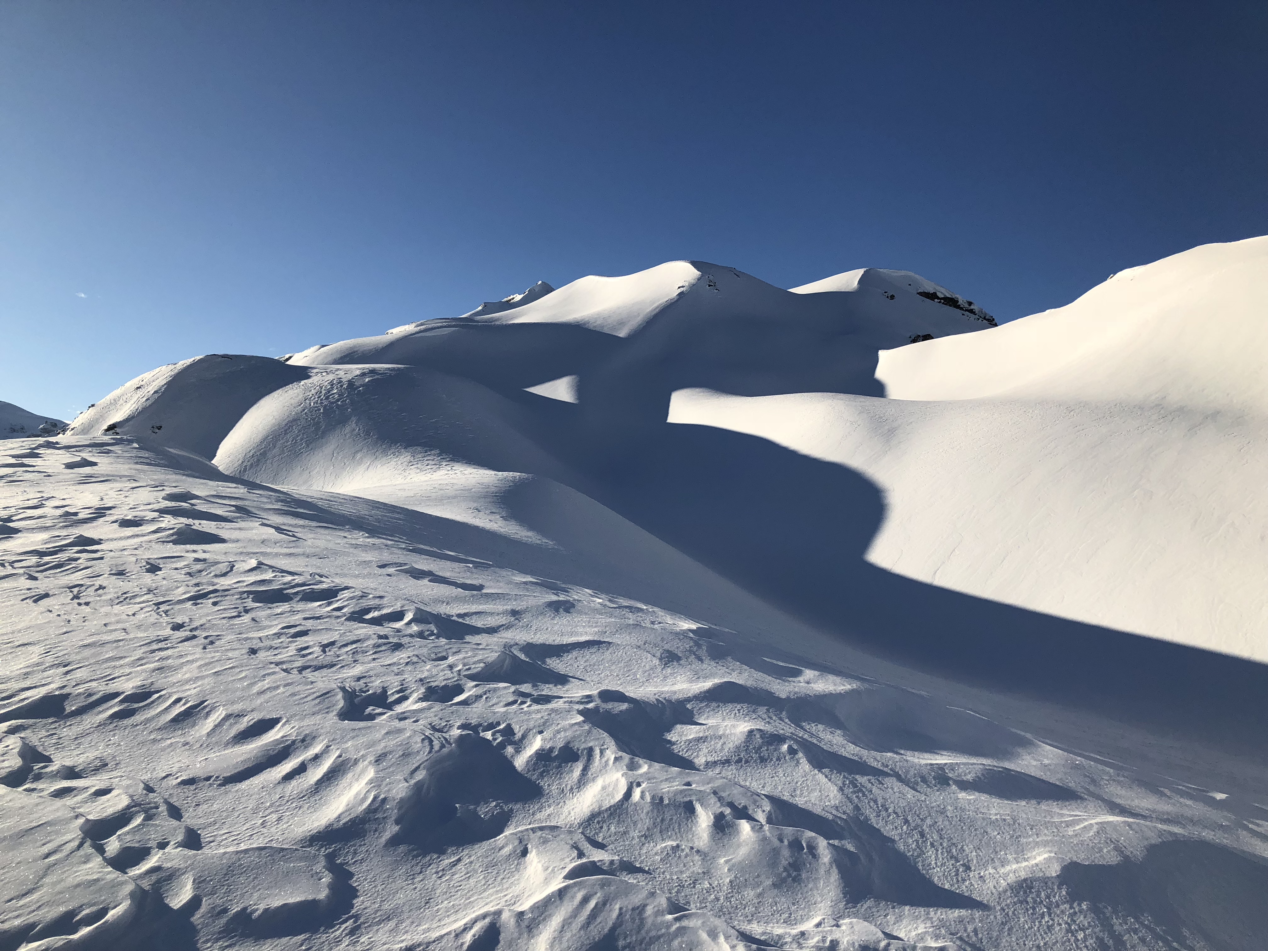
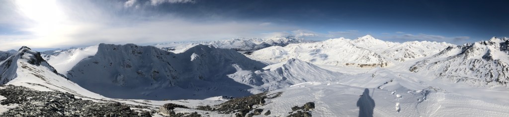
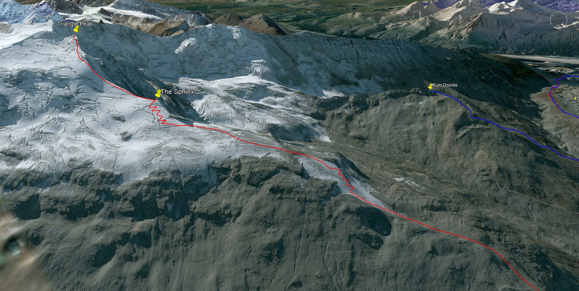
Unremarkably crossing into glaciated terrain, I made my way around a giant gendarme and to a rock outcropping known as the Sphinx. I traded splitboard for crampons and made my way up the top portion of the ridge proper, just as the bitterly-cold winds I associate with higher altitudes started picking up.
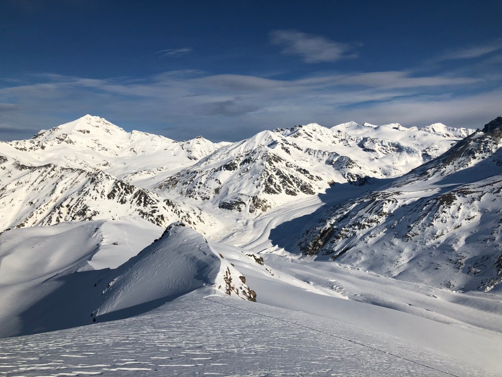
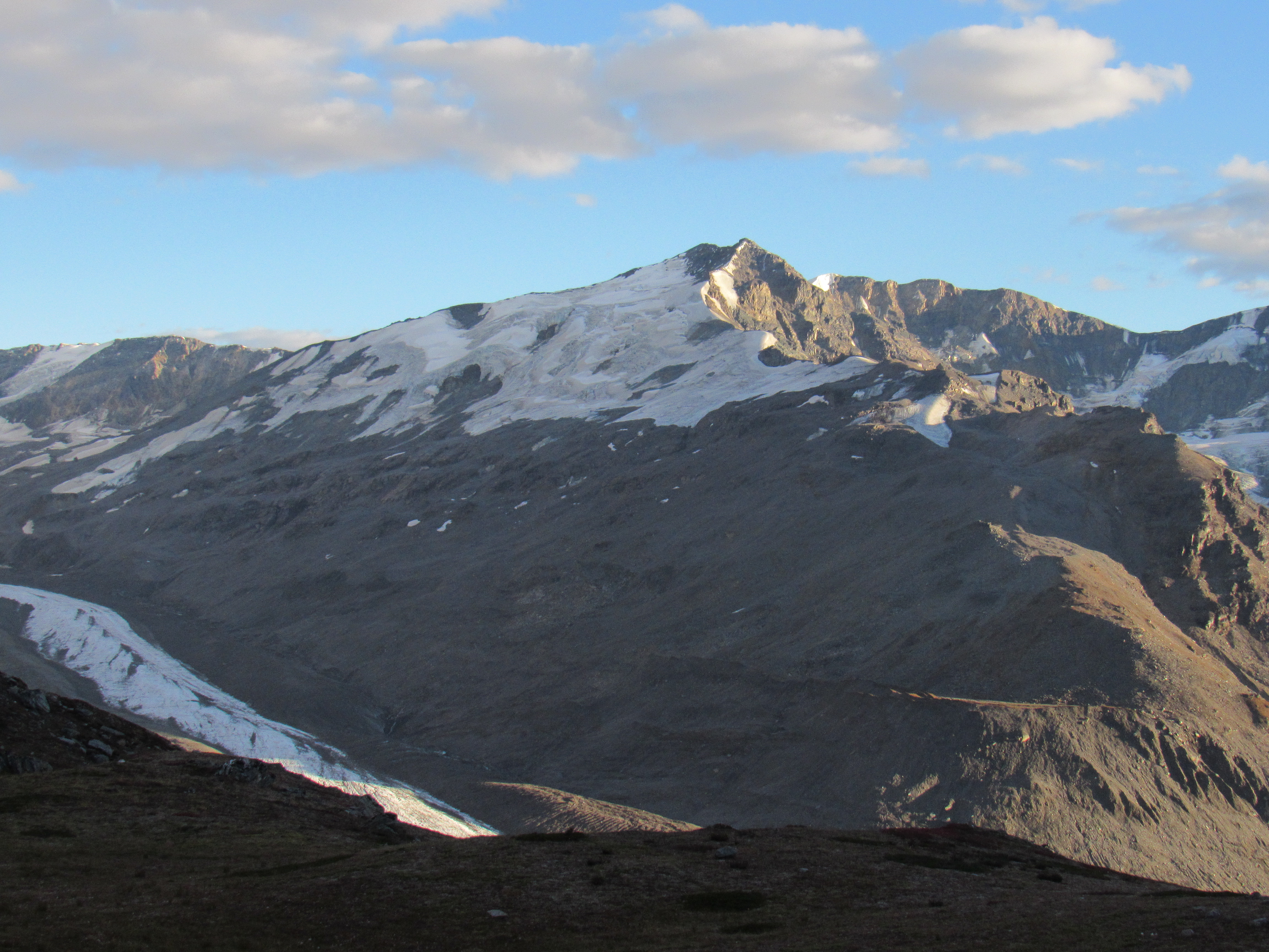
(it’s actually WAAAAAAY up the valley)
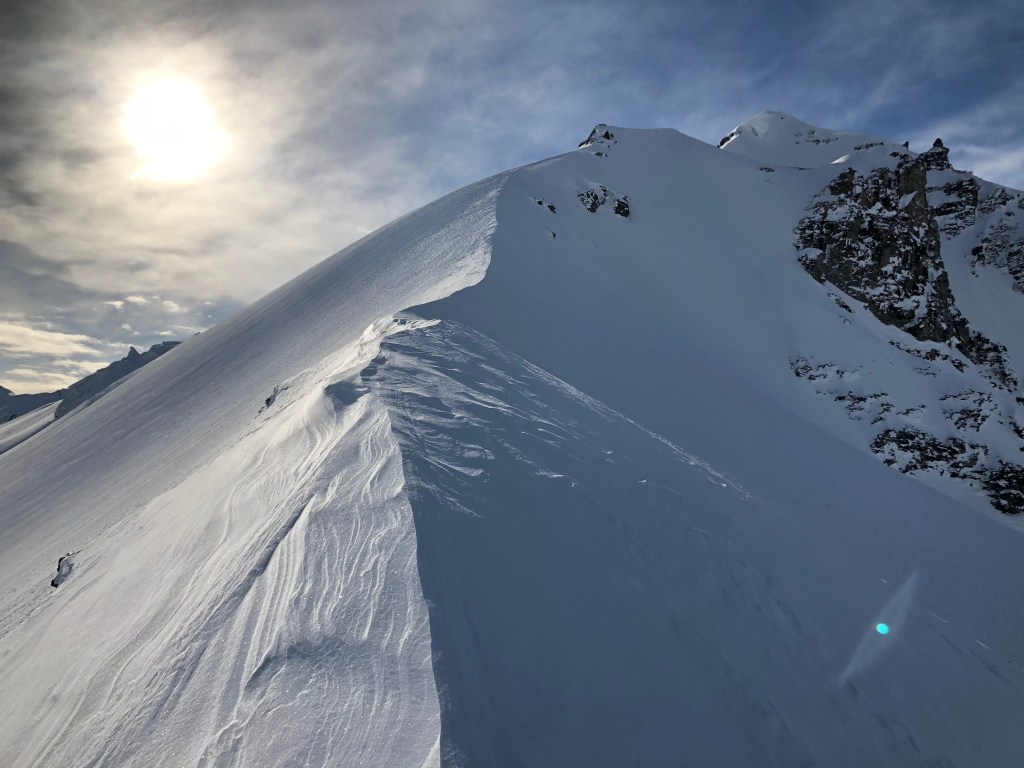
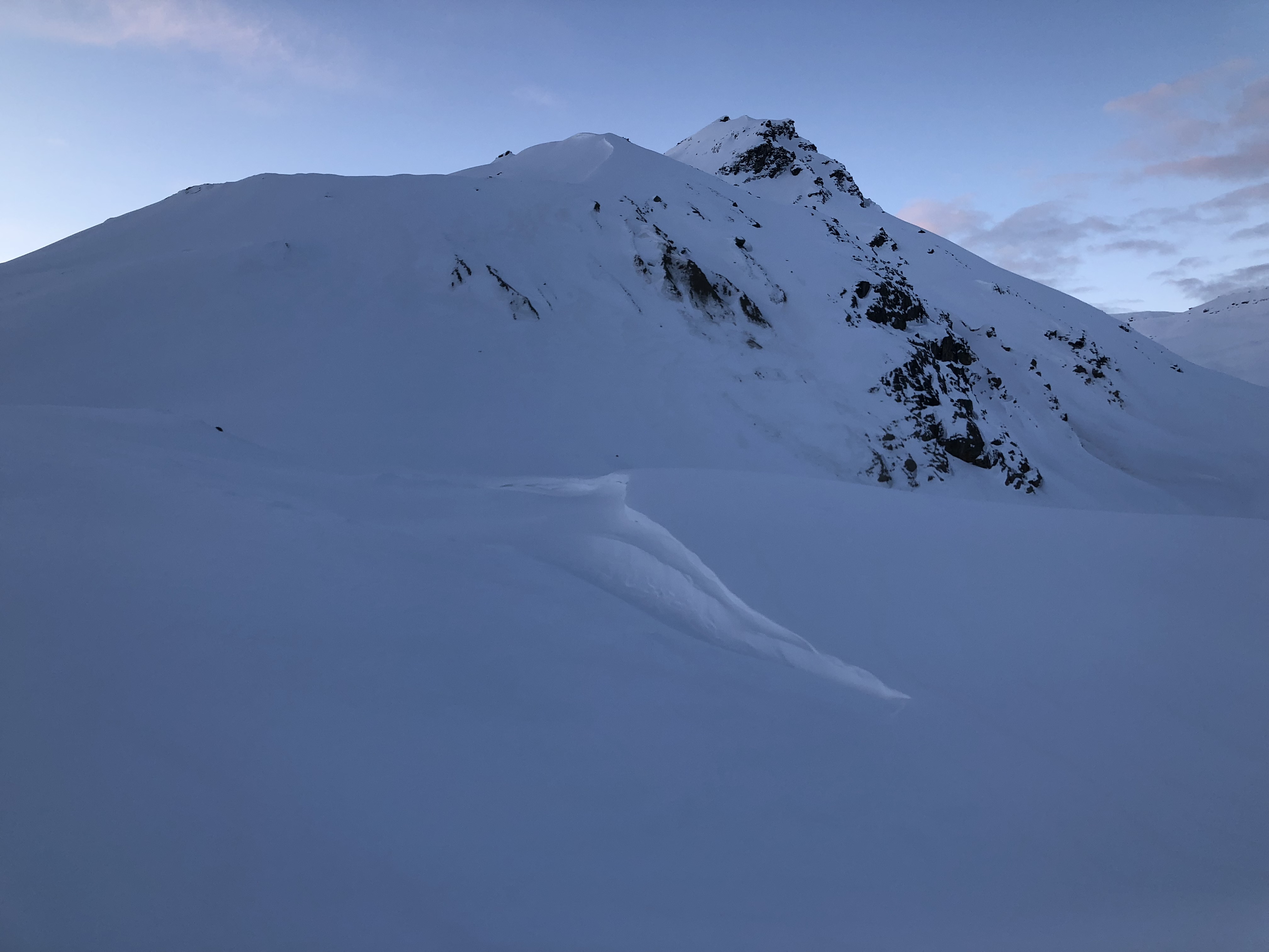
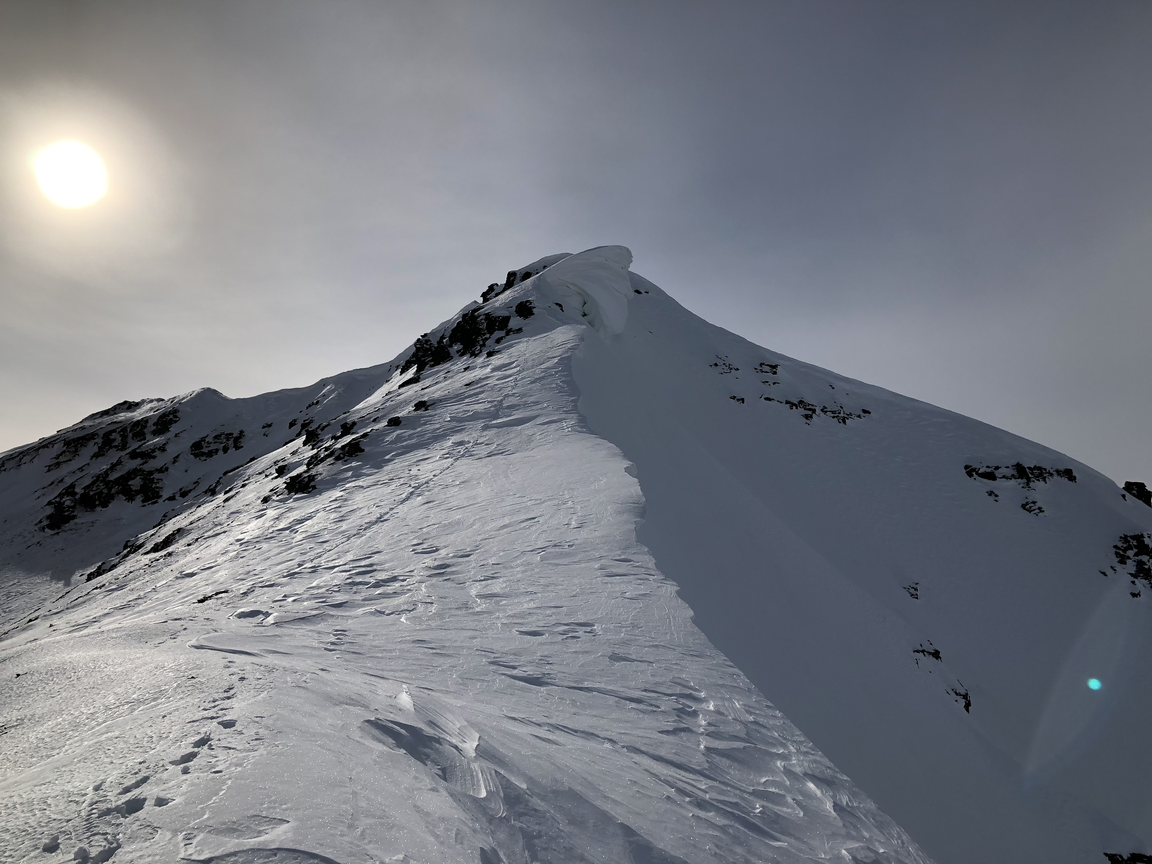
Every mountain in the Eastern Alaska Range has a unique feature: besides the Sphinx, Triangle boasts the Death Cornice that sits directly below the summit and reforms every year somewhere on the summit ridge. It tends to collapse sometime in the late spring but has been known to persist into summer. Climbers must cross it to reach the summit, and past parties have knocked it down by accident. The cornice was especially impressive this year, and resembled Calvin after being assaulted by Susie with snowballs. It was larger than some of the cabins I had lived in during my time in Fairbanks.

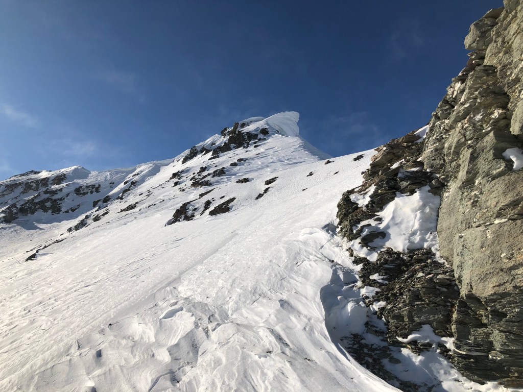
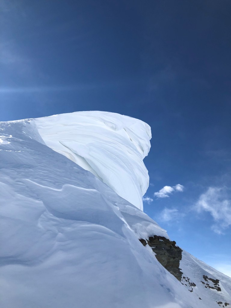
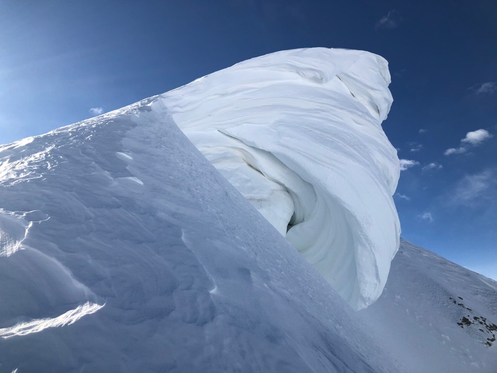
Even though there was no direct danger of the cornice falling on me, it’s unnerving to climb rock and snow directly to the side of such a large and unstable mass. Directly below the summit, I gingery walked as far from the edge of the cornice as I safely could.
Though it was barely after noon, the snow was again unseasonably warm and, as I attempted the final climb to gain the summit, my feet repeatedly punched through the isothermal snow onto the rock that comprise the summit ridge. Shoving my mittened hands into the snow, I pulled on whatever I could grasp to gain elevation, destroying much of the isothermal snow in the process. I finally stood on the summit, with my once-again forgotten skate ski poles on my back blowing in the numbing wind.
The wind had yet to abate, and my previous ascent of Triangle had a much different character. When Galen and I climbed it in April nearly two years previous, we basked in the cloudless and windless day for nearly an hour, stripping down to nothing at one point simply because it was an option.
Today I wasted no time. Removing my mittens to take the type of panoramic photos only possible from a summit, my exposed hand quickly lost sensation as the cold wind sucked heat out of it.


I hastily but carefully retraced my steps off the summit, and tried to keep my paranoia at bay as I downclimbed the rock adjacent to the Death Cornice. My crampons has just started to collect snow, a phenomena known as “balling” that becomes increasingly-dangerous as more warm snow collects, when I reached my splitboard. The wind had not calmed and the gusts began to push me around.

Any paranoia about wind or storms fled my body as soon as the descent started. Knowing I was crossing crevassed terrain, I didn’t stray far from my old tracks, using the faulty-but-oft-used theory that previously-traveled snow is tested and safe. I found the best powder of the mountain on the north side lower on the ridge, and carved as much as a I could on the way down, barely stopping but for the view. I descended the mountain on my splitboard in 20 minutes, comparable to Galen’s and my descent previously.

I reached the Confluence by early afternoon, already accepting I might not have crust to ski out on due to the unseasonable heat. Overjoyed to discover some pocket bacon I believed I’d forgotten, I started my way down the valley and was pleasantly-surprised to find the crust lasted all the way to the end of the moraine, but no further.
My long cross country ski poles plunged through multiple layers of snow as I used them to push me across the frozen creek. Arriving at my car over half a day after departing, I struggled up the slopes and removed my boots before I could sit down. My obsession with skate skiing this winter had left my feet soft and without muscle stamina to survive long days inside hard boots; the pain was intense but not unbearable.

I drove north back to Michael’s Creek and left a note on the car of a few climber friends I knew were in the area, who were attempting to navigate the ridge above Michael’s Creek. I drove south to a pullout near Rainbow Ridge that happened to have cell service and slept for the night. My mind was still attempting to convince me to try my luck for a third peak on Sunday by taking a steep-but-direct route up Rainbow from the road. A rainstorm that evening quenched any further thoughts of such a feat. The drive home the next day was uneventful and beautiful, and I accepted this was going to be my only trip to the Deltas this season. I was at peace.
This is the perfect mindset to be in for a trip back to the Castner just a few weeks into my future.


4 thoughts on “Triangle Peak”