


2023
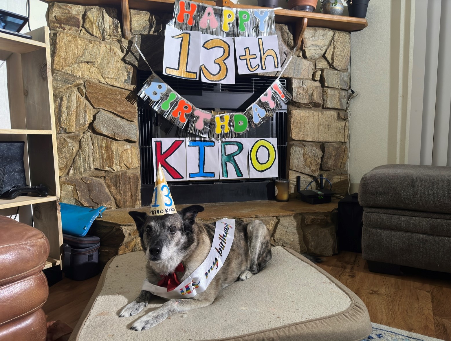
After 4 long years, a pandemic, an entire relationship, hip surgery, kitten acquisition, and the death of my beloved 13 year old dog Kiro: I’m finally back to climb in the Deltas, baby!

I’ve done my best to make this a memorable spring after an objectively terrible previous year (February 2022 to February 2023). Since Kiro died, I’ve been doing a lot of skate skiing, xc ski races, and learning to backcountry ski; I’ve skied Snowbird Glacier and Explorer Glacier, but spending springtime in the Deltas has been my goal.
In early November, Stefan Johnson and I started talking about doing a mountaineering trip together in March. He mentioned he had spring break off, so we tentatively planned to do something that week. I requested Wednesday March 15th through Friday the 17th off from work many weeks in advance.
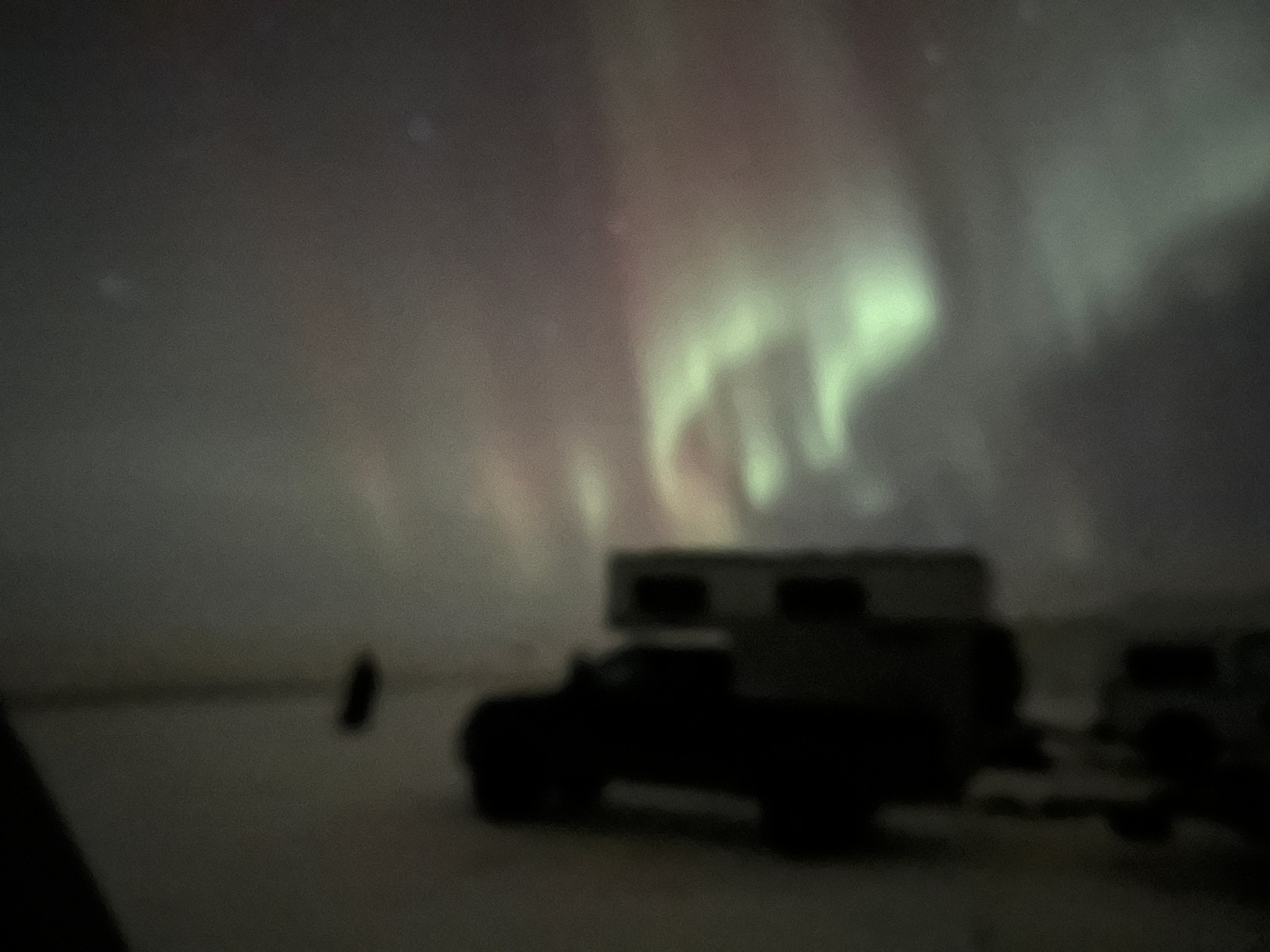
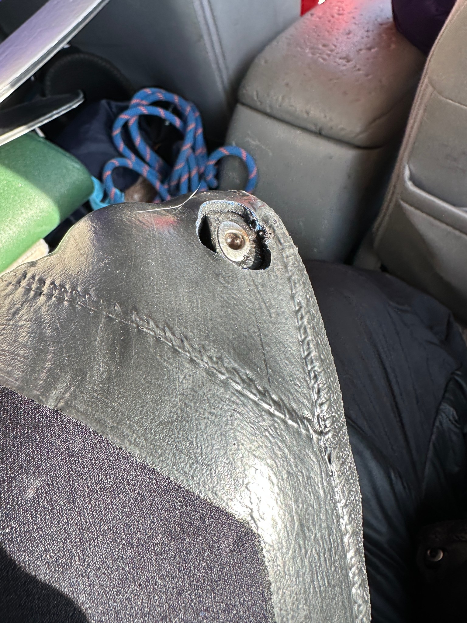
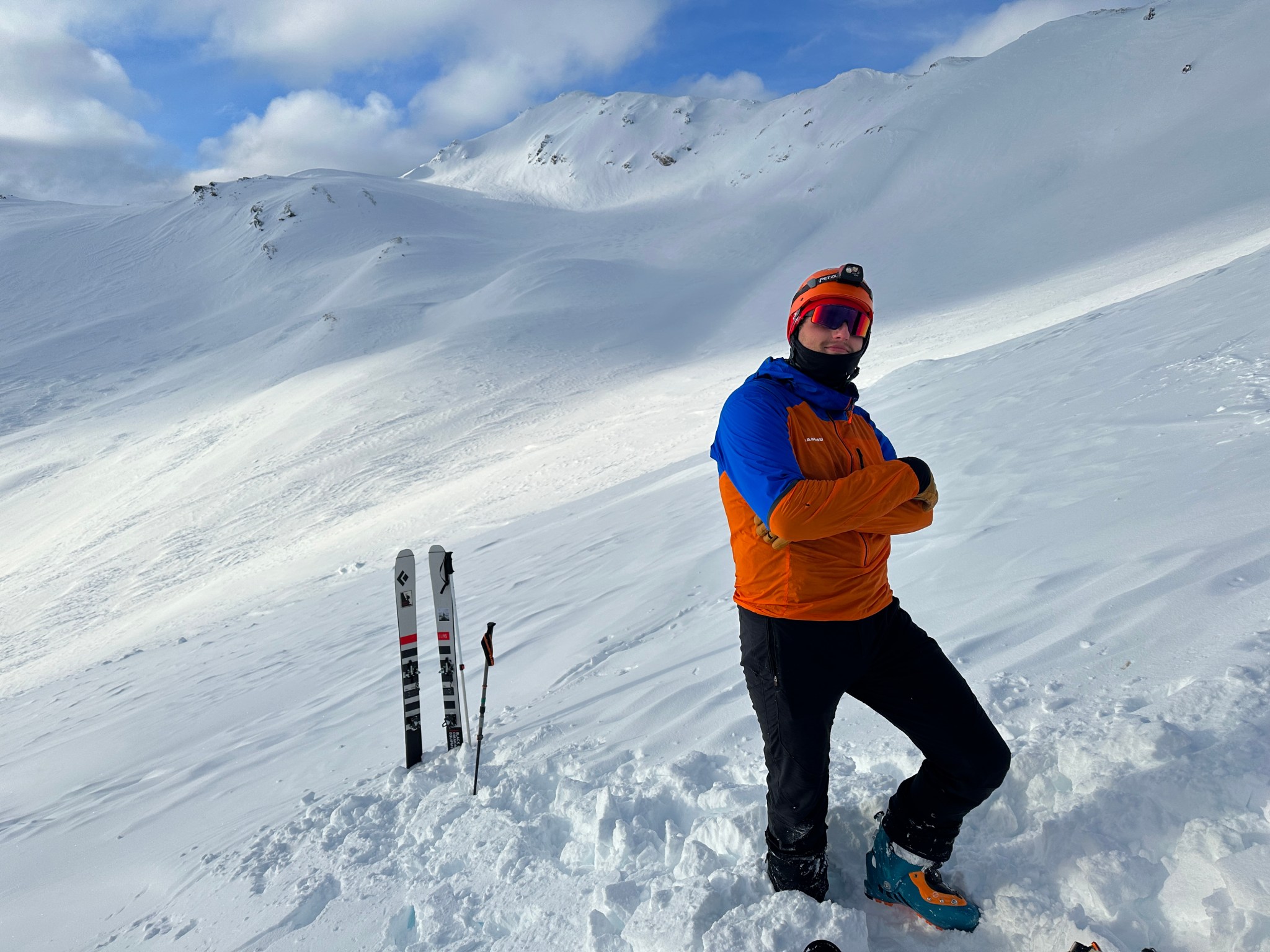
Tuesday the 14th rolls around, I swing by Moose’s Tooth to pick up Stefan to drive north to the Deltas. He and Zach Suave had been climbing in Eklutna Canyon for the past few days. Rather than resting, Stefan planned to go mountaineering in the Alaska Range—what a legend! We loaded my truck and met The Allison at the Richardson Monument around 10:30PM. I slept in the back of my truck and got a few glimpses of aurora, a good level 5, though the temps were incredibly cold. It was -20F when we woke up around 7AM with clear skies. Plan A assumed we’d be skiing towards Gulkana Glacier before 8AM. I heard a knock on my window and Allison shows me the remains of what had once been a lightweight climbing helmet. Apparently she had crushed it with her powerful knee accidentally as they packed the previous night.


“Well that does limit our options…”
Plan B would involve skiing up Augustana Creek, but without a helmet we wouldn’t set foot or ski upon a glacier or mountain, so it would be an out-and-back rather than a loop. Stefan was prepared to drive to Delta Junction to search out a potential replacement helmet, but then discovered he had forgotten his skins in Fairbanks. Allison was immediately absolved from all guilt for crushing our plans along with Stefan’s helmet, and Stefan decided to do a “quick trip back to Fairbanks” to retrieve his gear. Allison and I decided we would do Plan C and ski up Trims Creek, set up camp for an attempt on Item Peak and Stefan would ski up and meet us afterward.
I’ve only ever wandered up Trims Creek once, and it was an awful experience that ended with my partner and I wandering back down the northern ridge in a blizzard and skinning on top of trees to avoid wallowing. I hoped this time would put a positive spin on the creek. Allison and I left my truck at Trims DOT Maintenance Station and slogged with heavy packs about a mile up the creek, but horrendous trail conditions had us skiing right back out. Lots of open water, tight and exposed traverses above said open water, along with bushwacking up steep slopes; no thanks! I had to ski entirely in my puffy gear as the air temperature was sub-zero, though I halfway unzipped my puffy pants because I was still producing a lot of heat, just not enough to stay warm in gortex. Allison and I had a discussion over the merits of puffy skirts and their utility in the mountains at these temperatures and didn’t come to any conclusions. As we skied back my mind kept churning through potentialities. I figured Plan D we could simply drive a mile up the road to Michael Creek and repeat the same process without losing a beat. By the time we got back to the truck, the decision had been made.
“Forget camping, forget heavy packs, it’s way too cold for that. We’re doing this one alpine-style!”

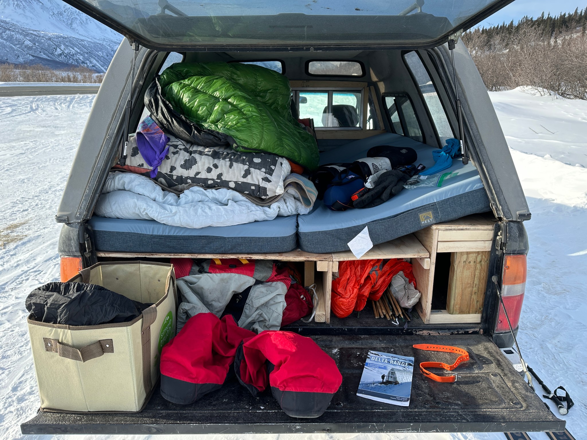
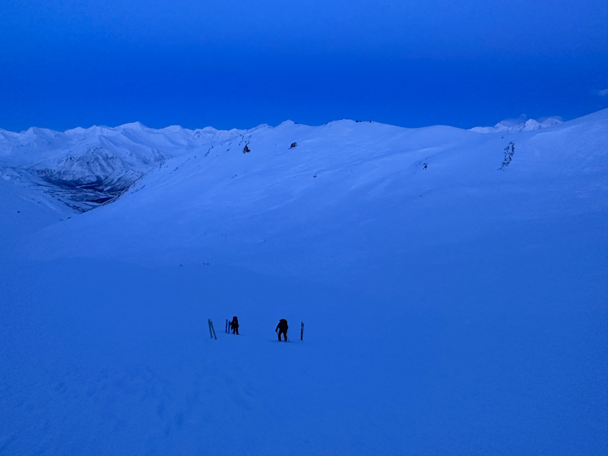
We called Stefan to confirm he would be in agreement. Free of heavy packs, Allison and I skied about a mile and a half up Michael Creek to make sure there were no insurmountable open water challenges and there were not. Stefan met us on our ski back down. Michael Creek is probably the best creek for skiing, it gains significant elevation but is relatively wide and mostly skiable, even with old skis. At the parking lot we packed our day packs for the next day and tried to grab a beer from Black Rapids Lodge, but sadly it was closed. This car ride gave me time to modify my overboots, which I had initially cut too conservatively to accommodate tech-toe bindings. Haphazardly cutting away more material, access to the toe attachment was now much easier.


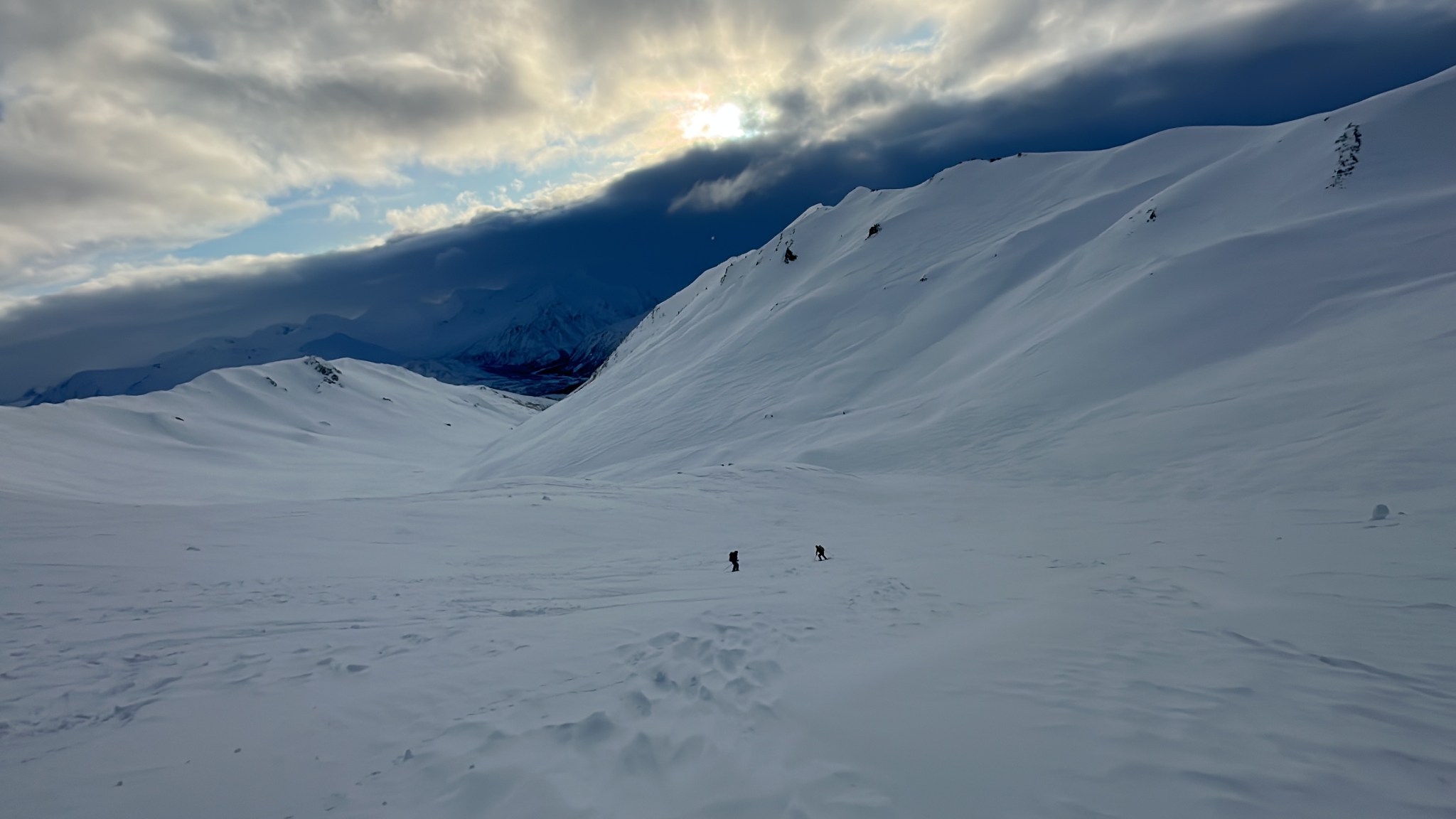
We made dinner and water at the parking lot and bedtime was 6PM for a 2AM wakeup call. Unable to sleep (typical), I stayed up for the sunset around 7:30. There were some clouds on the southern horizon, but mostly clear weather. With Kenny Loggins “Danger Zone” blaring at 2AM, I immediately got up and opened my truck window. A dishearteningly-low cloud ceiling filled the Delta Range, but regardless we heated our water for the day and started skiing up Michael Creek around 3AM. It was a cool -8F when we started. By 4AM, even more dissapointly, snow started to fall and was illuminated by our headlamps. As we were already a mile or so up the creek, we figured we might as well ski to the headwall because what else were we gonna do today?
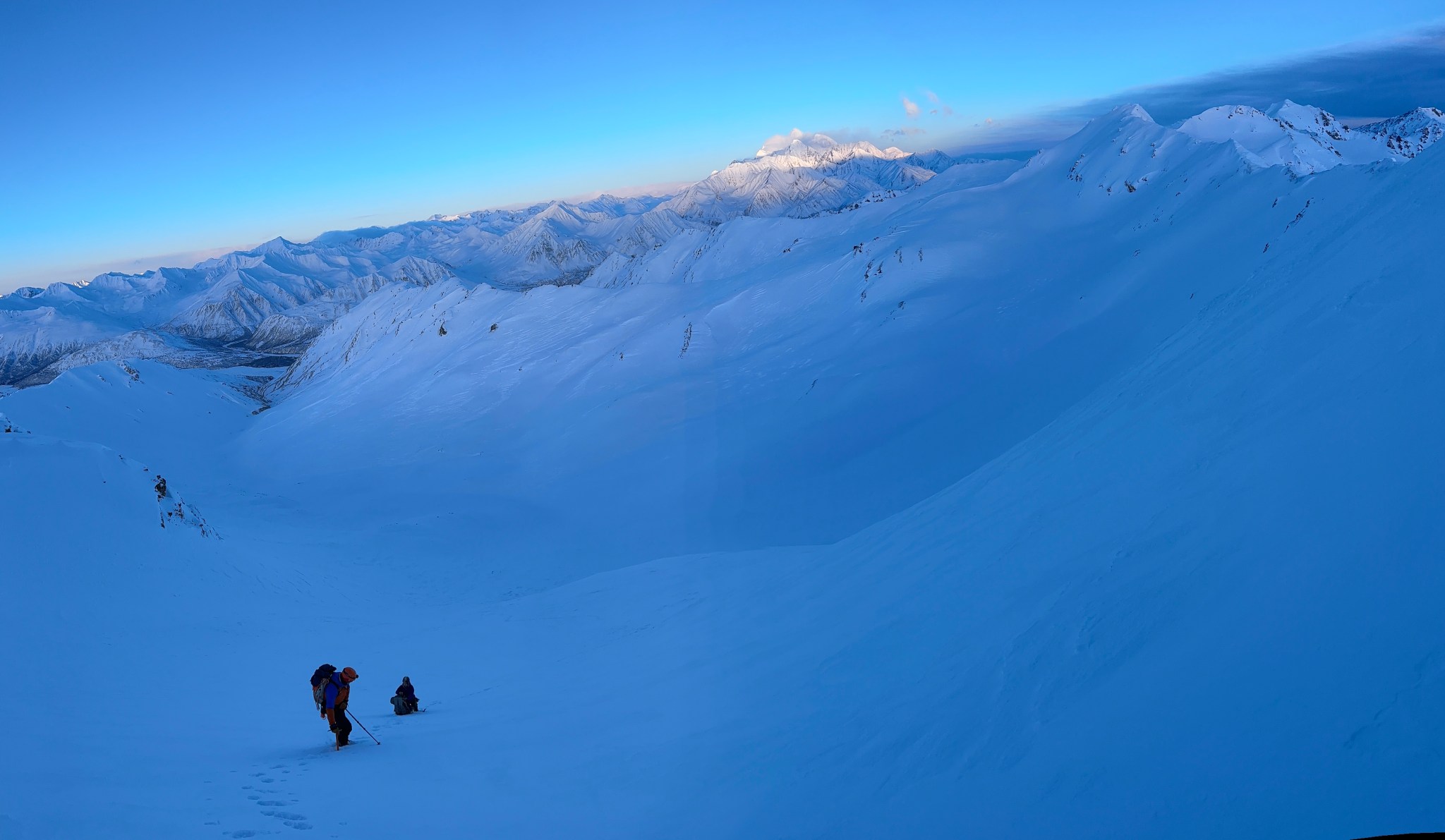
We all significantly lowered our expectations for the day. We justified: it would be nice to ski out with light, and the sun wouldn’t be up for a few more hours so we might as well get in some exercise. Hey: I could be back in Anchorage by the afternoon! By the time we reached the headwall around 7AM, the sun was rising, the skis had cleared, and we dared to believe we might get to climb today.

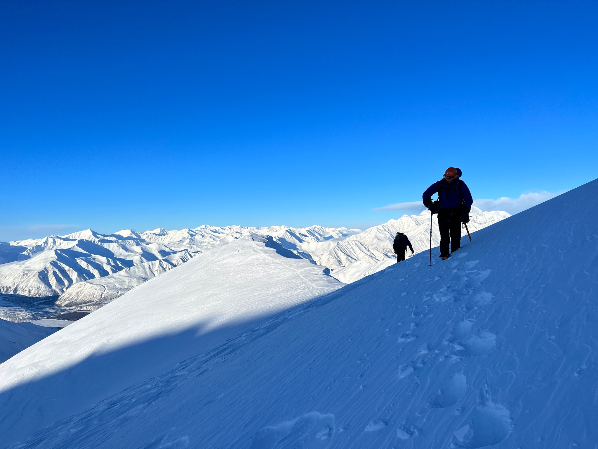
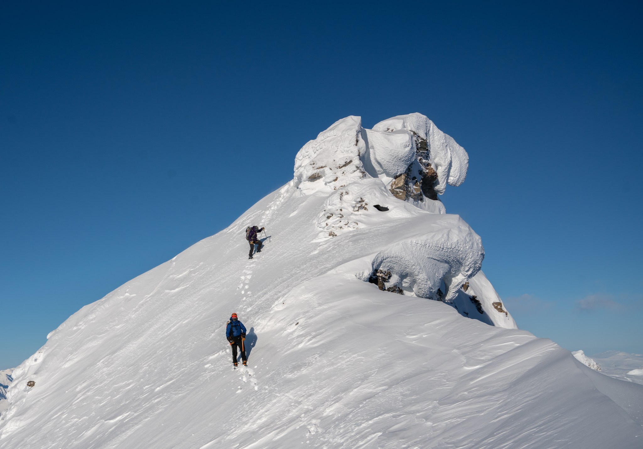
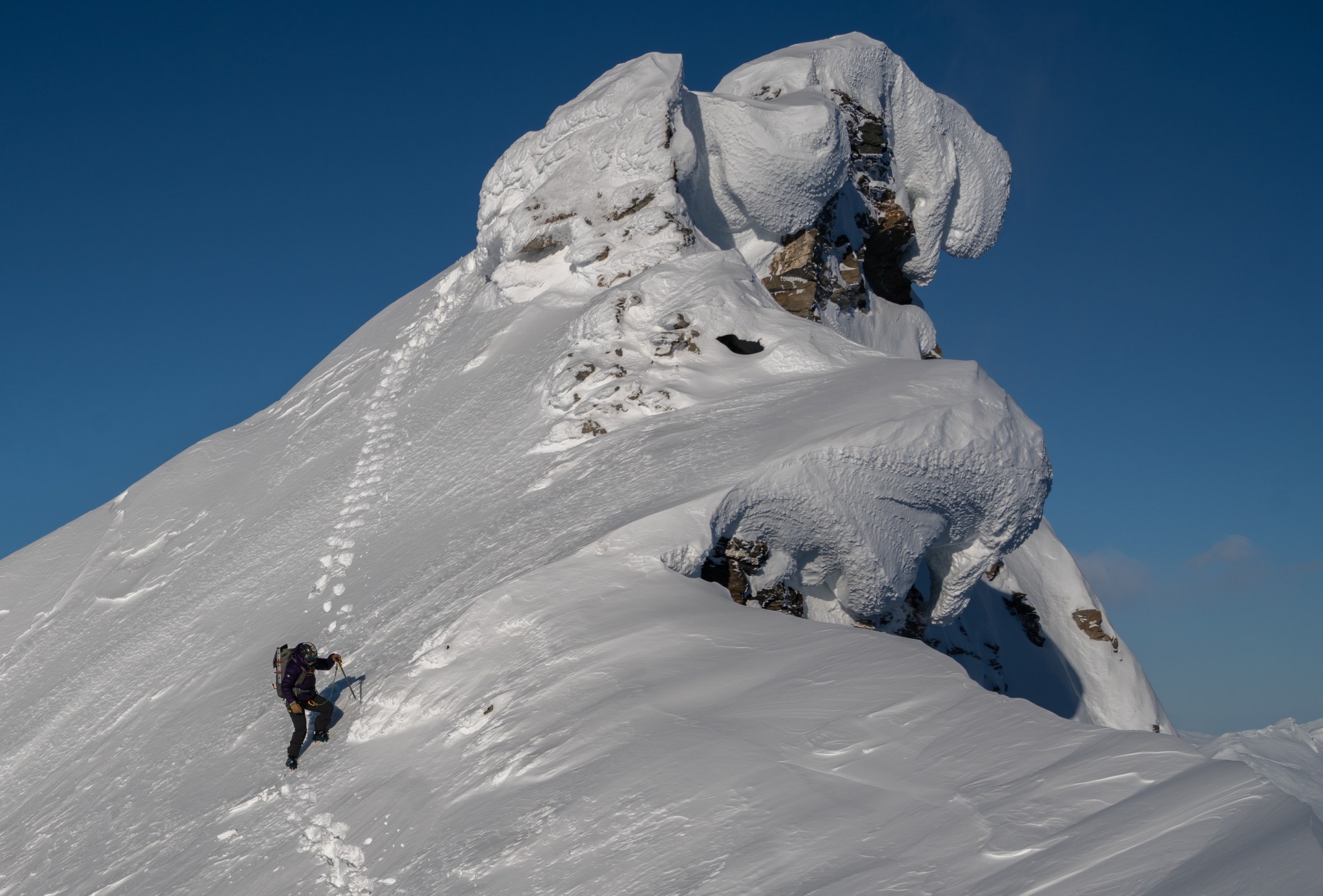
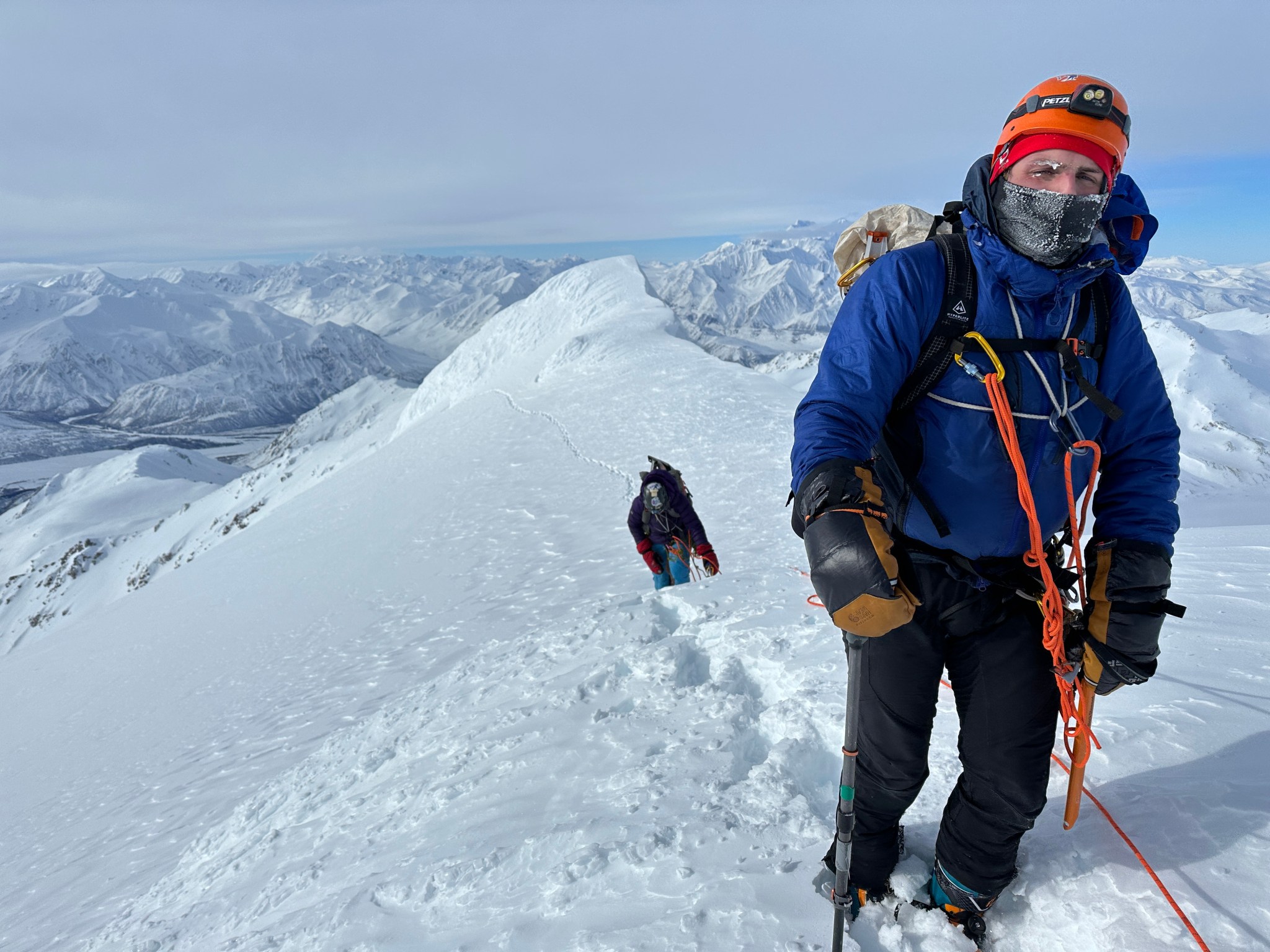
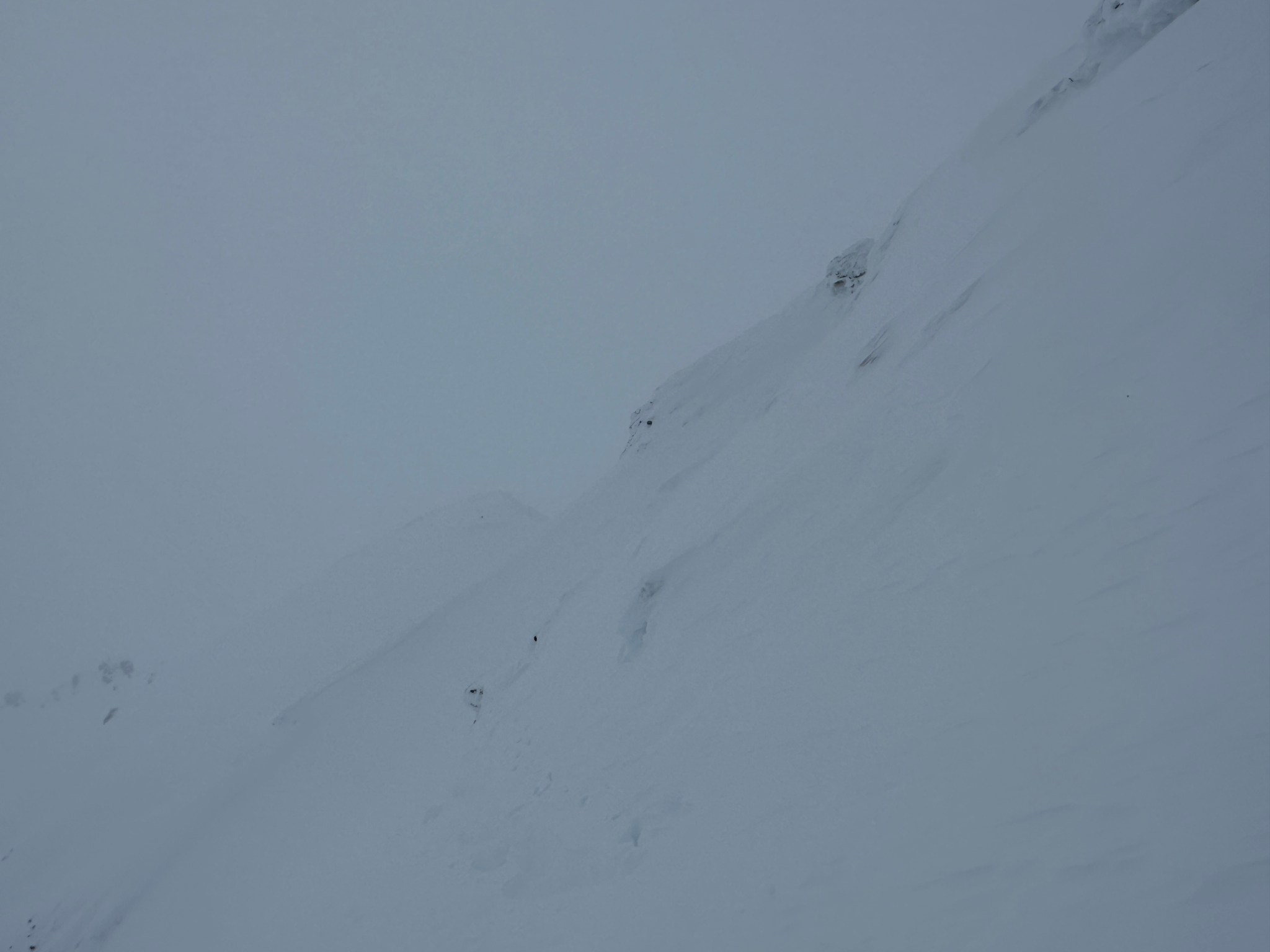
Dropping our skis and strapping on our spikes, we started cramponing up the headwall towards the far west bump of Item’s west ridge. The snow was quite cold, brittle, and variable; I don’t think any patch of snow was consistent for more than 15-20 feet, just lots of inconsistent wind-affected snow. It sounded like climbing on styrofoam. We climbed and climbed until we topped out, staying far away from the cornices that overhung the right side of the face. On top of the headwall summit we donned all our wind gear, as there was a pretty constant 10 mph breeze from the south and the air had yet to become warm. We kept our puffy gear on and even put on extra facewear due to cold, now-hateful wind. The sun hit our little headwall summit (“Michael Peak”) shortly after we arrived, and we soon left it’s illusion of warmth for the shaded west ridge.

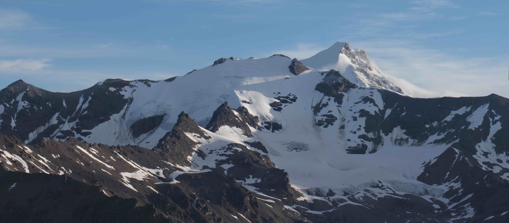
Below: Silvertip (left), Item’s False Summit (right).
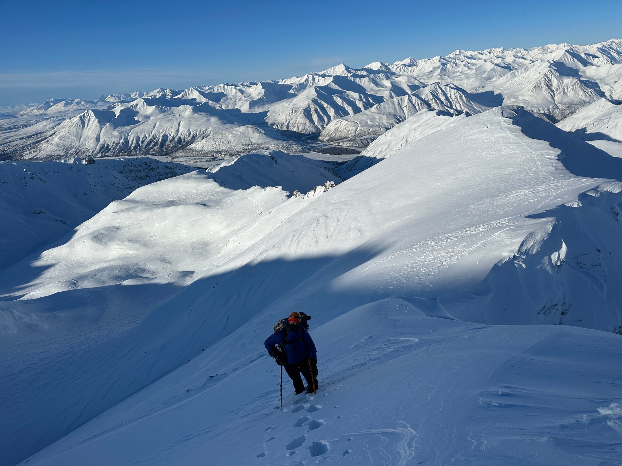
Last time I was on this ridge 10 years ago my party set off a sizable avalanche while crossing the middle of the first major slope (which was probably pretty stupid), so this time I led us high up the ridge and connected various rocks where the wind had formed safe little wells that could not avalanche. The snow was occasionally slabby, but nothing that concerned me. Staying high on the ridge and moving between rocks calmed fears of releasing the entire slope of snow and plummeting a thousandish feet down onto a glacier. This continued until we reached the lower slopes of the rimed-covered false summit. We could finally see the true summit, still half a ridge away. It was quite cold so I didn’t take nearly as many photos as I would have liked, a prospect I had to force myself to accept. I still took photos until my fingers numbed.
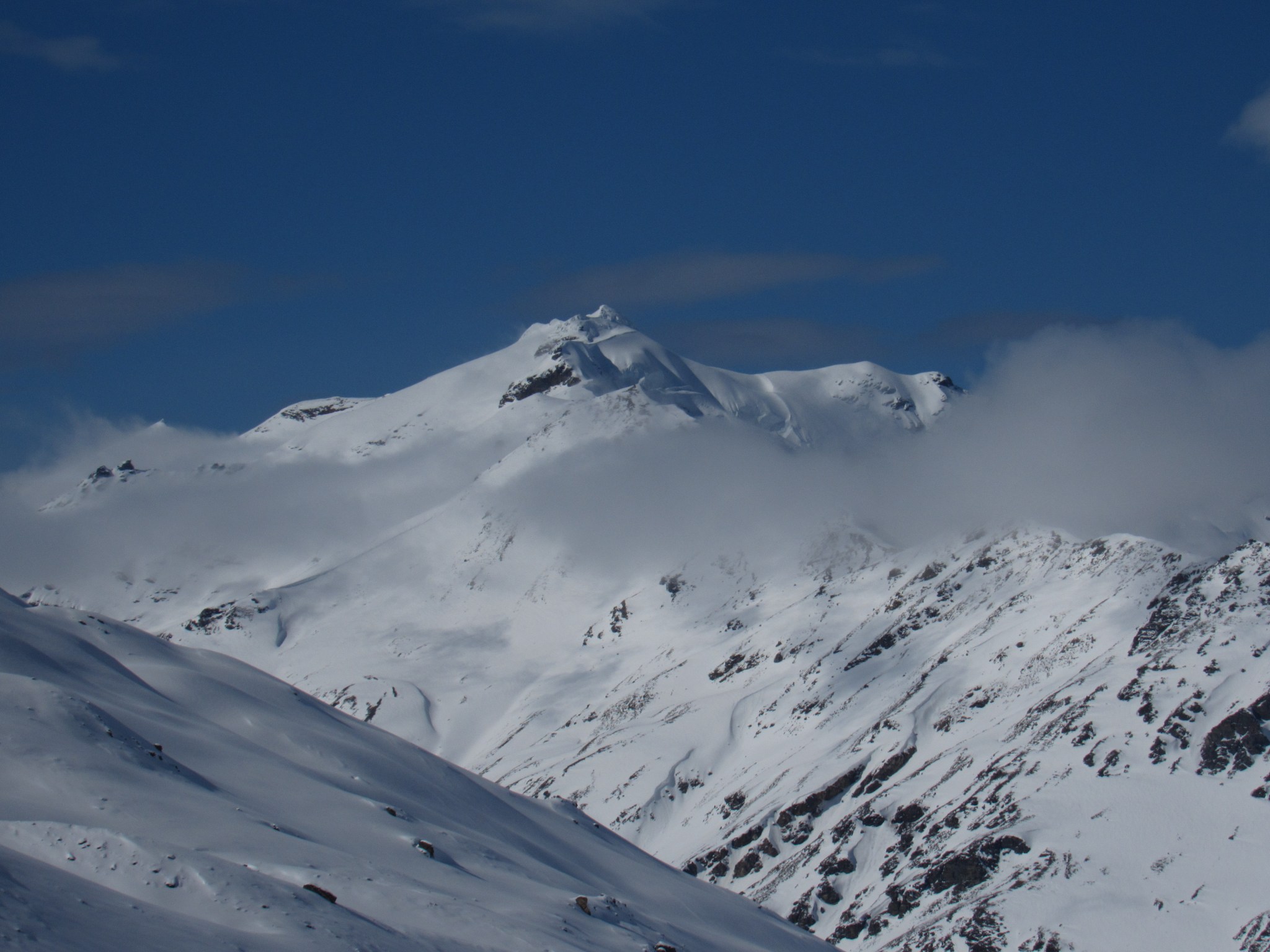
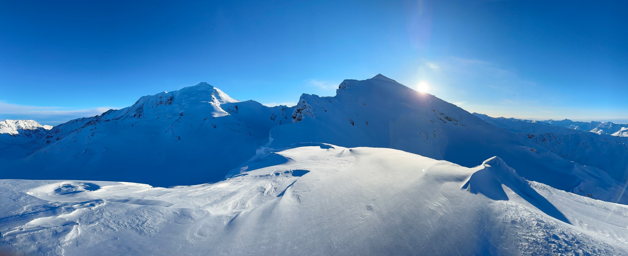
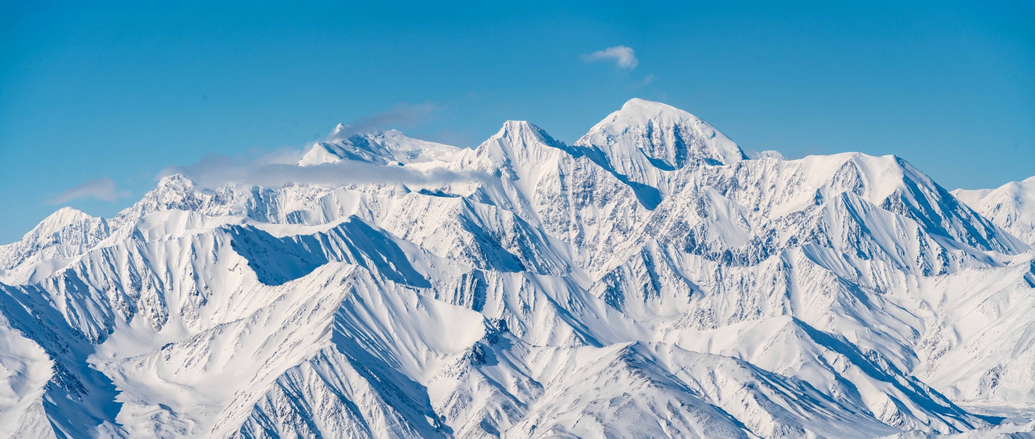
To conserve battery, I only broke out my nice camera twice on the ascent, first time to take this photo of Silvertip:


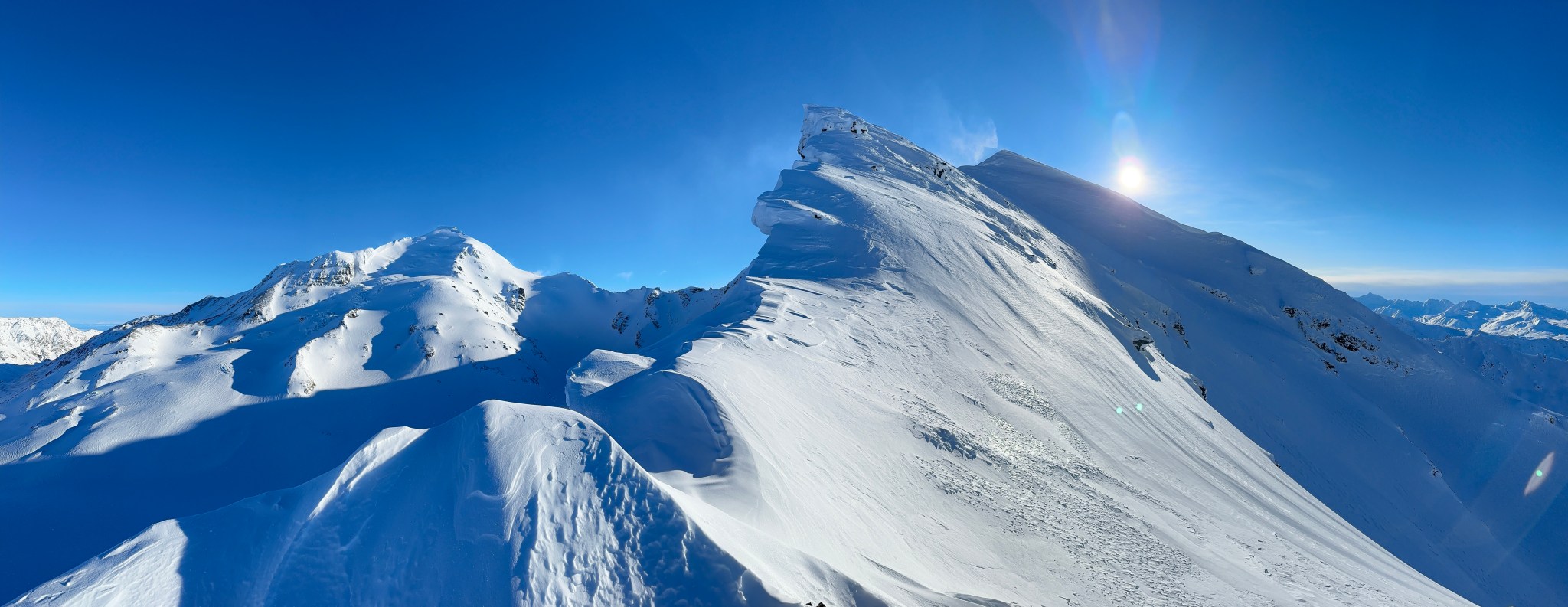

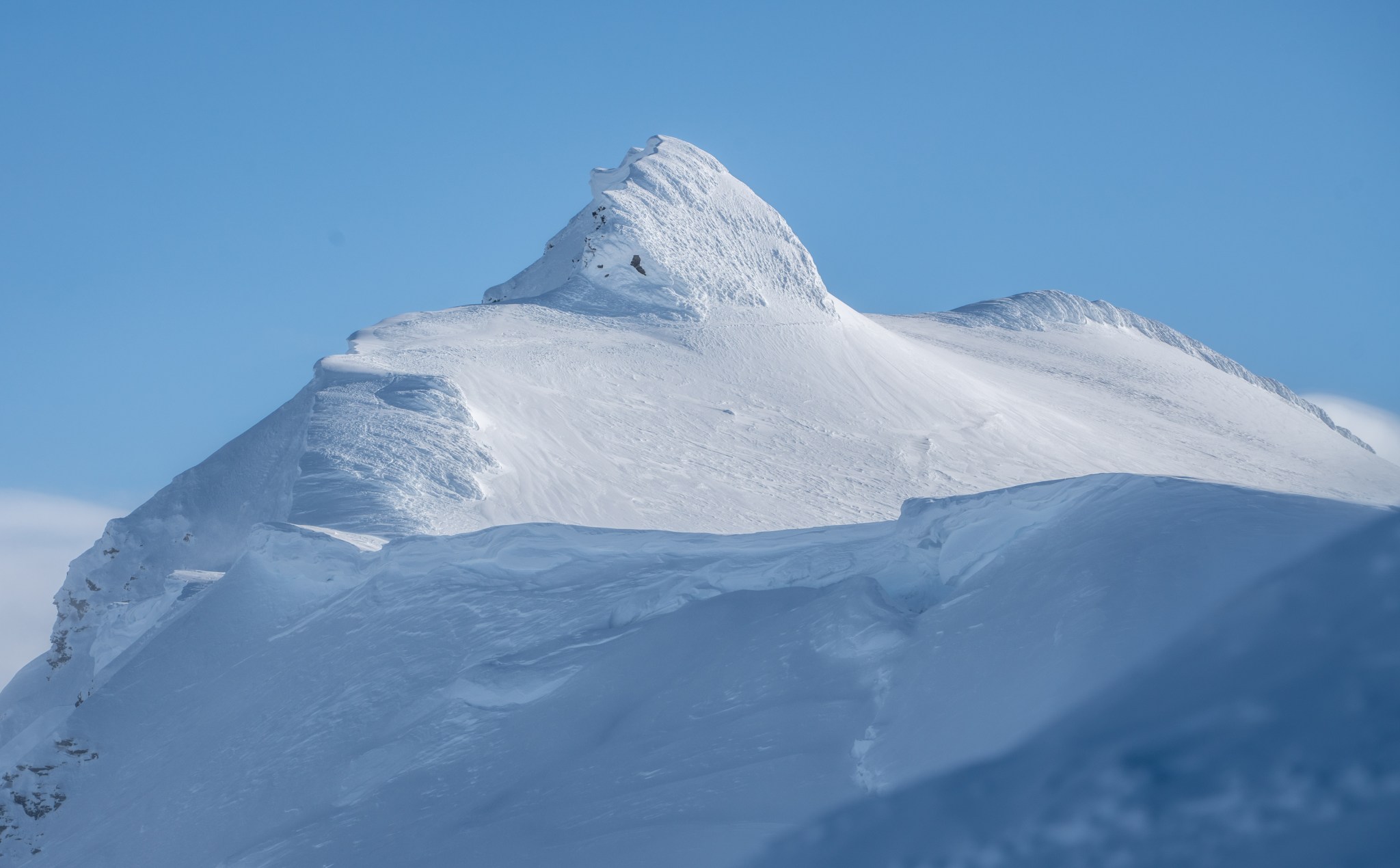
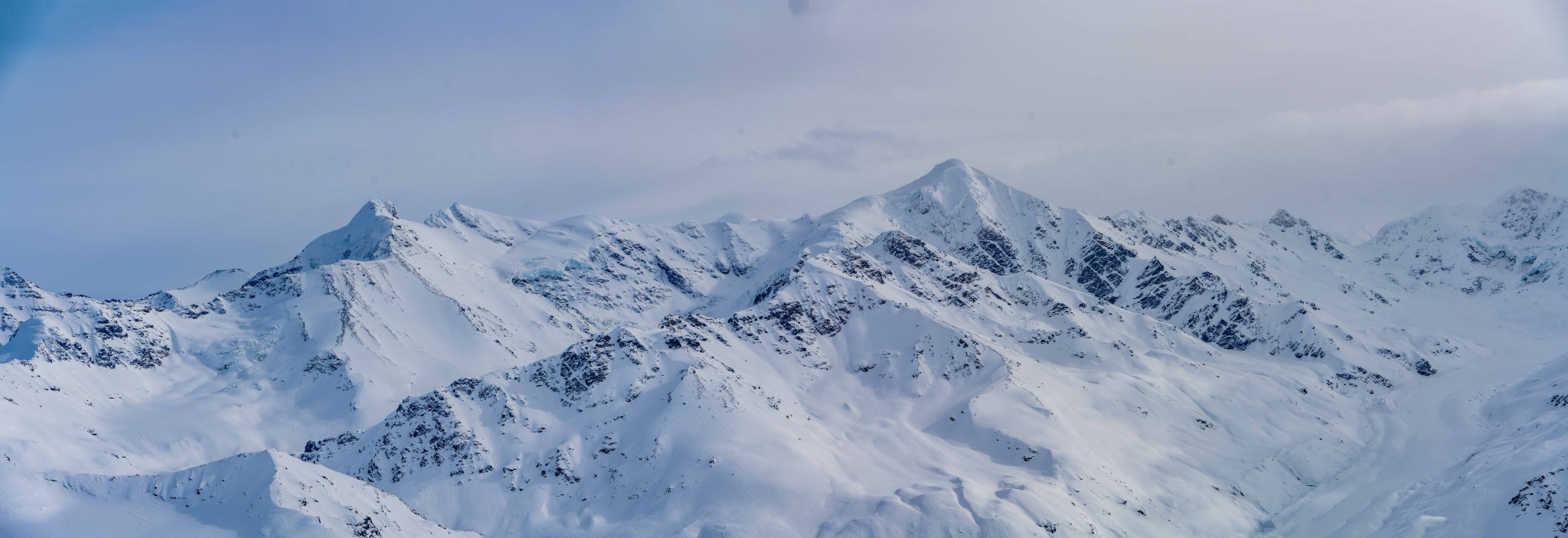
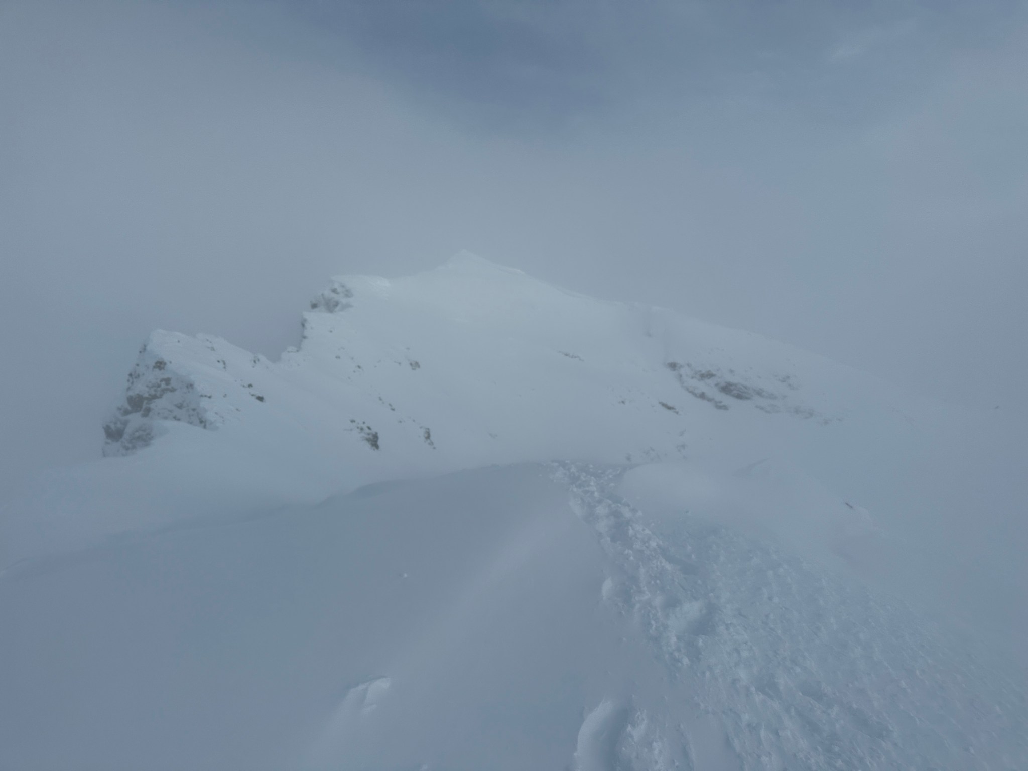
Below: That’s the summit! Dead center

The second time I broke out my nice camera was to take this photo of Item’s first summit:


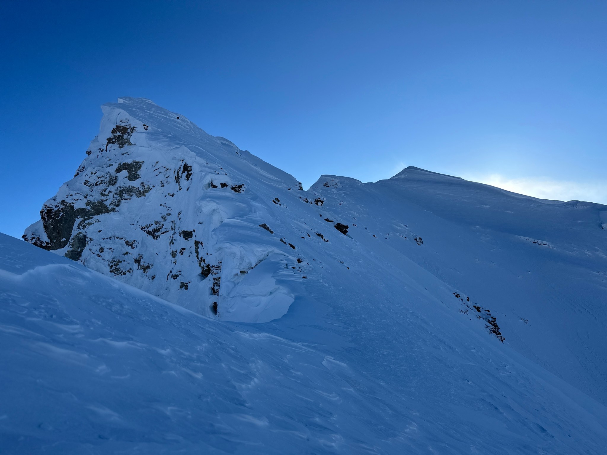
Given the flag of snow ominously trailing off the top, I told Stefan and Allison to expect higher constant winds when we topped out. We gained the false summit and had to immediately backtrack and traverse the south side, as it dropped off dramatically to the east. I forgot to take photos from the false summit, one of the best vantage points on the ridge. Guess I’ll have to head back sometime.
Allison’s core and hands were getting cold in the constant 20mph wind, so I gave her some extra warm gloves (alti-mitts) and a nutelladilla. We spied a storm hanging out to the east and south around Gakona Peak, the center of the current weather pattern. I figured the haze would reach our ridge, but it didn’t look like the storm was moving our direction yet.
I had only a vague recollection of the google earth imagery for this peak, I incorrectly recalled there being glaciated terrain from the false summit to the true summit, so I recommended roping up here. This was an awful task in the wind, and at one point I knowingly frostnipped my thumb on the only piece of metal on my harness because there was no way to get it doubled-back with gloves. We all got significantly chilled while roping up; as we already had all our warm gear on, movement was what would keep us warm.

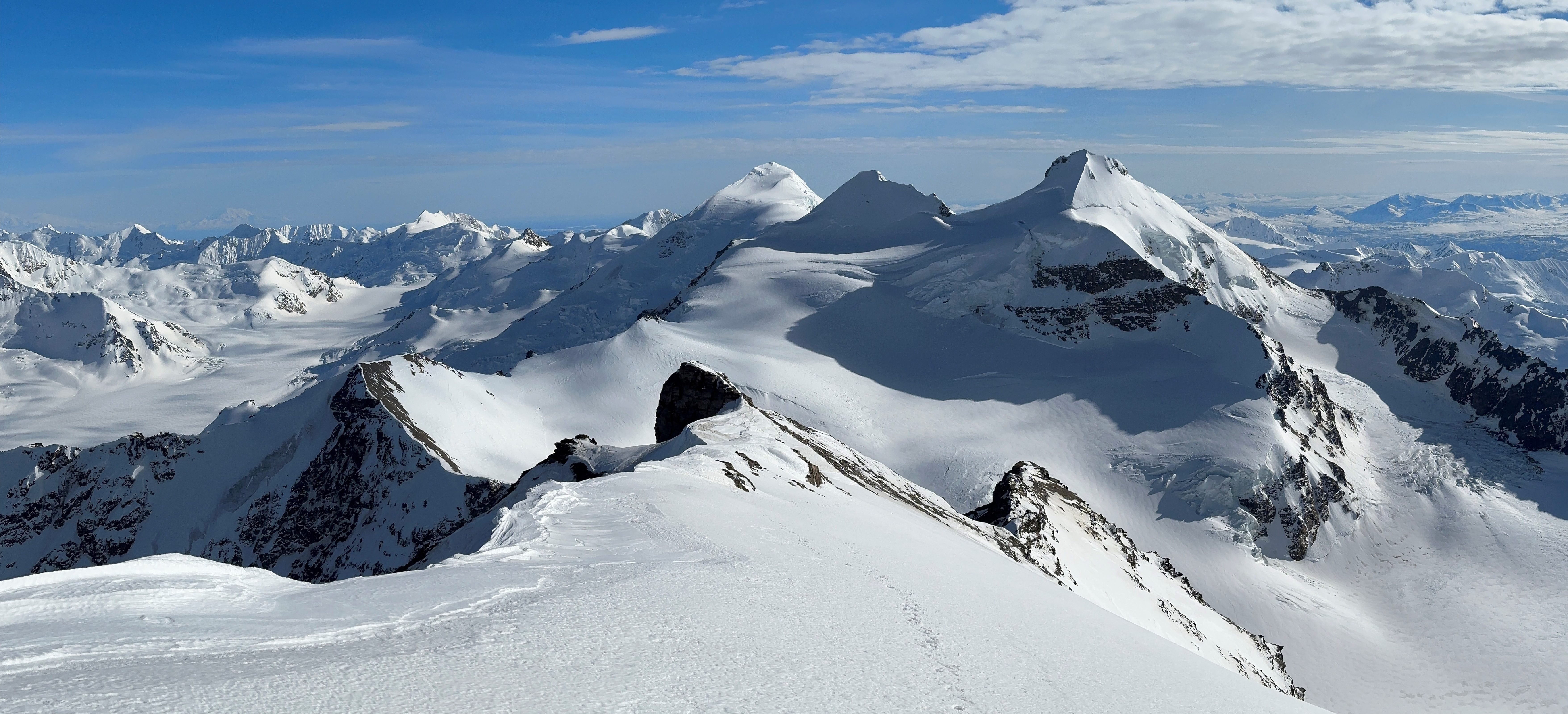
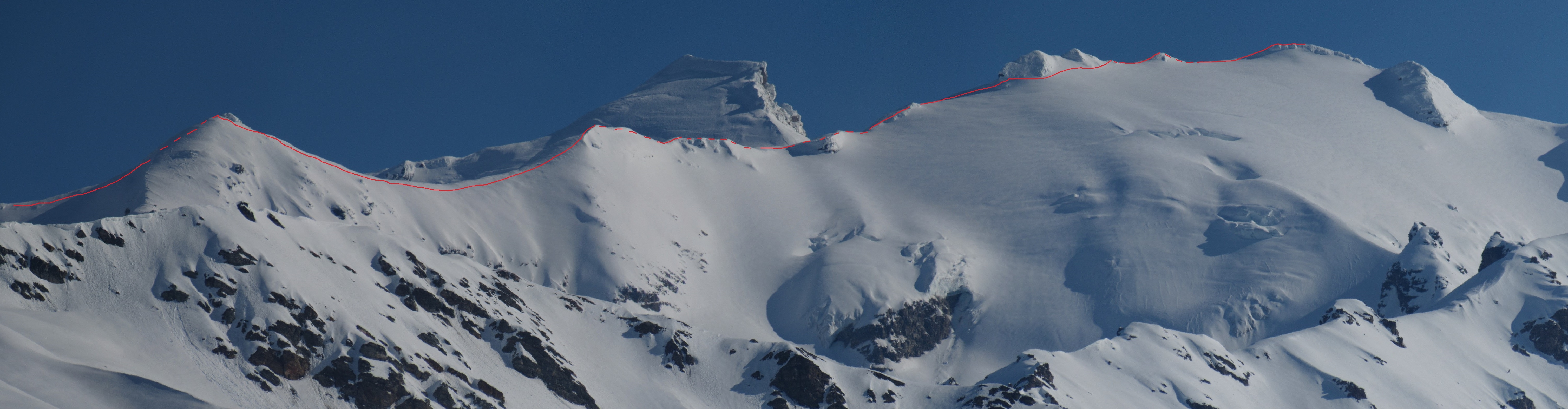
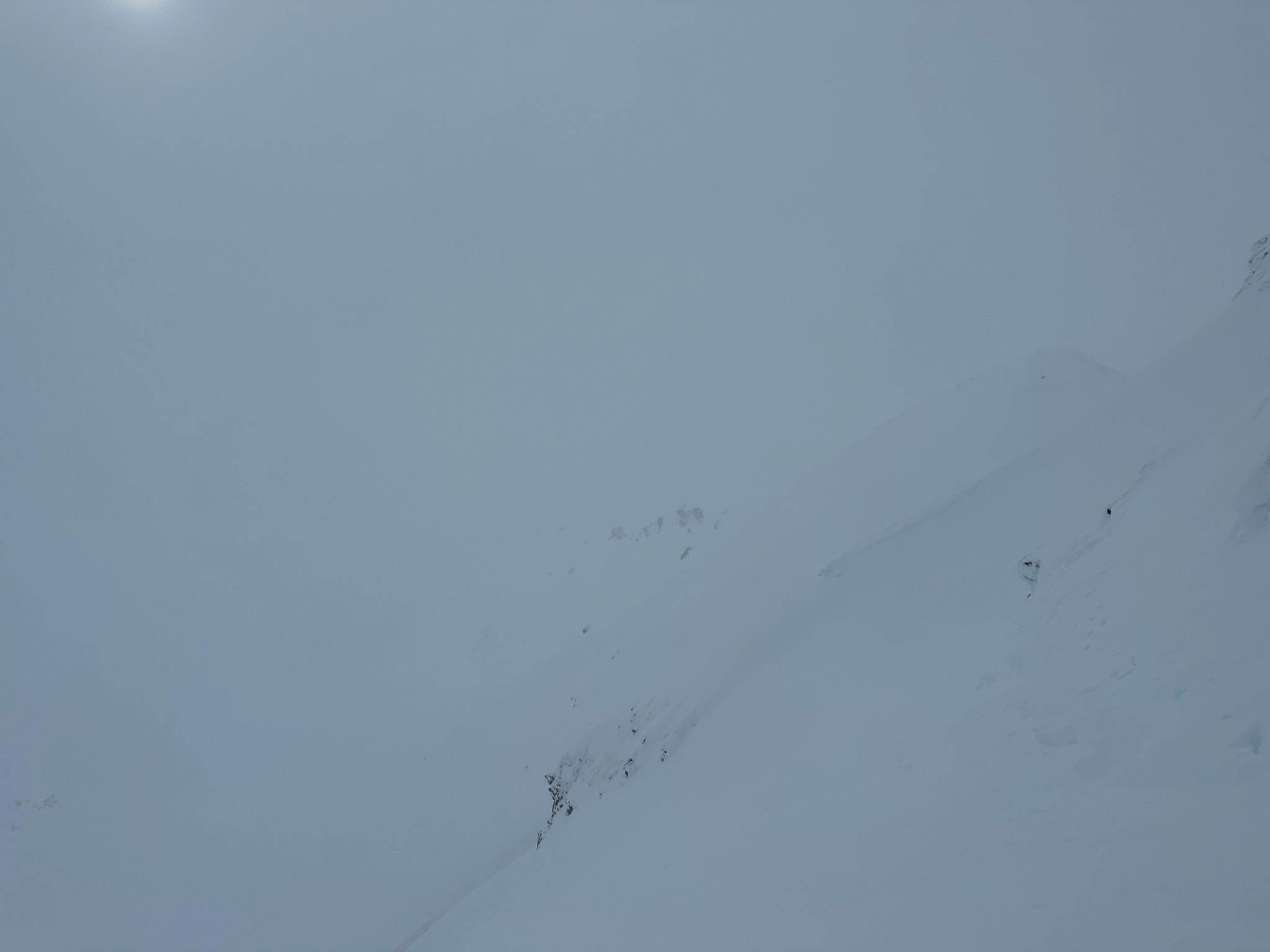
Roped up, we trekked down the giant saddle and up the rime-covered “last hill”. The ridge jogged north before heading east, around here is where glaciated terrain actually begins. We walked to the base of the true final hill which led to the base of the first summit. We traversed below the rime-covered rock and past the second summit, figuring we would tag these two on the way back since there’s easy access to both between them. As we walked over the third summit, we noticed the storm picking up speed and starting to consume the Institute-Rainbow ridge 8 miles to the south.


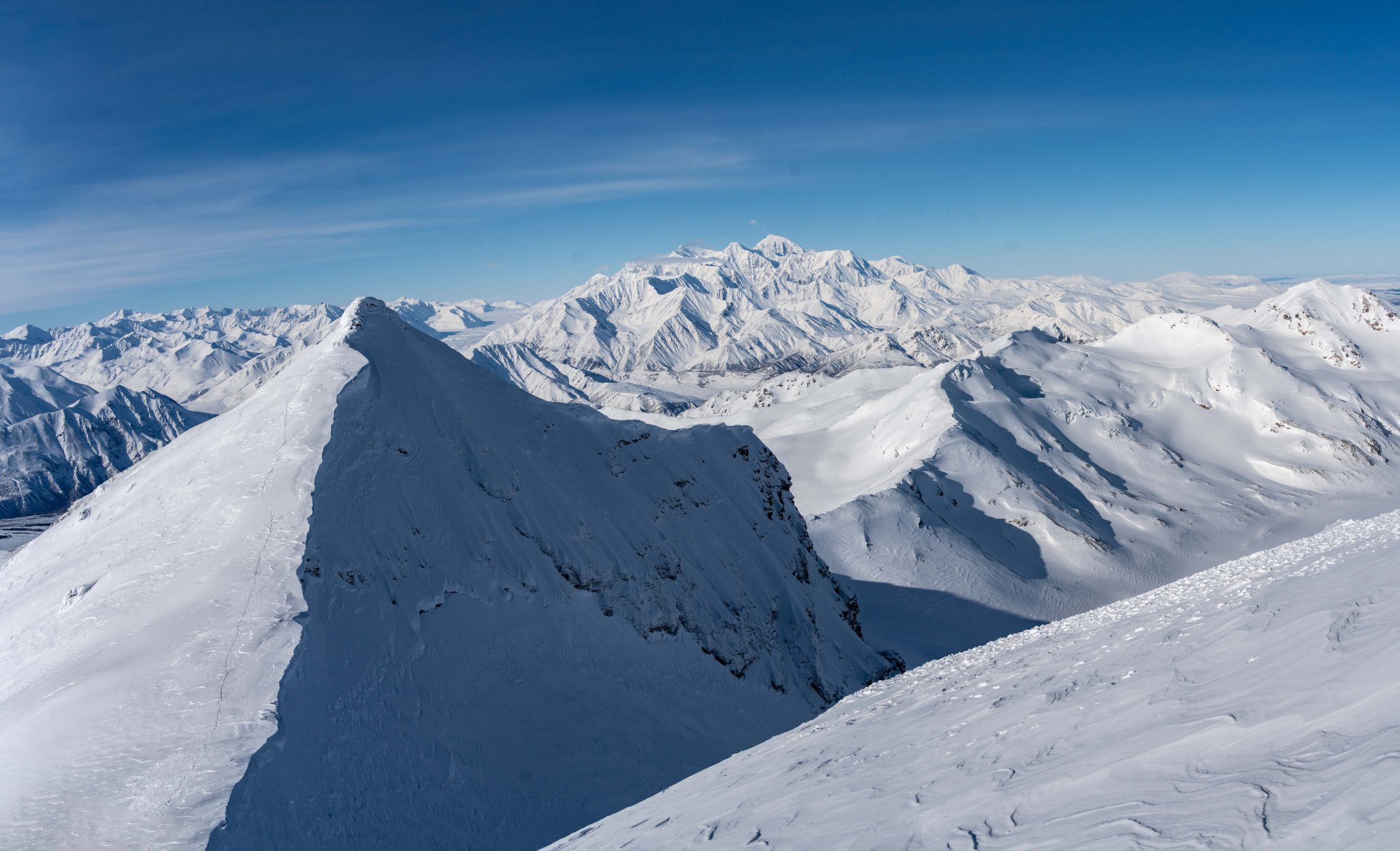


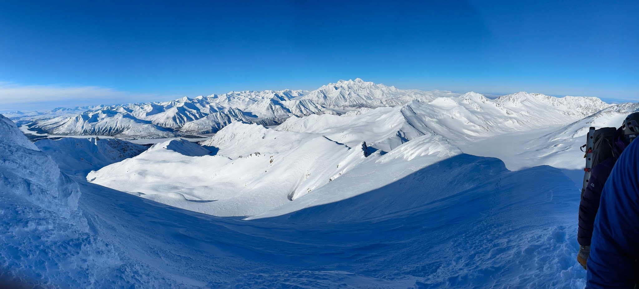
All of the Castner-Fels Divide visible! Triangle Peak at its head.


Silvertip (left), Castner Glacier Confluence (right)


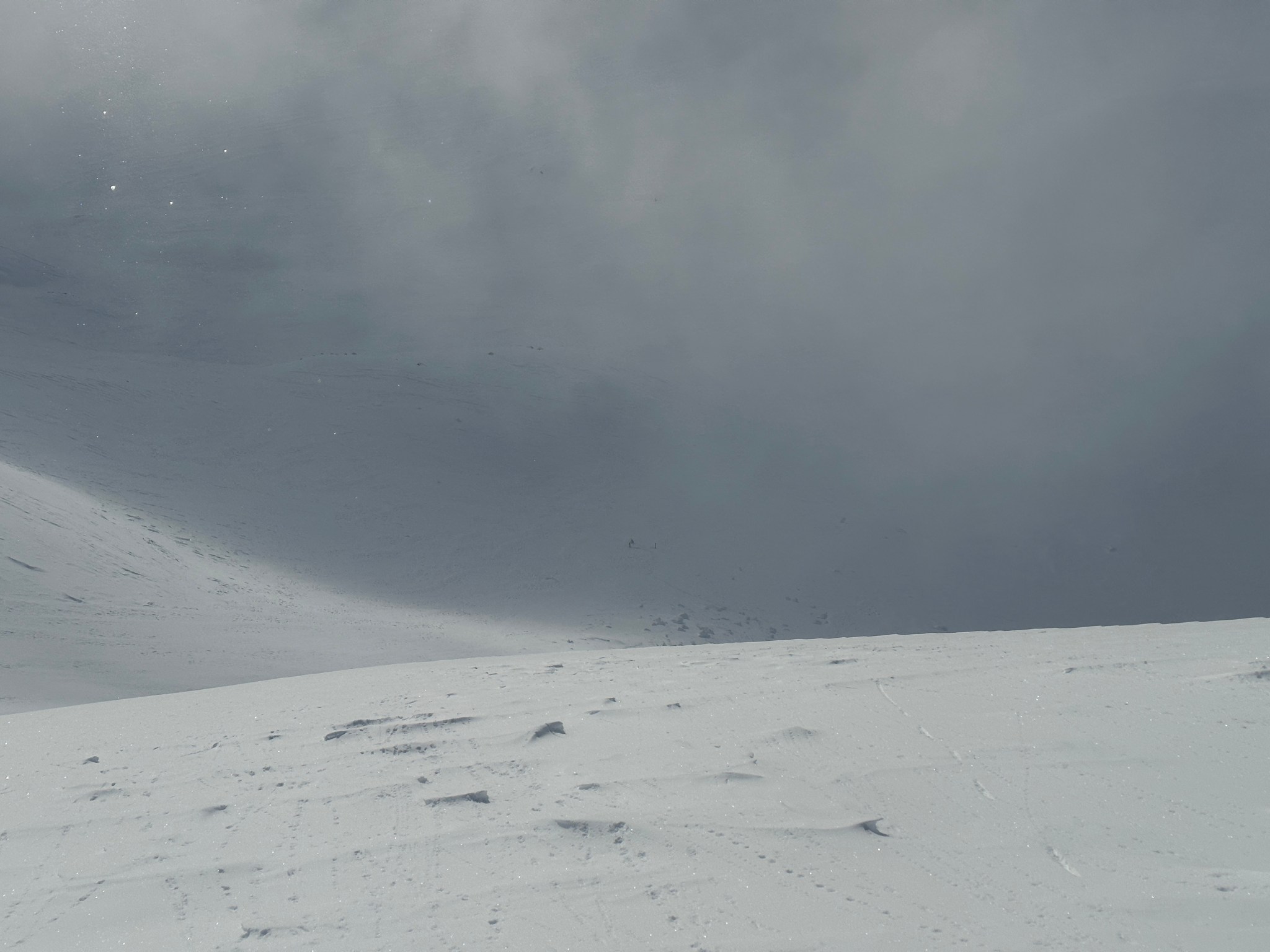
As we approached the true summit around 2PM, Stefan remarked we should probably head down immediately; I asked for 5 minutes to take photos. Didn’t take many to the south because, well, the view was rapidly vanishing. By the time we left the summit, the Institute ridge had disappeared into the storm. It took us about 45 minutes to get from the summit to the false summit, in that time the storm reached us. We made no attempts to climb Item’s other summits.

On our ascent when it was sunny, we had discussed taking the southwest ridge down and crossing Trim’s valley to access Michael Creek, avoiding the exposed west ridge and the headwall downclimb. However, that no longer seemed like a viable option in a whiteout storm. Luckily it wasn’t too snowy, mostly just clouds and wind. We were already accustomed to wind. We unroped at the false summit and started the traverse down the steep west ridge, which wasn’t too complicated to navigate physically, but after only a few hours our bootpack had already been mostly obliterated by the wind. I was able to connect vague footprints and mountaineering axe holes to lead us back across. I really wish I had brought wands.


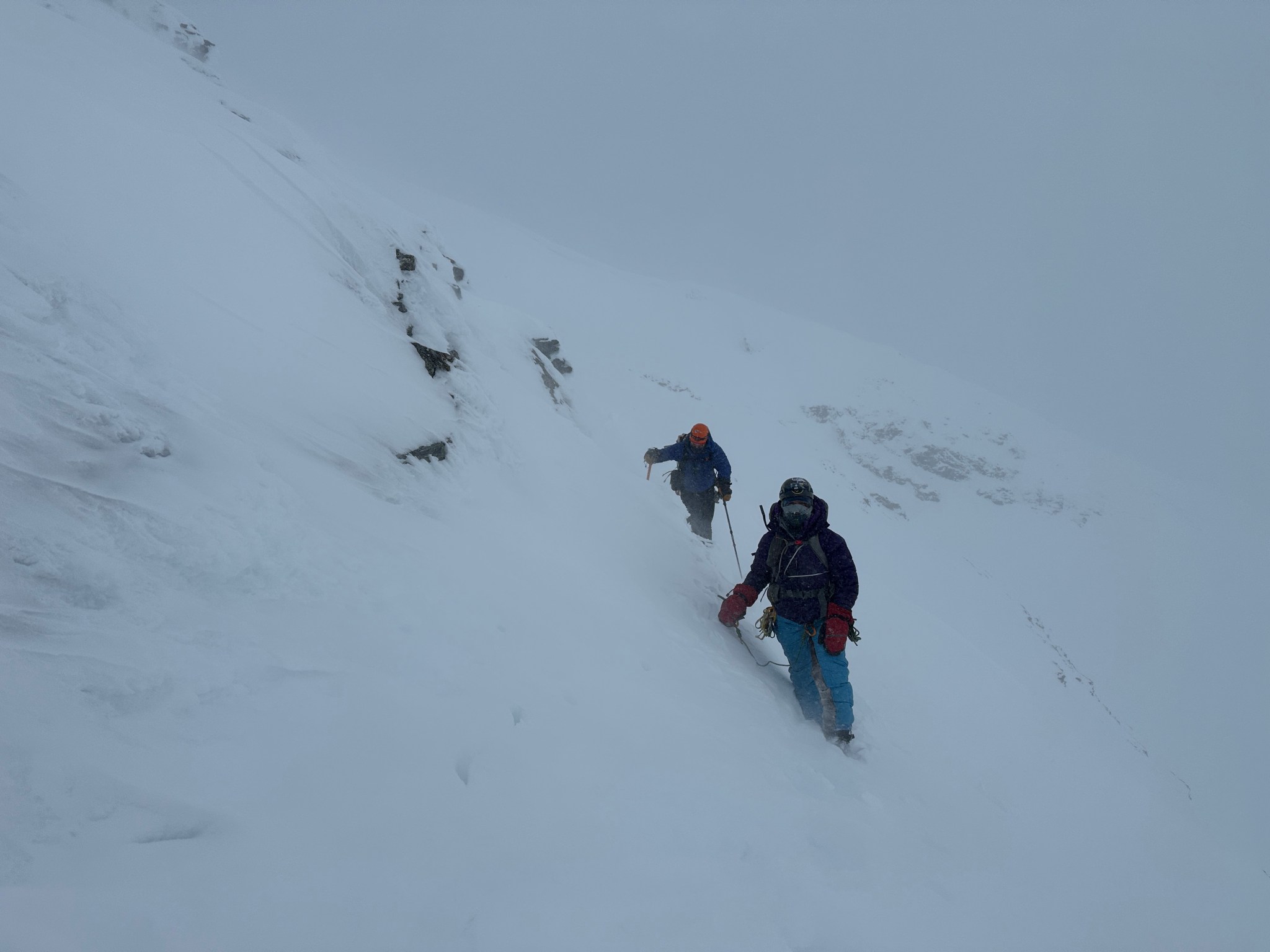


This part is just a blur in my memory, I was too focused on finding the route back, moving safely, and keeping track of my partners in the whiteout to recall specifics. It wasn’t my favorite part of the trip, but knowing we had already crossed it gave me confidence there was a route back we could find. When we finally made it to the gentle slope leading back to “Michael Peak”, Stefan said he felt like we were close to being off the ridge but he wasn’t sure. “No, it’s okay, we really are past the worst of it!” We made our way to the top of the headwall and noticed blue sky opening up above us…now?
Seriously?

As soon as we got over the lip of the headwall, the winds ceased dramatically and the sun emerged. The snow on the headwall had warmed significantly since the morning and was easy soft downclimbing. Eventually the angle eased off and we could walk the rest of the way down. I ripped off my balaclava because it was getting way too hot! What a problem to have immediately adjacent to our previous experience. We rendezvous at the skis and made a little water before ripping skins and skiing down the creek. I am still learning to ski and had to stop many times to curse and let the lactic acid leave my quads, but the 4.5 miles of terrain helped me improve my technique quite a bit. We stopped for water at the initial creek crossing, the crossing with the Dignity Thieves (a few trees by open water that require crawling/trickery to pass). It was fun to think about how these trees were too young to have existed last time I skied up this creek in 2014.


SKIS!


We made it back to the parking lot before 8PM, just under 17 hours. Stefan and Allison drove back to Fairbanks that evening, I made some glop dinner and passed out for 10-11 hours, with a brief hour of wakefulness around 3AM. The storm continued into the morning; I didn’t see any of more of the Deltas that trip and I was entirely okay with that.


4 thoughts on “Item Peak”